In this guide, we’ll walk you through how to efficiently convert your GML files to MAPINFO using the powerful Converter Tool in MAPOG Map Analysis. Whether you’re a beginner or an experienced user, Converting GML to MAPINFO with MAPOG, this tutorial will help you understand the process in easy steps.
Key Concept to Converting files
The Converter Tool is a feature in MAPOG Map Analysis that helps you change your data from one format to another. It’s like magic! You give it your data in one form, and it transforms it into another form that you need for your analysis. Additionally, with GIS Data, you can download data in any format, making it versatile and adaptable for various applications.
Converting GML to MAPINFO
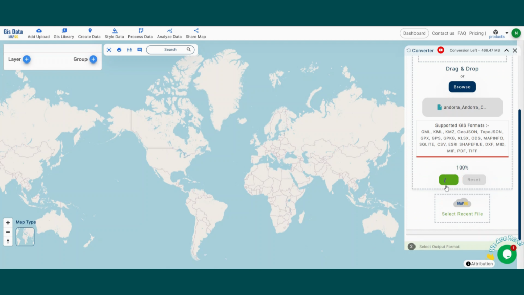
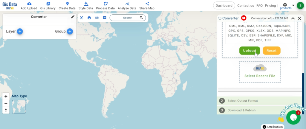
Step 1: Upload the Data
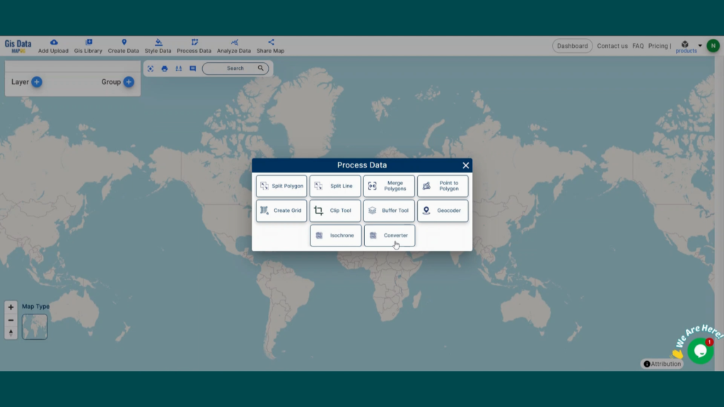
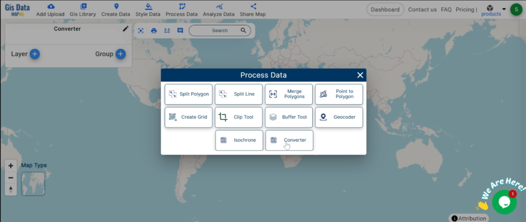
1. Click on the “Process Data” menu and choose the “Converter Tool” option.
2. Upload your GML file. This is your starting point where you provide the data that needs conversion.
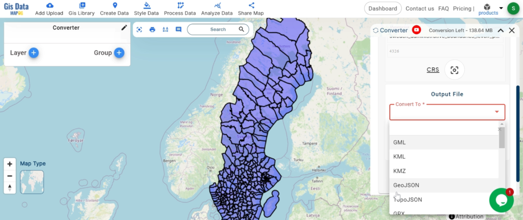
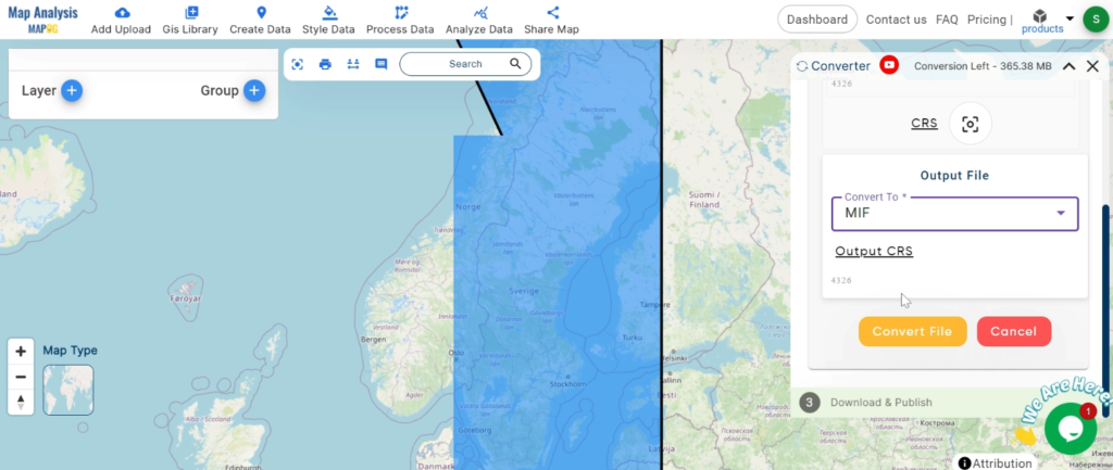
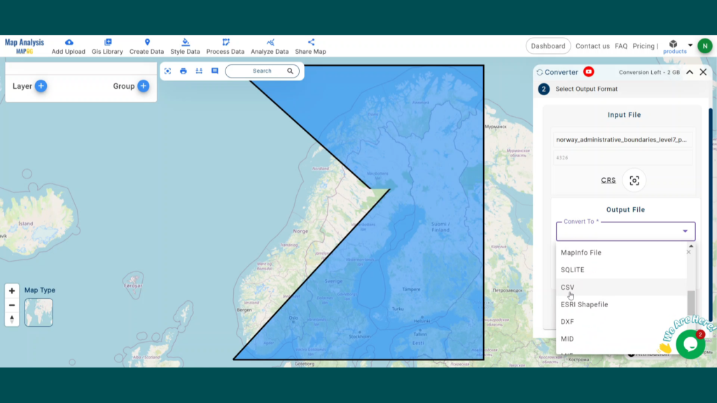
Step 2: Select the Format for Conversion
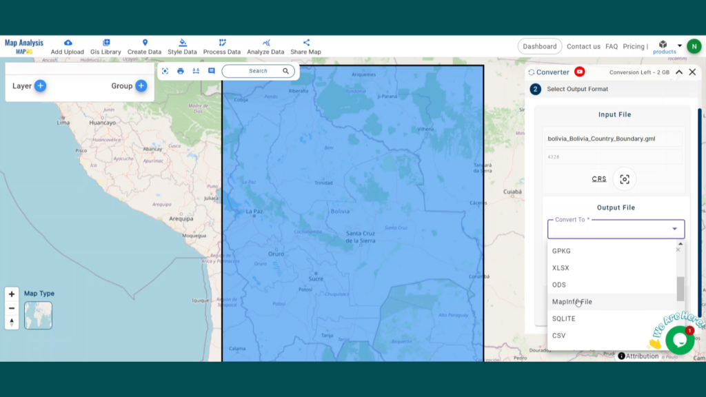
1. Choose the output file format as MAPINFO. The tool offers various formats, but for this guide, we are focusing on converting to MAPINFO.
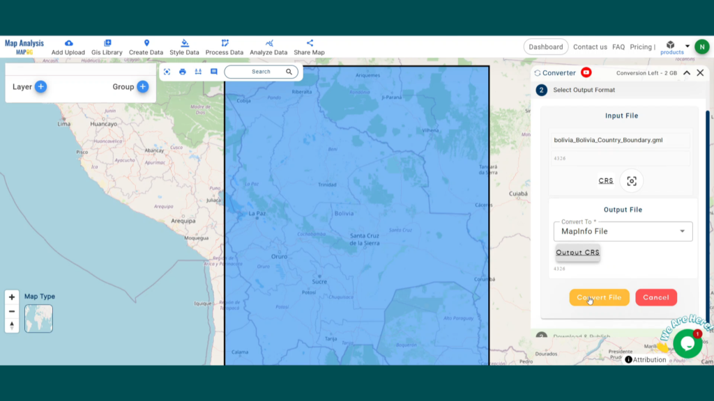
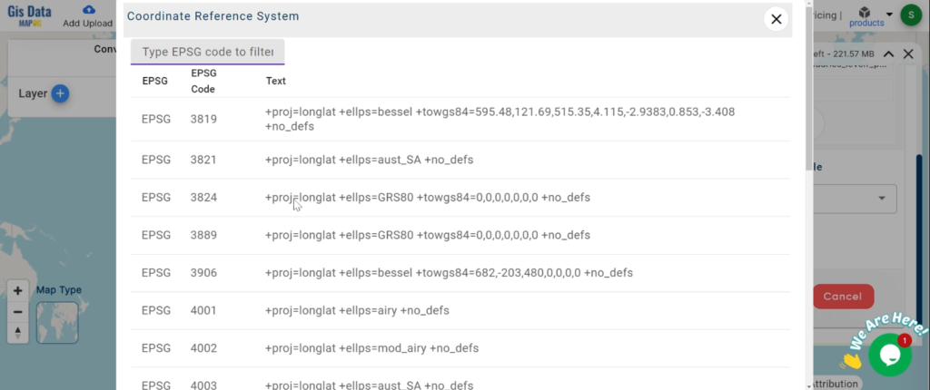
2.You can also set the CRS at this stage.
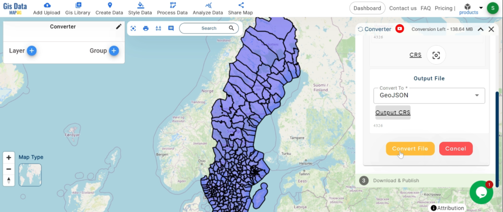
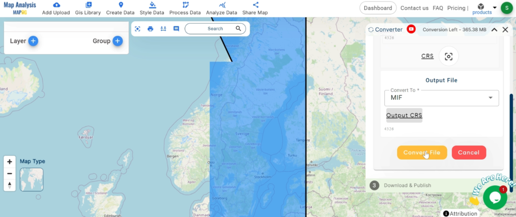
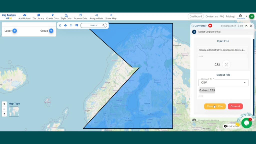
Step 3: Run the Conversion
Click ‘Convert’ and let the tool work its magic. The Converter Tool processes your data, transforming it from GML to MAPINFO format.
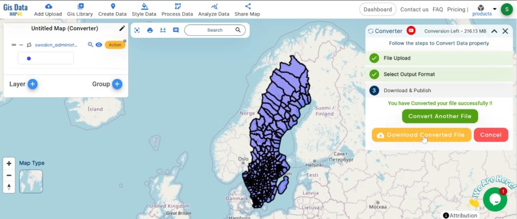
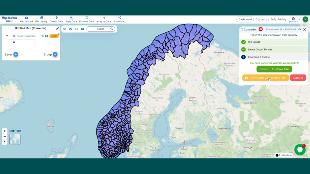
Step 4: Review and Download
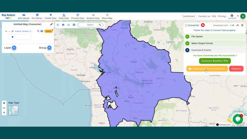
Finally, review your converted MAPINFO data to ensure it looks right. Once satisfied, download the converted file. This step is crucial to verify that the conversion has been successful and the data integrity is maintained.
And there you have it! You’ve successfully used the Converter Tool in MAPOG Map Analysis to convert your GML Files to MAPINFO. Now you can easily convert your data for all your analysis needs. This feature simplifies the process of handling different data formats, making your workflow more efficient and effective.
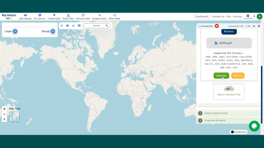
In this guide, we’ll walk you through how to efficiently convert your GML files to CSV using the powerful Converter Tool in MAPOG. Whether you’re a beginner or an experienced user, Converting GML to CSV with MAPOG, this tutorial will help you understand the process in easy steps.
Key Concept to Converting GIS Data files
The Converter Tool is a feature in MAPOG Map Analysis that helps you change your data from one format to another. It’s like magic! You give it your data in one form, and it transforms it into another form that you need for your analysis. Additionally, with GIS Data, you can download data in any format, making it versatile and adaptable for various applications.
Converting GML to CSV
Step 1: Upload the Data
1. Click on the “Process Data” menu and choose the “Converter Tool” option.
2. Upload your GML file. This is your starting point where you provide the data that needs conversion.
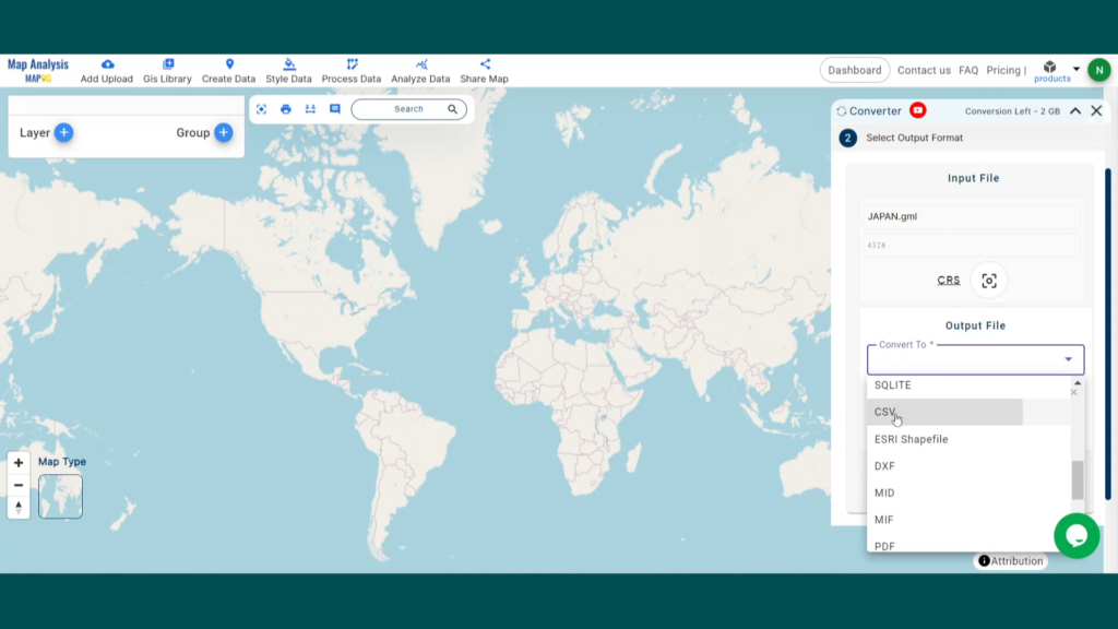
Step 2: Select the Format for Conversion
1. Choose the output file format as CSV. The tool offers various formats, but for this guide, we are focusing on converting to CSV.
2.You can also set the CRS at this stage.
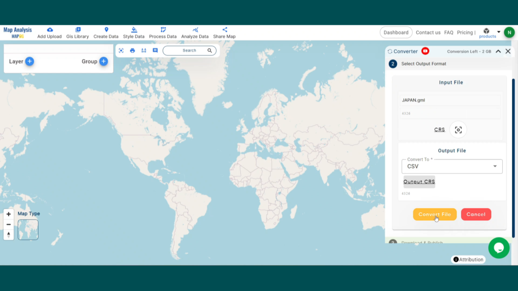
Step 3: Run the Conversion
Click ‘Convert’ and let the tool work its magic. The Converter Tool processes your data, transforming it from GML to CSV format.
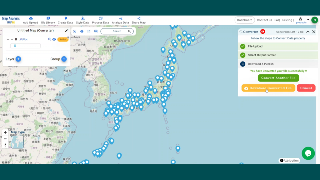
Step 4: Review and Download
Finally, review your converted CSV data to ensure it looks right. Once satisfied, download the converted file. This step is crucial to verify that the conversion has been successful and the data integrity is maintained.
And there you have it! You’ve successfully used the Converter Tool in MAPOG Map Analysis to convert your GML Files to CSV. Now you can easily convert your data for all your analysis needs. This feature simplifies the process of handling different data formats, making your workflow more efficient and effective.
In this guide, we’ll walk you through how to efficiently convert your GML files to SHP using the powerful Converter Tool in MAPOG . Whether you’re a beginner or an experienced user, Converting GML to SHP with MAPOG, this tutorial will help you understand the process in easy steps.
Key Concept to Converting GIS data files
The Converter Tool is a feature in MAPOG Map Analysis that helps you change your data from one format to another. It’s like magic! You give it your data in one form, and it transforms it into another form that you need for your analysis. Additionally, with GIS Data, you can download data in any format, making it versatile and adaptable for various applications.
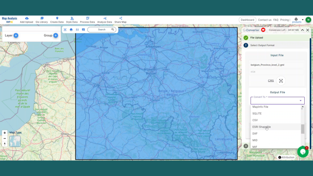
Converting GML to SHP
Step 1: Upload the Data
1. Click on the “Process Data” menu and choose the “Converter Tool” option.
2. Upload your GML file. This is your starting point where you provide the data that needs conversion.
Step 2: Select the Format for Conversion
1. Choose the output file format as SHP. The tool offers various formats, but for this guide, we are focusing on converting to SHP.
2.You can also set the CRS at this stage.
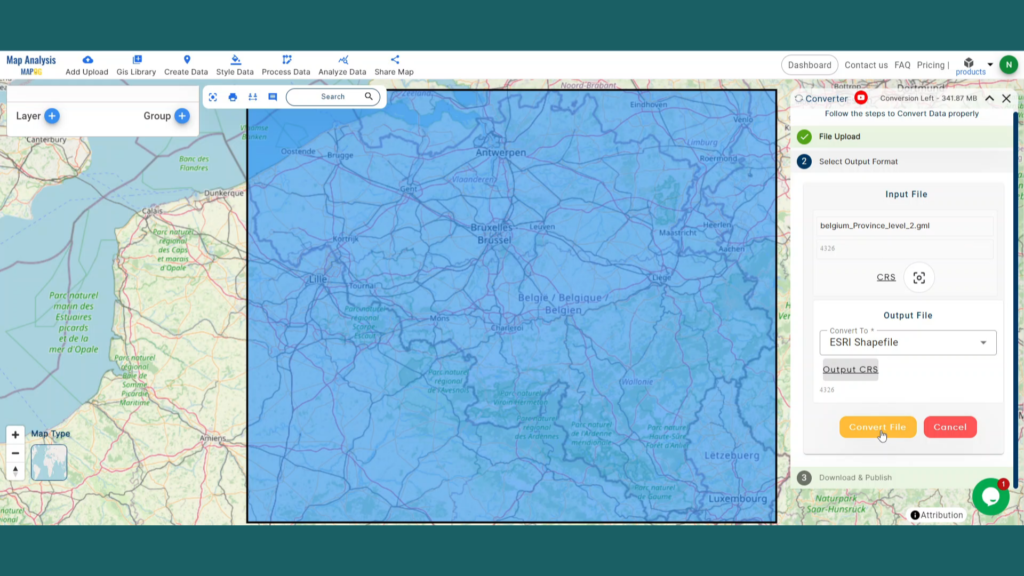
Step 3: Run the Conversion
Click ‘Convert’ and let the tool work its magic. The Converter Tool processes your data, transforming it from GML to SHP format.
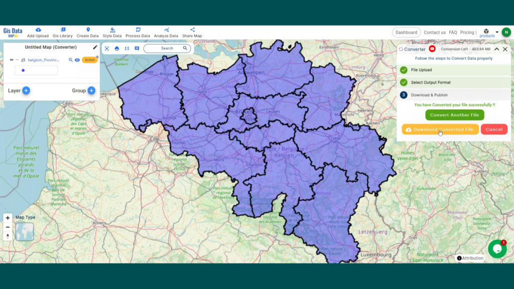
Step 4: Review and Download
Finally, review your converted SHP data to ensure it looks right. Once satisfied, download the converted file. This step is crucial to verify that the conversion has been successful and the data integrity is maintained.
And there you have it! You’ve successfully used the Converter Tool in MAPOG Map Analysis to convert your GML Files to SHP. Now you can easily convert your data for all your analysis needs. This feature simplifies the process of handling different data formats, making your workflow more efficient and effective.
Here are some other blogs you might be interested in:
KMZ to GeoJSON using MAPOG, you can transform your gis data, making it easier to analyze, share, and integrate into various GIS applications.
In this guide, we’ll walk you through how to efficiently convert your KMZ files to GeoJSON using the powerful Converter Tool in MAPOG . Whether you’re a beginner or an experienced user, Converting KMZ to GeoJSON with MAPOG, this tutorial will help you understand the process in easy steps.
Key Concept of Converting GIS format files
The Converter Tool is a feature in MAPOG Map Analysis that helps you change your data from one format to another. It’s like magic! You give it your data in one form, and it transforms it into another form that you need for your analysis. Additionally, with GIS Data, you can download data in any format, making it versatile and adaptable for various applications.
Online KMZ to GeoJSON GIS Converter
Now, let’s walk through the simple steps of using the Converter Tool to Converting KMZ to GeoJSON with MAPOG.
Step 1: Upload the Data
1. Click on the “Process Data” menu and choose the “Converter Tool” option.
2.Upload your KMZ file. This is your starting point where you provide the data that needs conversion.
Step 2: Select the Format for Conversion
1.Choose the output file format as GeoJSON. The tool offers various formats, but for this guide, we are focusing on converting to GeoJSON.
2.You can also set the CRS at this stage.
Step 3: Run the Conversion
Click ‘Convert’ and let the tool work its magic. The Converter Tool processes your data, transforming it from KMZ to GeoJSON format.
Step 4: Review and Download
Finally, review your converted GeoJSON data to ensure it looks right. Once satisfied, download the converted file. This step is crucial to verify that the conversion has been successful and the data integrity is maintained.
And there you have it! You’ve successfully used the Converter Tool in MAPOG Map Analysis to convert your KMZ files to GeoJSON. Now you can easily convert your data for all your analysis needs. This feature simplifies the process of handling different data formats, making your workflow more efficient and effective.
In this guide, we’ll walk you through how to efficiently convert your KMZ files to MIF using the powerful Converter Tool in MAPOG. Whether you’re a beginner or an experienced user, Converting KMZ to MIF with MAPOG, this tutorial will help you understand the process in easy steps.
Key Concept of Converting files
The Converter Tool is a feature in MAPOG Map Analysis that helps you change your data from one format to another. It’s like magic! You give it your data in one form, and it transforms it into another form that you need for your analysis. Additionally, with GIS Data, you can download data in any format, making it versatile and adaptable for various applications.
Online KMZ to MID GIS Converter
Now, let’s walk through the simple steps of using the Converter Tool to Converting KMZ to MIF with MAPOG.
Step 1: Upload the Data
1. Click on the “Process Data” menu and choose the “Converter Tool” option.
2.Upload your KMZ file. This is your starting point where you provide the data that needs conversion.
Step 2: Select the Format for Conversion
1.Choose the output file format as MIF. The tool offers various formats, but for this guide, we are focusing on converting to MIF.
2.You can also set the CRS at this stage.
Step 3: Run the Conversion
Click ‘Convert’ and let the tool work its magic. The Converter Tool processes your data, transforming it from KMZ to MIF format.
Step 4: Review and Download
Finally, review your converted MIF data to ensure it looks right. Once satisfied, download the converted file. This step is crucial to verify that the conversion has been successful and the data integrity is maintained.
And there you have it! You’ve successfully used the Converter Tool in MAPOG Map Analysis to convert your KMZ files to MIF. Now you can easily convert your data for all your analysis needs. This feature simplifies the process of handling different data formats, making your workflow more efficient and effective.
In this guide, we’ll walk you through how to efficiently convert your GeoJSON to TopoJSON using the powerful Converter Tool in MAPOG. Whether you’re a beginner or an experienced user, Converting GeoJSON to TopoJSON with MAPOG, this tutorial will help you understand the process in easy steps.
Key Concept to Converting files
The Converter Tool is a feature in MAPOG Map Analysis that helps you change your data from one format to another. It’s like magic! You give it your data in one form, and it transforms it into another form that you need for your analysis. Additionally, with GIS Data, you can download data in any format, making it versatile and adaptable for various applications.
Online GeoJSON to TopoJSON GIS Converter
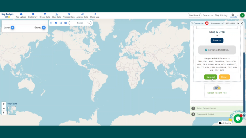
Step 1: Upload the Data
1. Click on the “Process Data” menu and choose the “Converter Tool” option.
2. Upload your GeoJSON file. This is your starting point where you provide the data that needs conversion.
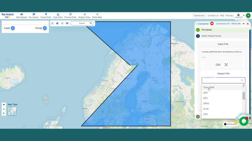
Step 2: Select the Format for Conversion
1. Choose the output file format as TopoJSON. The tool offers various formats, but for this guide, we are focusing on converting to TopoJSON.
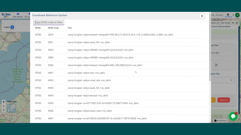
2.You can also set the CRS at this stage.
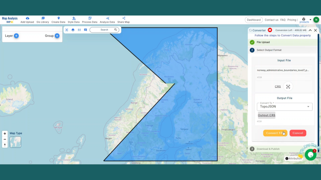
Step 3: Run the Conversion
Click ‘Convert Files’ and let the tool work its magic. The Converter Tool processes your data, transforming it from GeoJSON to TopoJSON format.
Step 4: Review and Download
Finally, review your converted TopoJSON data to ensure it looks right. Once satisfied, download the converted file. This step is crucial to verify that the conversion has been successful and the data integrity is maintained.
And there you have it! You’ve successfully used the Converter Tool in MAPOG Map Analysis to convert your files from GeoJSON to TopoJSON. Now you can easily convert your data for all your analysis needs. This feature simplifies the process of handling different data formats, making your workflow more efficient and effective.
Here are some other blogs you might be interested in:
In this guide, it will provide step by step of how the GeoJSON files can be easily and quickly converted to CSV format with the help of Converter Tool in MAPOG. So, both if you are a first-time user and a regular one, Converting GeoJSON to CSV with MAPOG, the entire process will be explained in simple steps for you.
Key Concept to Converting files
Converter Tool is a tool in the MAPOG Map Analysis used for the purpose of converting the information you have from one type to another. It’s like magic! You input data into it in one form, and you get it output in another form that you could use in your analysis. Moreover, GIS Data has a download in any format that means it is shift able in any kind of uses.
Online GeoJSON to CSV GIS Converter
Step 1: Upload the Data
1. Select the data through the “Process Data” and go to the “Converter Tool”.
2. Upload your GeoJSON file. This is your entry point where you feed in the information that needs conversion.
Step 2: Select the Format for Conversion
Select the output format as CSV or Comma-Separated Values if you want to expatriate only the data. The tool provides several options in arriving at the result but for this guide, we are using the option to convert the file to CSV.
2. You can also set the Output CRS at this stage.
Step 3: Run the Conversion
Go to ‘Convert Files’ and watch the tool at work. Working with the Converter Tool you input your data and then the tool converts it from the GeoJSON format to the CSV format.
Step 4: Review and Download
Take a moment to review your converted CSV data to make sure everything looks correct. Once you’re happy with it, go ahead and download the file. This step is really important to ensure that the conversion worked properly and that all your data is intact.
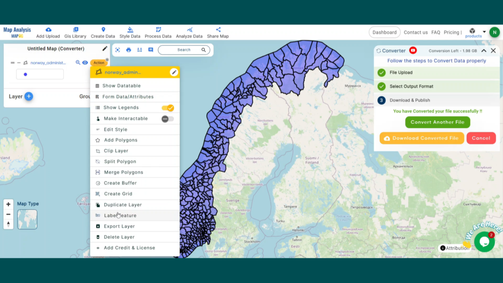
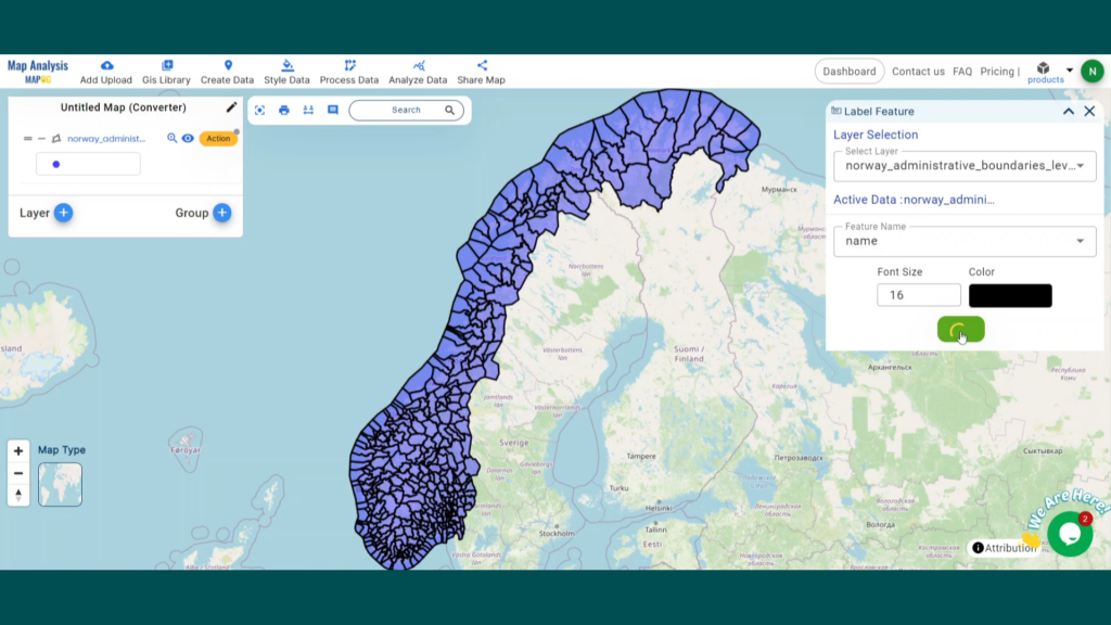
Step 5: Add Label Feature
1. We can add the Lebel on this map using the Label Feature in the map analysis interface. First, We need to go to the action button of the newly converted layer. Then select the Label feature from the drop down section.
2. Next, we need to provide the newly converted file in layer selection and the desired attribute in the feature name section. Label feature has the option to select the font size and color. When you are happy with it, Click the save button.
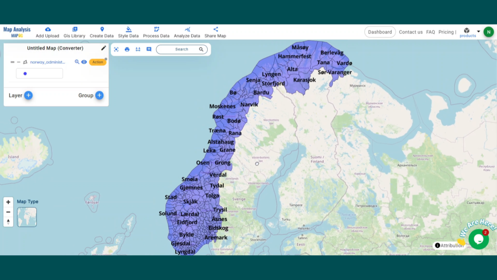
3. Now here you can see the newly converted data with all boundaries name mentioned into it.
That’s it! You’ve mastered the Converter Tool in MAPOG Map Analysis to turn your GeoJSON files into CSVs. Now, transforming your data is easier than ever, ready for any analysis you need. This handy feature streamlines dealing with various data formats, making your work smoother and more productive.
Here are some other blogs you might be interested in:
Explore geography of China seamlessly with MAPOG. Access a diverse range of datasets, including boundaries, rivers, vegetation, and airports. Take advantage of user-friendly tools like Download GIS Data, providing formats such as Shapefile, KML, GeoJSON, and CSV. Delve into China GIS Data confidently with MAPOG.
We offer an extensive array of data formats, including KML, SHP, CSV, GeoJSON, Tab, SQL, Tiff, GML, KMZ, GPKZ, SQLITE, Dxf, MIF, TOPOJSON, XLSX, GPX, ODS, MID, and GPS, ensuring compatibility and accessibility for various applications and analyses.
Note:
All data available are in GCS datum EPSG:4326 WGS84 CRS (Coordinate Reference System).
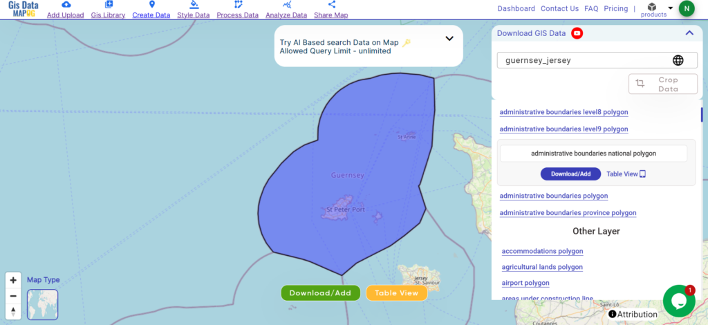
Guernsey and Jersey, nestled in the English Channel, are picturesque islands boasting a rich tapestry of history and culture. With a combined area of approximately 78 square kilometers, these charming destinations offer breathtaking coastlines and quaint countryside. St. Peter Port serves as the capital of Guernsey, while St. Helier holds the same distinction for Jersey, each exuding its own unique charm amidst stunning natural landscapes.
After successfully logging in with a legitimate email address, select the country you want to work with. Next, choose the specific layer you need and click on the download option. Once that’s done, pick the desired format to acquire the essential GIS data. Before proceeding with the data download, make sure to review the data table for any relevant information.
Disclaimer: If you find any shapefile data of country provided is incorrect do contact us or comment below, so that we will correct the same in our system as well we will try to correct the same in OpenStreetMap.
Explore geography of China seamlessly with MAPOG. Access a diverse range of datasets, including boundaries, rivers, vegetation, and airports. Take advantage of user-friendly tools like Download GIS Data, providing formats such as Shapefile, KML, GeoJSON, and CSV. Delve into China GIS Data confidently with MAPOG.
We offer an extensive array of data formats, including KML, SHP, CSV, GeoJSON, Tab, SQL, Tiff, GML, KMZ, GPKZ, SQLITE, Dxf, MIF, TOPOJSON, XLSX, GPX, ODS, MID, and GPS, ensuring compatibility and accessibility for various applications and analyses.
Note:
All data available are in GCS datum EPSG:4326 WGS84 CRS (Coordinate Reference System).
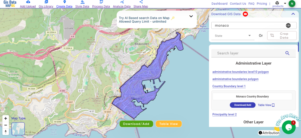
Monaco, nestled along the French Riviera, is a microstate known for its opulence and glamour. With an area of merely 2.02 square kilometers, it stands as one of the world’s smallest countries. Despite its size, Monaco boasts Monte Carlo as its capital, a bustling city renowned for its lavish casinos, yacht-filled harbors, and prestigious events like the Monaco Grand Prix.
Disclaimer: If you find any shapefile data of country provided is incorrect do contact us or comment below, so that we will correct the same in our system as well we will try to correct the same in OpenStreetMap.
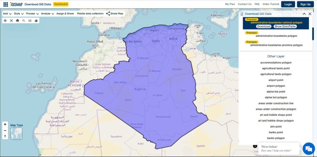
Algeria Shapefile Download Map – Free Polygon Administrative Download. Shapefiles showing Districts , Municipalities and Town and Cities.
Have you been searching too long for accurate GIS data for your country of interest? Well the wait is over with MAPOG, your one-stop destination for comprehensive GIS data covering 150+ countries. You can find more than 150 GIS data for each nation in MAPOG GIS Data Collection. The distinctive feature of MAPOG GIS data collection lies in its commitment to providing highly accurate GIS data of the administrative divisions. Users can also find data of other natural and man made geographic features such as river, roads, railway lines, airport locations etc. that are represented in appropriate geometric structures (point, line and polygon). MAPOG provides two important tools for accessing these GIS datasets – Download GIS Data and Add GIS Data.
We offer an extensive array of data formats, including KML, SHP, CSV, GeoJSON, Tab, SQL, Tiff, GML, KMZ, GPKZ, SQLITE, Dxf, MIF, TOPOJSON, XLSX, GPX, ODS, MID, and GPS, ensuring compatibility and accessibility for various applications and analyses.
Note:
All data available are in GCS datum EPSG:4326 WGS84 CRS (Coordinate Reference System).
You need to login for downloading the shapefile.
Download Shapefile Data of Algeria
Algeria is bordered to the northeast by Tunisia; to the east by Libya; to the southeast by Niger; to the southwest by Mali, Mauritania, and Western Sahara; to the west by Morocco; and to the north by the Mediterranean Sea. It is considered part of the Maghreb region of North Africa. It has a semi-arid geography, with most of the population living in the fertile north and the Sahara dominating the geography of the south. Algeria covers an area of 2,381,741 square kilometres (919,595 sq mi), making it the world’s, tenth largest nation by area and the largest nation in Africa, more than 200 times as large as the continent’s smallest country, The Gambia. With a population of 44 million, Algeria is the tenth-most populous country in Africa, and the 32nd most populous country in the world. The capital and largest city is Algiers, located in the far north on the Mediterranean coast.
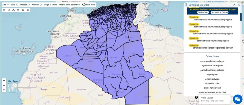
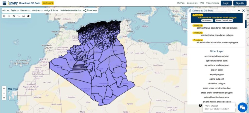
Algeria’s districts were created as arrondissements when Algeria was a colony of France and they had a status equal to those of mainland France. They were, like France’s arrondissements, part of departements, which are further part of a région (which was called a territory, territoire, in French Algeria). They were maintained 6 years after the country’s independence (until 1968) when they were renamed “daïras” and had their functions slightly changed.
The municipalities of Algeria form the third level of administrative subdivisions of Algeria. As of 2002, there were 1,541 municipalities in the country.
Disclaimer : If you find any shapefile data of country provided is incorrect do contact us or comment below, so that we will correct the same in our system as well we will try to correct the same in openstreetmap.
Loading Comments...
We use cookies to ensure that we give you the best experience on our website. If you continue to use this site we will assume that you are happy with it.