Here’s how you can effortlessly convert GPS files to SQLITE format using the Converter Tool in MAPOG. Whether you’re new to the process or a seasoned user, this guide will walk you through each step clearly and concisely.
Understanding the File Conversion Process
The Converter Tool in MAPOG is designed to transform data from one format to another with ease. Just like a magic trick, you input your GPS data, and it outputs it in the SQLITE format, ready for your analysis. The flexibility of GIS Data allows you to download it in various formats, making it adaptable for different uses.
Step-by-Step Guide to Converting GPS to SQLITE
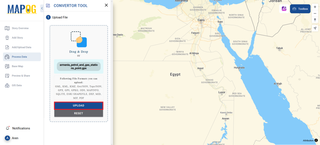
1. Uploading Your Data:
Begin by selecting your data through the “Process Data” option, then navigate to the “Converter Tool.”
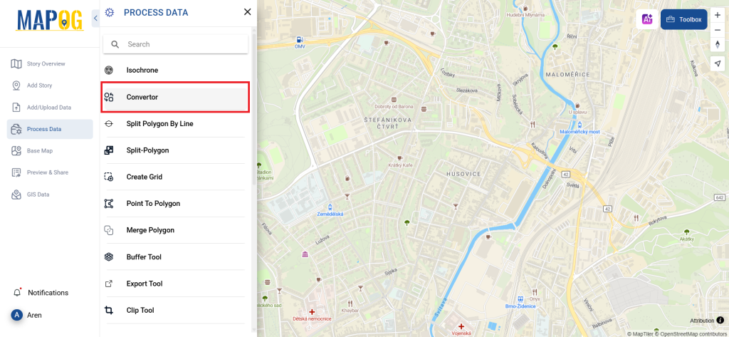
Upload your GPS file, which serves as the starting point for the conversion process.
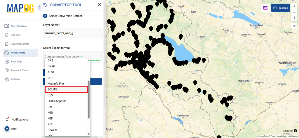
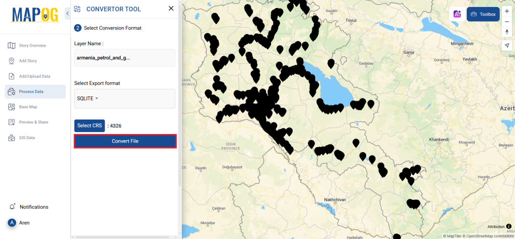
2. Choosing the Conversion Format:
Once your data is uploaded, select SQLITE as the output format. The Converter Tool offers multiple format options, but for this guide, we’ll focus on converting the file to SQLITE.
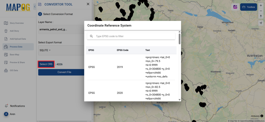
You can also set the CRS at this stage.
3. Running the Conversion:
Now, head over to ‘Convert Files’ and initiate the conversion. The tool will automatically process your GPS data and convert it to SQLITE format.
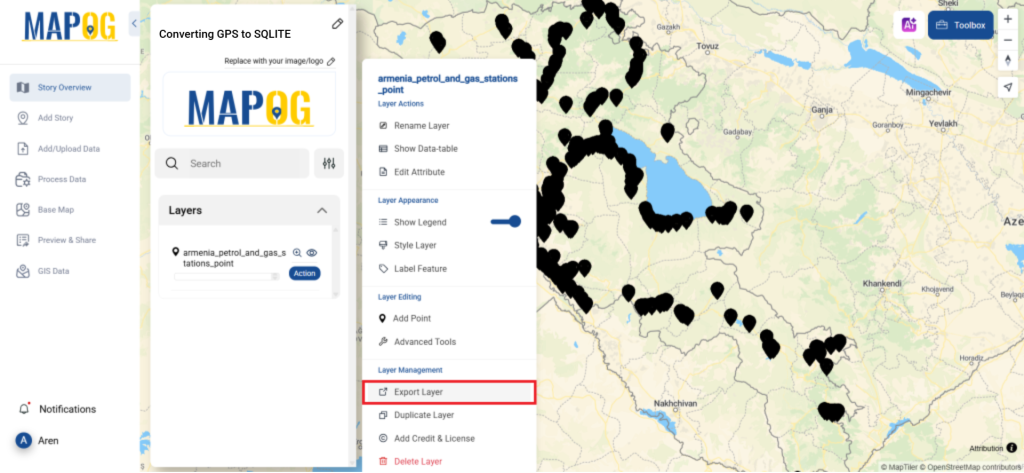
4. Reviewing and Downloading:
After the conversion is complete, take a moment to review your new SQLITE file. Make sure everything is accurate before downloading the final product. This review step is crucial to ensure the integrity of your data.
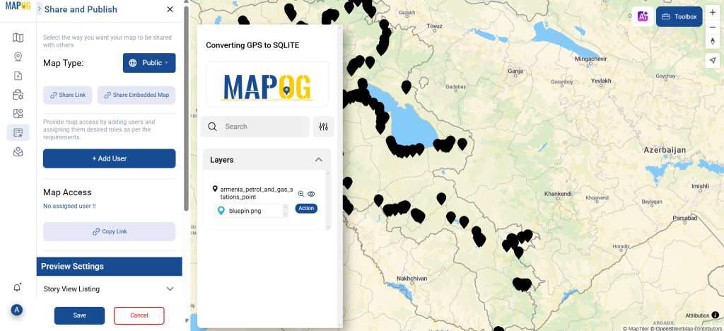
Step 5: Share Map
You can even share the map with your friends & colleagues using “Share and Publish” option that provide four methods of sharing like Embedded map, public sharing, assigns & share.
By following these steps, you’ve successfully used the Converter Tool in MAPOG to convert your GPS files to SQLITE format. This process not only simplifies data transformation but also enhances your productivity by making your data ready for analysis in just a few clicks.
With MAPOG’s versatile toolkit, you can effortlessly upload vector and upload Excel or CSV data, incorporate existing layers, perform polyline splitting, use the converter for various formats, calculate isochrones, and utilize the Export Tool.
Here are some other blogs you might be interested in:
- Convert Online GIS data : KML to PDF file
- Converting KML to GeoTIFF , Online Gis Data Converter
- Converting KMZ to SHP : Online GIS Data Conversion
- Converting TopoJSON to SHP Online : GIS Data Converter
- Converting GeoJSON to TopoJSON with MAPOG
- Converting GeoJSON to CSV with MAPOG
- Converting KMZ to KML with MAPOG
- Converting GML to KML with MAPOG
- Convert KMZ to TopoJSON Online
- Converting KMZ to GeoJSON Online
- Convert KML to MID Online
- Online Conversion KML to MIF