Consider that you are working in the urban planning sector. Higher authorities in the sector have decided to develop the surroundings of the bank area. Your senior has assigned you a project to create a buffer so that later the architect can design the area separately.
When you are working with spatial operations and analysis, GIS is the best method to find a solution to any task. A geographic information system (GIS) is a system that creates, manages, analyzes, and maps all types of data.
IGISMap provides you with all the facilities for spatial operations and analysis without any difficulty. It is easy to use, and it saves your time.
How to upload file in IGISMap
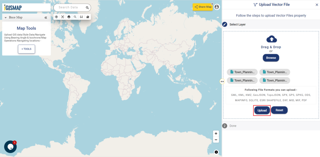
An upload vector file is a GIS tool in IGISMap. This tool helps you to upload a file of your requirement.
Click on https://map.igismap.com/upload-vector-files and open the Upload Vector file tool
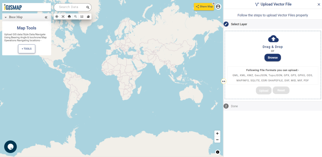
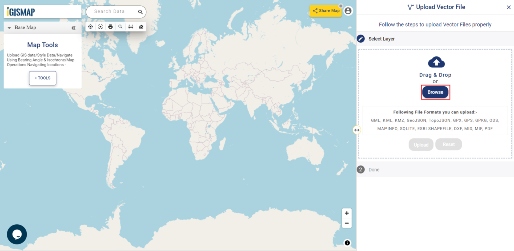
Browse Data
In the select layer click on Browse to find the relevant data from the device.
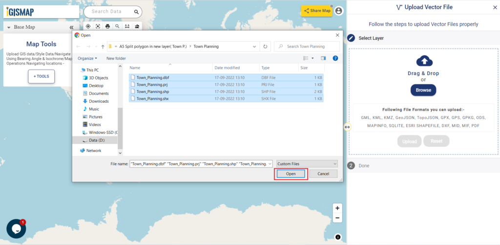
Select File
Now select the appropriate file, then click on open.
Upload File
Since we have selected the file, now click on upload to add data in IGISMap.
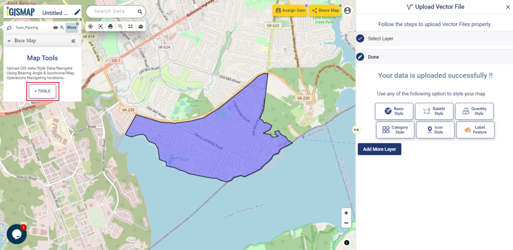
Map Tools
After uploading the shapefile click on Tools, to access other GIS tools. Here you can do bubble style, icon style, category style or label feature, etc. shown in image below.
In Map Tools, Open Buffer analysis tool. You can also try other tools like converter, split polygon, merge polygon, point to polygon, etc
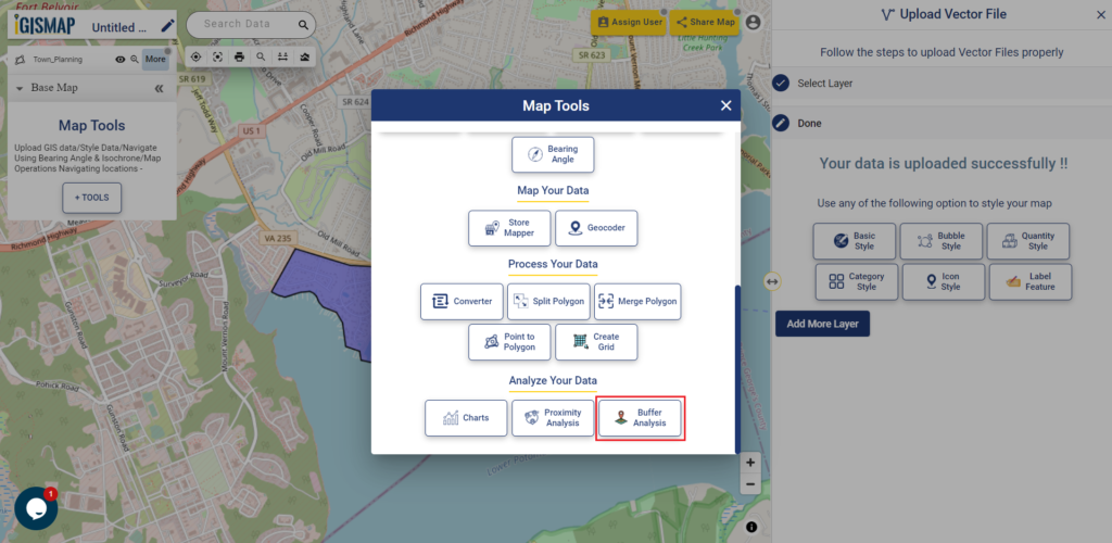
Buffer Analysis Tool
The buffer Analysis tool of IGISMap is a powerful GIS tool. This tool helps you to create a zone of your requirement which is also called Buffer.
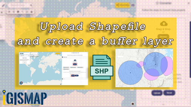
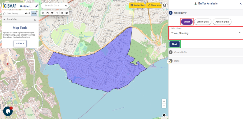
Upload shapefile and create a buffer layer
Select Layer
In the select layer click on the Select option, then from the drop-down Manu select the GIS Data, after that click on Next
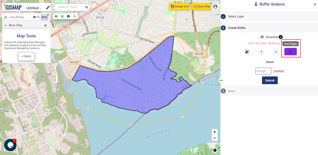
Create Buffer
In create buffer, Select draw a polygon option. Draw a polygon that covers the input shapefile.
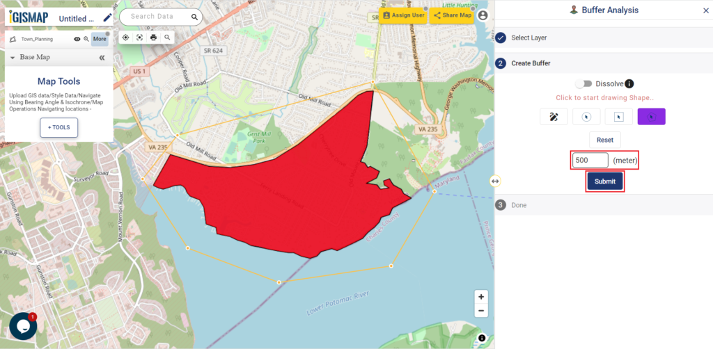
Enter the value in meters for buffer map, then click on submit.
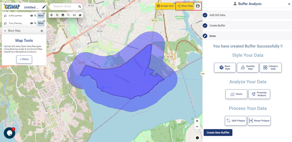
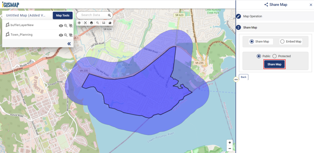
Share Your Map
You can directly share the map by clicking on Share Map.
After filing up Map Operation, Click on the next button.
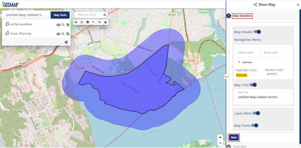
You can share your map as per your requirement.
You can also use the link to share the relevant data.
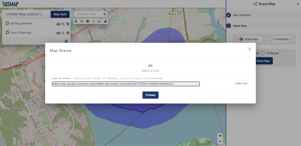
In the above steps, you have learned about sharing a map. If you want to embed the map on your website then that is also possible with this tool.