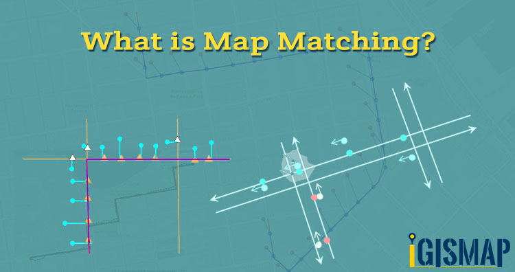
Hello GIS learner today in this post we are introducing term Map matching is the linking or matching of observed raw GPS signals shown in below image with green color points with the road segments which the GPS signals actually corresponds. The coordinates of GPS observations are close to the road map but not exactly on it. So map matching is process taking input as raw GPS data and giving output as the actual position of road network.
![]()
Create your Own Customized Map and Share with Your Clients using IGIS Map Tool.
Why we need Map Matching system?
Now what is the need of map matching, why don’t we use raw data as it is. Map matching problems become complex when the raw GPS data travelled a multi lane road network, even manually distinguish is difficult. Map Matching is used in navigation. Now in the below image you can see the GPS signals in blue navigation but the route is different. In this observation any body can confused with these GPS signals on multi lane. Suppose if you are following these points then you get puzzled when many lanes running simultaneously. It’s a preprocessing method in GIS applications.
![]()
In Traffic flow Analysis and in directions Map Matching is useful factor. Aligning GPS across route is termed as Map Matching.
If you are new to GIS – Geographical Information System then check :
We also provide GIS Customized application contact us at juhi@igismap.com for more information.