Download Norway Administrative Boundary Shapefiles – Regional State Administrative Agencies, Municipalities

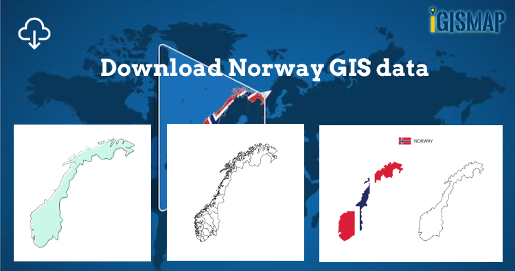
Hey! GIS user here in this blog you can download Norway shapefile GIS data. IGISMAP have collection for more than 100 new countries. Links for downloading the shapefiles of the important administrative divisions of Norway are provided in the following. You can also download these data in any format like KML, GeoJSON, or CSV etc.

Note:

  • All data available are in GCS datum EPSG:4326 WGS84 CRS (Coordinate Reference System).
  • You need to login for downloading the shapefile.

Here is the video tutorial to download data:

Download Free Shapefile Data of Norway

Norway is a country located in Northern Europe in the northern and western parts of the Scandinavian Peninsula. It has a land border with Sweden to the east and a shorter border with Finland and an even shorter border with Russia to the northeast. The country’s average elevation is 460 meter’s (1,510 ft), and 32 percent of the mainland is located above the tree line. The regional climate was up to 1–3 °C (1.8–5.4 °F) warmer in 7000 BC to 3000 BC in the Holocene Climatic Optimum, (relative to the 1961-90 period), melting the remaining glaciers in the mountains almost completely during that period.

Norway National Boundary

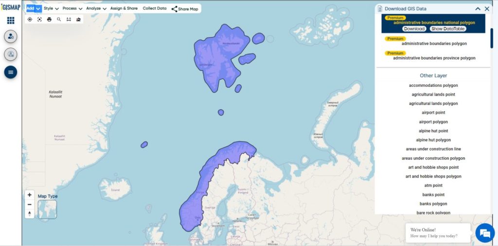
Download Norway National Boundary Shapefile

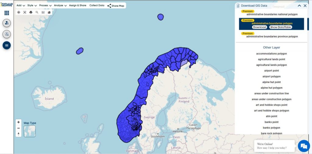
Download Norway Counties Shapefile Data

Norway is divided into 11 administrative regions, called counties . The island territories of Svalbard and Jan Mayen are outside the county division and ruled directly at the national level. The capital Oslo is both a county and a municipality.

Norway Counties Boundary

Download Norway Counties Boundaries Shapefile

This shapefile covers following Counties of Norway listed below:

  • Agder
  • Innlandet
  • More og Romsdal
  • Nordland
  • Oslo
  • Rogaland
  • Vestfold og Telemark
  • Troms og Finnmark
  • Trondelag
  • Vestland
  • Viken

Download Norway Municipalities Shapefile Data

Municipalities are the atomic unit of local government in Norway and are responsible for primary education (until 10th grade), outpatient health services, senior citizen services, unemployment and other social services, zoning, economic development, and municipal roads. Law enforcement and church services are provided at a national level in Norway.

Norway Municipality Boundaries Shapefiles
Norway Municipalities Boundary

Download Norway Municipality Boundaries Shapefiles

Other Administrative Boundary Data:

Download Free Shapefile for the following:

  1. World Countries Shapefile
  2. Australia
  3. Argentina
  4. Austria
  5. Belgium
  6. Brazil
  7. Canada
  8. Denmark
  9. Fiji
  10. Finland
  11. Germany
  12. Greece
  13. India
  14. Indonesia
  15. Ireland
  16. Italy
  17. Japan
  18. Kenya
  19. Lebanon
  20. Madagascar
  21. Malaysia
  22. Mexico
  23. Mongolia
  24. Netherlands
  25. New Zealand
  26. Nigeria
  27. Papua New Guinea
  28. Philippines
  29. Poland
  30. Russia
  31. Singapore
  32. South Africa
  33. South Korea
  34. Spain
  35. Switzerland
  36. Tunisia
  37. United Kingdom Shapefile
  38. United States of America
  39. Vietnam
  40. Croatia
  41. Chile
  42. Norway
  43. Maldives

Disclaimer : If you find any shapefile data of country provided is incorrect do contact us or comment below, so that we will correct the same in our system as well we will try to correct the same in OpenStreetMap.

GIS – Best tool to search House Land

Today is the era where we want everything to be visualized. No matter what we are looking for , be it the route to our new office, nearby market places or maybe when you are looking to buy a home or want one on rent. These all are the problems usually faced by people. While these  problems are faced by many people but there is something which can solve all these problems. So the solution to all the problems is GIS- which helps you to search House Land

Best tool to search House Land – GIS

GIS is putting its foot in Housing solutions too!!! Isn’t it good that you can also get the Housing details with the help of GIS .  GIS stands for Geographic information system . GIS is one of the important tool for the people across the globe. GIS is highly used by the housing associations now days, as it helps them in the quick decision making for selecting any location for their house .

GIS - Best tool to search House Land
GIS – Best tool to search House Land

Have you ever thought of getting all the necessary details while sitting at home; regarding the location and nearby amenities,or to look over the shops to meet your daily need???

How great would that be to analyze and evaluate your considered choices while being at your comfort zone completely?? Yeah it would be so comforting to know about the place where you are planning to move.

So, Basically GIS is that main tool which helps you to take a tour to your future residence. GIS helps you in analyzing and evaluating your decisions in the following way:\

  • Know the Shops : You can now the what all shops are there , how far they are ?
  • Know the shops timings: you can also check the time at which these shops get opened.
  • Nearest Stations: Know the nearest stations and how to reach there,which trains to board.

Say for an instance ,Google Maps ; Google Maps is one of the most used GIS application. It shows us the Nearby place to our location. Google Maps is the best fit example to understand GIS concepts.

Now , that you are quite familiar with the GIS helps for housing solutions.

But the main thing is to know how can we find out the details . So, for knowing that we have to input the Spatial data, such as address,postcodes, locations and the people can produce the visual maps on the go.

Benefits of using GIS – Best tool to search House Land

This information helps us to make quick decision , getting all the money related information  for purchasing or renting, how likely your employment would be affected. If we do not use GIS for these Spatial things then we would not be able to fast and precisely see this pattern, as ultimately our main aim is to assess the monetary impact of using GIS on both the Business and customers.

Hence we can say that GIS is actually doing  good and offering service to its users in every best way possible. Plan your home with the GIS and share your experience with us by commenting below in the comment box.