Dive into the dynamic island of Taiwan with MAPOG! Unearth a treasure trove of GIS data, revealing the intricate details of its administrative districts. Trace the winding paths of Taiwan’s majestic rivers and their tributaries. Map your journey along the island’s vital transportation network – navigate the intricate web of roads and soar over the skies with data on essential air gateways, its airports. Download this wealth of Taiwan GIS data with ease in formats like Shapefile, KML, GeoJSON, and CSV using our user-friendly tools. Empower your analysis of Taiwan’s geography – choose MAPOG for all your Taiwan GIS data needs!
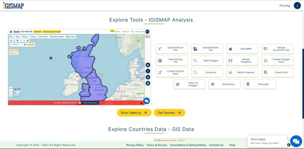
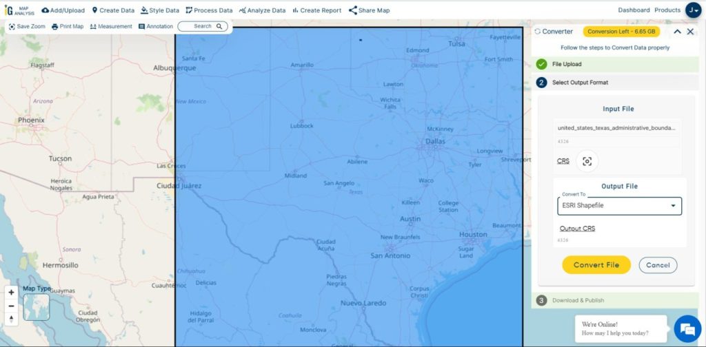
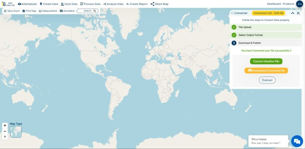
With MAPOG’s versatile toolkit, you can effortlessly upload vector, add WMS (Web Map Service) layers, upload Excel or CSV data, incorporate existing files, perform polygon splitting and merging, generate new polygon and polyline data, use the converter for various formats, conduct buffer analysis, create grids, transform points into polygons, calculate isochrones, and utilize the geocoder for precise location information.
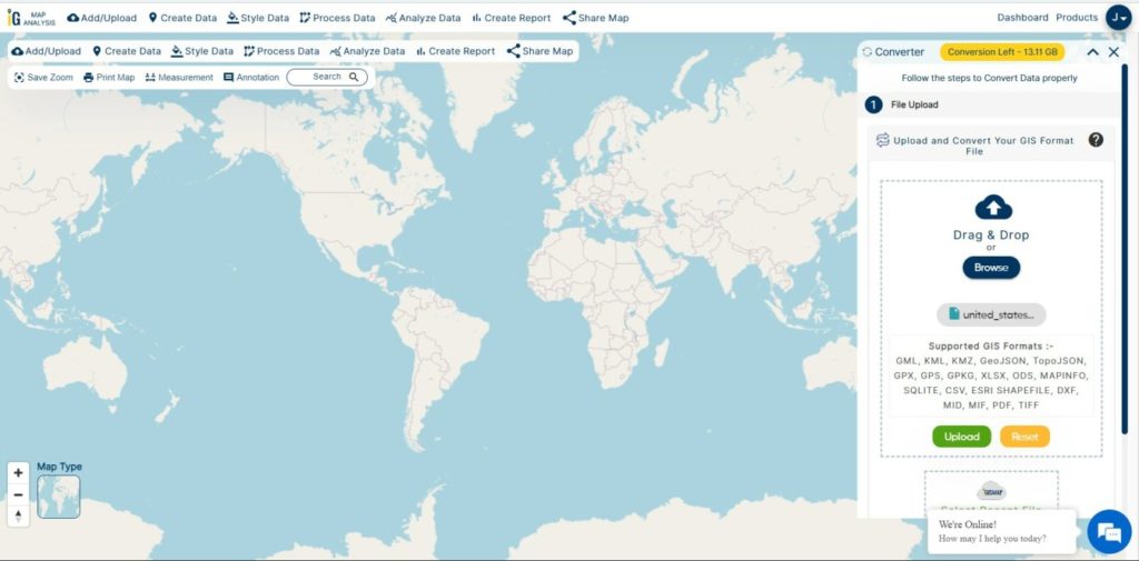
We offer an extensive array of data formats, including KML, SHP, CSV, GeoJSON, Tab, SQL, Tiff, GML, KMZ, GPKZ, SQLITE, Dxf, MIF, TOPOJSON, XLSX, GPX, ODS, MID, and GPS, ensuring compatibility and accessibility for various applications and analyses.
Note:
- All data available are in GCS datum EPSG:4326 WGS84 CRS (Coordinate Reference System).
- You need to login for downloading the shapefile.
Download Shapefile Data of Taiwan
Taiwan, officially the Republic of China (ROC), is a country in East Asia. It is located at the junction of the East and South China Seas in the northwestern Pacific Ocean, with the People’s Republic of China (PRC) to the northwest, Japan to the northeast, and the Philippines to the south. The ROC controls 168 islands with a combined area of 36,193 square kilometers (13,974 square miles). The main island of Taiwan, also known as Formosa, has an area of 35,808 square kilometers (13,826 square miles). Mountain ranges dominate the eastern two-thirds of the island, while plains in the western third host its highly urbanized population. The capital, Taipei, together with New Taipei City and Keelung, forms the largest metropolitan area. With around 23.9 million inhabitants, Taiwan is among the most densely populated countries.
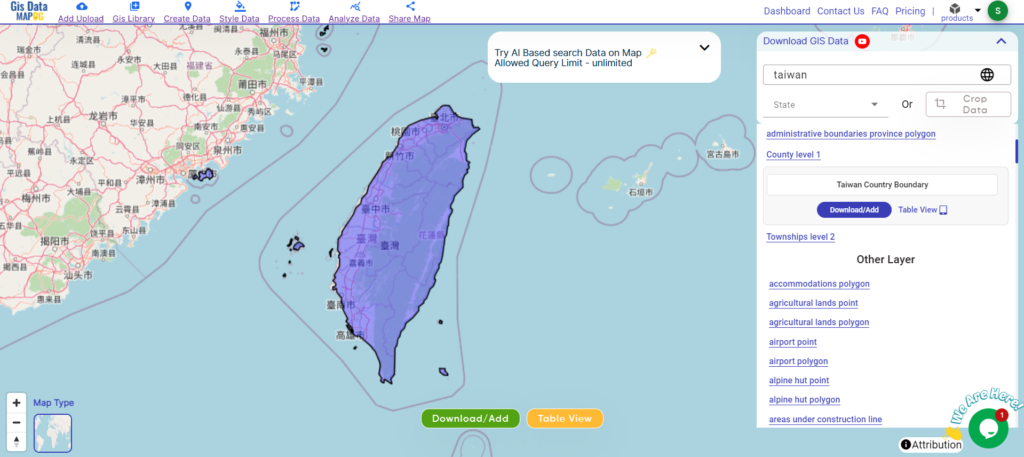
Download Taiwan National Boundary Shapefile
After successfully logging in with a legitimate email address, select the country you want to work with. Next, choose the specific layer you need and click on the download option. Once that’s done, pick the desired format to acquire the essential GIS data. Before proceeding with the data download, make sure to review the data table for any relevant information.
Download Taiwan Counties Shapefile Data
Taiwan boasts 13 counties scattered across the island. From the agricultural heartland of Changhua County to the natural beauty of Hualien County with its stunning Taroko Gorge, each county offers unique experiences.
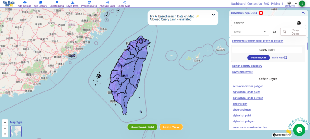
Download Taiwan Counties Boundary Shapefile
Here’s a list of the 13 counties in Taiwan:
- Changhua County
- Chiayi County
- Hsinchu County
- Hualien County
- Kaohsiung County
- Miaoli County
- Nantou County
- Penghu County
- Pingtung County
- Taichung County
- Tainan County
- Taipei County
- Taitung County
Download Taiwan Townships Shapefile Data
Taiwan’s administrative divisions include counties, some of which have been merged with cities. There are no townships that govern the entire island, but there are 184 townships spread across the counties.
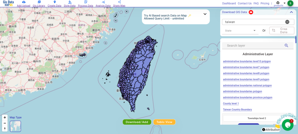
Download Taiwan Townships Boundary Shapefile
Other GIS Data:
- Download Taiwan Airport Point Shapefile
- Download Taiwan Highway Lines Shapefile
- Download Taiwan Road Lines Shapefile
- Download Taiwan Rivers Shapefile
Above all links are provided for GIS data of Taiwan if you are looking for any specific data please write us on support@mapog.com
Download Shapefile for the following:
- World Countries Shapefile
- Australia
- Argentina
- Austria
- Belgium
- Brazil
- Canada
- Denmark
- Fiji
- Finland
- Germany
- Greece
- India
- Indonesia
- Ireland
- Italy
- Japan
- Kenya
- Lebanon
- Madagascar
- Malaysia
- Mexico
- Mongolia
- Netherlands
- New Zealand
- Nigeria
- Papua New Guinea
- Philippines
- Poland
- Russia
- Singapore
- South Africa
- South Korea
- Spain
- Switzerland
- Tunisia
- United Kingdom Shapefile
- United States of America
- Vietnam
- Croatia
- Chile
- Norway
- Maldives
- Bhutan
- Colombia
- Libya
- Comoros
- Hungary
- Laos
- Estonia
- Iraq
- Portugal
- Azerbaijan
- Macedonia
- Romania
- Peru
- Marshall Islands
- Slovenia
- Nauru
- Guatemala
- El Salvador
- Afghanistan
- Cyprus
- Syria
- Slovakia
- Luxembourg
- Jordan
- Armenia
- Haiti And Dominican Republic
Disclaimer : If you find any shapefile data of country provided is incorrect do contact us or comment below, so that we will correct the same in our system as well we will try to correct the same in openstreetmap.