Download Mississippi state GIS maps – counties, rail, highway, shapefile

GIS Data and Maps of Mississippi State is used by planners and surveyors for visualizing and identifying the patterns that are difficult to examine when data is in table form. Here you can download the GIS data of the state boundary, county division, rail and highway maps in just a few clicks. You can use these data for analysis in MAPOG itself or download them in any suitable GIS format. You can download these data in KML, GeoJSON, CSV or Shapefile formats.

Note:

  • All data available are in GCS datum EPSG:4326 WGS84 CRS (Coordinate Reference System).
  • You need to login for downloading the shapefile.

Download Shapefile Data of Mississippi state

Mississippi is the southern state of the United States with the Mississippi River to its west. Jackson is the capital city of Mississippi.

Mississippi GIS Data - State Boundary
Mississippi State Boundary

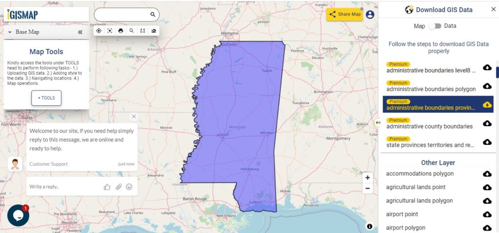
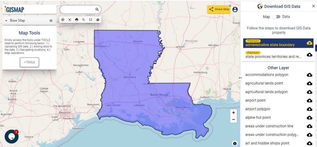
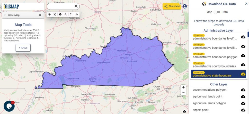
Download Mississippi State Outline Boundary Shapefile

After, clicking on the link State boundary map will appear. Click on download button located near layers name on the Right side of the screen. Once you tap on button of selected layer, a modal will appear. Choose the GIS format from the drop down list. Make sure to check data table through switching button from Map to Data.

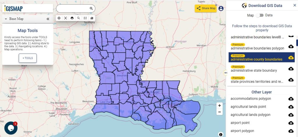
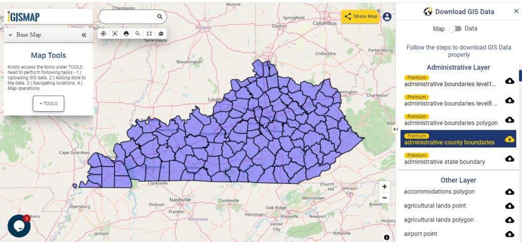
Download Mississippi County Shapefile

Mississippi are divided into 82 counties.

Mississippi GIS Data - County Bondary
Mississippi County Bondary

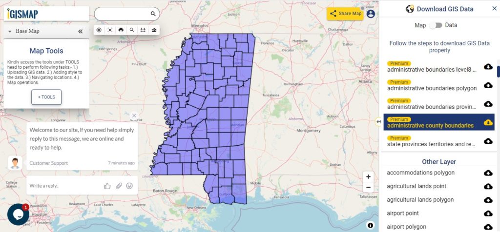
Download Mississippi County Boundary Shapefile

In above screen polygon shapefile of Mississippi state. In addition to administrative GIS maps other GIS layers are available for example – art & hobbies shops point, polygon, ATM point, areas under construction, etc.

Above all, Gis data covers the following Mississippi Counties –

  • Adams
  • Alcorn
  • Amite
  • Attala
  • Benton
  • Bolivar
  • Calhoun
  • Carroll
  • Chickasaw
  • Choctaw
  • Claiborne
  • Clarke
  • Clay
  • Coahoma
  • Copiah
  • Covington
  • De Soto
  • Forrest
  • Franklin
  • George
  • Greene
  • Grenada
  • Hancock
  • Harrison
  • Hinds
  • Holmes
  • Humphreys
  • Issaquena
  • Itawamba
  • Jackson
  • Jasper
  • Jefferson
  • Jefferson Davis
  • Jones
  • Kemper
  • Lafayette
  • Lamar
  • Lauderdale
  • Lawrence
  • Leake
  • Lee
  • Leflore
  • Lincoln
  • Lowndes
  • Madison
  • Marion
  • Marshall
  • Monroe
  • Montgomery
  • Neshoba
  • Newton
  • Noxubee
  • Oktibbeha
  • Panola
  • Pearl River
  • Perry
  • Pike
  • Pontotoc
  • Prentiss
  • Quitman
  • Rankin
  • Scott
  • Sharkey
  • Simpson
  • Smith
  • Stone
  • Sunflower
  • Tallahatchie
  • Tate
  • Tippah
  • Tishomingo
  • Tunica
  • Union
  • Walthall
  • Warren
  • Washington
  • Wayne
  • Webster
  • Wilkinson
  • Winston
  • Yalobusha
  • Yazoo

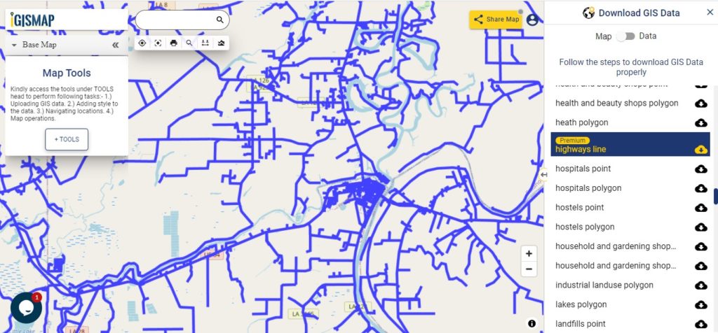
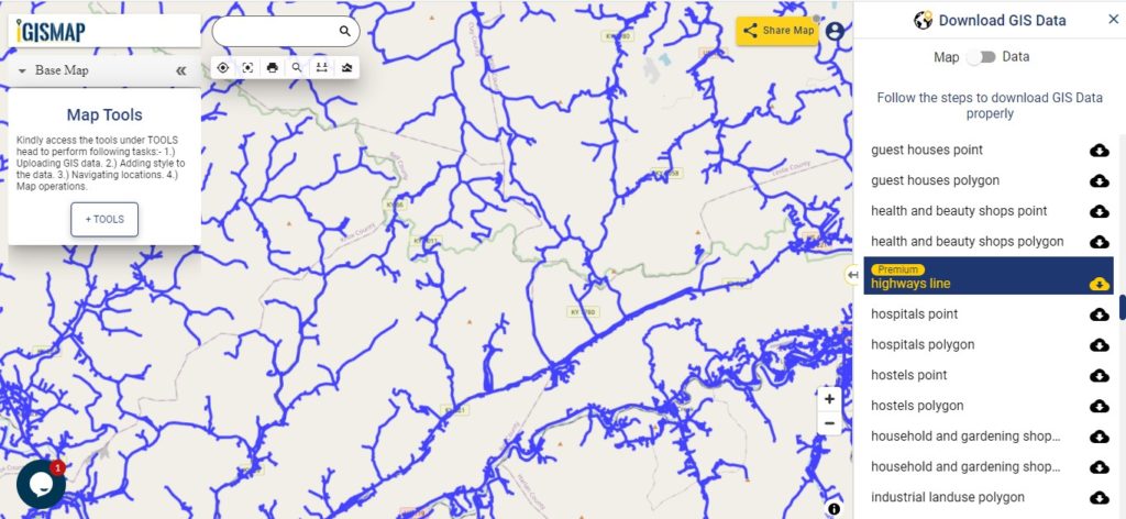
Highway Line GIS Data of Mississippi

Mississippi GIS Data - Highway Line
Mississippi Highway Line

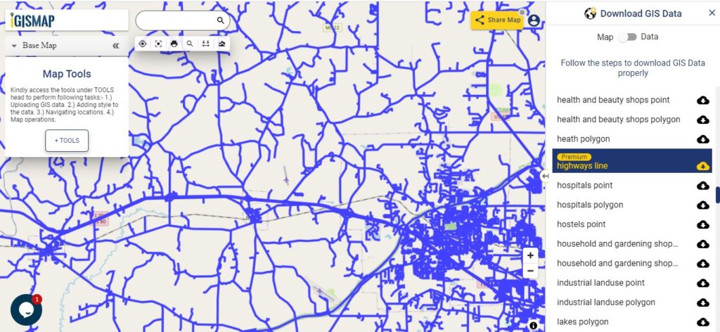
Download Mississippi Highway Line Shapefile

Zoom in view of highway line map is shown shown above. Similarly, you can easily download point based GIS data of airport point, ATM point, parking area, hospital location, etc.

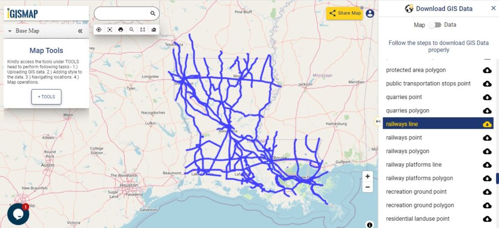
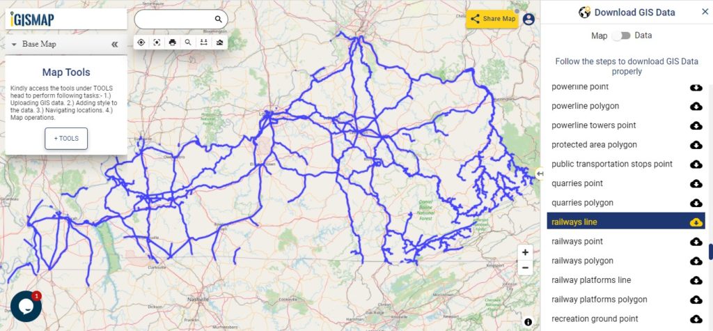
Railway Line GIS Data of Mississippi

Mississippi GIS Data - Railway Line
Mississippi Railway Line

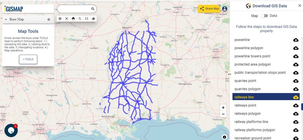
Download Mississippi Railway Line Shapefile

Railway line map is shown in above screen. Likewise you can download other GIS layers too. For example – Recreation grounds, residential, restaurants, business location, etc.

Download GIS Data of other states of USA:

  1. Alabama
  2. Alaska
  3. Arizona
  4. Arkansas
  5. California
  6. Colorado
  7. Connecticut
  8. Florida
  9. Georgia
  10. Hawaii
  11. Idaho
  12. Illinois
  13. Indiana
  14. Iowa
  15. Kansas
  16. Massachusetts
  17. Maryland
  18. Michigan
  19. Minnesota
  20. Mississipi
  21. Missouri
  22. Montana
  23. Nevada
  24. Nebraska
  25. Ohio
  26. Oklahoma
  27. Pennsylvania
  28. Utah
  29. Vermont
  30. Washington
  31. Wisconsin
  32. Wyoming
  33. Tennessee
  34. Texas
  35. Kentucky
  36. Louisiana
  37. Maine
  38. North Carolina
  39. Oregon
  40. Virginia
  41. West Virginia

Disclaimer : If you find any shapefile data of country provided is in correct do contact us or comment below, so that we will correct the same in our system.

Download Louisiana State GIS Map – Boundary, Parishes, Rail, highway

GIS Data and Maps of Louisiana State is used by planners and surveyors for visualizing and identifying the patterns that are difficult to examine when data is in table form. Here you can download the GIS data of the state boundary, county division, rail and highway maps in just a few clicks. You can use these data for analysis in MAPOG itself or download them in any suitable GIS format. You can download these data in KML, GeoJSON, CSV or Shapefile formats.

Note:

  • All data available are in GCS datum EPSG:4326 WGS84 CRS (Coordinate Reference System).
  • You need to login for downloading the shapefile.

Download Shapefile Data of Louisiana State

Louisiana State is the Southeastern state of the United States. Baton Rouge is the capital city of the state.

Louisiana GIS Data - State Boundary
Louisiana State Boundary

Download Louisiana State Outline Boundary Shapefile

In the above screen, the administrative boundary map is shown. Before download view the data table by switching button from Map to Data (shown on the above screen with arrow). Click on the button placed beside the layer name. A modal will appear, select the gis format i.e. Shapefile, Kml, CSV, GeoJSON, Mapinfo, PostgreSQL, etc. Further, if you want your GIS data in another GIS formats use Gis File Converter.

Download Louisiana Counties GIS Data

The U.S. state Louisiana is divided into 64 Parishes.

Louisiana GIS Data - County Boundary
Louisiana County Boundary

Download Louisiana County Boundary Shapefile

A state map with divisions is shown on the above screen. You can change color, add an attribute column, add a legend for a more understandable view use the Analysis Tool.

This GIS Map covers following parishes (Counties)-

  • Acadia
  • Allen
  • Ascension
  • Assumption
  • Avoyelles
  • Beauregard
  • Bienville
  • Bossier
  • Caddo
  • Calcasieu
  • Caldwell
  • Cameron
  • Catahoula
  • Claiborne
  • Concordia
  • De Soto
  • East Baton Rouge
  • Parish East Carroll
  • East Feliciana
  • Evangeline
  • Franklin
  • Grant
  • Iberia
  • Iberville
  • Jackson
  • Jefferson
  • Jefferson Davis
  • La Salle
  • Lafayette
  • Lafourche
  • Lincoln
  • Livingston
  • Madison
  • Morehouse
  • Natchitoches
  • Orleans
  • Ouachita
  • Plaquemines
  • Pointe Coupee
  • Rapides
  • Red River
  • Richland
  • Sabine
  • St. Bernard
  • St. Charles
  • St. Helena
  • St. James
  • St. John The Baptist
  • St. Landry
  • St. Martin
  • St. Mary
  • St. Tammany
  • Tangipahoa
  • Tensas
  • Terrebonne
  • Union
  • Vermilion
  • Vernon
  • Washington
  • Webster
  • West Baton Rouge
  • The West Carroll
  • West Feliciana
  • Winn

Highway Line GIS data of Louisiana

Louisiana GIS Data - Highway Line
Louisiana Highway Line

Download Louisiana Highway Line Shapefile

Zoom in view of highway line map is shown shown above. Similarly, you can easily download point based GIS data of airport point, ATM point, parking area, hospital location, etc.

Railways Line Map of Louisiana State

Louisiana GIS Data - Railway Line
Louisiana Railway Line

Download Louisiana Railway Line Shapefile

Railway line map of Louisiana state is shown in ab0ve screen. In addition, to railway line you are able to download residential land point, polygon, restaurant GIS location layer.

Download GIS Data of other states of USA:

  1. Alabama
  2. Alaska
  3. Arizona
  4. Arkansas
  5. California
  6. Colorado
  7. Connecticut
  8. Florida
  9. Georgia
  10. Hawaii
  11. Idaho
  12. Illinois
  13. Indiana
  14. Iowa
  15. Kansas
  16. Massachusetts
  17. Maryland
  18. Michigan
  19. Minnesota
  20. Mississipi
  21. Missouri
  22. Montana
  23. Nevada
  24. Nebraska
  25. Ohio
  26. Oklahoma
  27. Pennsylvania
  28. Utah
  29. Vermont
  30. Washington
  31. Wisconsin
  32. Wyoming
  33. Tennessee
  34. Texas
  35. Kentucky
  36. Louisiana
  37. Maine
  38. North Carolina
  39. Oregon
  40. Virginia
  41. West Virginia

Disclaimer : If you find any shapefile data of country provided is in correct do contact us or comment below, so that we will correct the same in our system.

Download Kentucky State GIS Maps – Boundary, Counties, Rail, highway

GIS Data and Maps of Kentucky State is used by planners and surveyors for visualizing and identifying the patterns that are difficult to examine when data is in table form. Here you can download the GIS data of the state boundary, county division, rail and highway maps in just a few clicks. You can use these data for analysis in MAPOG itself or download them in any suitable GIS format. You can download these data in KML, GeoJSON, CSV or Shapefile formats.

Note:

  • All data available are in GCS datum EPSG:4326 WGS84 CRS (Coordinate Reference System).
  • You need to login for downloading the shapefile.

Download Free Shapefile Data of Kentucky State

Kentucky State is a U.S. state in the southern region. Frankfort is the capital city of Kentucky. Download state boundary, county, rail, highway gis maps in just a few clicks. Before download first, you need to log in or register.

Kentucky GIS Data - State Boundary
Kentucky State Boundary

Download Kentucky State Outline Boundary Shapefile

In the above screen, the Kentucky GIS map is shown. Before download makes sure to check the data table of the map by switching from Map to data. (Shown in the screen above) For download tap on the button located near the layer name. A modal will appear to select the GIS format in which you want your GIS data.

Download Counties shapefile of Kentucky state

There are 79 (seventy – nine ) counties in the Kentucky State of United States.

Kentucky GIS Data - County Boundary
Kentucky County Boundary

Download Kentucky County Boundary Shapefile

You can view a polygon map of the Kentucky State. You can also add an attribute column if you want, then use the analysis tool. Create your custom map and share it with others.

The GIS map covers information about following counties of Kentucky.

  • Adair
  • Allen
  • Anderson
  • Ballard
  • Barren
  • Bath
  • Bell
  • Boone
  • Bourbon
  • Boyd
  • Boyle
  • Bracken
  • Breathitt
  • Breckinridge
  • Bullitt
  • Butler
  • Caldwell
  • Calloway
  • Campbell
  • Carlisle
  • Carroll
  • Carter
  • Casey
  • Christian
  • Clark
  • Clay
  • Clinton
  • Crittenden
  • Cumberland
  • Daviess
  • Edmonson
  • Elliott
  • Estill
  • Fayette
  • Fleming
  • Floyd
  • Franklin
  • Fulton
  • Gallatin
  • Garrard
  • Grant
  • Graves
  • Grayson
  • Green
  • Greenup
  • Hancock
  • Hardin
  • Harlan
  • Harrison
  • Hart
  • Henderson
  • Henry
  • Hickman
  • Hopkins
  • Jackson
  • Jefferson
  • Jessamine
  • Johnson
  • Kenton
  • Knott
  • Knox
  • Larue
  • Laurel
  • Lawrence
  • Lee
  • Leslie
  • Letcher
  • Lewis
  • Lincoln
  • Livingston
  • Logan
  • Lyon
  • McCracken
  • McCreary
  • McLean
  • Madison
  • Magoffin
  • Marion
  • Marshall
  • Martin
  • Mason
  • Meade
  • Menifee
  • Mercer
  • Metcalfe
  • Monroe
  • Montgomery
  • Morgan
  • Muhlenberg
  • Nelson
  • Nicholas
  • Ohio
  • Oldham
  • Owen
  • Owsley
  • Pendleton
  • Perry
  • Pike
  • Powell
  • Pulaski
  • Robertson
  • Rockcastle
  • Rowan
  • Russell
  • Scott
  • Shelby
  • Simpson
  • Spencer
  • Taylor
  • Todd
  • Trigg
  • Trimble
  • Union
  • Warren
  • Washington
  • Wayne
  • Webster
  • Whitley
  • Wolfe
  • Woodford

Highway Line GIS Data of Kentucky State

Kentucky GIS Data - Highway Line
Kentucky Highway Line

Download Kentucky Highway Line Shapefile

Zoom in view of highway line map is shown shown above. Similarly, you can easily download point based GIS data of airport point, ATM point, parking area, hospital location, etc.

Kentucky State Railways Line GIS data

Kentucky GIS Data - Railway Line
Kentucky Railway Line

Download Kentucky Railway Line Shapefile

Railway Line GIS map of the U.S. State Kentucky is shown on above screen.

Download GIS Data of other states of USA:

  1. Alabama
  2. Alaska
  3. Arizona
  4. Arkansas
  5. California
  6. Colorado
  7. Connecticut
  8. Florida
  9. Georgia
  10. Hawaii
  11. Idaho
  12. Illinois
  13. Indiana
  14. Iowa
  15. Kansas
  16. Massachusetts
  17. Maryland
  18. Michigan
  19. Minnesota
  20. Mississipi
  21. Missouri
  22. Montana
  23. Nevada
  24. Nebraska
  25. Ohio
  26. Oklahoma
  27. Pennsylvania
  28. Utah
  29. Vermont
  30. Washington
  31. Wisconsin
  32. Wyoming
  33. Tennessee
  34. Texas
  35. Kentucky
  36. Louisiana
  37. Maine
  38. North Carolina
  39. Oregon
  40. Virginia
  41. West Virginia

Disclaimer : If you find any shapefile data of country provided is in correct do contact us or comment below, so that we will correct the same in our system.