GIS Data and Maps of Marryland State is used by planners and surveyors for visualizing and identifying the patterns that are difficult to examine when data is in table form. Here you can download the GIS data of the state boundary, county division, rail and highway maps in just a few clicks. You can use these data for analysis in IGISMAP itself or download them in any suitable GIS format. You can download these data in KML, GeoJSON, CSV or Shapefile formats.
Note:
- All data available are in GCS datum EPSG:4326 WGS84 CRS (Coordinate Reference System).
- You need to login for downloading the shapefile.
Download Free Shapefile Data of Maryland State
The U.S. State Maryland is a mid- Atlantic region state with Annapolis as a Capital city of the state. Maryland State is known as Free State.
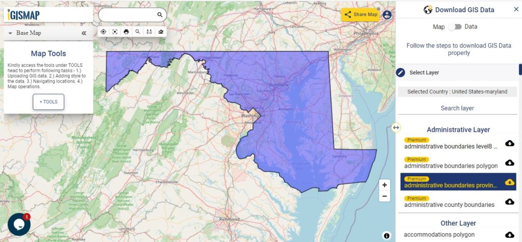
Download Maryland State Outline Boundary Shapefile
In the above screen United States – Maryland state boundary is shown on the map. Map layers are provided on the left side of the screen. For download click on the button placed beside the layer name. A modal will appear on the screen select the GIS format in which you want your map or data. Make sure to check the data table before downloading by a toggle from Map to Data.
Download Counties shapefile of Maryland State
Maryland is divided into 24 counties.
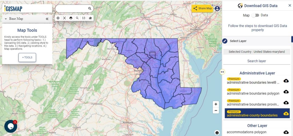
Download Maryland County Boundary Shapefile
In the above map screen, you see the Maryland State County Division Map. If you want your map more attractive and appealing try the MAPOG and share your map with others.
Above Gis Map Covers following Counties –
- Allegany
- Anne Arundel
- Baltimore
- Baltimore City
- Calvert
- Caroline
- Carroll
- Cecil
- Charles
- Dorchester
- Frederick
- Garrett
- Harford
- Howard
- Kent
- Montgomery
- Prince George’s
- Queen Anne’s
- St. Mary’s
- Somerset
- Talbot
- Washington
- Wicomico
- Worcester
Highway Line Gis Data of Maryland State
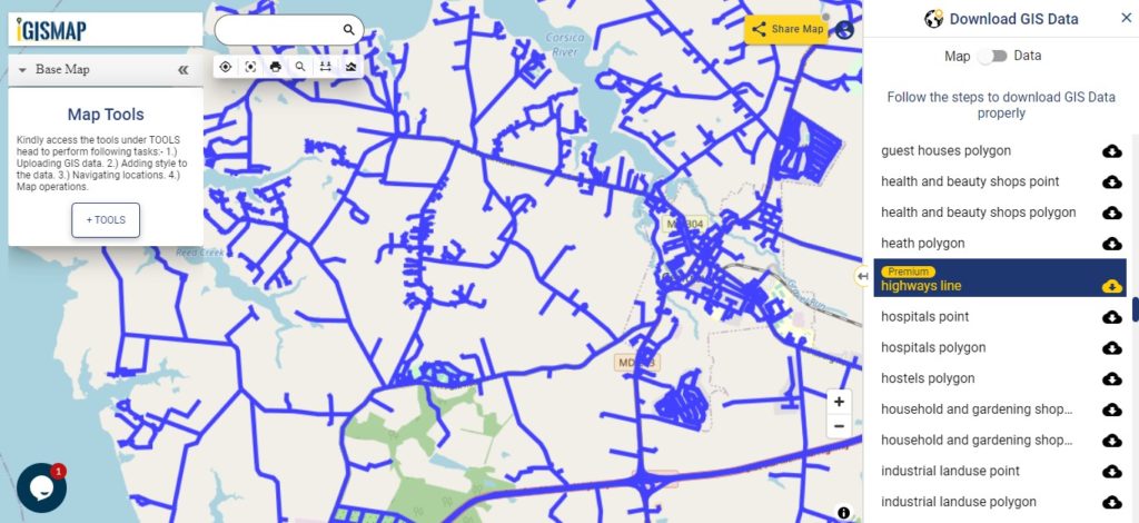
Download Maryland Highway Line Shapefile
Zoom in view of highway line map is shown shown above. Similarly, you can easily download point based GIS data of airport point, ATM point, parking area, hospital location, etc.
Railways LinE GIS Data of Maryland
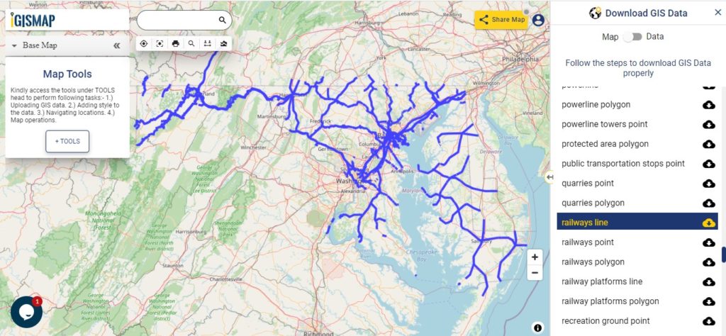
Download Maryland Railway Line Shapefile
Railway line GIS Map is shown in above screen. With above all links you can download GIS data for research and study.
Download GIS Data of other states of USA:
- Alabama
- Alaska
- Arizona
- Arkansas
- California
- Colorado
- Connecticut
- Florida
- Georgia
- Hawaii
- Idaho
- Illinois
- Indiana
- Iowa
- Kansas
- Massachusetts
- Maryland
- Michigan
- Minnesota
- Mississipi
- Missouri
- Montana
- Nevada
- Nebraska
- Ohio
- Oklahoma
- Pennsylvania
- Utah
- Vermont
- Washington
- Wisconsin
- Wyoming
- Tennessee
- Texas
- Kentucky
- Louisiana
- Maine
- North Carolina
- Oregon
- Virginia
- West Virginia
Disclaimer : If you find any shapefile data of country provided is in correct do contact us or comment below, so that we will correct the same in our system.