

Unlock a world of geospatial insights with MAPOG, your gateway to Download Pakistan Administrative Boundary GIS Data for– National, Province, Districts and more. Dive into a treasure trove of datasets covering national, provincial, district levels, and more.
Navigating Pakistan’s GIS data is seamless with MAPOG. Access over 200 meticulously curated datasets to detailing administrative boundaries and geographic features such as rivers, roads, and national parks. Our platform offers intuitive tools for effortless exploration: Download Pakistan Administrative Boundary GIS Data for– National, Province, Districts and more. With the Download GIS Data tool, choose from a variety of formats like Shapefile, KML, GeoJSON, or CSV to obtain the precise data you need. Need guidance on using the Add GIS Data tool? Consult our comprehensive guide for step-by-step instructions. Let MAPOG be your trusted companion on an enriching geospatial journey through Pakistan’s breathtaking landscapes.
With MAPOG’s versatile toolkit, you can effortlessly upload vector, add WMS (Web Map Service) layers, upload Excel or CSV data, incorporate existing files, perform polygon splitting and merging, generate new polygon and polyline data, use the converter for various formats, conduct buffer analysis, create grids, transform points into polygons, calculate isochrones, and utilize the geocoder for precise location information.
Our platform supports an extensive range of data formats, including KML, SHP, CSV, GeoJSON, Tab, SQL, Tiff, GML, KMZ, GPKZ, SQLITE, Dxf, MIF, TOPOJSON, XLSX, GPX, ODS, MID, and GPS, ensuring seamless compatibility and accessibility across different analyses.
Note:
- all data provided by MAPOG are in GCS datum EPSG:4326 WGS84 CRS (Coordinate Reference System).
- Additionally, access to shapefile downloads requires logging in to the platform.
Download Pakistan Administrative Boundary- National
Pakistan, nestled in South Asia, offers a captivating blend of natural beauty and cultural heritage. Bordered by India, China, Afghanistan, and Iran, it boasts diverse landscapes ranging from the towering peaks of the Karakoram and Himalayas to the vast deserts of Sindh and Balochistan. The country’s rich geography includes iconic landmarks such as K2, the second-highest mountain in the world, the ancient city of Mohenjo-Daro, and the bustling metropolis of Karachi.

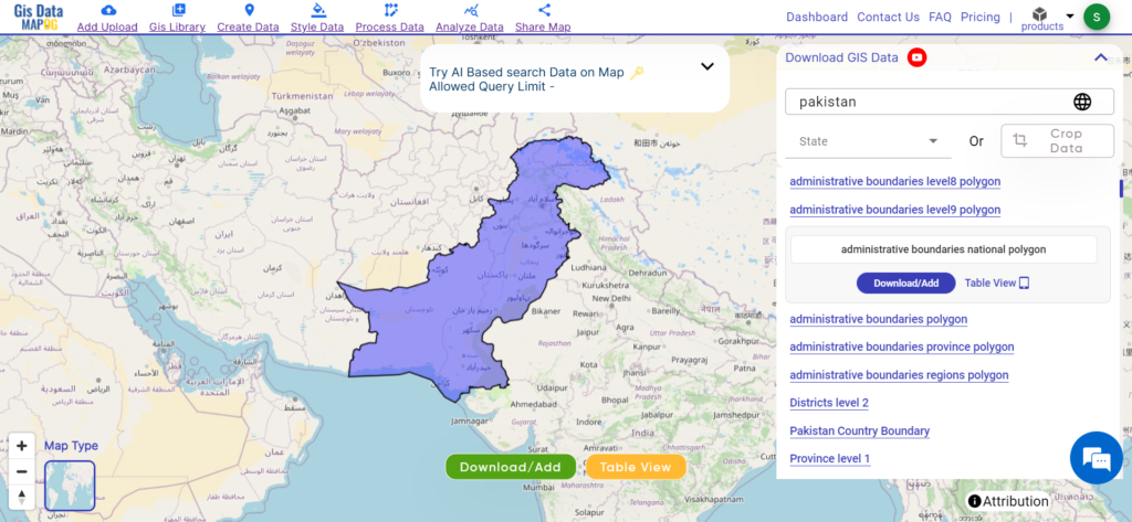
Download Pakistan National Boundary
Download Pakistan Administrative Boundary- provinces
Pakistan is divided into four provinces and two autonomous territories, each encompassing a unique blend of cultural, geographical, and historical significance. These regions play a vital role in decentralized governance and regional development efforts. Delve into the administrative boundaries and geographic features of Pakistan’s provinces and territories to gain a deeper understanding of their diversity and importance. Here are Pakistan’s provinces and territories:
- Punjab
- Sindh
- Khyber Pakhtunkhwa
- Balochistan
- Gilgit-Baltistan (Autonomous territory)
- Azad Jammu and Kashmir (Autonomous territory)
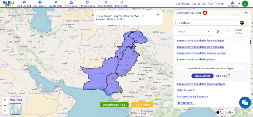
Download Pakistan Provinces Shapefile
Download Pakistan Administrative Boundary- Districts
Pakistan is divided into 154 districts, each encapsulating a unique blend of cultural heritage, geographical features, and administrative significance. These districts serve as fundamental units of governance and are essential for regional development efforts. Delve into the administrative boundaries and geographic features of Pakistan’s districts to gain a deeper understanding of their diversity and importance.
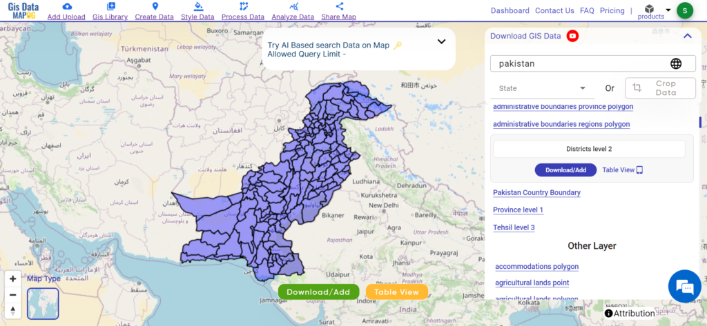
Download Pakistan District Shapefile
Other GIS Data:
- Download Pakistan Airport Point Data
- Download Pakistan Tourism Data
- Download Pakistan Forest Data
- Download Pakistan Settlement Data
Above all links are provided for GIS data of Pakistan if you are looking for any specific data please write us on support@mapog.com
Download Data for the following:
- World Countries Shapefile
- Australia
- Argentina
- Austria
- Belgium
- Brazil
- Canada
- Denmark
- Fiji
- Finland
- Germany
- Greece
- India
- Indonesia
- Ireland
- Italy
- Japan
- Kenya
- Lebanon
- Madagascar
- Malaysia
- Mexico
- Mongolia
- Netherlands
- New Zealand
- Nigeria
- Papua New Guinea
- Philippines
- Poland
- Russia
- Singapore
- South Africa
- South Korea
- Spain
- Switzerland
- Tunisia
- United Kingdom Shapefile
- United States of America
- Vietnam
- Croatia
- Chile
- Norway
- Maldives
- Bhutan
- Colombia
- Libya
- Comoros
- Hungary
- Laos
- Estonia
- Iraq
- Portugal
- Azerbaijan
- Macedonia
- Romania
- Peru
- Marshall Islands
- Slovenia
- Nauru
- Guatemala
- El Salvador
- Afghanistan
- Cyprus
- Syria
- Slovakia
- Luxembourg
- Jordan
- Armenia
- Haiti And Dominican Republic
- Malta
- Djibouti
- East Timor
- Micronesia
- Morocco
- Liberia
- Kosovo
- Isle Of Man
- Paraguay
- Tokelau
- Palau
- Ile De Clipperton
- Mauritius
- Equatorial Guinea
- Tonga
- Myanmar
- Thailand
- New Caledonia
- Niger
- Nicaragua
- Pakistan
- Nepal
- Seychelles
- Democratic Republic of the Congo
- China
- Kenya
- Kyrgyzstan
- Bosnia Herzegovina
- Burkina Faso
- Canary Island
- Togo
- Israel And Palestine
- Algeria
- Suriname
- Angola
- Cape Verde
- Liechtenstein
- Taiwan
- Turkmenistan
- Tuvalu
- Ivory Coast
- Moldova
- Somalia
- Belize
Disclaimer : If you find any shapefile data of country provided is incorrect do contact us or comment below, so that we will correct the same in our system as well we will try to correct the same in openstreetmap.