Download Kenya Locations Data in Shapefile, KML, MID and more

Need accurate location-based geographic data for better planning and mapping? Download Kenya Locations Data easily with GIS Data by MAPOG, a powerful platform designed to provide structured GIS datasets in multiple formats like Shapefile, KML, MID, GeoJSON, and many more. This platform helps users access organized administrative and location-based datasets for infrastructure planning, research, development projects, and spatial analysis.

Understanding Kenya Locations Data

Kenya Locations Data includes important geographic boundaries and administrative location details used for mapping, governance, land planning, and regional analysis. These datasets help users understand area divisions, settlements, and local administrative structures more clearly.

With GIS Data by MAPOG, users can quickly access these datasets from a large collection of 200+ countries and 900+ layers. Since multiple GIS formats are supported, the data can be easily used across different GIS software platforms for professional analysis and visualization.

Download Kenya Locations Data

Important Note:
  • All datasets are available in GCS datum EPSG:4326 WGS84 CRS (Coordinate Reference System).
  • Users must log in before accessing and downloading their required GIS data formats.

Step-by-Step Guide to Download Kenya Locations Data

Step 1: Search for Kenya Locations Data

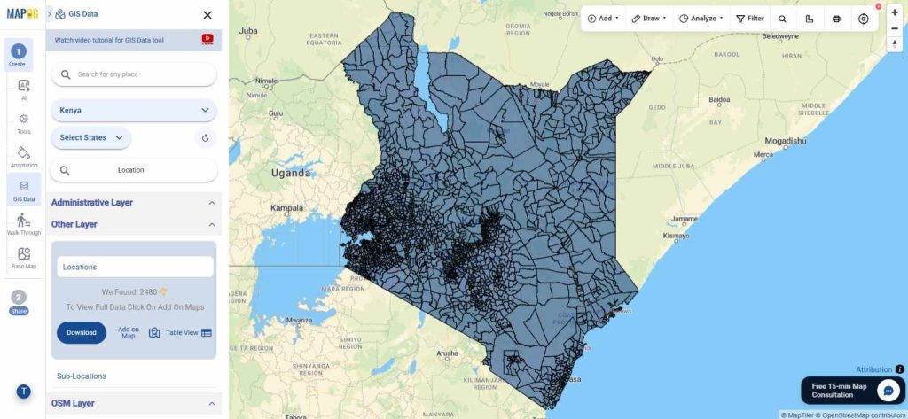
Begin by selecting GIS Data tool. Choose “Kenya” in select country panel. Then, you can get the Locations layer in other layer or use the search layer option and enter Locations Data to find the relevant dataset. You should also review the attributes section to check whether the data is available in point, polygon, or boundary format.
Download Kenya Locations Data
Step 2: Apply Data Filters

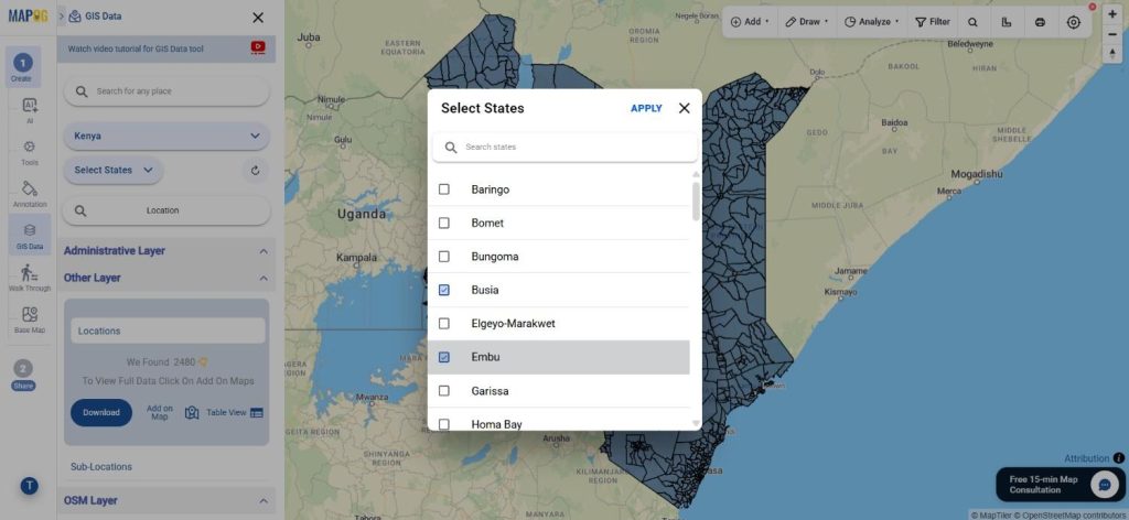
The Filter Data option allows users to refine results more effectively. Data can be filtered using state, district, or smaller administrative divisions for more precise searching. If large-scale country-level data is available, this filtering feature helps users go deeper into highly specific local-level information.
Download Kenya Locations Data
Step 3: Use the “Add on Map” Option

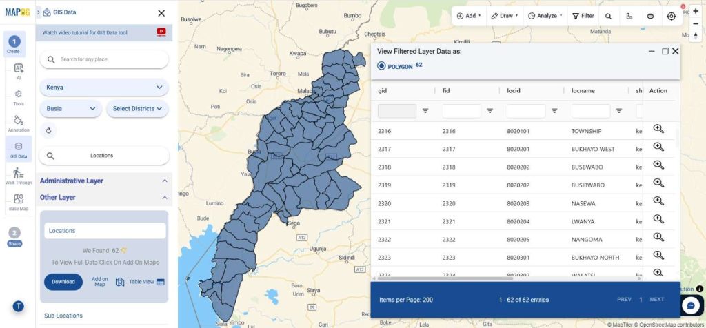
The “Add on Map” feature helps users directly place the selected layer onto the map analysis interface. This makes visualization much easier and supports further spatial analysis by allowing users to study boundaries, nearby features, and geographic relationships more efficiently.
Download Kenya Locations Data
Step 4: Download Kenya Locations Data

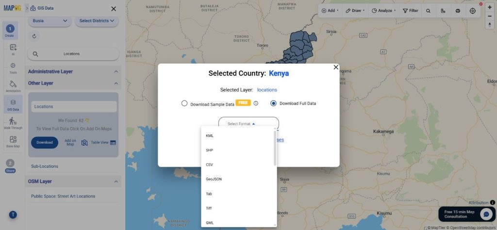
After reviewing the dataset, click on the download option to proceed. Users can choose either sample data or the full dataset depending on their project needs. Select the preferred format such as Shapefile, KML, MID, GeoJSON, CSV, SQL, DXF, MIF, GPX, or other supported formats. Accept the terms and complete the process to Download Kenya Locations Data successfully.
Download Kenya Locations Data

Conclusion

GIS Data by MAPOG makes geographic data access simple, fast, and highly efficient. Whether the requirement is for planning, mapping, administration, or GIS-based research, users can easily Download Kenya Locations Data in flexible formats suitable for multiple platforms. With smart search tools, filtering options, and map visualization features, the entire workflow becomes smoother and more accurate for every GIS project.

Download More Useful Data from Kenya:

Download Shapefile for the following:

  1. World Countries Shapefile
  2. Australia
  3. Argentina
  4. Austria
  5. Belgium
  6. Brazil
  7. Canada
  8. Denmark
  9. Fiji
  10. Finland
  11. Germany
  12. Greece
  13. India
  14. Indonesia
  15. Ireland
  16. Italy
  17. Japan
  18. Kenya
  19. Lebanon
  20. Madagascar
  21. Malaysia
  22. Mexico
  23. Mongolia
  24. Netherlands
  25. New Zealand
  26. Nigeria
  27. Papua New Guinea
  28. Philippines
  29. Poland
  30. Russia
  31. Singapore
  32. South Africa
  33. South Korea
  34. Spain
  35. Switzerland
  36. Tunisia
  37. United Kingdom Shapefile
  38. United States of America
  39. Vietnam
  40. Croatia
  41. Chile
  42. Norway
  43. Maldives
  44. Bhutan
  45. Colombia
  46. Libya
  47. Comoros
  48. Hungary
  49. Laos
  50. Estonia
  51. Iraq
  52. Portugal
  53. Azerbaijan
  54. Macedonia
  55. Romania
  56. Peru
  57. Marshall Islands
  58. Slovenia
  59. Nauru
  60. Guatemala
  61. El Salvador
  62. Afghanistan
  63. Cyprus
  64. Syria
  65. Slovakia
  66. Luxembourg
  67. Jordan
  68. Armenia
  69. Haiti And Dominican Republic
  70. Malta
  71. Djibouti
  72. East Timor
  73. Micronesia
  74. Morocco
  75. Liberia
  76. Kosovo
  77. Isle Of Man
  78. Paraguay
  79. Tokelau
  80. Palau
  81. Ile De Clipperton
  82. Mauritius
  83. Equatorial Guinea
  84. Tonga
  85. Myanmar
  86. Thailand
  87. New Caledonia
  88. Niger
  89. Nicaragua
  90. Pakistan
  91. Nepal
  92. Seychelles
  93. Democratic Republic of the Congo
  94. China
  95. Kenya
  96. Kyrgyzstan
  97. Bosnia Herzegovina
  98. Burkina Faso
  99. Canary Island
  100. Togo
  101. Israel And Palestine
  102. Algeria
  103. Suriname
  104. Angola
  105. Cape Verde
  106. Liechtenstein
  107. Taiwan
  108. Turkmenistan
  109. Tuvalu
  110. Ivory Coast
  111. Moldova
  112. Somalia
  113. Belize
  114. Swaziland
  115. Solomon Islands
  116. North Korea
  117. Sao Tome And Principe
  118. Guyana
  119. Serbia
  120. Senegal And Gambia
  121. Faroe Islands
  122. Guernsey Jersey
  123. Monaco
  124. Tajikistan
  125. Pitcairn

Disclaimer : The GIS data provided for download in this article was initially sourced from OpenStreetMap (OSM) and further modified to enhance its usability. Please note that the original data is licensed under the Open Database License (ODbL) by the OpenStreetMap contributors. While modifications have been made to improve the data, any use, redistribution, or modification of this data must comply with the ODbL license terms. For more information on the ODbL, please visit OpenStreetMap’s License Page.

Here are some blogs you might be interested in:

Download Mauritius Administrative Boundary Shapefiles – National , Districts, Villages and More

download-mauritius-administrative-boundary-shapefiles-national-districts-villages-and-more

It’s fantastic to hear that MAPOG has expanded its GIS data collection to include data for more than 100 new countries, bringing the total coverage to over 150 countries. This is undoubtedly a valuable resource for GIS enthusiasts and professionals around the world. The availability of detailed information on administrative divisions, rivers, roads, and airports can greatly enhance various geospatial projects and analyses.

The option to access the data through tools like “Download GIS Data” and “Add GIS Data” seems convenient and user-friendly. Providing data in different formats such as Shapefile, KML, GeoJSON, and CSV ensures compatibility with a wide range of GIS software and applications, making it easier for users to integrate the data into their workflows.

This article will walk you through downloading administrative-level GIS data for Mauritius using the Download GIS Data tool. Experience a seamless geospatial journey with MAPOG as your trusted partner!

Note:

  • All data available are in GCS datum EPSG:4326 WGS84 CRS (Coordinate Reference System).
  • You need to login for downloading the shapefile.

Download Shapefile Data of Mauritius

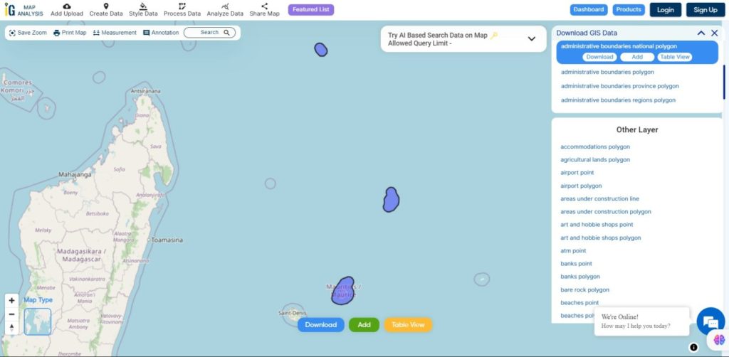
Mauritius lies 2,000 km (1,200 mi) off the southeast coast of Africa, between latitudes 19°58.8’S and 20°31.7’S and longitudes 57°18.0’E and 57°46.5’E.

Mauritius National Boundary

Download Mauritius National Boundary Shapefile

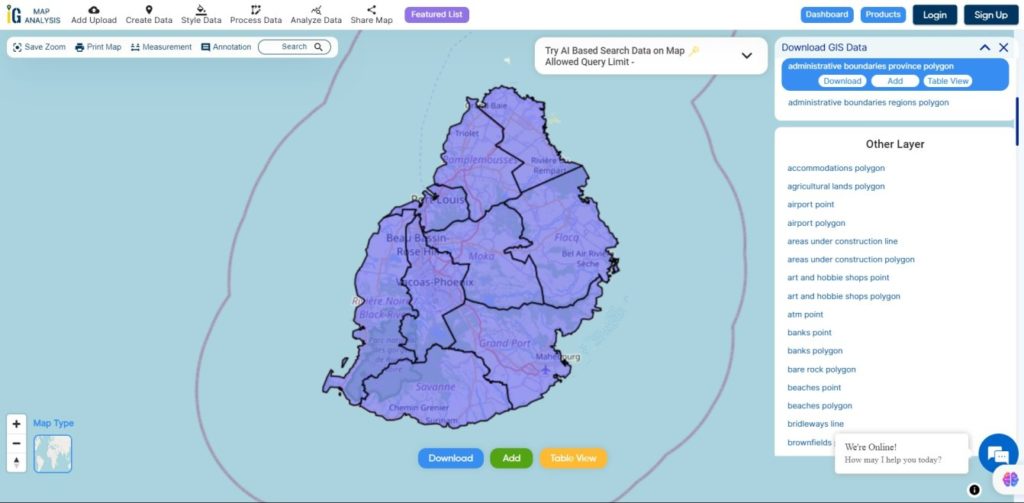
Download Mauritius Districts Shapefile Data

Mauritius is divided into 9 Districts

  • Flacq
  • Grand Port
  • Moka
  • Pamplemousses
  • Plaines Wilhems
  • Port Louis
  • Riviere du Rempart
  • Riviere Noire
  • Savanne
Mauritius Districts Boundaries

Download Mauritius Districts Boundaries Shapefile

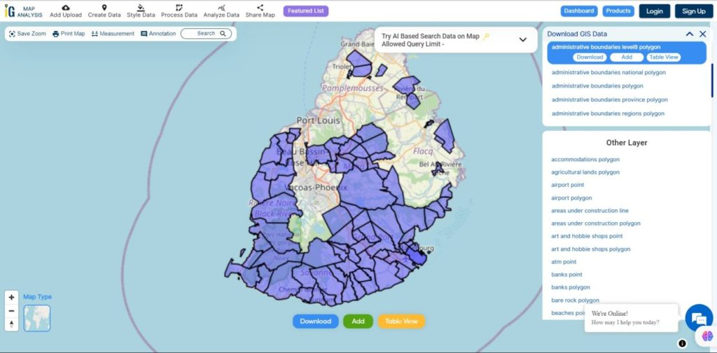
Download Mauritius Village Shapefile Data

Mauritius is divided into 88 Villages

Mauritius Villages Boundaries

Download Mauritius Villages Boundaries Shapefile

Other GIS Data:

Download Free Shapefile for the following:

  1. World Countries Shapefile
  2. Australia
  3. Argentina
  4. Austria
  5. Belgium
  6. Brazil
  7. Canada
  8. Denmark
  9. Fiji
  10. Finland
  11. Germany
  12. Greece
  13. India
  14. Indonesia
  15. Ireland
  16. Italy
  17. Japan
  18. Kenya
  19. Lebanon
  20. Madagascar
  21. Malaysia
  22. Mexico
  23. Mongolia
  24. Netherlands
  25. New Zealand
  26. Nigeria
  27. Papua New Guinea
  28. Philippines
  29. Poland
  30. Russia
  31. Singapore
  32. South Africa
  33. South Korea
  34. Spain
  35. Switzerland
  36. Tunisia
  37. United Kingdom Shapefile
  38. United States of America
  39. Vietnam
  40. Norway
  41. Chile
  42. Croatia
  43. Estonia
  44. Laos
  45. Hungary
  46. Libya
  47. Comoros
  48. Colombia
  49. Bhutan
  50. Maldives
  51. Iraq
  52. Azerbaijan
  53. Portugal

Disclaimer : If you find any shapefile data of country provided is incorrect do contact us or comment below, so that we will correct the same in our system as well we will try to correct the same in OpenStreetMap.

Create Customized Maps with Google Maps – My Map Feature

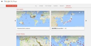
My Map is one of the new feature offered by the Google Maps, Google maps are trying to satisfy their users by providing the best ease of using the Google Maps. Customization has reached to a level that now it is available in the google maps too. My maps is the tool which helps in making your own customized and personal maps.

Customization of the Maps has never been so easy than this. customization itself is a very much good attribute to hike upon on business and as we all know that we like the things which we can mould according to us, according to our comfort, according to our ease of use ,according to our benefit.

My Maps feature on web Platform – Google Map

Primary Features of My Maps

Let us check the way to use My Maps Feature on web, so as to create your own customized map:

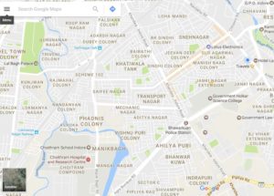
  • To use my maps features of Google Maps open Google Maps in the Web platform google map  my map editor. Or you can do it by navigating to google map and follow this steps:

Customized Maps With Google Maps

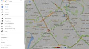
  • Tap on the hamburger button located left to the search bar.
  • when you tap on the hamburger button you will see ‘your places’ options.

Customized Maps With Google Maps

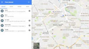
  • Tap on ‘your places’ option.

Customized Maps With Google Maps

  • once you tap on the ‘your places’ options you will see the card getting opened for your your places.
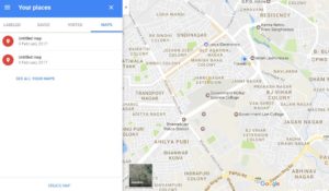
  • Tap on the ‘Maps’ option of the ‘your places’ card.
  • Customized Maps With Google Maps
  • once you tap that card you will see the maps you have already created and in the bottom you will see the option to ‘create maps’ and ‘see all your maps’.
  • Tap on either of the option to create your customized map.

Customized Maps With Google Maps

  • You will see this ‘create a new Map’ option, tap on it and now you can create your own map.

customized maps with google Maps

So, this is how you can make your customized map. Still not satisfied with the level of customization? okay not a big deal for google Maps, adding more features to Customization now you can also add image to your markers. As shown in the above image you can see at the right bottom of the card a camera sign, that means you can also add the image of your choice to that mark.

There are so many things which you can do with your customized Maps , such as :

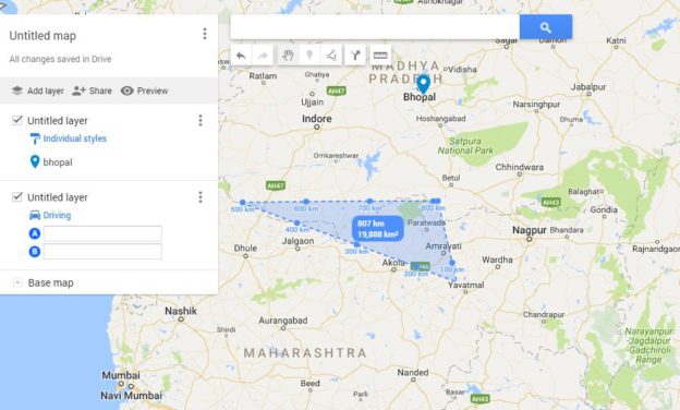
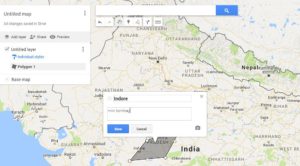
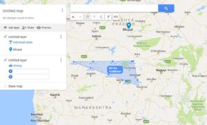
  • Making Polygons: You can make polygons with the help of ‘draw line’ options by joining them. You can also change the color of the polygon once you save the polygon you can add color to it by tapping on the style icon. We use colors to give every polygon an Identity, You can give blue color to the polygon for water surfaces, green indicates park or garden.
  • Draw lines :  While with the plain lining you can also add the route for four wheeler, two wheeler and for the pedalist as well. You can use styling to color the poly lines also.
  • Label the spots :  you can also add the spots and label them.

customized maps with google Maps

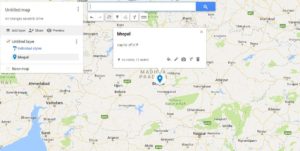
  • Add the Marker : as shown in the above image I have marked a location by tapping on the pin.
  • You can also add directions to it:  you can add directions too while creating your customized map.
  • measure the distances: Google Maps customized map also help you in measuring the distances.

customized maps with google Maps

Share your Maps:  

You can also share your Maps by tapping on the ‘your Places’ and then tapping on the Maps to see all your Maps when you can see all  your Maps tap on any map and then it will be opened up as shown in the above picture.tap on the share button and then give a name to your Map and fill its description, and then add the name of the people you want to share it with and change the access according to you.

Secondary Features Of My Maps – Create Customized Map

Google Maps’ My Maps features also facilitates you to check map explorer option of Google map:

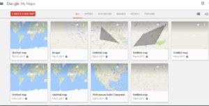
  • All Maps that you have created, own and the ones which you do not own.

Customized Maps with My Maps Feature of Google Maps

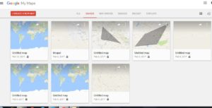
  • Maps you own

Customized Maps with My Maps Feature of Google Maps

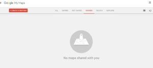
  • Maps shared with You

Customized Maps with My Maps Feature of Google Maps

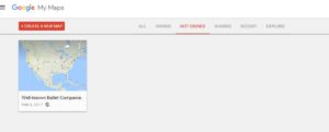
  • Maps not owned by you

Customized Maps with My Maps Feature of Google Maps

  • Maps you have been recently to.

Customized Maps with My Maps Feature of Google Maps

Maps View :

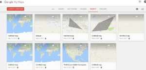
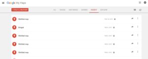
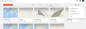
You can also view the maps according to your preferences, you can arrange them in the list or grid order, you can also sort them according to you.

  • List View

google maps My maps feature

  • Sorting

customized maps of google maps

Moreover, you can also ‘Share customized maps’ on Google maps ,for other users to use and explore them and get to know about the various locations. Google Maps are very much known and reachable to anyone across the globe.

Look more Google Map tips and Tricks, So,now make your own map ,showcase your location, let people know more about the places , and enjoy the customization at Google Maps too.

💬 Book a Meeting