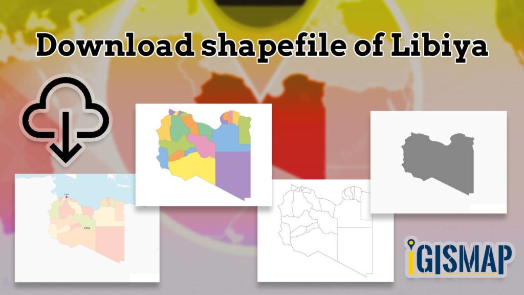
Thrilling updates for those passionate about Geographic Information Systems (GIS)! IGISMAP’s GIS data collection has now expanded to include Libya, among over 100 other countries. Dive into the comprehensive and up-to-date GIS data for Libya, encompassing a wide array of geographic and administrative features like water bodies, roads, airport locations, and more. This dataset encompasses various administrative boundaries, providing valuable insights for your mapping projects, whether on a national or local scale. You have the flexibility to choose from formats such as ESRI Shapefile, KML, GeoJSON, and CSV for easy downloads. Don’t miss out on this exceptional opportunity to elevate your mapping projects with the latest GIS data for Libya, complete with administrative boundaries. Enjoy your exploration and mapping!
With MAPOG’s versatile toolkit, you can effortlessly upload vector, add WMS (Web Map Service) layers, upload Excel or CSV data, incorporate existing files, perform polygon splitting and merging, generate new polygon and polyline data, use the converter for various formats, conduct buffer analysis, create grids, transform points into polygons, calculate isochrones, and utilize the geocoder for precise location information.
We provide an extensive range of data formats, including KML, SHP, CSV, GeoJSON, Tab, SQL, Tiff, GML, KMZ, GPKZ, SQLITE, Dxf, MIF, TOPOJSON, XLSX, GPX, ODS, MID, and GPS, ensuring compatibility and accessibility for a variety of applications and analyses.
If you want to know how to use Add GIS Data tool, check out this article Add GIS data from IGISMap GIS data collection.
Note:
- All data available are in GCS datum EPSG:4326 WGS84 CRS (Coordinate Reference System).
- You need to login for downloading the shapefile.
Download Shapefile Data of Libya
Nestled within the Maghreb region of North Africa, Libya stands as a country of substantial importance, officially known as the State of Libya. It shares its borders with the Mediterranean Sea to the north, Egypt to the east, Sudan to the southeast, Chad to the south, Niger to the southwest, Algeria to the west, and Tunisia to the northwest. Comprising the historical regions of Tripolitania, Fezzan, and Cyrenaica, Libya’s vast expanse covers 1.8 million km2 (700,000 sq mi), ranking it as Africa’s fourth-largest and the Arab world’s, as well as the 16th largest globally. The dynamic capital, Tripoli, nestled in the northwest, not only houses over a million residents but also resonates as a center of cultural and societal vibrancy within the nation’s seven million-strong population.
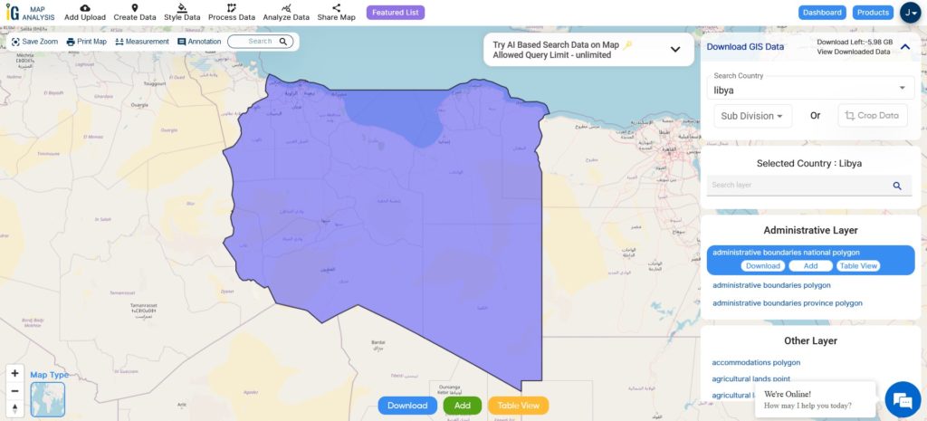
Download Libya National Boundary Shapefile
After successfully logging in with a legitimate email address, select the country you want to work with. Next, choose the specific layer you need and click on the download option. Once that’s done, pick the desired format to acquire the essential GIS data. Before proceeding with the data download, make sure to review the data table for any relevant information.
Download Libya District Shapefile Data
Libya is divided into twenty-two districts. Districts are the highest administrative regions in Libya.
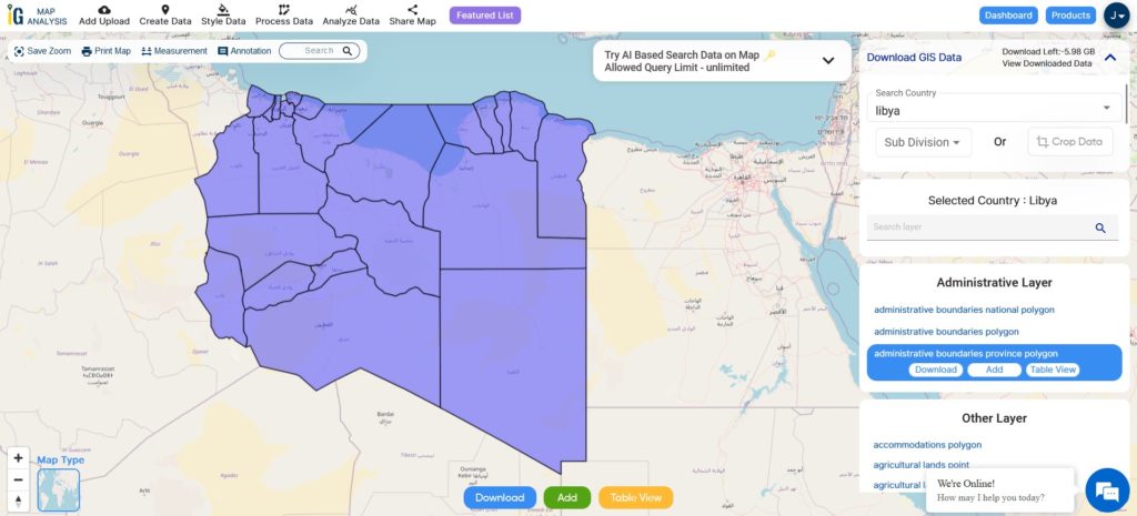
Download Libya Districts Shapefile
This shapefile covers following districts of Libya listed below:
- Tripoli
- Murqub
- Jabal al Gharbi
- Nalut
- Zawiya
- Jafara
- Misrata
- Sirte
- Benghazi
- Marj
- Butnan
- Al Wahat
- Kufra
- Al Jufra
- Wadi al Shatii
- Murzuq
- Sabha
- Wadi al Hayaa
- Nalut
- Yafran
- Ghadamis
- Ghat
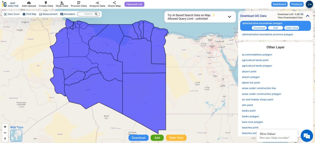
Download Libya Administrative Boundaries Combined Shapefile Data
There are currently 22 districts in Libya, according to the 2007 Administrative Divisions Law.These districts are further subdivided into municipalities (baladiyat). The municipalities are the basic administrative units in Libya. They are responsible for providing basic services to the people, such as education, healthcare, and infrastructure.
Download Libya National, District Shapefile
Other GIS Data:
- Download Libya Road Lines Shapefile
- Download Libya Highway Lines Shapefile
- Download Libya Agricultural lands Shapefile
- Download Libya Railway Lines Shapefile
- Download Libya Airport Point Shapefile
- Download Libya River Line Shapefile
Above all links are provided for GIS data of Libya if you are looking for any specific data please write us on support@mapog.com
Download Shapefile for the following:
- World Countries Shapefile
- Australia
- Argentina
- Austria
- Belgium
- Brazil
- Canada
- Denmark
- Fiji
- Finland
- Germany
- Greece
- India
- Indonesia
- Ireland
- Italy
- Japan
- Kenya
- Lebanon
- Madagascar
- Malaysia
- Mexico
- Mongolia
- Netherlands
- New Zealand
- Nigeria
- Papua New Guinea
- Philippines
- Poland
- Russia
- Singapore
- South Africa
- South Korea
- Spain
- Switzerland
- Tunisia
- United Kingdom Shapefile
- United States of America
- Vietnam
- Croatia
- Chile
- Norway
- Maldives
- Bhutan
- Colombia
- Libya
- Comoros
- Hungary
- Laos
- Estonia
- Iraq
- Portugal
- Azerbaijan
- Macedonia
- Romania
- Peru
- Marshall Islands
- Slovenia
- Nauru
- Guatemala
- El Salvador
- Afghanistan
- Cyprus
- Syria
- Slovakia
- Luxembourg
- Jordan
- Armenia
- Haiti And Dominican Republic
Disclaimer : If you find any shapefile data of country provided is incorrect do contact us or comment below, so that we will correct the same in our system as well we will try to correct the same in openstreetmap.