Download Algeria Administrative Boundary Shapefiles – National, Districts, Municipalities and more

Algeria Shapefile Download Map – Free Polygon Administrative Download. Shapefiles showing Districts , Municipalities and Town and Cities.

Have you been searching too long for accurate GIS data for your country of interest? Well the wait is over with MAPOG, your one-stop destination for comprehensive GIS data covering 150+ countries. You can find more than 150 GIS data for each nation in MAPOG GIS Data Collection. The distinctive feature of MAPOG GIS data collection lies in its commitment to providing highly accurate GIS data of the administrative divisions. Users can also find data of other natural and man made geographic features such as river, roads, railway lines, airport locations etc. that are represented in appropriate geometric structures (point, line and polygon). MAPOG provides two important tools for accessing these GIS datasets – Download GIS Data and Add GIS Data.

With MAPOG’s versatile toolkit, you can effortlessly upload vector and raster filesadd WMS (Web Map Service) layers, upload Excel or CSV data, incorporate existing files, perform polygon splitting and merging, generate new polygon and polyline data, use the converter for various formats, conduct buffer analysiscreate gridstransform points into polygons, calculate isochrones, and utilize the geocoder for precise location information.

We offer an extensive array of data formats, including KML, SHP, CSV, GeoJSON, Tab, SQL, Tiff, GML, KMZ, GPKZ, SQLITE, Dxf, MIF, TOPOJSON, XLSX, GPX, ODS, MID, and GPS, ensuring compatibility and accessibility for various applications and analyses.

Note:

  • All data available are in GCS datum EPSG:4326 WGS84 CRS (Coordinate Reference System).
  • You need to login for downloading the shapefile.

Download Shapefile Data of Algeria

Algeria is bordered to the northeast by Tunisia; to the east by Libya; to the southeast by Niger; to the southwest by Mali, Mauritania, and Western Sahara; to the west by Morocco; and to the north by the Mediterranean Sea. It is considered part of the Maghreb region of North Africa. It has a semi-arid geography, with most of the population living in the fertile north and the Sahara dominating the geography of the south. Algeria covers an area of 2,381,741 square kilometres (919,595 sq mi), making it the world’s, tenth largest nation by area and the largest nation in Africa, more than 200 times as large as the continent’s smallest country, The Gambia. With a population of 44 million, Algeria is the tenth-most populous country in Africa, and the 32nd most populous country in the world. The capital and largest city is Algiers, located in the far north on the Mediterranean coast.
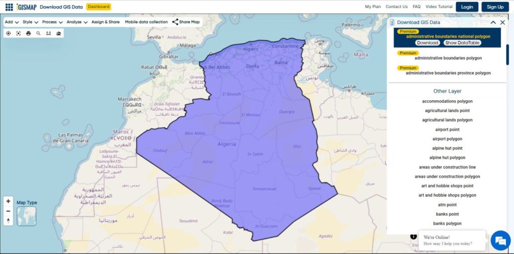
Algeria National Boundary

Download Algeria National Boundary Shapefile

Download Algeria Districts Shapefile Data

Algeria’s districts were created as arrondissements when Algeria was a colony of France and they had a status equal to those of mainland France. They were, like France’s arrondissements, part of departements, which are further part of a région (which was called a territory, territoire, in French Algeria). They were maintained 6 years after the country’s independence (until 1968) when they were renamed “daïras” and had their functions slightly changed.

Algeria Districts Boundaries

Download Algeria Districts Boundaries Shapefile

Download Algeria Municipalities Shapefile Data

The municipalities of Algeria form the third level of administrative subdivisions of Algeria. As of 2002, there were 1,541 municipalities in the country.

Algeria Municipalities Boundaries

Download Algeria Municipalities Boundaries Shapefile

Other Administrative Boundary Data:

Other GIS Data:

Download Shapefile for the following:

  1. World Countries Shapefile
  2. Australia
  3. Argentina
  4. Austria
  5. Belgium
  6. Brazil
  7. Canada
  8. Denmark
  9. Fiji
  10. Finland
  11. Germany
  12. Greece
  13. Greenland
  14. India
  15. Indonesia
  16. Ireland
  17. Italy
  18. Japan
  19. Kenya
  20. Lebanon
  21. Madagascar
  22. Malaysia
  23. Mexico
  24. Mongolia
  25. Netherlands
  26. New Zealand
  27. Nigeria
  28. Papua New Guinea
  29. Philippines
  30. Poland
  31. Russia
  32. Singapore
  33. South Africa
  34. South Korea
  35. Spain
  36. Switzerland
  37. Tunisia
  38. United Kingdom Shapefile
  39. United States of America
  40. Vietnam
  41. Norway
  42. Chile
  43. Crotia

Disclaimer : If you find any shapefile data of country provided is incorrect do contact us or comment below, so that we will correct the same in our system as well we will try to correct the same in openstreetmap.

Download Angola Administrative Boundary Shapefiles – National, Provinces and more

Download GIS data of Angola such as Angola National Boundary, Provinces, Municipalities and more. Download in Shapefile or CSV formats

Are you struggling to find accurate and up-to-date GIS data for your desired country? Worry no more, as MAPOG is here to be your ultimate solution! Our platform offers a comprehensive collection of GIS data covering more than 150 countries. You’ll find an impressive selection of over 150 GIS datasets available for each nation in the MAPOG GIS Data Collection. The hallmark of our GIS data lies in its exceptional accuracy, especially when representing administrative divisions. Moreover, our users can access a diverse range of data pertaining to natural and man-made geographic features, including rivers, roads, railway lines, airport locations, and much more, all meticulously represented in appropriate geometric structures (points, lines, and polygons). Facilitating seamless access to this invaluable data are two essential tools – Download GIS Data and Add GIS Data, thoughtfully integrated into the MAPOG platform. To delve deeper into the functionalities of the Add GIS Data tool, check out our enlightening article – “Add GIS data from IGISMap GIS data collection

With MAPOG’s versatile toolkit, you can effortlessly upload vector and raster filesadd WMS (Web Map Service) layers, upload Excel or CSV data, incorporate existing files, perform polygon splitting and merging, generate new polygon and polyline data, use the converter for various formats, conduct buffer analysiscreate gridstransform points into polygons, calculate isochrones, and utilize the geocoder for precise location information.

We offer an extensive array of data formats, including KML, SHP, CSV, GeoJSON, Tab, SQL, Tiff, GML, KMZ, GPKZ, SQLITE, Dxf, MIF, TOPOJSON, XLSX, GPX, ODS, MID, and GPS, ensuring compatibility and accessibility for various applications and analyses.

Note:

  • All data available are in GCS datum EPSG:4326 WGS84 CRS (Coordinate Reference System).
  • You need to login for downloading the shapefile.

Download Shapefile Data of Angola

Angola is located on the western Atlantic Coast of Southern Africa between Namibia and the Republic of the Congo. It also is bordered by the Democratic Republic of the Congo and Zambia to the east. The country consists of a sparsely watered and somewhat sterile coastal plain extending inland for a distance varying from 50 to 160 km (31 to 99 mi). Slightly inland and parallel to the coast is a belt of hills and mountains and behind those a large plateau. The total land size is 1,246,700 km2 (481,400 sq mi). It has an Exclusive Economic Zone of 518,433 km2 (200,168 sq mi).

Angola National Boundary

Download Angola National Boundary Shapefile

Download Angola Provinces Shapefile Data

Angola is divided into eighteen provinces, known in Portuguese as províncias:

  • Bengo
  • Caxito
  • Benguela
  • Bié
  • Cabinda
  • Cuando Cubango
  • Cuanza Norte
  • Cuanza Sul
  • Cunene
  • Huambo
  • Huíla
  • Luanda
  • Lunda Norte
  • Lunda Sul
  • Malanje
  • Moxico
  • Namibe
  • Uíge
  • Zaire
Angola Provinces Boundaries

Download Angola Provinces Boundaries Shapefiles

Other GIS Data:

Download Shapefile for the following:

  1. World Countries Shapefile
  2. Australia
  3. Argentina
  4. Austria
  5. Belgium
  6. Brazil
  7. Canada
  8. Denmark
  9. Fiji
  10. Finland
  11. Germany
  12. Greece
  13. India
  14. Indonesia
  15. Ireland
  16. Italy
  17. Japan
  18. Kenya
  19. Lebanon
  20. Madagascar
  21. Malaysia
  22. Mexico
  23. Mongolia
  24. Netherlands
  25. New Zealand
  26. Nigeria
  27. Papua New Guinea
  28. Philippines
  29. Poland
  30. Russia
  31. Singapore
  32. South Africa
  33. South Korea
  34. Spain
  35. Switzerland
  36. Tunisia
  37. United Kingdom Shapefile
  38. United States of America
  39. Vietnam
  40. Norway
  41. Chile
  42. Crotia

Disclaimer : If you find any shapefile data of country provided is in correct do contact us or comment below, so that we will correct the same in our system as well we will try to correct the same in OpenStreetMap.

Download Chile Administrative Boundary Shapefiles – Regional State Administrative Agencies, Municipalities & more

That’s fantastic news! GIS enthusiasts will definitely appreciate the availability of GIS data for over 100 new countries. If you’re interested in obtaining shapefiles of the important administrative divisions of Chile, you can find the download links for various formats such as KML, GeoJSON, and CSV on the IGISMAP website. These files will allow you to explore and analyze the geographical and administrative aspects of Chile in your GIS applications. Enjoy exploring the data!

Note:

  • All data available are in GCS datum EPSG:4326 WGS84 CRS (Coordinate Reference System).
  • You need to login for downloading the shapefile.

Download Free Shapefile Data of Chile

Chile is a long, narrow country stretching along South America’s western edge, with more than 6,000km of Pacific Ocean coastline. Santiago, its capital, sits in a valley surrounded by the Andes and Chilean Coast Range mountains. The city’s palm-lined Plaza de Armas contains the neoclassical cathedral and the National History Museum. The massive Parque Metropolitano offers swimming pools, a botanical garden and zoo.

Chile National Boundary

Download Chile National Boundary Shapefile

Once you click on the link, you will be redirected to the gis data of Chile, select the format and tap on download button.

Download Chile Province Shapefile Data

A province is the second-largest administrative division in Chile with 56 in total. The largest administrative division in Chile is that of a region with 16 in total.

Chile Province Boundaries Shapefile

Download Chile Province Boundaries Shapefile

Download Chile Municipalities Shapefile Data

A commune is the smallest administrative subdivision in Chile. It may contain cities, towns, villages, hamlets as well as rural areas. In highly populated areas, such as Santiago, Valparaíso and Concepción, a conurbation may be broken into several communes. In sparsely populated areas, conversely, a commune may cover a substantial rural area together with several settled areas which could range from hamlets to towns or cities.

Chile Municipality Boundaries

Download Chile Municipality Boundaries Shapefile

Other Administrative Boundary Data:

Download Free Shapefile for the following:

  1. World Countries Shapefile
  2. Australia
  3. Argentina
  4. Austria
  5. Belgium
  6. Brazil
  7. Canada
  8. Croatia
  9. Denmark
  10. Fiji
  11. Finland
  12. Germany
  13. Greece
  14. India
  15. Indonesia
  16. Ireland
  17. Italy
  18. Japan
  19. Kenya
  20. Lebanon
  21. Madagascar
  22. Malaysia
  23. Mexico
  24. Mongolia
  25. Netherlands
  26. New Zealand
  27. Nigeria
  28. Papua New Guinea
  29. Philippines
  30. Poland
  31. Russia
  32. Singapore
  33. South Africa
  34. South Korea
  35. Spain
  36. Switzerland
  37. Tunisia
  38. United Kingdom Shapefile
  39. United States of America
  40. Vietnam
  41. Norway
  42. Albania
  43. GCC Sates
  44. Bolivia
  45. Algeria

Disclaimer : If you find any shapefile data of country provided is incorrect do contact us or comment below, so that we will correct the same in our system as well we will try to correct the same in OpenStreetMap.

Plot telephone pole locations online with attribute data

Structure of telecommunication networks are complex and create large quantities of geographically dispersed data. Consider you are a data engineer working in the telecommunication sector who wants to plot telephone pole locations with its attribute data to keep the track for its operations and maintenance. The attribute data added with the plotted locations can help you to observe information associated with each telephone pole and maybe embed this map on the department website.

GIS technology is advancing in various field including the telecommunications sector to build maps and perform GIS analysis. Limited GIS software are available that provides services in both creating maps and hosting them on websites. GIS mapping enables people working in telecommunication sectors to enhance network planning, deployment, maintenance, operations, and even sales and marketing.

IGISMap gives powerful tool sets to create interactive maps of locations and geospatial features associated with any applications based on social services, business analysis, scientific research etc. Using the tools in the IGISMap application, we can track, maintain and analyze the telephone poles. IGISMap is a web platform providing multiple GIS applications that are most important in the field of geospatial analytics. GIS tools of IGISMap application allows users to Add Data, Create Data, Map Data, Style Data, Process Data, Analyze Data and also help users to Share Data privately or publicly

How to plot Telephone pole locations online with Attributes?

Create Point Data tool of IGISMap is a powerful GIS tool to plot point vector data to represent locations and point objects with latitude and longitude value. Using this online tool, we can plot the locations of telephone poles and can add the attribute data to each location of the data created.

Telephone pole locations

Click https://map.igismap.com/add-points to open Create Point Data tool

Create Point Data tool

Start Plotting Points for Telephone Pole Locations

First step is Add Points, where we can start plotting the telephone pole locations as pins. IGISMap provides you with three features for plotting points: Drop Points, Search Address, and Lat Lon Values.

Drop points let us drop a pin at the desired location on the map. Zoom to the location of the telephone pole and click to add the pin.

Add Points – Drop Points

Search Address option opens a search address box, where you can enter an address and choose the right location address from the dropdown and click the Plot button to plot a point on that location.

Add Points – Search Address

Lat Lon Values will open two boxes to enter latitude and longitude values of the location you want to plot, Plot Location button in this option will plot a pin at the location you have entered.

Add Points – Lat Lon

Also, a popup will open for entering attribute values in each attribute field for that telephone pole locations when a point is plotting. Click the Submit button to submit the save the attribute entries. You can choose to delete the point you plotted by clicking the Delete Point button. You can disable the default opening of this popup using the toggle button.

But we can open this popup anytime while plotting, by simply clicking on an existing pin.

Note: If the Drop Points option is active for dropping pins, it should be unselected for selecting the plotted pins to open the attribute popup.

After plotting every desired slum locations for our data, click the Save and Publish button to publish your data in the map.

Review and edit the datatable

After publishing Telephone poles, Show/Edit Datatable section will be opened. Here you can edit the attribute values entered for each point location after clicking button in the datatable along each row in the datatable. You can also choose to delete a point by clicking button.

Show Datatable

Options to edit or delete the attribute fields are also available in this step along with the option to add new attribute fields to this data. If you thought of adding more points to the data of ATM Locations, select the Back button to go to the Add Points section, where you can add more points and make changes to the already published data.

Option to update the data table as bulk is available in this section. Where the whole data table can be downloaded in Excel format using Download Datatable button. And to make the changes outside IGISMap, then upload the edited/updated spreadsheet file using Upload Datatable button and integrate with the same point data of ATM locations. 

After making all the changes in the datatable, let’s move to the styling section by clicking the Next button to finish plotting.

Style Your Telephone Pole Points

A map will become more meaningful if appropriate icons and colors are used to visualize the features of the map. In IGISMap styling options, Bubble Style and Icon Style are provided for point GIS data.

In Icon Styling, IGISMap provides two more options – Basic and Category styling. Basic Style will provide an appropriate pin icon for styling the telephone pole points and apply it on the telephone poles data as follows.

Basic Icon style

Another style is the Category Icon styling, where users can select the category on the basis of which styling is added to the point data. For example, if the user selects maintenance attribute as a categorical option, style is changed to symbol using those items.

Category Icon style

Check this article to understand How to style point GIS data categorically using Icon Style tool

Bubble style is used to visualize the data quantitatively based on the numerical fields in the datatable. We can assign the size and color of the bubble for each class of values.

Bubble style

Check this article understand How to create Bubble Map for point GIS data

Click on Save Style option to save the Bubble style option for the added points.

It’s done! Now if the user wants to add more points, click on Create more points on the layer option. If the user wants to create a new layer, select Create New Layer option.

Created point GIS data

After the point GIS data of telephone pole locations is published in the name Telephone poles, More option beside the data provides list of other features. They can be used for adding more points, showing the legend in the map, editing the style and more.

More options

Check the article Share your Map to understand about Share Map feature of IGISMap.

Check other articles:
Check the following IGISMap tools:

Map the locations of slums and embed the map on your website

On one fine day, people from a well reputed Non-Governmental Organization (NGO) contacted us about how we can locate slum areas. This NGO works for social welfare activities such as food, clothes, water supply, drainage, etc. for the people who live in slums. They basically wanted a web map for slum locations where they can provide the above social services and keep track of various details to those locations through visualization and spatial analysis.

The use of GIS technology is advancing in the field of data science and information technology as demand for maps and geospatial analysis became important in both public and private sectors. There is limited GIS software that provides services in both creating maps and hosting them on websites. IGISMap gives powerful tool sets to create interactive maps of locations and geospatial features associated with applications based on social services, business analysis, scientific research etc. Using the tools of IGISMap, we can manage, analyze, and visualize slum areas where monitoring and management is required. IGISMap is a web platform providing multiple GIS applications that are most important in the field of geospatial analytics. GIS tools of IGISMap application allows users to Add Data, Create Data, Map Data, Style Data, Process Data, Analyze Data and also help users to Share Data privately or publicly.

IGISMap application has Create Point Data tool which can be used to plot locations and point objects as point vector data model. By using the Create Point Data tool let’s discuss how we can map the slum locations like the following.

Final Map of Slum Locations

Click https://map.igismap.com/add-points to open Create Point Data tool

Start plotting points for the slum locations

In Create Point Data tool, first step is to Add Points, where we can start plotting the slum locations as points, in the form of pins. IGISMap provides you with three features for plotting points: Drop Points, Search Address, and Lat Lon Values.

Create Point Data tool
  • Drop points let us drop a pin at the desired location on the map. Zoom to the location of the slum and click to add the pin.
Drop Points
  • Search Address option opens a search address box, where you can enter an address and choose the right option from the dropdown list, then click the Plot button to plot a point on that location.
Seach Address and Plot Points
  • Lat Lon Values will open two boxes to enter latitude and longitude values of the location you want to plot, Plot Location button in this option will plot a pin at the location you have entered.
Enter Coordinates and Plot Points

Add Attributes popup will appear every time you plot a point. Using this popup, you can add the attribute fields and values. Click the Submit button to Submit the save the attribute entries. You can choose to delete the point you plotted by clicking the Delete Point button. You can disable this popup anytime using the following toggle button.

But we can open this popup anytime while plotting, by simply clicking on an existing pin.

After plotting every desired location for our data, click the Save and Publish button to publish your data in the map.

Review and edit the datatable

After the slum locations are published as point GIS layer, Show/Edit Datatable section will be open. Here you can edit the attribute values entered for each point location after clicking the button in the data table along each row in the data table. You can also choose to delete a point by clickingbutton.

Show/Edit Datatable

Options to edit or delete the attribute fields are also available in this step along with the option to add new attribute fields to this data. If you thought of adding more points to the data of ATM Locations, select the Back button to go to the Add Points section, where you can add more points and make changes to the already published data.

Option to update the data table as bulk is available in this section. Where the whole data table can be downloaded in Excel format using Download Datatable button. And to make the changes outside IGISMap, then upload the edited/updated spreadsheet file using Upload Datatable button and integrate with the same point data of ATM locations. 

After making all the changes in the datatable, let’s move to the styling section by clicking the Next button to finish plotting.

Plotting of Slum Locations Completed

Styling the slum location points

A map will become more meaningful if appropriate icons and colors are used to visualize the spatial features of the map. In IGISMap styling options, Bubble Style and Icon Style are provided for point GIS data.

In Icon Styling, IGISMap provides two more options – Basic and Category styling. For now, let’s make it simple by providing an appropriate pin icon for styling the Slum location points.

After opening Icon Style tool from the Done section or from the Map Tools, select the data from the dropdown and click Next

Styling with Proper Icons

Basic Icon will be selected as default. Select appropriate icon from the list and click Save Style to apply icon for the points.

Select Icon

Another styling option using Icon Style tool is the Categorial Icon, where users can select the category on the basis of which styling is added to the point data.

Check this article to understand How to style point GIS data categorically using Icon Style tool.

Bubble style is used to visualize the data quantitatively based on the numerical fields in the datatable. We can assign the size and color of the bubble for each class of values.

Check this article understand How to create Bubble Map for point GIS data.

Click on Save Style option to save the Styling options of added points.

It’s done! Now if the user wants to add more points, click on Create more points on the layer option, which will then direct you back to the Add Points section.

Add Points

If the user wants to create a new layer, select Create New Layer option.

Embed your slum locations map in a website

As the data is created completely and styles appropriately, let’s embed the map of Slums in a website. For this, click the button at the top right, where you will reach the UI to control the sharing of this map.

Share Map

After the share map components are enabled and disabled as desired, click Next button to proceed to the step for copying the iframe link to embed in a website.

Embed Map
Iframe link

Copy this link from the popup and attach it to your website. Thus the map will be available as interactive as below.

Check the article Share your Map to understand more about Share Map feature of IGISMap.

Check other articles:
Check the following IGISMap tools:

Map habitat locations of endangered animals & keep track of their living

Wilderness without wildlife is just scenery
-Lois Crisler

The International Union for Conservation of Nature (IUCN) states that endangered species are the species of plant or animal that are seriously at the risk of extinction. In this time of data revolution, data analytics plays a huge role in the field of environmental science and atmospheric studies. Keeping the record of the habitat locations of endangered species and observing the variations in their environmental factors will help the authorities to study the causes that threaten the life of these species. These observations can be further useful to prevent global extinction by rehabilitating their populations and restoring habitats. In the article we create point vector data in GIS tool.

GIS technology is an effective tool for managing, analyzing, and visualizing wildlife data to target areas where monitoring and managing is required. GIS technology helps in tracking the migration patterns, mapping biodiversity, and habitat suitability models which provide analysis for animals to locate their habitat locations in suitable environmental conditions. 

Consider that a wildlife conservationist wants to map the habitat locations of endangered animals in India and keep track of the factors such as total strength, temperature, precipitation, food, water, etc. There are a lot of GIS applications available, but only IGISMap meets the requirements creating a map and hosting the map. Create Point Data tool of IGISMap can be used to plot locations and point objects as a point vector data model.

Map habitat locations of endangered species

Users can rely on the Create Point Data tool of IGISMap application to plot the habitat locations of endangered animals as given below.

Final Map of Habitat Locations

GIS data created in IGISMap can be shared via links or embed in websites. More information based on these locations can be added as attributes in the datatable. Attribute information in the datatable can be queried using the Proximity Analysis tool of IGISMap. Let’s look into the steps on how the habitat location map can be created and further used for the protection of endangered animals.

To navigate to the IGISMap Create Point Data tool, click the below link

https://map.igismap.com/add-points

Adding the points of habitat locations of endangered animals

First step is to Add Points, where we can start plotting the habitat locations as points, in the form of pins. IGISMap provides you with three features for plotting points: Drop Points, Search Address, and Lat Lon Values.

Create Point Data tool
  • Let’s select the Drop Points option and zoom to the location with the desired location to plot a pin in that specific location on the map
Drop Points

Everytime when a point gets plotted, a popup will open to enter the attribute values in each attribute field of the habitat locations. Click the Submit button to Submit and save the attribute entries. You can choose to delete the point you plotted by clicking the Delete Point button. Else you can click Skip to close the popup. You can disable the default opening of this popup using the toggle button.

  • Search Address option opens a search address box, where you can enter an address and choose the right option from the dropdown list, then click the Plot button to plot a point on that location.
  • Lat Lon Values will open two boxes to enter latitude and longitude values of the location you want to plot, Plot Location button in this option will plot a pin at the location you have entered.

A plotted point can be moved to a different location by click and drag to the desired location

Note: If the Drop Points option is active for dropping pins, it should be unselected for selecting the plotted pins to open the attribute popup.

After making all the changes, click on the Save and Publish button to publish the GIS data of habitat locations.

Review and Edit the Datatable of the Data

Save and Publish button will publish the point location of endangered animals as point GIS data layer. The default name of the published layer will be point1 that can be edited any time. Show/Edit Datatable section will also open, where attribute fields and attribute values of each location can be edited, updated or deleted.

Option to update the data table as bulk is available in this section. Here the whole datatable can be downloaded in Excel format using Download Datatable button. And to make the changes outside IGISMap, then upload the edited/updated spreadsheet file using Upload Datatable button. Further, integrate with the same point data of habitat locations.

Show/Edit Datatable

Here the Back button is present for going back to the Add Points section to add more points or click Next option to proceed further.

Styling The Habitat Location Points Of Endangered Species

A map will become more meaningful if appropriate icons and colors are used to visualize the features of the map. IGISMap provides – Bubble Style and Icon Style for point GIS data. Icon Styling has two more options – Basic Icon and Category Icon styling.

In basic styling, users can use different styling options for the pin. In Basic Icon styling, user can select any of the icons to represent the point locations.

Basic Icon Styling

Check this article to understand How to style point GIS data categorically using Icon Style tool

Here we are going to style our data using Bubble Style. Bubble style is used to visualize the data quantitatively based on the numerical fields in the datatable. We can assign the size and color of the bubble for each class of values.

Bubble Styling

Check this article understand How to create Bubble Map for point GIS data

IGISMap provides direct access to Icon Style and Bubble Style tools from an existing map, where you can style point GIS data published in that map

It’s done! Now if the user wants to add more points, click on Create more points on the layer option. If the user wants to create a new layer, select Create New Layer option.

Add Points feature is available in the More section of the layer which will allow to add more points and attribute informations to the data you created.

More options

Embedding Map In Your Website

Now lets embed the map of habitat location in a website. For this, click the button at the top right, where you will reach the UI to control the sharing of this map.

Share Map

Enable and provide the necessary components of the Share Map and click Next button. Now select the Embed Map option and click Embed Map button.

Embed Map

A popup appears with html iframe code

HTML Iframe Link

Copy this link from the popup and attach it to your website. Check the article Share your Map to understand more about Share Map feature of IGISMap.

Check similar articles:
Check the following IGISMap tools:

Convert GML to KML

GML is used in a geographic information system(GIS) for expressing  geographic features as well as an open interchange format for geographic transactions on the Internet. KML is a file format used to display geographic data in an Earth browser such as Google Earth. KML is an international standard maintained by the Open Geospatial Consortium, Inc. (OGC).

You can convert GML to KML as well as other GIS Data Conversion using IGIS Map tool.

IGISMAP to Convert GML to KML

For GML to KML conversion go to IGIS Map Tool, after logging in with your registered email and password. If you are a new user, click the Sign Up button in the Login popup and register to IGISMAP by filling the details.

There are three main steps for using GIS Converter:

  • Upload the data
  • Choose the format to which it should be converted
  • Download the converted file.

Step one is to upload your GML file which you want to convert. You can upload your file from system or select from the Recent Files.

Upload GML

Step two is to select choose the output format of the converted file, in this case its KML. You can also set the Coordinate Reference System of your preference. As a default CRS will set to WGS 84 (World) [EPSG:4326]. Click on the Convert File.

Select KML as Output Format

After uploading your GML file, it will undergo conversion to a KML file within a few seconds. Once the conversion is complete, you’ll be able to download the KML file.

Download and Publish KML File

You can also choose to style the layer or continue with further conversion process by clicking the Convert Another File button.

Converted Files section from the dashboard contains the list of the details of all the conversion done in your account, providing both input and output data available for download their corresponding formats.

Other GIS data Conversions

If you are facing any problem in conversion or login then please let us know by mailing at support@igismap.com or drop comment.

Download Denmark Administrative Boundary Shapefiles – Regions, Municipalities, Postal Areas and More

Hello GIS enthusiasts, IGISMAP has now published the latest GIS vector data of Denmark administrative levels. Links for downloading the shapefiles of the important administrative divisions of Denmark are provided in the following. You can also download these data in KML, GeoJSON or CSV formats. 

Note:

  • All data available are in GCS datum EPSG:4326 WGS84 CRS (Coordinate Reference System).
  • You need to login for downloading the shapefile.

Download Free Shapefile Data of Denmark

Denmark is a Nordic country in Northern Europe. It is the most populous and politically central constituent of the Kingdom of Denmark, a constitutionally unitary state that includes the autonomous territories of the Faroe Islands and Greenland in the North Atlantic Ocean. European Denmark is the southernmost of the Scandinavian countries, lying southwest of Sweden, south of Norway, and north of Germany. Spanning a total area of 42,943 km2 (16,580 sq mi), it consists of the peninsula of Jutland and an archipelago of 443 named islands, of which the largest are Zealand, Funen and the North Jutlandic Island. Denmark’s geography is characterized by flat, arable land, sandy coasts, low elevation, and a temperate climate. As of 2022, it had a population of 5.88 million (1 March 2022), of which 800,000 live in the capital and largest city, Copenhagen.

Denmark National Boundary

Download Denmark National Outline Boundary Shapefile

Download Denmark Regions Shapefile Data

Denmark is divided into 5 regions. The governing bodies of the regions are the regional councils, each with forty-one councillors elected for four-year terms.

Following are the list of regions:

  1. Hovedstaden – Capital Region of Denmark
  2. Midtjylland – Central Denmark Region
  3. Nordjylland – North Denmark Region
  4. Sjælland – Region Zealand
  5. Syddanmark – Region of Southern Denmark
Denmark Region Boundaries

Download Denmark Region Boundaries Shapefile

Download Denmark Municipalities Shapefile Data

Denmark Municipality Boundaries

Download Denmark Municipality Boundaries Shapefile

Download Denmark Postal Areas Shapefile Data

Denmark Postal Area Boundaries

Download Denmark Postal Area Boundaries Shapefile

Other Administrative Boundary Data:

Other GIS Data:

Please note that the Papua New Guinea data provided here is license under Open Data Commons Open Database License (ODbL). Please review the same before using it. If you want data under different license you can also look over to the post : Download Free Shapefile Maps – Country Boundary Polygon, Rail-Road, Water polyline etc

Download Free Shapefile for the following:

  1. World Countries Shapefile
  2. Australia
  3. Argentina
  4. Austria
  5. Belgium
  6. Brazil
  7. Canada
  8. Denmark
  9. Fiji
  10. Finland
  11. Germany
  12. Greece
  13. India
  14. Indonesia
  15. Ireland
  16. Italy
  17. Japan
  18. Kenya
  19. Lebanon
  20. Madagascar
  21. Malaysia
  22. Mexico
  23. Mongolia
  24. Netherlands
  25. New Zealand
  26. Nigeria
  27. Papua New Guinea
  28. Philippines
  29. Poland
  30. Russia
  31. Singapore
  32. South Africa
  33. South Korea
  34. Spain
  35. Switzerland
  36. Tunisia
  37. United Kingdom Shapefile
  38. United States of America
  39. Vietnam
  40. Croatia
  41. Chile
  42. Norway

Disclaimer : If you find any shapefile data of country provided is in correct do contact us or comment below, so that we will correct the same in our system as well we will try to correct the same in openstreetmap.

Exit mobile version
%%footer%%