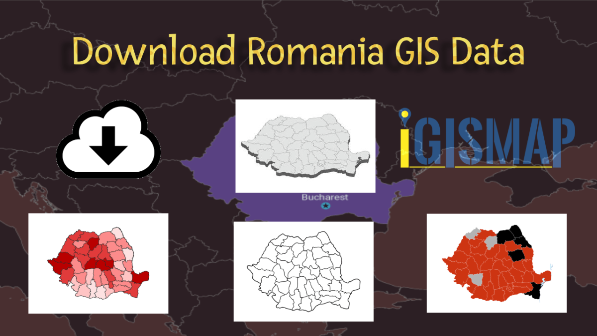
Easily explore Romania’s geographical data using MAPOG. Discover a wide range of datasets, including details about administrative boundaries, rivers, roads, and airports. Accessing this information is simple with the Download GIS Data and Add GIS Data tools. The Download GIS Data tool lets you choose formats like Shapefile, KML, GeoJSON, and CSV. For a more detailed guide on using the Add GIS Data tool, check out “Maximizing Romania’s GIS Data Collection from MAPOG.” This guide helps you step by step in getting administrative GIS data using the Download GIS Data tool. Explore Romania’s geography using MAPOG as your trusted guide.
With MAPOG’s versatile toolkit, you can effortlessly upload vector, add WMS (Web Map Service) layers, upload Excel or CSV data, incorporate existing files, perform polygon splitting and merging, generate new polygon and polyline data, use the converter for various formats, conduct buffer analysis, create grids, transform points into polygons, calculate isochrones, and utilize the geocoder for precise location information.
We offer an extensive array of data formats, including KML, SHP, CSV, GeoJSON, Tab, SQL, Tiff, GML, KMZ, GPKZ, SQLITE, Dxf, MIF, TOPOJSON, XLSX, GPX, ODS, MID, and GPS, ensuring compatibility and accessibility for various applications and analyses.
Note:
- All data available are in GCS datum EPSG:4326 WGS84 CRS (Coordinate Reference System).
- You need to login for downloading the shapefile.
Download Shapefile Data of Romania
Nestled at the crossroads of Eastern, Southeastern, and Central Europe, Romania boasts a diverse geography. With Bulgaria to the south, Ukraine to the north, Hungary to the west, Serbia to the southwest, Moldova to the east, and the shimmering expanse of the Black Sea to the southeast, Romania is a country of striking contrasts. Spanning approximately 238,397 square kilometers (92,046 square miles), Romania hosts a population of 19,892,812 people as of 2023, a statistic meticulously recorded by Macrotrend and Worldometer. This positions Romania as the twelfth-largest European nation and a notable member of the European Union, ranking as the sixth-most populous.
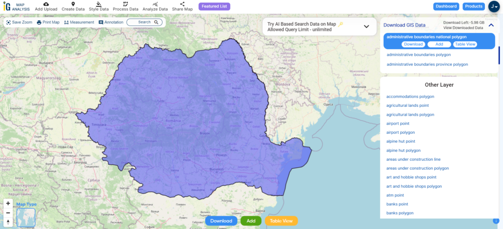
Download Romania National Boundary Shapefile
After successfully logging in with a legitimate email address, select the country you want to work with. Next, choose the specific layer you need and click on the download option. Once that’s done, pick the desired format to acquire the essential GIS data. Before proceeding with the data download, make sure to review the data table for any relevant information.
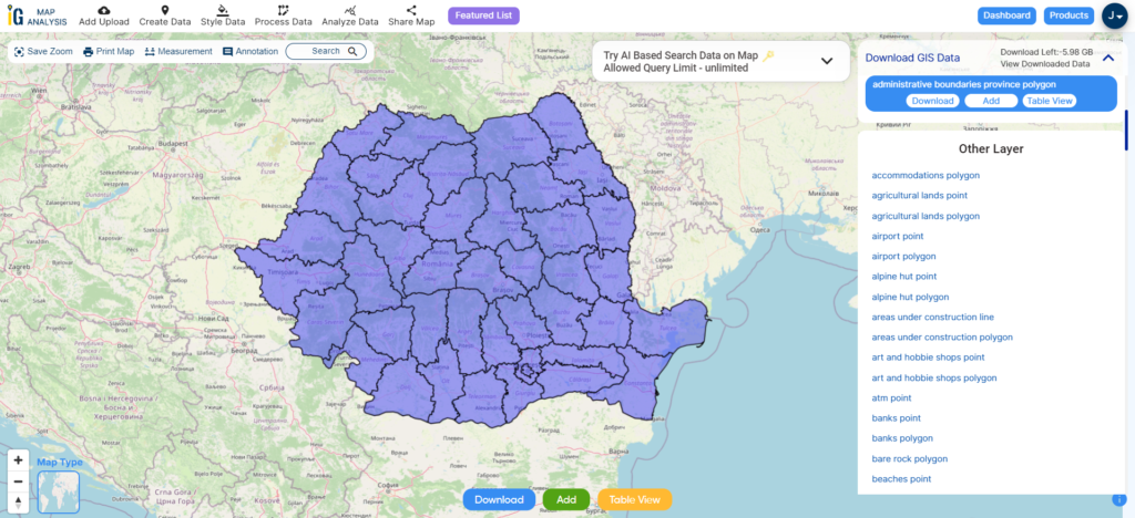
Download Romania Counties Shapefile Data
Romania is divided into 41 counties (known as “județe” in Romanian), along with the municipality of Bucharest, which together form the recognized administrative divisions. These divisions correspond to NUTS-3 (Nomenclature of Territorial Units for Statistics – Level 3) categories within the European Union. Each county operates as an independent local government unit within its defined boundaries. The majority of counties derive their names from prominent rivers in the region, while a few are named after significant cities that serve as their administrative centers.
Download Romania Counties Shapefile
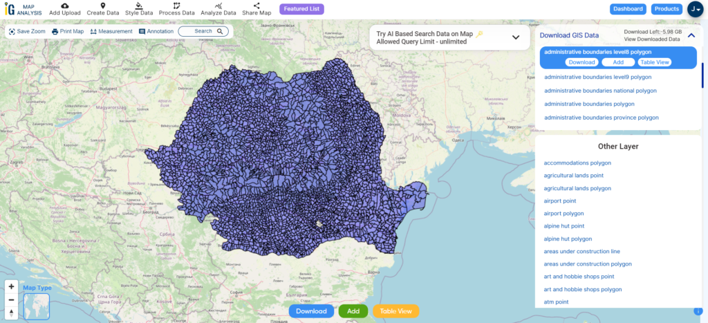
Download Romania Communes Shapefile Data
A commune (comună in Romanian) is the lowest level of administrative subdivision in Romania. There are 2,686 communes in Romania. The commune is the rural subdivision of a county. Urban areas, such as towns and cities within a county, are given the status of city or municipality.
Download Romania Communes Shapefile
Other Administrative Boundary Data:
Other GIS Data:
- Download Romania Airport Point Shapefile
- Download Romania Railway Lines Shapefile
- Download Romania Road Lines Shapefile
- Download Romania Rivers Shapefile
Above all links are provided for GIS data of Romania if you are looking for any specific data please write us on support@igismap.com
Download Shapefile for the following:
- World Countries Shapefile
- Australia
- Argentina
- Austria
- Belgium
- Brazil
- Canada
- Denmark
- Fiji
- Finland
- Germany
- Greece
- India
- Indonesia
- Ireland
- Italy
- Japan
- Kenya
- Lebanon
- Madagascar
- Malaysia
- Mexico
- Mongolia
- Netherlands
- New Zealand
- Nigeria
- Papua New Guinea
- Philippines
- Poland
- Russia
- Singapore
- South Africa
- South Korea
- Spain
- Switzerland
- Tunisia
- United Kingdom Shapefile
- United States of America
- Vietnam
- Croatia
- Chile
- Norway
- Maldives
- Bhutan
- Colombia
- Libya
- Comoros
- Hungary
- Laos
- Estonia
- Iraq
- Portugal
- Azerbaijan
- Macedonia
- Romania
- Peru
- Marshall Islands
- Slovenia
- Nauru
- Guatemala
- El Salvador
- Afghanistan
- Cyprus
- Syria
- Slovakia
- Luxembourg
- Jordan
- Armenia
- Haiti And Dominican Republic
Disclaimer : If you find any shapefile data of country provided is incorrect do contact us or comment below, so that we will correct the same in our system as well we will try to correct the same in openstreetmap.