Download Mauritius Administrative Boundary Shapefiles – National , Districts, Villages and More

download-mauritius-administrative-boundary-shapefiles-national-districts-villages-and-more

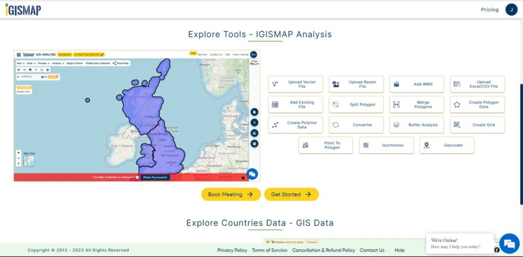
It’s fantastic to hear that MAPOG has expanded its GIS data collection to include data for more than 100 new countries, bringing the total coverage to over 150 countries. This is undoubtedly a valuable resource for GIS enthusiasts and professionals around the world. The availability of detailed information on administrative divisions, rivers, roads, and airports can greatly enhance various geospatial projects and analyses.

The option to access the data through tools like “Download GIS Data” and “Add GIS Data” seems convenient and user-friendly. Providing data in different formats such as Shapefile, KML, GeoJSON, and CSV ensures compatibility with a wide range of GIS software and applications, making it easier for users to integrate the data into their workflows.

This article will walk you through downloading administrative-level GIS data for Mauritius using the Download GIS Data tool. Experience a seamless geospatial journey with MAPOG as your trusted partner!

Note:

  • All data available are in GCS datum EPSG:4326 WGS84 CRS (Coordinate Reference System).
  • You need to login for downloading the shapefile.

Download Shapefile Data of Mauritius

Mauritius lies 2,000 km (1,200 mi) off the southeast coast of Africa, between latitudes 19°58.8’S and 20°31.7’S and longitudes 57°18.0’E and 57°46.5’E.

Mauritius National Boundary

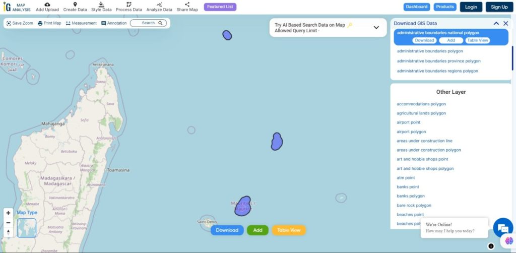
Download Mauritius National Boundary Shapefile

Download Mauritius Districts Shapefile Data

Mauritius is divided into 9 Districts

  • Flacq
  • Grand Port
  • Moka
  • Pamplemousses
  • Plaines Wilhems
  • Port Louis
  • Riviere du Rempart
  • Riviere Noire
  • Savanne
Mauritius Districts Boundaries

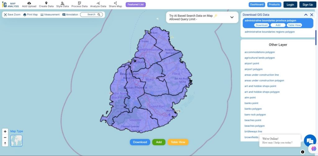
Download Mauritius Districts Boundaries Shapefile

Download Mauritius Village Shapefile Data

Mauritius is divided into 88 Villages

Mauritius Villages Boundaries

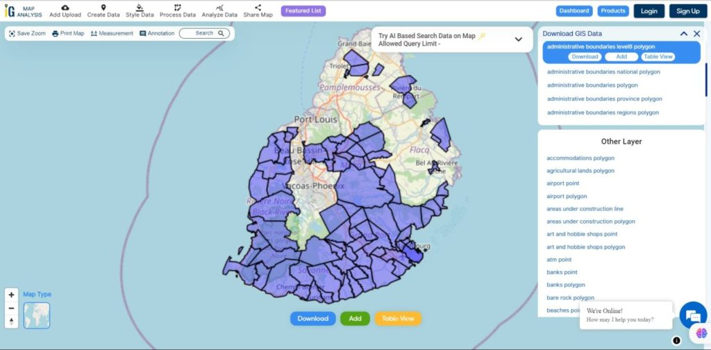
Download Mauritius Villages Boundaries Shapefile

Other GIS Data:

Download Free Shapefile for the following:

  1. World Countries Shapefile
  2. Australia
  3. Argentina
  4. Austria
  5. Belgium
  6. Brazil
  7. Canada
  8. Denmark
  9. Fiji
  10. Finland
  11. Germany
  12. Greece
  13. India
  14. Indonesia
  15. Ireland
  16. Italy
  17. Japan
  18. Kenya
  19. Lebanon
  20. Madagascar
  21. Malaysia
  22. Mexico
  23. Mongolia
  24. Netherlands
  25. New Zealand
  26. Nigeria
  27. Papua New Guinea
  28. Philippines
  29. Poland
  30. Russia
  31. Singapore
  32. South Africa
  33. South Korea
  34. Spain
  35. Switzerland
  36. Tunisia
  37. United Kingdom Shapefile
  38. United States of America
  39. Vietnam
  40. Norway
  41. Chile
  42. Croatia
  43. Estonia
  44. Laos
  45. Hungary
  46. Libya
  47. Comoros
  48. Colombia
  49. Bhutan
  50. Maldives
  51. Iraq
  52. Azerbaijan
  53. Portugal

Disclaimer : If you find any shapefile data of country provided is incorrect do contact us or comment below, so that we will correct the same in our system as well we will try to correct the same in OpenStreetMap.

Convert KML to PDF

KML or Keyhole Markup Language is a collection of geospatial data on map and commonly used in Google Earth or google services, while PDF stands for  Portable Document Format is used for digital exchange. KML and PDF is a type of vector format of GIS data.

Using IGIS Map Tool you can easily convert – KML to PDF. You can also do other GIS Data Conversion using this tool.

IGISMAP to Convert KML to PDF

For KML to PDF conversion, go to IGIS Map Tool, after logging in with your registered email and password. If you are a new user, click the Sign Up button in the Login popup and register to IGISMAP by filling the details.

IGISMAP

There are three main steps for using GIS Converter:

  • Click on Tool Converter
  • Upload the data
  • Choose the format to which it should be converted
  • Download the converted file

Step one is to upload your KML file which you want to convert. You can upload your file from system or select from the Recent Files.

Upload KML

Here we have uploaded the Shapefile of the US state ‘Texas’.

Step two is to select choose the output format of the converted file, in this case its PDF. You can also set the Coordinate Reference System of your preference. As a default CRS will set to WGS 84 (World) [EPSG:4326]. Click on the Convert File.

Select PDF as Output Format

Your KML file will then gets converted to PDF after a few seconds and will be available for downloading.

Download PDF File

You can download the converted data by clicking on Download Converter File.

You can also convert Shapefile SHP to PDF.

Download free shapefile of various countries.

Create your own shapefile and share with your clients or embed on your website. 

Convert KML to TopoJSON

KML or Keyhole Markup Language is a collection of geospatial data on map and commonly used in Google Earth or google services. TIFF (also known as Tagged Image File Format) is a file format for transferring, storing, and displaying raster images. Scanned aerial photography and maps, as well as digital satellite imagery and other geographic data, can be found in this file format.

A TopoJSON file format is a format that encodes topology. TopoJSON is an extension of GeoJSON. This format contains both geospatial data (arcs) and attribute data. In contrast to other GIS formats TopoJSON uses arcs. Arcs are sequences of points, while line strings and polygons are defined as sequences of arcs.

You can convert KML to TopoJSON  file using IGIS Map Tool. You can also use it for other GIS data Conversion.

IGISMAP to Convert KML to TopoJSON

For KML to TopoJSON conversion go to IGIS Map Tool, after logging in with your registered email and password. If you are a new user, click the Sign Up button in the Login popup and register to IGISMAP by filling the details.

There are three main steps for using GIS Converter:

  • Upload the data
  • Choose the format to which it should be converted
  • Download the converted file.

Step one is to upload your KML file which you want to convert. You can upload your file from system or select from the Recent Files.

Upload KML

Step two is to select choose the output format of the converted file, in this case its TopoJSON. You can also set the Coordinate Reference System of your preference. As a default CRS will set to WGS 84 (World) [EPSG:4326]. Click on the Convert File.

Select TopoJSON as Output Format

Your KML file will then gets converted TopoJSON file after a few seconds and will be available for downloading.

Download and Publish TopoJSON File

You can also choose to style the layer or continue with further conversion process by clicking the Convert Another File button.

Converted Files section from the dashboard contains the list of the details of all the conversion done in your account, providing both input and output data available for download their corresponding formats.

Other GIS data Conversion

If you are facing any problem in conversion or login then please let us know by mailing at support@igismap.com or drop comment.

Exit mobile version
%%footer%%