
Digital Elevation Model is a 3D representation of a terrain. It is generated by collecting elevation points of terrain. We don’t have to do hectic work like this as webgis provides us with ready-made digital elevation data. WebGIS is where you can find all the leading information and resources for Geographical Information Systems. Here you will find how to download Digital Terrain Data and create contour map.
Download Digital Terrain Data:
1.) Go to link: http://www.webgis.com
2.) Digital Terrain data is all we need. You can explore the links given. We will download from SRTM. You can read the documentation for information. Click on SRTM 3.
3.) Click on large map.
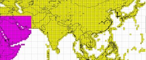
4.) Here you can determine the coordinates of the tile in which your location is lying. You must know where your location is on earth i.e. North East or North West etc. As you determine the coordinates of tile, go to previous page and Click on the map where your location is.
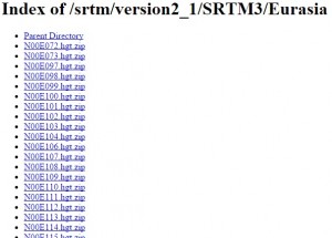
5.) Now click the tile from the index you determined from the large map. It will automatically downloaded to your computer after clicking the link.
Extract DEM and create contour Map:
Contour map shows contour lines with relative space indicating the relative slope of the surface. Here we will open DEM in QGIS and create the contour Map. Here are the steps:
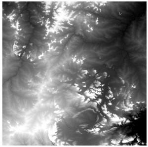
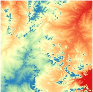
1.) After opening QGIS, we first need to extract the downloaded file, and import the .hgt file using add raster layer tool in QGIS, where you will see a singleband gray image as shown below.
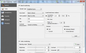
2.) Go to layer properties and click style. Notice the minimum and maximum value. These values are in meters.
3.) In render type dropdown select singleband pseudocolor and click classify.
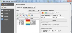
4.) Click apply and ok.
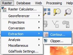
5.) Now we will extract contours from this image. Go to Raster-> Extraction-> Contour as shown.
6.) Set the pop up as shown below.
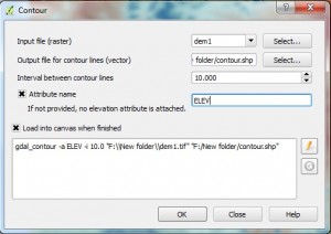
7.) Click ok. The contour file is loaded into your canvas.

You may also be interested in QGIS tutorial. Now you can easily analyze the surface by seeing the contour map. Hope this tutorials helped you. If you want to share some suggestion or want to ask some question do comment below.