Download Aboriginal Lands Boundary Data in Shapefile, KML, MID +15 GIS Formats Using GIS Data

Looking for accurate and structured boundary information? Download Aboriginal Lands Boundary Data easily using GIS Data by MAPOG. This powerful and user-friendly platform provides access to multiple GIS formats such as Shapefile, KML, MID, GeoJSON, and more, ensuring smooth compatibility with various GIS tools. Aboriginal Lands Boundary data plays a crucial role in land governance, cultural preservation, planning, and spatial analysis by clearly defining traditional and legally recognized land extents.

How GIS Data by MAPOG Simplifies the Process

GIS Data by MAPOG streamlines the entire data discovery and download experience. With access to 900+ GIS layers and support for over 15 formats—including SHP, KML, CSV, GeoJSON, SQL, DXF, MIF, TOPOJSON, and GPX—the platform is well-suited for both beginners and professionals. As a result, Download Aboriginal Lands Boundary Data becomes efficient, accurate, and hassle-free.

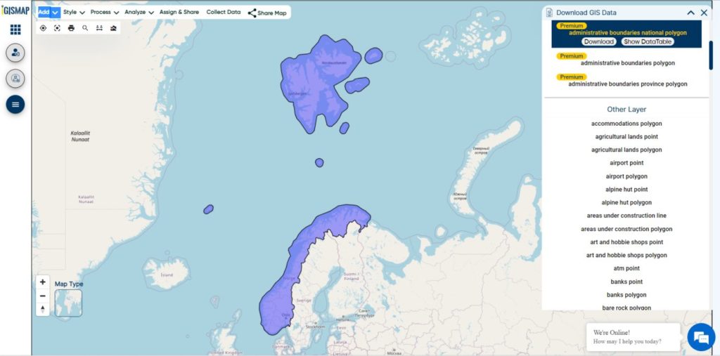
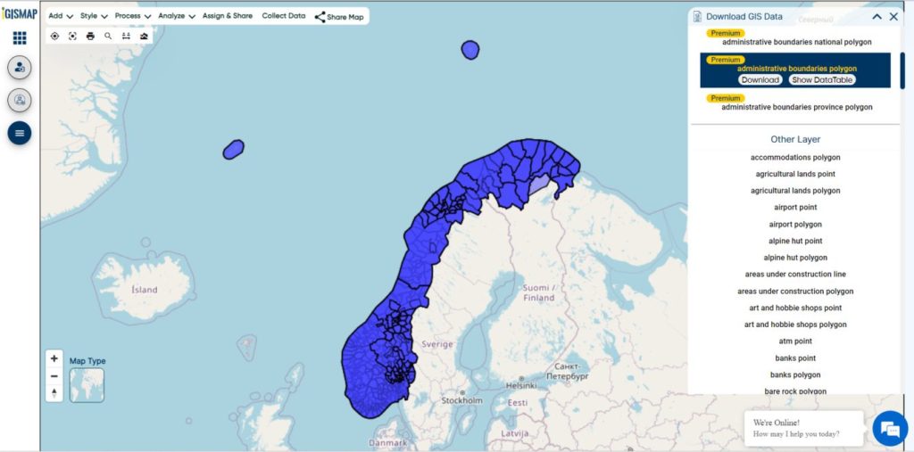
Download Aboriginal Lands Boundary Data of any countries

Note:
  • All datasets are provided in GCS Datum EPSG:4326 (WGS84 Coordinate Reference System).
  • Users must be logged in to download data in their preferred format.

Step-by-Step Guide to Download Aboriginal Lands Boundary Data

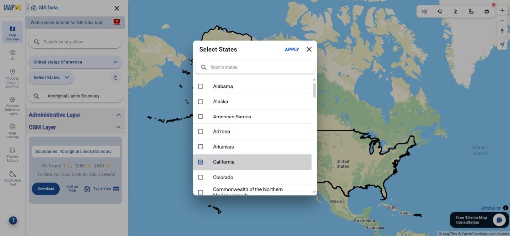
Step 1: Search for Aboriginal Lands Boundary Data

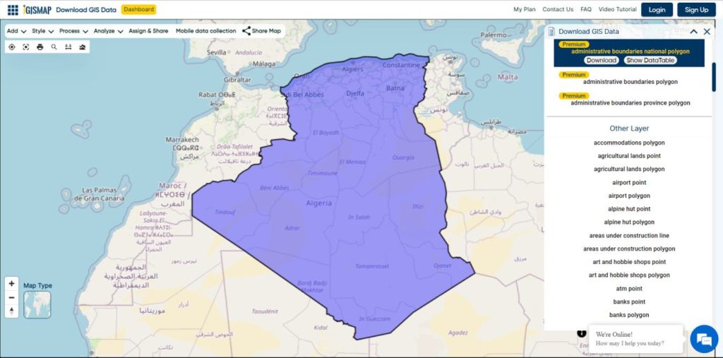
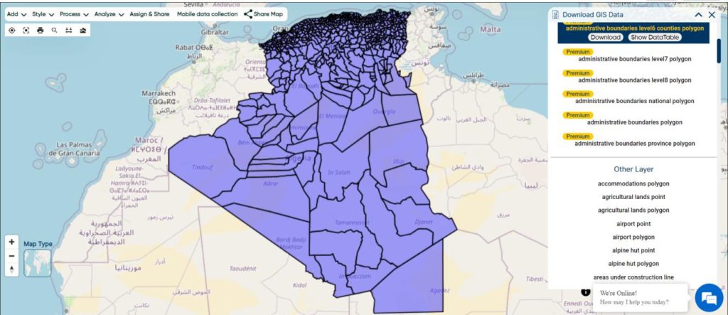
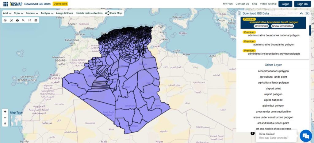
Begin by selecting the required region within the GIS Data by MAPOG interface. Use the search layer option to find “Aboriginal Lands Boundary” and review the attributes to understand the data structure, typically available as polygon layers.

Download Aboriginal Lands Boundary Data
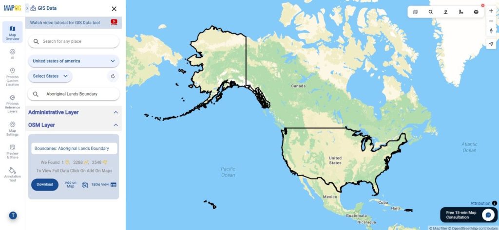
Step 2: Apply Data Filters

The Filter Data option allows refinement of results by state and district. When working with broader datasets, users can drill down further to locate precise boundary data, ensuring relevance for focused analysis.

Download Aboriginal Lands Boundary Data
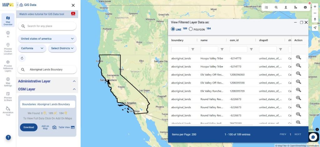
Step 3: Analyze Using “Add on Map”

With the “Add on Map” feature, selected boundary layers can be visualized directly in the map analysis interface. This enables better spatial understanding, comparison with other layers, and informed decision-making before downloading.

Download Aboriginal Lands Boundary Data
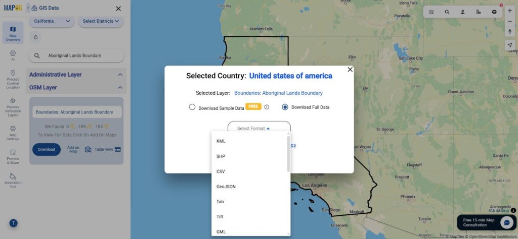
Step 4: Download the Data

After finalizing the dataset, click on “Download.” Choose between sample or full data, select the required format (Shapefile, KML, MID, or others), accept the terms, and proceed with the download.

Download Aboriginal Lands Boundary Data

Final Thoughts

GIS Data by MAPOG offers a reliable and flexible way to access boundary datasets for mapping and analysis. With advanced filtering, AI-powered search, and multi-format support, Download Aboriginal Lands Boundary Data seamlessly for use in planning, research, and GIS projects. The platform ensures accuracy, accessibility, and efficiency—making spatial data handling simpler and more effective.

With MAPOG’s versatile toolkit, you can effortlessly upload vector and upload Excel or CSV data, incorporate existing layers, perform Split polygon by line, use the converter for various formats, calculate isochrones, and utilize the Export Tool.

For any questions or further assistance, feel free to reach out to us at support@mapog.com. We’re here to help you make the most of your GIS data.

Download Shapefile for the following:

  1. World Countries Shapefile
  2. Australia
  3. Argentina
  4. Austria
  5. Belgium
  6. Brazil
  7. Canada
  8. Denmark
  9. Fiji
  10. Finland
  11. Germany
  12. Greece
  13. India
  14. Indonesia
  15. Ireland
  16. Italy
  17. Japan
  18. Kenya
  19. Lebanon
  20. Madagascar
  21. Malaysia
  22. Mexico
  23. Mongolia
  24. Netherlands
  25. New Zealand
  26. Nigeria
  27. Papua New Guinea
  28. Philippines
  29. Poland
  30. Russia
  31. Singapore
  32. South Africa
  33. South Korea
  34. Spain
  35. Switzerland
  36. Tunisia
  37. United Kingdom Shapefile
  38. United States of America
  39. Vietnam
  40. Croatia
  41. Chile
  42. Norway
  43. Maldives
  44. Bhutan
  45. Colombia
  46. Libya
  47. Comoros
  48. Hungary
  49. Laos
  50. Estonia
  51. Iraq
  52. Portugal
  53. Azerbaijan
  54. Macedonia
  55. Romania
  56. Peru
  57. Marshall Islands
  58. Slovenia
  59. Nauru
  60. Guatemala
  61. El Salvador
  62. Afghanistan
  63. Cyprus
  64. Syria
  65. Slovakia
  66. Luxembourg
  67. Jordan
  68. Armenia
  69. Haiti And Dominican Republic
  70. Malta
  71. Djibouti
  72. East Timor
  73. Micronesia
  74. Morocco
  75. Liberia
  76. Kosovo
  77. Isle Of Man
  78. Paraguay
  79. Tokelau
  80. Palau
  81. Ile De Clipperton
  82. Mauritius
  83. Equatorial Guinea
  84. Tonga
  85. Myanmar
  86. Thailand
  87. New Caledonia
  88. Niger
  89. Nicaragua
  90. Pakistan
  91. Nepal
  92. Seychelles
  93. Democratic Republic of the Congo
  94. China
  95. Kenya
  96. Kyrgyzstan
  97. Bosnia Herzegovina
  98. Burkina Faso
  99. Canary Island
  100. Togo
  101. Israel And Palestine
  102. Algeria
  103. Suriname
  104. Angola
  105. Cape Verde
  106. Liechtenstein
  107. Taiwan
  108. Turkmenistan
  109. Tuvalu
  110. Ivory Coast
  111. Moldova
  112. Somalia
  113. Belize
  114. Swaziland
  115. Solomon Islands
  116. North Korea
  117. Sao Tome And Principe
  118. Guyana
  119. Serbia
  120. Senegal And Gambia
  121. Faroe Islands
  122. Guernsey Jersey
  123. Monaco
  124. Tajikistan
  125. Pitcairn

Disclaimer : The GIS data provided for download in this article was initially sourced from OpenStreetMap (OSM) and further modified to enhance its usability. Please note that the original data is licensed under the Open Database License (ODbL) by the OpenStreetMap contributors. While modifications have been made to improve the data, any use, redistribution, or modification of this data must comply with the ODbL license terms. For more information on the ODbL, please visit OpenStreetMap’s License Page.

Here are some blogs you might be interested in:

Download Algeria Administrative Boundary Shapefiles – National, Districts, Municipalities and more

Algeria Shapefile Download Map – Free Polygon Administrative Download. Shapefiles showing Districts , Municipalities and Town and Cities.

Have you been searching too long for accurate GIS data for your country of interest? Well the wait is over with MAPOG, your one-stop destination for comprehensive GIS data covering 150+ countries. You can find more than 150 GIS data for each nation in MAPOG GIS Data Collection. The distinctive feature of MAPOG GIS data collection lies in its commitment to providing highly accurate GIS data of the administrative divisions. Users can also find data of other natural and man made geographic features such as river, roads, railway lines, airport locations etc. that are represented in appropriate geometric structures (point, line and polygon). MAPOG provides two important tools for accessing these GIS datasets – Download GIS Data and Add GIS Data.

With MAPOG’s versatile toolkit, you can effortlessly upload vector, add WMS (Web Map Service) layers, upload Excel or CSV data, incorporate existing files, perform polygon splitting and merging, generate new polygon and polyline data, use the converter for various formats, conduct buffer analysis, create grids, transform points into polygons, calculate isochrones, and utilize the geocoder for precise location information.

We offer an extensive array of data formats, including KML, SHP, CSV, GeoJSON, Tab, SQL, Tiff, GML, KMZ, GPKZ, SQLITE, Dxf, MIF, TOPOJSON, XLSX, GPX, ODS, MID, and GPS, ensuring compatibility and accessibility for various applications and analyses.

Note:

  • All data available are in GCS datum EPSG:4326 WGS84 CRS (Coordinate Reference System).
  • You need to login for downloading the shapefile.

Download Shapefile Data of Algeria

Algeria is bordered to the northeast by Tunisia; to the east by Libya; to the southeast by Niger; to the southwest by Mali, Mauritania, and Western Sahara; to the west by Morocco; and to the north by the Mediterranean Sea. It is considered part of the Maghreb region of North Africa. It has a semi-arid geography, with most of the population living in the fertile north and the Sahara dominating the geography of the south. Algeria covers an area of 2,381,741 square kilometres (919,595 sq mi), making it the world’s, tenth largest nation by area and the largest nation in Africa, more than 200 times as large as the continent’s smallest country, The Gambia. With a population of 44 million, Algeria is the tenth-most populous country in Africa, and the 32nd most populous country in the world. The capital and largest city is Algiers, located in the far north on the Mediterranean coast.

Algeria National Boundary

Download Algeria National Boundary Shapefile

Download Algeria Districts Shapefile Data

Algeria’s districts were created as arrondissements when Algeria was a colony of France and they had a status equal to those of mainland France. They were, like France’s arrondissements, part of departements, which are further part of a région (which was called a territory, territoire, in French Algeria). They were maintained 6 years after the country’s independence (until 1968) when they were renamed “daïras” and had their functions slightly changed.

Algeria Districts Boundaries

Download Algeria Districts Boundaries Shapefile

Download Algeria Municipalities Shapefile Data

The municipalities of Algeria form the third level of administrative subdivisions of Algeria. As of 2002, there were 1,541 municipalities in the country.

Algeria Municipalities Boundaries

Download Algeria Municipalities Boundaries Shapefile

Other Administrative Boundary Data:

Other GIS Data:

Download Shapefile for the following:

  1. World Countries Shapefile
  2. Australia
  3. Argentina
  4. Austria
  5. Belgium
  6. Brazil
  7. Canada
  8. Denmark
  9. Fiji
  10. Finland
  11. Germany
  12. Greece
  13. Greenland
  14. India
  15. Indonesia
  16. Ireland
  17. Italy
  18. Japan
  19. Kenya
  20. Lebanon
  21. Madagascar
  22. Malaysia
  23. Mexico
  24. Mongolia
  25. Netherlands
  26. New Zealand
  27. Nigeria
  28. Papua New Guinea
  29. Philippines
  30. Poland
  31. Russia
  32. Singapore
  33. South Africa
  34. South Korea
  35. Spain
  36. Switzerland
  37. Tunisia
  38. United Kingdom Shapefile
  39. United States of America
  40. Vietnam
  41. Norway
  42. Chile
  43. Crotia

Disclaimer : If you find any shapefile data of country provided is incorrect do contact us or comment below, so that we will correct the same in our system as well we will try to correct the same in openstreetmap.

Download Norway Administrative Boundary Shapefiles – Regional State Administrative Agencies, Municipalities

Hey! GIS user here in this blog you can download Norway shapefile GIS data. IGISMAP have collection for more than 100 new countries. Links for downloading the shapefiles of the important administrative divisions of Norway are provided in the following. You can also download these data in any format like KML, GeoJSON, or CSV etc.

Note:

  • All data available are in GCS datum EPSG:4326 WGS84 CRS (Coordinate Reference System).
  • You need to login for downloading the shapefile.

Here is the video tutorial to download data:

Download Free Shapefile Data of Norway

Norway is a country located in Northern Europe in the northern and western parts of the Scandinavian Peninsula. It has a land border with Sweden to the east and a shorter border with Finland and an even shorter border with Russia to the northeast. The country’s average elevation is 460 meter’s (1,510 ft), and 32 percent of the mainland is located above the tree line. The regional climate was up to 1–3 °C (1.8–5.4 °F) warmer in 7000 BC to 3000 BC in the Holocene Climatic Optimum, (relative to the 1961-90 period), melting the remaining glaciers in the mountains almost completely during that period.

Norway National Boundary

Download Norway National Boundary Shapefile

Download Norway Counties Shapefile Data

Norway is divided into 11 administrative regions, called counties . The island territories of Svalbard and Jan Mayen are outside the county division and ruled directly at the national level. The capital Oslo is both a county and a municipality.

Norway Counties Boundary

Download Norway Counties Boundaries Shapefile

This shapefile covers following Counties of Norway listed below:

  • Agder
  • Innlandet
  • More og Romsdal
  • Nordland
  • Oslo
  • Rogaland
  • Vestfold og Telemark
  • Troms og Finnmark
  • Trondelag
  • Vestland
  • Viken

Download Norway Municipalities Shapefile Data

Municipalities are the atomic unit of local government in Norway and are responsible for primary education (until 10th grade), outpatient health services, senior citizen services, unemployment and other social services, zoning, economic development, and municipal roads. Law enforcement and church services are provided at a national level in Norway.

Norway Municipality Boundaries Shapefiles
Norway Municipalities Boundary

Download Norway Municipality Boundaries Shapefiles

Other Administrative Boundary Data:

Download Free Shapefile for the following:

  1. World Countries Shapefile
  2. Australia
  3. Argentina
  4. Austria
  5. Belgium
  6. Brazil
  7. Canada
  8. Denmark
  9. Fiji
  10. Finland
  11. Germany
  12. Greece
  13. India
  14. Indonesia
  15. Ireland
  16. Italy
  17. Japan
  18. Kenya
  19. Lebanon
  20. Madagascar
  21. Malaysia
  22. Mexico
  23. Mongolia
  24. Netherlands
  25. New Zealand
  26. Nigeria
  27. Papua New Guinea
  28. Philippines
  29. Poland
  30. Russia
  31. Singapore
  32. South Africa
  33. South Korea
  34. Spain
  35. Switzerland
  36. Tunisia
  37. United Kingdom Shapefile
  38. United States of America
  39. Vietnam
  40. Croatia
  41. Chile
  42. Norway
  43. Maldives

Disclaimer : If you find any shapefile data of country provided is incorrect do contact us or comment below, so that we will correct the same in our system as well we will try to correct the same in OpenStreetMap.

💬 Book a Meeting