Planners and surveyors in Alaska leverage GIS Data and Maps to visually analyze complex data patterns that are challenging to discern in tabular form. You can conveniently access and download GIS data for the state’s boundary, county divisions, rail, and highway maps with just a few clicks. This data is available for analysis within IGISMAP or for download in various GIS formats, such as KML, GeoJSON, CSV, or Shapefile.
With MAPOG’s versatile toolkit, you can effortlessly upload vector, add WMS (Web Map Service) layers, upload Excel or CSV data, incorporate existing files, perform polygon splitting and merging, generate new polygon and polyline data, use the converter for various formats, conduct buffer analysis, create grids, transform points into polygons, calculate isochrones, and utilize the geocoder for precise location information.
We offer an extensive array of data formats, including KML, SHP, CSV, GeoJSON, Tab, SQL, Tiff, GML, KMZ, GPKZ, SQLITE, Dxf, MIF, TOPOJSON, XLSX, GPX, ODS, MID, and GPS, ensuring compatibility and accessibility for various applications and analyses.
Note:
- All data available are in GCS datum EPSG:4326 WGS84 CRS (Coordinate Reference System).
- You need to login for downloading the shapefile.
Download Shapefile of Alaska County
Alaska is a northwest state of the United States of America. It is divided into 19 organized boroughs and one unorganized boroughs and is the largest US states according to area. Juneau is the capital of Alaska state. It is a northwest state of the United States of America. It is divided into 19 organized boroughs and one unorganized boroughs.
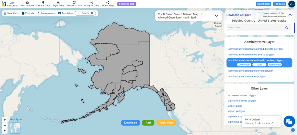
Download Alaska County Boundaries Shapefile
In the above screen, the GIS data of Alaska administrative boundary is visible. You can download it into shapefile, kml, geojson, Mapinfo, PostgreSQL, and CSV. And for any other formats try our GIS Converter Tool.
This GIS data covers both organized and unorganized boroughs of states.
- Aleutians East Borough
- Anchorage
- Bristol Bay Borough
- Denali Borough
- Fairbanks North Star Borough
- Haines Borough
- Juneau
- Kenai Peninsula Borough
- Ketchikan Gateway Borough
- Kodiak Island Borough
- Lake and Peninsula Borough
- Matanuska-Susitna Borough
- North Slope Borough
- Northwest Arctic Borough
- Petersburg Borough
- Sitka
- Skagway
- Unorganized Borough
- Wrangell
- Yakutat
Download Cities, Towns and Villages Shapefile of Alaska
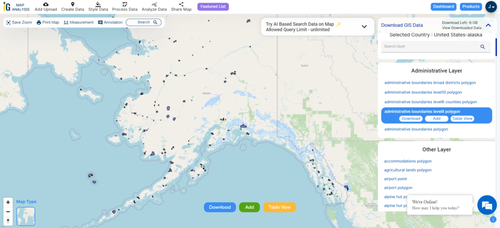
Download Alaska Cities, Towns and Villages Boundary Shapefile
Airport point GIS data of Alaska State
Click on the link for downloading airport point location data of Alaska state. Location data of Cold Bay Airport, Birchwood Airport, Boswell Bay Airport, Black Rapids Airport, Big Mountain Airport, Bettles Airport, Candle 2 Airport, Brown Low Point, Cantwell Airport, Buckland Airport, Atmautluak Airport, Juneau Harbor Seaplane, etc.
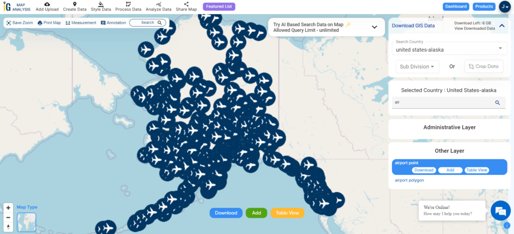
Download Alaska Airport Points Shapefile
Zoom in or Zoom out for a clear view. Change the color of icons using the MAPOG TOOL
Highway Line GIS data of Alaska
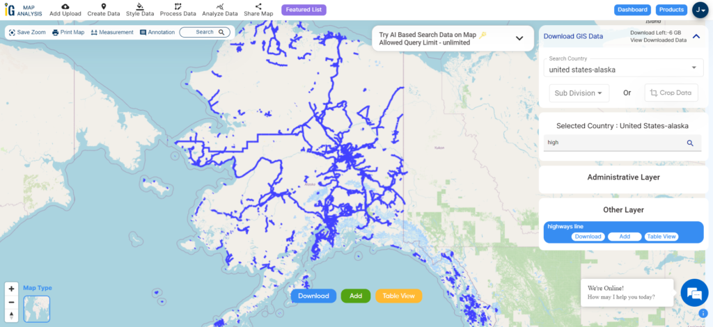
Download Alaska Highway Line Shapefile
Zoom in view of highway line map is shown shown above. Similarly, you can easily download point based GIS data of airport point, ATM point, parking area, hospital location, etc.
Download GIS Data of other states of USA:
- Alabama
- Alaska
- Arizona
- Arkansas
- California
- Colorado
- Connecticut
- Florida
- Georgia
- Hawaii
- Idaho
- Illinois
- Indiana
- Iowa
- Kansas
- Massachusetts
- Maryland
- Michigan
- Minnesota
- Mississipi
- Missouri
- Montana
- Nevada
- Nebraska
- Ohio
- Oklahoma
- Pennsylvania
- Utah
- Vermont
- Washington
- Wisconsin
- Wyoming
- Tennessee
- Texas
- Kentucky
- Louisiana
- Maine
- North Carolina
- Oregon
- Virginia
- West Virginia
Download Shapefile for the following:
- World Countries Shapefile
- Australia
- Argentina
- Austria
- Belgium
- Brazil
- Canada
- Denmark
- Fiji
- Finland
- Germany
- Greece
- India
- Indonesia
- Ireland
- Italy
- Japan
- Kenya
- Lebanon
- Madagascar
- Malaysia
- Mexico
- Mongolia
- Netherlands
- New Zealand
- Nigeria
- Papua New Guinea
- Philippines
- Poland
- Russia
- Singapore
- South Africa
- South Korea
- Spain
- Switzerland
- Tunisia
- United Kingdom Shapefile
- United States of America
- Vietnam
- Croatia
- Chile
- Norway
- Maldives
- Bhutan
- Colombia
- Libya
- Comoros
- Hungary
- Laos
- Estonia
- Iraq
- Portugal
- Azerbaijan
- Macedonia
- Romania
- Peru
- Marshall Islands
- Slovenia
- Nauru
- Guatemala
- El Salvador
- Afghanistan
- Cyprus
- Syria
- Slovakia
- Luxembourg
- Jordan
- Armenia
- Haiti And Dominican Republic
Disclaimer : If you find any shapefile data of country provided is incorrect do contact us or comment below, so that we will correct the same in our system as well we will try to correct the same in openstreetmap.