KMZ to CSV using MAPOG, you can transform gis data, making it easier to analyze, share, and integrate into various GIS applications.
In this guide, we’ll walk you through how to efficiently convert your KMZ files to CSV using the powerful Converter Tool in MAPOG. Whether you’re a beginner or an experienced user, Converting KMZ to CSV with MAPOG, this tutorial will help you understand the process in easy steps.
Key Concept of Converting files
The Converter Tool is a feature in MAPOG Map Analysis that helps you change your data from one format to another. It’s like magic! You give it your data in one form, and it transforms it into another form that you need for your analysis. Additionally, with GIS Data, you can download data in any format, making it versatile and adaptable for various applications.
Online KMZ to CSV GIS Converter
Now, let’s walk through the simple steps of using the Converter Tool to Converting KMZ to CSV with MAPOG.
Step 1: Upload the Data
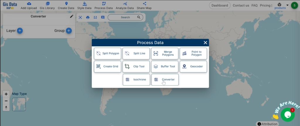
1. Click on the “Process Data” menu and choose the “Converter Tool” option.
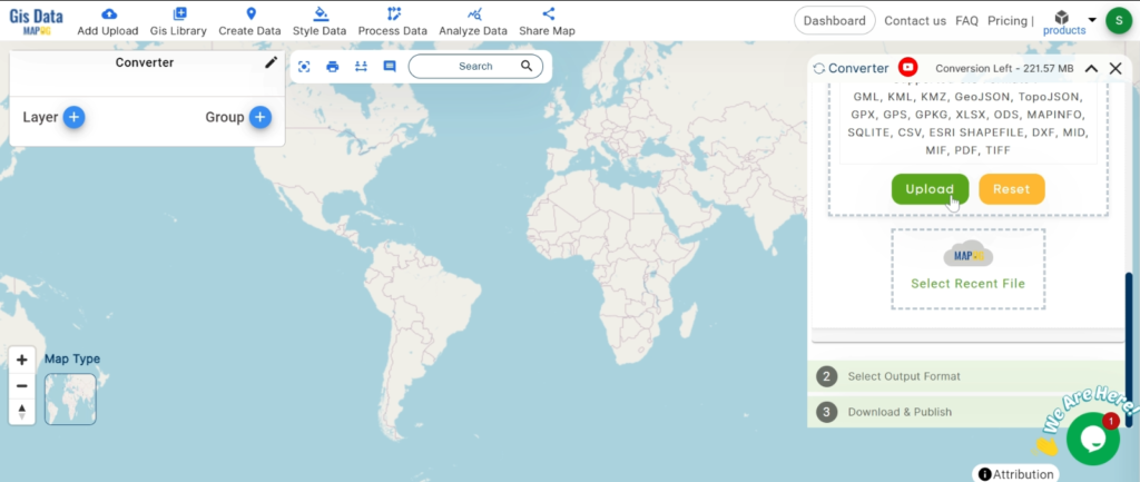
2.Upload your KMZ file. This is your starting point where you provide the data that needs conversion.
Step 2: Select the Format for Conversion
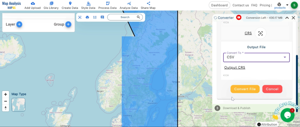
1.Choose the output file format as CSV. The tool offers various formats, but for this guide, we are focusing on converting to CSV.
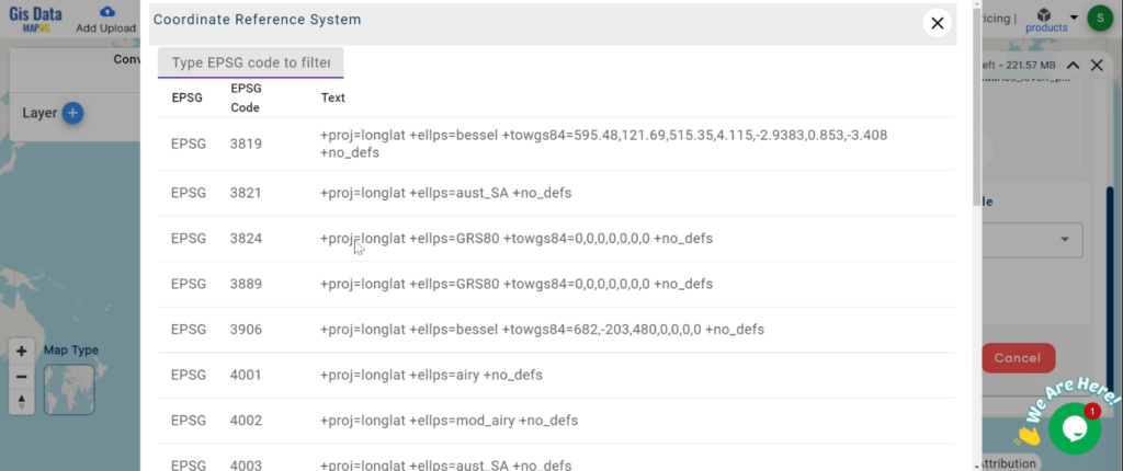
2.You can also set the CRS at this stage.
Step 3: Run the Conversion
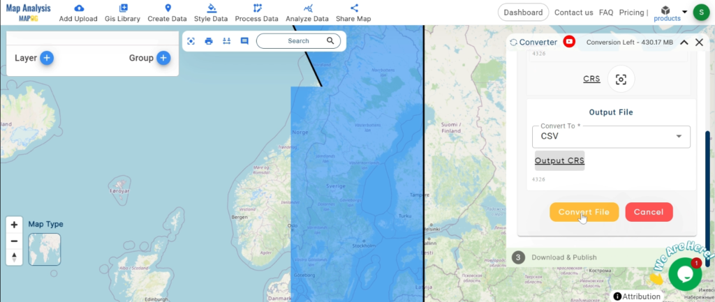
Click ‘Convert’ and let the tool work its magic. The Converter Tool processes your data, transforming it from KMZ to CSV format.
Step 4: Review and Download
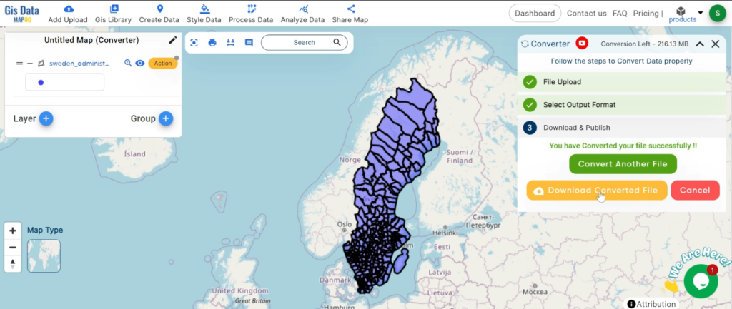
Finally, review your converted CSV data to ensure it looks right. Once satisfied, download the converted file. This step is crucial to verify that the conversion has been successful and the data integrity is maintained.
And there you have it! You’ve successfully used the Converter Tool in MAPOG Map Analysis to convert your KMZ files to CSV. Now you can easily convert your data for all your analysis needs. This feature simplifies the process of handling different data formats, making your workflow more efficient and effective.
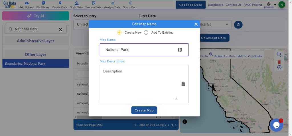
GIS Data by MAPOG is a user-friendly portal that enables users to download National Park data in Shapefile, KML, and GeoJSON formats. It simplifies the process of accessing administrative and geographic datasets so that detailed mapping and analysis of National Parks can be done worldwide. It supports more than 15 formats, ensuring compatibility with almost all GIS tools.
Overview of the Process
GIS Data by MAPOG streamlines downloading National Park data by offering a step-by-step guide. Users can explore data from 200+ countries and 900+ layers. The platform’s extensive format options make it easy to integrate the data into different GIS applications for analysis and planning.
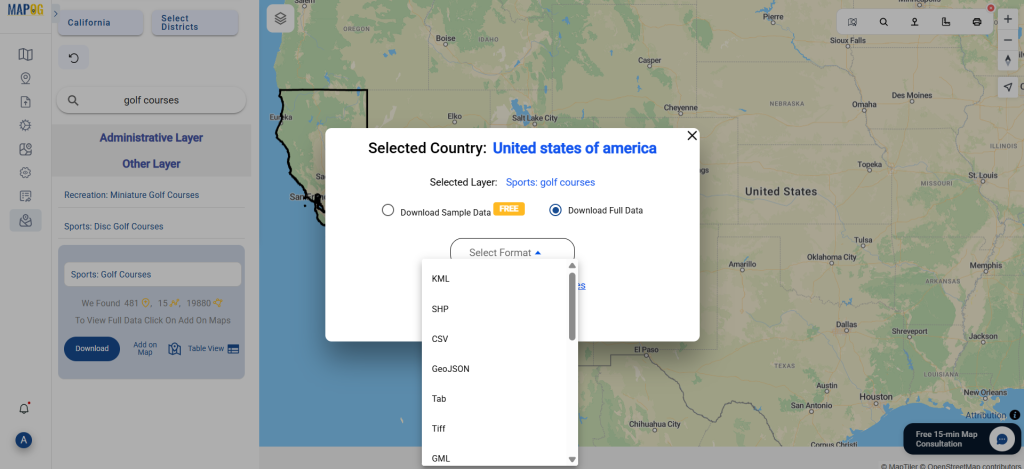
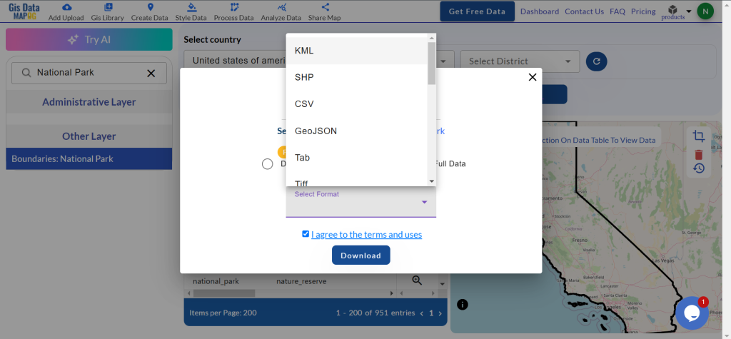
The available formats include KML, SHP, CSV, GeoJSON, Tab, SQL, Tiff, GML, KMZ, GPKZ, SQLITE, Dxf, MIF, TOPOJSON, XLSX, GPX, ODS, MID, and GPS. This ensures compatibility with various applications.
All data is provided in GCS datum EPSG:4326 WGS84 CRS (Coordinate Reference System).
Users need to log in to access and download their preferred data formats.
Steps to Access and Download National Park Data
Step 1: Locate National Park Data
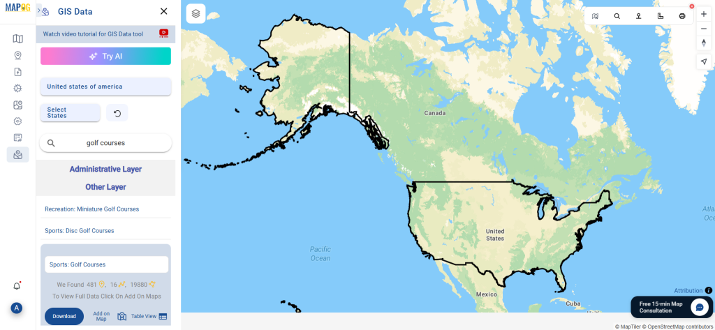
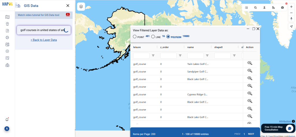
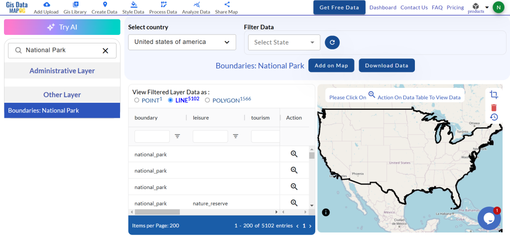
Log in and open the GIS Data interface. Select a country and use the search layer to find “National Park” data. Check the data’s attributes, such as whether it’s in point or polygon format.
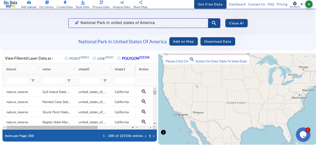
Simplify your search with the “Try AI” feature. Type in what you’re looking for, and the tool will quickly provide relevant results. This saves time and improves search accuracy.
Step 3: Apply Filters for Precision
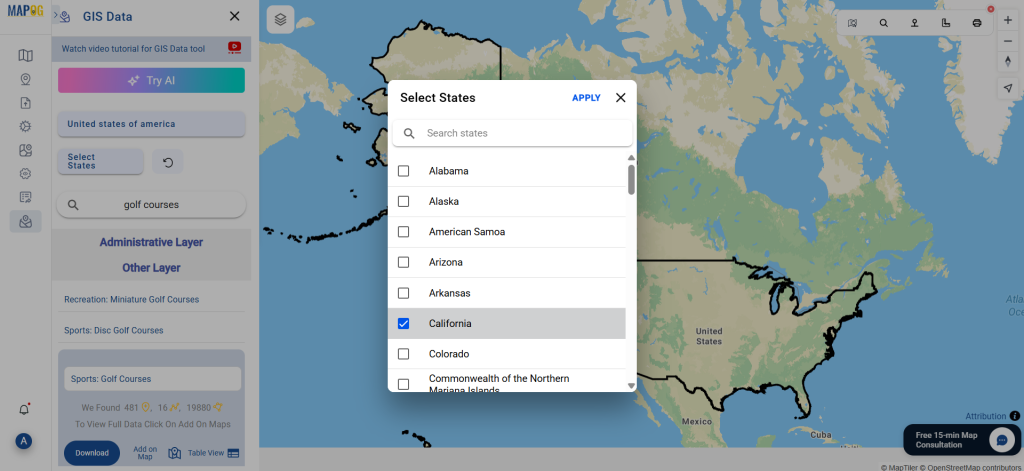
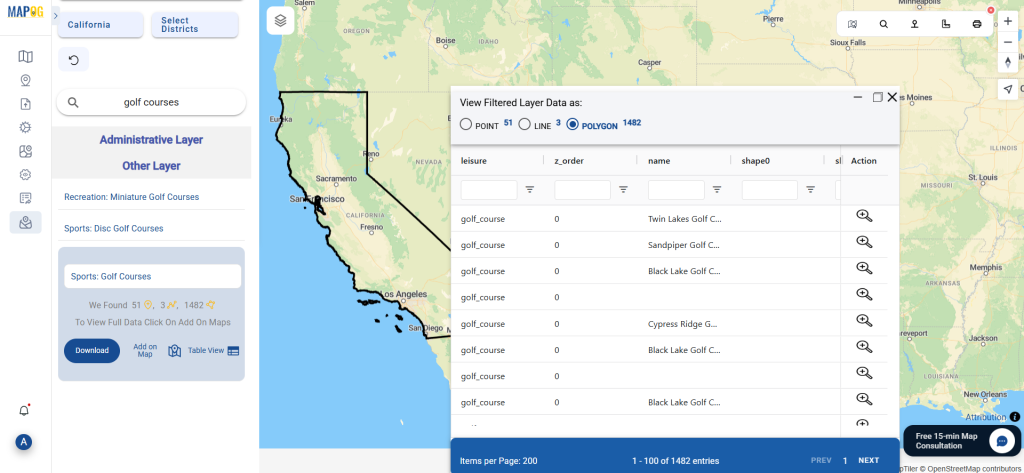
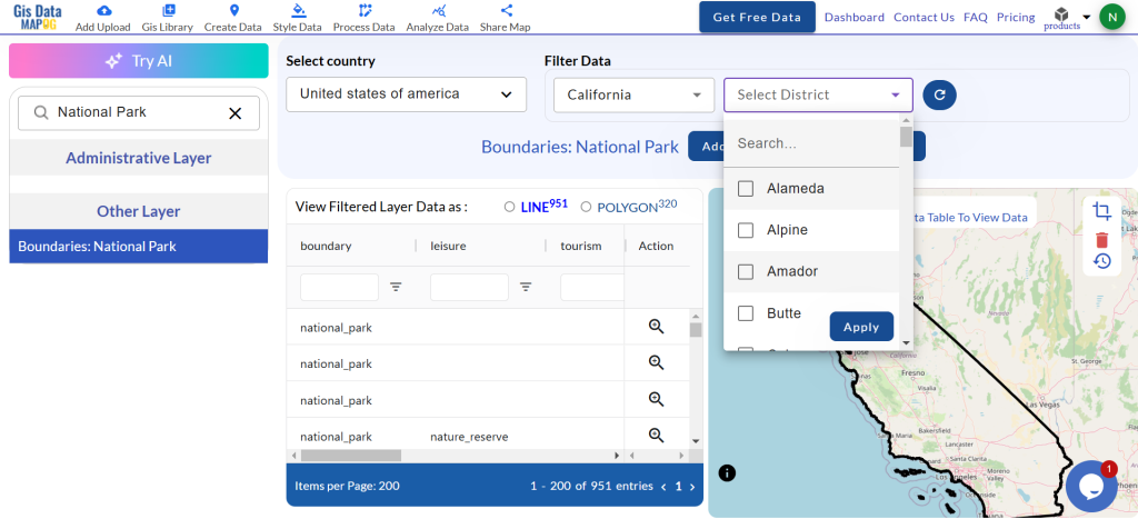
The filter data option lets you narrow down your search by state or district. This is particularly useful for finding specific National Parks within a region, providing more precise datasets for analysis.
Step 4: Visualize Data on the Map
Click “Add on Map” to overlay the data on the MAPOG interface. This helps visualize spatial relationships and patterns, supporting better insights. Users can add data to a new map or integrate it into an existing one.
Step 5: Download the Data
Once satisfied with your selection, click “Download Data.” Choose between sample data or the full dataset. Select your preferred format—Shapefile, KML, or any of the 15+ supported options. Agree to the terms and initiate the download.
Conclusion
GIS Data by MAPOG allows users to freely download National Park data in multiple formats. It provides accurate and current geographic information for applications like conservation, environmental studies, and policy planning. This platform serves as an important tool both for professionals and enthusiasts in GIS.
Disclaimer : The GIS data provided for download in this article was initially sourced from OpenStreetMap (OSM) and further modified to enhance its usability. Please note that the original data is licensed under the Open Database License (ODbL) by the OpenStreetMap contributors. While modifications have been made to improve the data, any use, redistribution, or modification of this data must comply with the ODbL license terms. For more information on the ODbL, please visit OpenStreetMap’s License Page.
Access and download Eswatini (Swaziland) administrative boundary GIS data, including national, regions, and districts, for detailed geographic analysis and mapping.
Eswatini’s diverse landscapes await your exploration with MAPOG! Uncover a treasure trove of GIS data, unlocking the intricate details of administrative districts. Chart your course along the majestic flow of the rivers and their tributaries. Track the vital transportation network that connects the kingdom – the roads, and the essential air gateways – its airports. Download this wealth of Eswatini GIS data with ease in formats like Shapefile, KML, GeoJSON, and CSV using our user-friendly tools. Empower your analysis of Eswatini’s geography – choose MAPOG for all your Eswatini GIS data needs!
We offer an extensive array of data formats, including KML, SHP, CSV, GeoJSON, Tab, SQL, Tiff, GML, KMZ, GPKZ, SQLITE, Dxf, MIF, TOPOJSON, XLSX, GPX, ODS, MID, and GPS, ensuring compatibility and accessibility for various applications and analyses.
Note:
All data available are in GCS datum EPSG:4326 WGS84 CRS (Coordinate Reference System).
You need to login for downloading the shapefile.
Download Shapefile Data of Swaziland
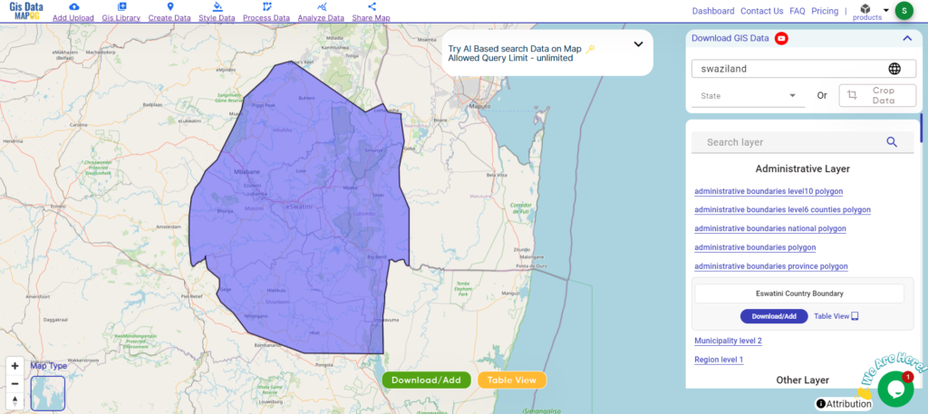
Eswatini, officially the Kingdom of Eswatini and formerly known as Swaziland, is a landlocked country in Southern Africa. It is bordered by Mozambique to the northeast and South Africa to the north, west, south, and southeast. Despite its small size—no more than 200 km (120 mi) from north to south and 130 km (81 mi) from east to west—Eswatini boasts diverse climates and topographies, ranging from a cool and mountainous highveld to a hot and dry lowveld.
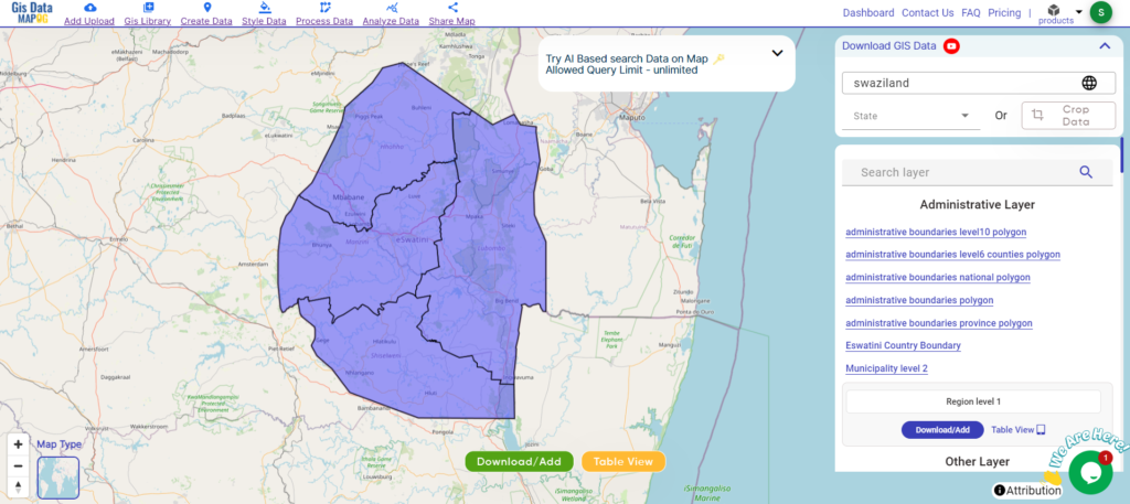
After successfully logging in with a legitimate email address, select the country you want to work with. Next, choose the specific layer you need and click on the download option. Once that’s done, pick the desired format to acquire the essential GIS data. Before proceeding with the data download, make sure to review the data table for any relevant information.
Download Swaziland Regions Shapefile Data
Eswatini, formerly known as Swaziland, is divided into four administrative regions:
Disclaimer : If you find any shapefile data of country provided is incorrect do contact us or comment below, so that we will correct the same in our system as well we will try to correct the same in openstreetmap.
Unlock Sao Tome and Principe’s GIS data: national boundaries, provincial, and district divisions in various formats with MAPOG.
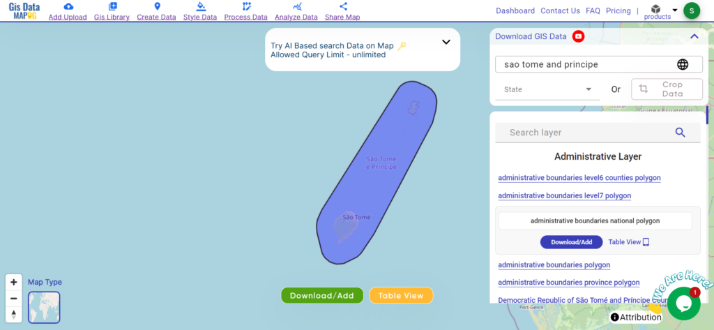
Unlock a world of geospatial insights with MAPOG, your gateway to Download Sao Tome And Principe Administrative Boundary GIS Data. Dive into a treasure trove of datasets covering national, administrative divisions, and more.
Navigating and Download Sao Tome And Principe Administrative Boundary GIS Data is seamless with MAPOG. Access over 150 meticulously curated datasets detailing administrative boundaries and geographic features such as coastlines, roads, and conservation areas. Our platform offers intuitive tools for effortless exploration: Download GIS Data and Add GIS Data. With the Download GIS Data tool, choose from a variety of formats like Shapefile, KML, GeoJSON, or CSV to obtain the precise data you need. Need guidance on using the Add GIS Data tool? Consult our comprehensive guide for step-by-step instructions. Let MAPOG be your trusted companion on an enriching geospatial journey through the breathtaking landscapes of Sao Tome and Principe.
Our platform supports an extensive range of data formats, including KML, SHP, CSV, GeoJSON, Tab, SQL, Tiff, GML, KMZ, GPKZ, SQLITE, Dxf, MIF, TOPOJSON, XLSX, GPX, ODS, MID, and GPS, ensuring seamless compatibility and accessibility across different analyses.
Note:
all data provided by MAPOG are in GCS datum EPSG:4326 WGS84 CRS (Coordinate Reference System).
access to shapefile downloads requires logging in to the platform.
Download Data of Sao Tome and Principe
Sao Tome and Principe, nestled in the Gulf of Guinea, offer a captivating blend of natural beauty and cultural heritage. Known for their lush rainforests, pristine beaches, and colonial architecture, these islands are a paradise for nature lovers and adventurers.
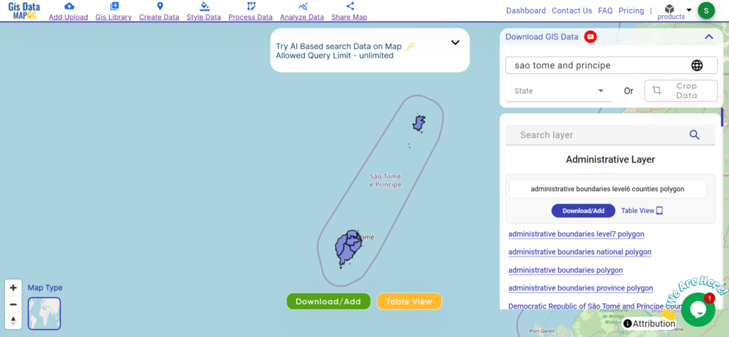
Explore Sao Tome and Principe’s provincial divisions, each encapsulating unique cultural and geographical features. Delve into the administrative boundaries and geographic features of these provinces to gain a deeper understanding of their diversity and importance.
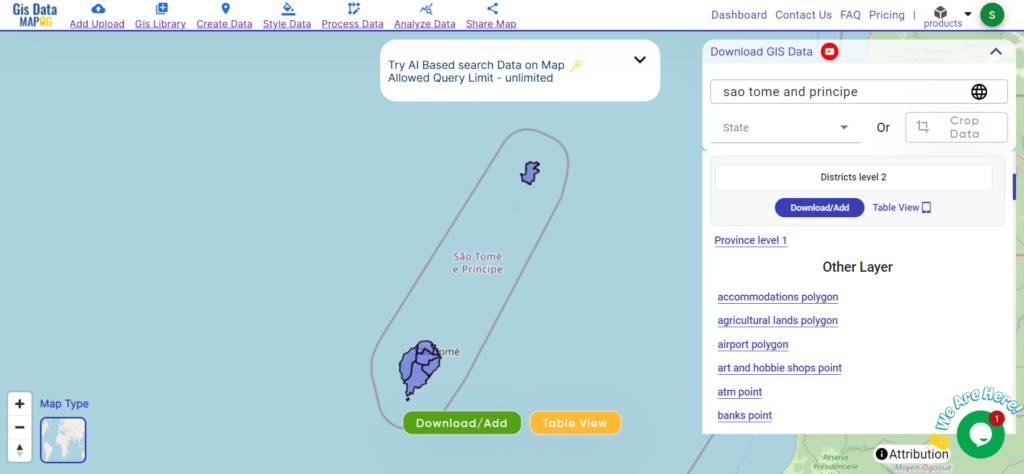
Discover the district boundaries of Sao Tome and Principe, fundamental units of governance and essential for regional development efforts. Delve into the administrative boundaries and geographic features of these districts to gain insights into their significance and diversity.
Disclaimer : If you find any shapefile data of country provided is incorrect do contact us or comment below, so that we will correct the same in our system as well we will try to correct the same in openstreetmap.
Explore geography of Guyana seamlessly with MAPOG. Access a diverse range of datasets, including boundaries, rivers, vegetation, and airports. Take advantage of user-friendly tools like Download GIS Data, providing formats such as Shapefile, KML, GeoJSON, and CSV. Delve into China GIS Data confidently with MAPOG.
We offer an extensive array of data formats, including KML, SHP, CSV, GeoJSON, Tab, SQL, Tiff, GML, KMZ, GPKZ, SQLITE, Dxf, MIF, TOPOJSON, XLSX, GPX, ODS, MID, and GPS, ensuring compatibility and accessibility for various applications and analyses.
Note:
All data available are in GCS datum EPSG:4326 WGS84 CRS (Coordinate Reference System).
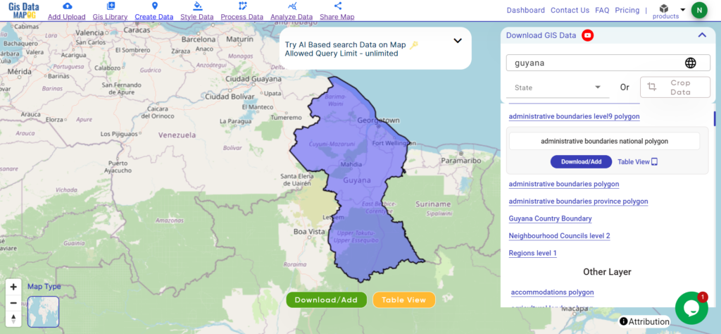
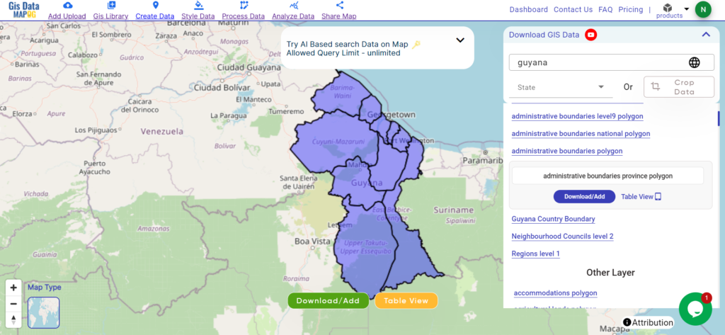
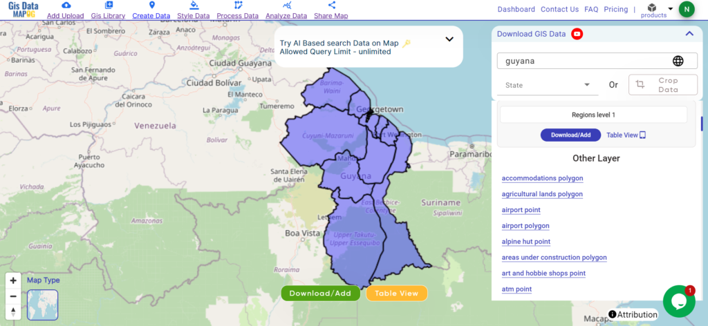
Guyana, located on the northern coast of South America, spans an area of approximately 214,970 square kilometers. Known for its dense rainforests and the vast Rupununi Savannah, Guyana boasts a rich biodiversity. The capital city, Georgetown, sits along the Atlantic coast, serving as the country’s largest urban center. Bordered by Venezuela, Brazil, and Suriname, Guyana is the only English-speaking nation in South America.
After successfully logging in with a legitimate email address, select the country you want to work with. Next, choose the specific layer you need and click on the download option. Once that’s done, pick the desired format to acquire the essential GIS data. Before proceeding with the data download, make sure to review the data table for any relevant information.
Regions in Guyana are administrative units, aiding local governance and services. They facilitate direct interaction between the government and communities, contributing to efficient development efforts. Please verify for recent changes.
Disclaimer: If you find any shapefile data of country provided is incorrect do contact us or comment below, so that we will correct the same in our system as well we will try to correct the same in OpenStreetMap.
Explore geography of China seamlessly with MAPOG. Access a diverse range of datasets, including boundaries, rivers, vegetation, and airports. Take advantage of user-friendly tools like Download GIS Data, providing formats such as Shapefile, KML, GeoJSON, and CSV. Delve into China GIS Data confidently with MAPOG.
We offer an extensive array of data formats, including KML, SHP, CSV, GeoJSON, Tab, SQL, Tiff, GML, KMZ, GPKZ, SQLITE, Dxf, MIF, TOPOJSON, XLSX, GPX, ODS, MID, and GPS, ensuring compatibility and accessibility for various applications and analyses.
Note:
All data available are in GCS datum EPSG:4326 WGS84 CRS (Coordinate Reference System).
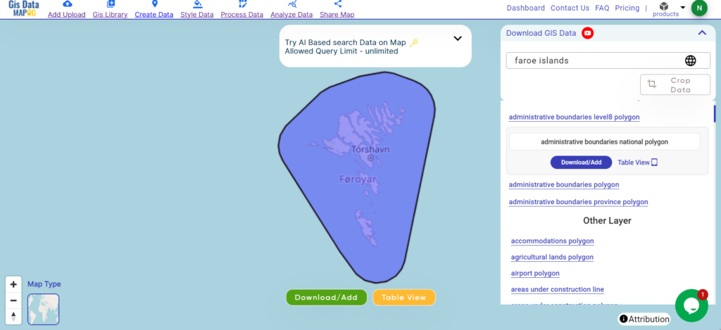
Nestled in the North Atlantic Ocean, the Faroe Islands boast rugged cliffs, verdant valleys, and dramatic fjords across its 1,400-square-kilometer expanse. This autonomous territory of Denmark comprises 18 volcanic islands, with Torshavn as its capital, renowned for its colorful houses lining the harbor. Despite its small size, the Faroes captivate visitors with their pristine landscapes and rich Norse heritage.
After successfully logging in with a legitimate email address, select the country you want to work with. Next, choose the specific layer you need and click on the download option. Once that’s done, pick the desired format to acquire the essential GIS data. Before proceeding with the data download, make sure to review the data table for any relevant information.
Disclaimer: If you find any shapefile data of country provided is incorrect do contact us or comment below, so that we will correct the same in our system as well we will try to correct the same in OpenStreetMap.
Explore geography of China seamlessly with MAPOG. Access a diverse range of datasets, including boundaries, rivers, vegetation, and airports. Take advantage of user-friendly tools like Download GIS Data, providing formats such as Shapefile, KML, GeoJSON, and CSV. Delve into China GIS Data confidently with MAPOG.
We offer an extensive array of data formats, including KML, SHP, CSV, GeoJSON, Tab, SQL, Tiff, GML, KMZ, GPKZ, SQLITE, Dxf, MIF, TOPOJSON, XLSX, GPX, ODS, MID, and GPS, ensuring compatibility and accessibility for various applications and analyses.
Note:
All data available are in GCS datum EPSG:4326 WGS84 CRS (Coordinate Reference System).
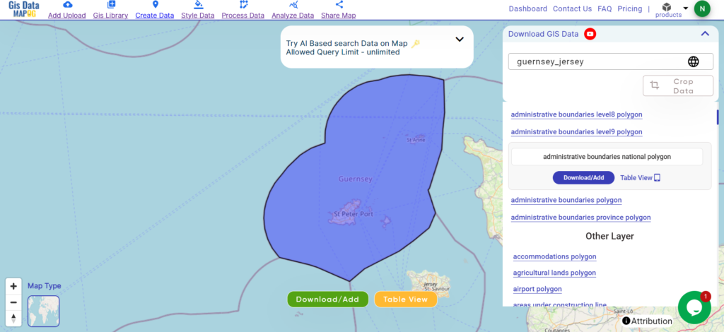
Guernsey and Jersey, nestled in the English Channel, are picturesque islands boasting a rich tapestry of history and culture. With a combined area of approximately 78 square kilometers, these charming destinations offer breathtaking coastlines and quaint countryside. St. Peter Port serves as the capital of Guernsey, while St. Helier holds the same distinction for Jersey, each exuding its own unique charm amidst stunning natural landscapes.
After successfully logging in with a legitimate email address, select the country you want to work with. Next, choose the specific layer you need and click on the download option. Once that’s done, pick the desired format to acquire the essential GIS data. Before proceeding with the data download, make sure to review the data table for any relevant information.
Disclaimer: If you find any shapefile data of country provided is incorrect do contact us or comment below, so that we will correct the same in our system as well we will try to correct the same in OpenStreetMap.
Explore Greenland’s geography seamlessly with MAPOG. Access a diverse range of datasets, including boundaries, rivers, vegetation, and airports. Take advantage of user-friendly tools like Download GIS Data, providing formats such as Shapefile, KML, GeoJSON, and CSV. Delve into Greenland GIS Data confidently with MAPOG
We offer an extensive array of data formats, including KML, SHP, CSV, GeoJSON, Tab, SQL, Tiff, GML, KMZ, GPKZ, SQLITE, Dxf, MIF, TOPOJSON, XLSX, GPX, ODS, MID, and GPS, ensuring compatibility and accessibility for various applications and analyses.
Note:
All data available are in GCS datum EPSG:4326 WGS84 CRS (Coordinate Reference System).
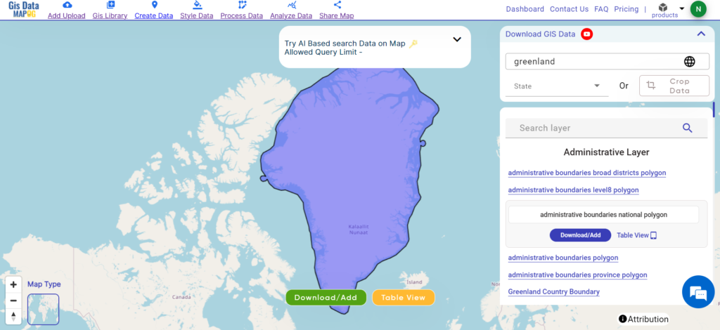
Greenland, the world’s largest island, spans over 2,166,086 square kilometers. Located between the Arctic and Atlantic Oceans, it is an autonomous territory within the Kingdom of Denmark. The island is predominantly covered by ice sheets, with its capital, Nuuk, situated on the southwest coast. Despite its vast size, Greenland has a small population concentrated in coastal areas.
After successfully logging in with a legitimate email address, select the country you want to work with. Next, choose the specific layer you need and click on the download option. Once that’s done, pick the desired format to acquire the essential GIS data. Before proceeding with the data download, make sure to review the data table for any relevant information.
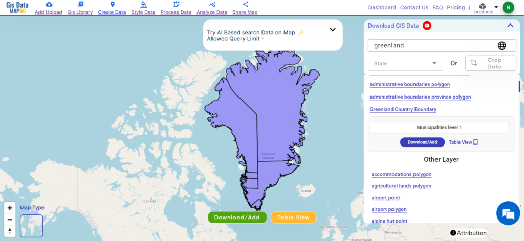
Download Greenland Municipalities Shapefile Data
Municipalities in Greenland are administrative units, aiding local governance and services. They facilitate direct interaction between the government and communities, contributing to efficient development efforts. Please verify for recent changes.
Disclaimer: If you find any shapefile data of country provided is incorrect do contact us or comment below, so that we will correct the same in our system as well we will try to correct the same in OpenStreetMap.
Access and download Turkmenistan administrative boundary GIS data, including national, regions, and districts, for comprehensive geographic analysis and mapping.
Unleash the rich tapestry of Turkmenistan with MAPOG! Delve into a treasure trove of GIS data, unlocking the intricate details of its administrative regions. Chart the courses of Turkmenistan’s mighty rivers and their winding tributaries. Map your exploration across the country’s vital transportation network – navigate the intricate web of roads and take flight with data on Turkmenistan’s essential air gateways, its airports. Download this wealth of Turkmenistan GIS data with ease in formats like Shapefile, KML, GeoJSON, and CSV using our user-friendly tools. Empower your analysis of Turkmenistan’s geography – choose MAPOG for all your Turkmenistan GIS data needs!
We offer an extensive array of data formats, including KML, SHP, CSV, GeoJSON, Tab, SQL, Tiff, GML, KMZ, GPKZ, SQLITE, Dxf, MIF, TOPOJSON, XLSX, GPX, ODS, MID, and GPS, ensuring compatibility and accessibility for various applications and analyses.
Note:
All data available are in GCS datum EPSG:4326 WGS84 CRS (Coordinate Reference System).
You need to login for downloading the shapefile.
Download Shapefile Data of Turkmenistan
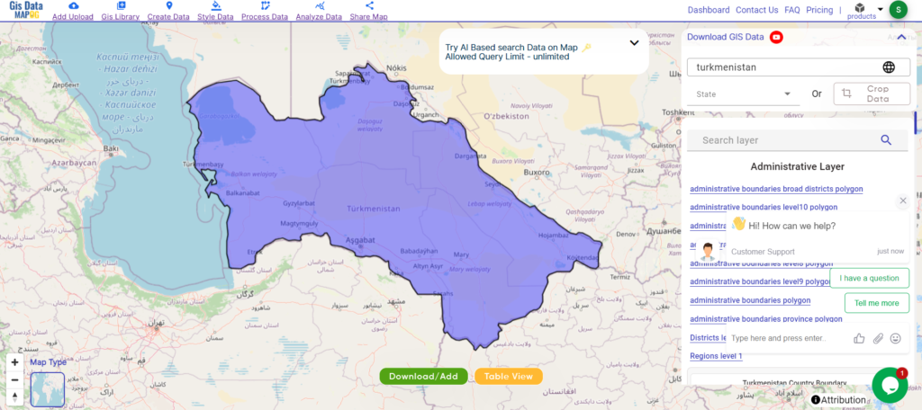
Turkmenistan is a country in Central Asia bordered by Kazakhstan to the northwest, Uzbekistan to the north and east, Afghanistan to the southeast, Iran to the south and southwest, and the Caspian Sea to the west. Ashgabat is the capital and largest city. It is one of the six independent Turkic states. With a population of 6.5 million, Turkmenistan is the 35th most populous country in Asia and the least populous of the Central Asian republics, making it one of the most sparsely populated nations on the Asian continent.
After successfully logging in with a legitimate email address, select the country you want to work with. Next, choose the specific layer you need and click on the download option. Once that’s done, pick the desired format to acquire the essential GIS data. Before proceeding with the data download, make sure to review the data table for any relevant information.
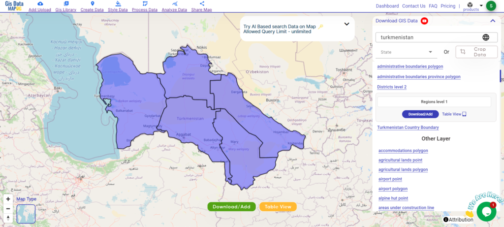
Download Turkmenistan Regions Shapefile Data
Turkmenistan is divided into five regions (welaýatlar) and one capital city with the status of an administrative region. Here are the regions and the capital city:
Disclaimer : If you find any shapefile data of country provided is incorrect do contact us or comment below, so that we will correct the same in our system as well we will try to correct the same in openstreetmap.
Explore geography of China seamlessly with MAPOG. Access a diverse range of datasets, including boundaries, rivers, vegetation, and airports. Take advantage of user-friendly tools like Download GIS Data, providing formats such as Shapefile, KML, GeoJSON, and CSV. Delve into China GIS Data confidently with MAPOG.
We offer an extensive array of data formats, including KML, SHP, CSV, GeoJSON, Tab, SQL, Tiff, GML, KMZ, GPKZ, SQLITE, Dxf, MIF, TOPOJSON, XLSX, GPX, ODS, MID, and GPS, ensuring compatibility and accessibility for various applications and analyses.
Note:
All data available are in GCS datum EPSG:4326 WGS84 CRS (Coordinate Reference System).
The Ivory Coast, officially known as Côte d’Ivoire, is a West African country renowned for its vibrant culture and diverse landscapes. Covering an area of approximately 322,463 square kilometers, it boasts lush rainforests, savannahs, and sandy beaches along the Gulf of Guinea. Its capital, Yamoussoukro, stands as a testament to its rich history and serves as the political center of the nation.
After successfully logging in with a legitimate email address, select the country you want to work with. Next, choose the specific layer you need and click on the download option. Once that’s done, pick the desired format to acquire the essential GIS data. Before proceeding with the data download, make sure to review the data table for any relevant information.
Download Ivory Coast District Shapefile Data
Districts in Ivory Coast are administrative regions, aiding local governance and services. They facilitate direct interaction between the government and communities, contributing to efficient development efforts. Please verify for recent changes.
Disclaimer: If you find any shapefile data of country provided is incorrect do contact us or comment below, so that we will correct the same in our system as well we will try to correct the same in OpenStreetMap.
Loading Comments...
We use cookies to ensure that we give you the best experience on our website. If you continue to use this site we will assume that you are happy with it.Ok