It’s fantastic to hear that MAPOG has expanded its GIS data collection to include data for more than 100 new countries, bringing the total coverage to over 150 countries. This is undoubtedly a valuable resource for GIS enthusiasts and professionals around the world. The availability of detailed information on administrative divisions, rivers, roads, and airports can greatly enhance various geospatial projects and analyses.
The option to access the data through tools like “Download GIS Data” and “Add GIS Data” seems convenient and user-friendly. Providing data in different formats such as Shapefile, KML, GeoJSON, and CSV ensures compatibility with a wide range of GIS software and applications, making it easier for users to integrate the data into their workflows.
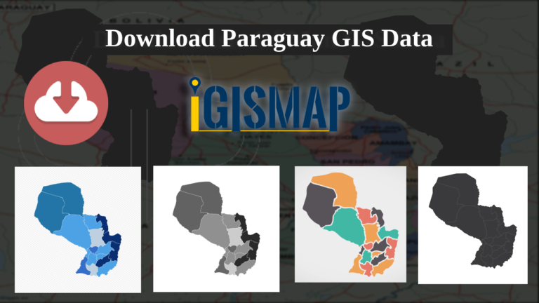
This article will walk you through downloading administrative-level GIS data for Paraguay using the Download GIS Data tool. Experience a seamless geospatial journey with MAPOG as your trusted partner!
Note:
All data available are in GCS datum EPSG:4326 WGS84 CRS (Coordinate Reference System).
Disclaimer : If you find any shapefile data of country provided is incorrect do contact us or comment below, so that we will correct the same in our system as well we will try to correct the same in OpenStreetMap
administrative boundary GIS data for the Isle of Man, covering districts, parishes, and more.
Effortlessly navigate the geography of the Isle of Man with MAPOG. Explore a variety of datasets, including boundaries, rivers, highways, and airports. Utilize user-friendly tools such as Download GIS Data, where you can select from formats like Shapefile, KML, GeoJSON, and CSV. Immerse yourself confidently in Isle of Man GIS Data with MAPOG.
We offer an extensive array of data formats, including KML, SHP, CSV, GeoJSON, Tab, SQL, Tiff, GML, KMZ, GPKZ, SQLITE, Dxf, MIF, TOPOJSON, XLSX, GPX, ODS, MID, and GPS, ensuring compatibility and accessibility for various applications and analyses.
Note:
All data available are in GCS datum EPSG:4326 WGS84 CRS (Coordinate Reference System).
The Isle of Man is a self-governing British Crown Dependency in the Irish Sea between Great Britain and Ireland. It is known for its rugged coastline, medieval castles, and rural landscape, rising to a mountainous center. The island’s capital is Douglas.
After successfully logging in with a legitimate email address, select the country you want to work with. Next, choose the specific layer you need and click on the download option. Once that’s done, pick the desired format to acquire the essential GIS data. Before proceeding with the data download, make sure to review the data table for any relevant information.
Download Isle of Man District Shapefile Data
The Isle of Man is a self-governing Crown dependency in the Irish Sea, located between Great Britain and Ireland. The island is divided into six administrative districts.
here is the list of the 6 districts in Isle of Man :
Garff
Ayre
Michael
Rushen
Glenfaba
Middle
Download Isle of Man Parishes Shapefile Data
the Isle of Man is divided into 17 parishes. Each parish has its own local government and is further divided into smaller townships or villages. The parishes are an important administrative and geographic division on the island.
Disclaimer : If you find any shapefile data of country provided is incorrect do contact us or comment below, so that we will correct the same in our system as well we will try to correct the same in openstreetmap.
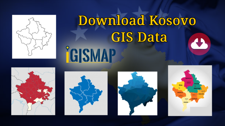
Here at MAPOG! You now have the chance to download administrative boundary GIS data for Kosovo, covering national boundaries, municipalities, and more.
Explore Kosovo’s geography seamlessly with MAPOG. Access a diverse range of datasets, including boundaries, rivers, highways, and airports. Take advantage of user-friendly tools like Download GIS Data, providing formats such as Shapefile, KML, GeoJSON, and CSV. Delve into Kosovo GIS Data confidently with MAPOG
We offer an extensive array of data formats, including KML, SHP, CSV, GeoJSON, Tab, SQL, Tiff, GML, KMZ, GPKZ, SQLITE, Dxf, MIF, TOPOJSON, XLSX, GPX, ODS, MID, and GPS, ensuring compatibility and accessibility for various applications and analyses.
Note:
All data available are in GCS datum EPSG:4326 WGS84 CRS (Coordinate Reference System).
Kosovo is a partially recognized state in Southeast Europe. It is a landlocked country bordered by Serbia to the north and east, North Macedonia to the south, Albania to the southwest, and Montenegro to the northwest. Kosovo is the smallest country in the Balkans, with an area of 10,887 square kilometers (4,203 square miles). Its capital and largest city is Pristina.
After successfully logging in with a legitimate email address, select the country you want to work with. Next, choose the specific layer you need and click on the download option. Once that’s done, pick the desired format to acquire the essential GIS data. Before proceeding with the data download, make sure to review the data table for any relevant information.
Download Kosovo Municipality Shapefile Data
Kosovo is divided into 38 municipalities, each of which is responsible for local government services within its jurisdiction. These municipalities are the basic administrative division in Kosovo and constitute the only level of power in local governance.
Disclaimer : If you find any shapefile data of country provided is incorrect do contact us or comment below, so that we will correct the same in our system as well we will try to correct the same in openstreetmap.
Dive into the world of GIS mapping with MAPOG! You can now download administrative boundary GIS data for Kiribati, including national boundaries, islands, atolls, and more.
Discover Kiribati’s geography effortlessly with MAPOG. Explore a variety of datasets, including boundaries, rivers, highways, and airports. Utilize user-friendly tools like Download GIS Data, offering formats such as Shapefile, KML, GeoJSON, and CSV. Dive into Kiribati GIS Data with confidence using MAPOG.
We offer an extensive array of data formats, including KML, SHP, CSV, GeoJSON, Tab, SQL, Tiff, GML, KMZ, GPKZ, SQLITE, Dxf, MIF, TOPOJSON, XLSX, GPX, ODS, MID, and GPS, ensuring compatibility and accessibility for various applications and analyses.
Note:
All data available are in GCS datum EPSG:4326 WGS84 CRS (Coordinate Reference System).
You need to login for downloading the shapefile.
Download Shapefile Data of Kiribati
Kiribati, officially the Republic of Kiribati, is an island country in the Micronesia subregion of Oceania in the central Pacific Ocean. It is home to a population of over 119,000 people, with over half of them living on Tarawa Atoll. The country comprises 32 atolls and one remote raised coral island, Banaba. Its total land area is 811 square kilometers (313 square miles) dispersed over 3,441,810 square kilometers (1,328,890 square miles) of ocean.
After successfully logging in with a legitimate email address, select the country you want to work with. Next, choose the specific layer you need and click on the download option. Once that’s done, pick the desired format to acquire the essential GIS data. Before proceeding with the data download, make sure to review the data table for any relevant information.
Download Kiribati Atolls Shapefile Data
Kiribati consists of 33 coral islands divided among three island groups: the Gilbert Islands, the Phoenix Islands, and the Line Islands.
Kiribati is an island country in the central Pacific Ocean, made up of 33 islands. Only 20 of these are inhabited. Although the land area is small, the islands are scattered widely. Most of the islands are very low-lying atolls (ring-shaped coral reefs).
Disclaimer : If you find any shapefile data of country provided is incorrect do contact us or comment below, so that we will correct the same in our system as well we will try to correct the same in openstreetmap.
Explore the world of GIS mapping with MAPOG! We’re delighted to offer you the chance to download administrative boundary GIS data for both Haiti and the Dominican Republic. Dive into datasets that cover national boundaries, provinces, arrondissements, and more.
“Discover the geographical intricacies of Haiti and the Dominican Republic effortlessly through MAPOG. Access a comprehensive range of datasets covering vital aspects like boundaries, rivers, highways, and airports for both nations. MAPOG simplifies your exploration with user-friendly tools like Download GIS Data, offering multiple formats like Shapefile, KML, GeoJSON, and CSV for your convenience. Navigate through the GIS Data of Haiti and the Dominican Republic confidently, courtesy of IGISMAP.”
We offer an extensive array of data formats, including KML, SHP, CSV, GeoJSON, Tab, SQL, Tiff, GML, KMZ, GPKZ, SQLITE, Dxf, MIF, TOPOJSON, XLSX, GPX, ODS, MID, and GPS, ensuring compatibility and accessibility for various applications and analyses.
Note:
All data available are in GCS datum EPSG:4326 WGS84 CRS (Coordinate Reference System).
Download Shapefile Data of Haiti And Dominican Republic
Haiti and the Dominican Republic are two neighboring countries located on the island of Hispaniola in the Caribbean Sea. They share the same island but have distinct histories, cultures, and languages.
Haiti, officially known as the Republic of Haiti, is a nation situated on the island of Hispaniola within the Greater Antilles archipelago in the Caribbean Sea. It lies to the east of Cuba and Jamaica, and to the south of The Bahamas and the Turks and Caicos Islands. Haiti occupies the western portion of the island, sharing it with the Dominican Republic. The capital city of Haiti is Port-au-Prince.
The Dominican Republic, known as República Dominicana in Spanish, is a nation situated on the island of Hispaniola within the Greater Antilles archipelago in the Caribbean region. It encompasses the eastern five-eighths of the island, sharing this landmass with Haiti. The Dominican Republic is the second-largest country in the Antilles in terms of land area (following Cuba), covering 48,671 square kilometers (18,792 square miles). Approximately 3.3 million of these inhabitants reside in the metropolitan area of Santo Domingo, which serves as the capital city.
Data of Haiti And Dominican Republic National Boundary
After successfully logging in with a legitimate email address, select the country you want to work with. Next, choose the specific layer you need and click on the download option. Once that’s done, pick the desired format to acquire the essential GIS data. Before proceeding with the data download, make sure to review the data table for any relevant information.
Download Haiti And Dominican Republic Provinces Shapefile Data
Haiti and the Dominican Republic are divided into provinces or administrative regions. Here’s an overview of the provinces in each country:
Haiti: Haiti is divided into 10 administrative departments
Artibonite
Centre
Grand’Anse
Nippes
Nord
Nord-Est
Nord-Ouest
Ouest (includes the capital, Port-au-Prince)
Sud
Sud-Est
Dominican Republic: The Dominican Republic is divided into 31 provinces and the National District (Distrito Nacional), which includes the capital city, Santo Domingo.
Azua
Baoruco
Barahona
Dajabón
Duarte
Elías Piña
El Seibo
Espaillat
Hato Mayor
Hermanas Mirabal
Independencia
La Altagracia
La Romana
La Vega
María Trinidad Sánchez
Monseñor Nouel
Monte Cristi
Monte Plata
Pedernales
Peravia
Puerto Plata
Samaná
Sánchez Ramírez
San Cristóbal
San José de Ocoa
San Juan
San Pedro de Macorís
Santiago
Santiago Rodríguez
Santo Domingo (National District)
Valverde
Download Haiti And Dominican Republic Arrondissements Shapefile Data
Haiti is divided into 10 departments, which are further subdivided into 42 arrondissements. The arrondissements are the second-level administrative divisions in Haiti.
The arrondissements are headed by a sub-prefect, who is appointed by the central government. The sub-prefect is responsible for overseeing the administration of the arrondissement, including the provision of public services, the maintenance of law and order, and the collection of taxes.
Haiti And Dominican Republic Arrondissements Boundaries
Above all links are provided for GIS data of Haiti And Dominican Republic if you are looking for any specific data please write us on support@mapog.com
Disclaimer : If you find any shapefile data of country provided is incorrect do contact us or comment below, so that we will correct the same in our system as well we will try to correct the same in openstreetmap.
Unlock the potential of mapping! MAPOG introduces a unique opportunity: download Armenia’s administrative boundary shapefile, covering provinces, districts, and more. Elevate your mapping projects with these comprehensive GIS datasets. Seize the opportunity for enriched exploration and mapping experiences!
Searching for accurate and up-to-date GIS data for your chosen country? Look no further than MAPOG! We offer an extensive GIS Data Collection covering 150+ countries, with over 150 datasets available for each nation. Our data is known for its exceptional accuracy, particularly in representing administrative divisions. Explore a wide range of geographic features such as rivers, roads, railway lines, airport locations, and more, meticulously represented in appropriate geometric structures (points, lines, and polygons). Accessing this valuable data is easy with our two essential tools – Download GIS Data and Add GIS Data, designed to simplify your data acquisition process. Choose from ESRI Shapefile, KML, GeoJSON, or CSV formats to download the data from Download GIS Data tool.
In this article, we’ll focus on the administrative level GIS data of Armenia and walk you through how to download it using the Download GIS Data tool. MAPOG ensures a user-friendly experience, making GIS data acquisition a breeze. Don’t miss the chance to enhance your geospatial projects with MAPOG‘s accurate and reliable GIS data solutions!
All data available are in GCS datum EPSG:4326 WGS84 CRS (Coordinate Reference System).
You need to login for downloading the shapefile.
Download Shapefile Data of Armenia
Armenia, a landlocked country in the Armenian Highlands of West Asia, shares borders with Turkey, Georgia, Azerbaijan, Iran, and the Azerbaijani exclave of Nakhchivan. Due to its connections with Europe, Armenia is considered part of the Caucasus region. Yerevan, the capital and largest city, serves as the country’s financial center. Administratively, Armenia is divided into 11 regions known as Marzes, which include Yerevan. Municipalities within each Marz oversee the governance of cities, towns, and villages. At a smaller scale, communities called Hamaynkner have their own local governments led by mayors or village heads. This well-structured administrative system ensures effective governance and service delivery throughout the nation.
Once you have successfully logged in with your verified email ID, select Armenia as your desired country. Proceed by choosing the specific layer and format for the GIS data you require. Before initiating the download Armenia administrative boundaries GIS data, you have the option to review the data table for additional details. Finally, click on the download button to start downloading the data and seize the opportunity to enhance your mapping endeavors.
Download Armenia Provinces Shapefile Data
In Armenia, there are eleven administrative divisions, consisting of ten provinces referred to as “marzer” or “marz” in Armenian. The provinces have the crucial responsibility of local governance and are under the leadership of a chief executive known as the “marzpet.” The government of Armenia appoints the marzpets to their respective provinces. It’s important to note that Yerevan, the capital, has a distinct status and operates with its own separate administrative structure. Unlike the other provinces, it is not affiliated with any specific province and maintains its own governance system.
This shapefile covers following Provinces of armenia listed below:
Aragatsotn
Ararat
Armavir
Gegharkunik
Kotayk
Lori
Shirak
Syunik
Tavush
Vayots Dzor
Yerevan (capital city, also considered a province)
Download Armenia Municipality, Towns and villages Shapefile Data
Municipalities, towns, and villages form an integral part of the administrative structure in Armenia, playing crucial roles in local governance and community development. Municipalities are responsible for the governance and management of specific areas, such as cities or towns.
Towns, as urban areas with larger populations and more developed infrastructure, have their own local governments. Villages, on the other hand, represent rural settlements with smaller populations and less developed infrastructure.
Disclaimer : If you find any shapefile data of country provided is incorrect do contact us or comment below, so that we will correct the same in our system as well we will try to correct the same in openstreetmap.
Attention GIS enthusiasts! MAPOG unveils specialized GIS data for Luxembourg, providing intricate geographical insights along with comprehensive administrative boundaries. Elevate your mapping projects using this cutting-edge resource, with format options like ESRI Shapefile, KML, GeoJSON, and CSV for seamless integration. Explore now to enhance your mapping endeavors with the latest Luxembourg GIS data, including administrative boundaries.
Calling all GIS enthusiasts! Exciting updates await at MAPOG. Introducing our specialized GIS data for Luxembourg, offering intricate geographical insights and detailed administrative boundaries. Elevate your local and national mapping projects with this cutting-edge resource. Choose from formats like ESRI Shapefile, KML, GeoJSON, and CSV for seamless integration. Don’t miss the chance to enhance your mapping pursuits with the latest Luxembourg GIS data. Explore now!
We offer an extensive array of data formats, including KML, SHP, CSV, GeoJSON, Tab, SQL, Tiff, GML, KMZ, GPKZ, SQLITE, Dxf, MIF, TOPOJSON, XLSX, GPX, ODS, MID, and GPS, ensuring compatibility and accessibility for various applications and analyses.
Note:
All data available are in GCS datum EPSG:4326 WGS84 CRS (Coordinate Reference System).
You need to login for downloading the shapefile.
Download Shapefile Data of Luxembourg
Nestled in Western Europe, Luxembourg is a compact landlocked nation. It shares borders with Belgium to the north and west, Germany to the east, and France to the south. The country’s capital and largest city, Luxembourg, holds significance as one of the European Union’s key seats, hosting vital institutions like the Court of Justice of the European Union. The Grand Duchy of Luxembourg is deeply entwined with its French and German neighbors, evident in its culture, people, and languages. While Luxembourgish is the national language, French takes the lead in legislation, while all three – Luxembourgish, French, and German – play roles in administrative affairs.
After successfully logging in with a legitimate email address, select the country you want to work with. Next, choose the specific layer you need and click on the download option. Once that’s done, pick the desired format to acquire the essential GIS data. Before proceeding with the data download, make sure to review the data table for any relevant information.
Download Luxembourg Cantons Shapefile Data
The 12 cantons within the Grand Duchy of Luxembourg serve as local government regions at the primary tier of the European Union’s Nomenclature of Territorial Units for Statistics (LAU-1) for Eurostat.
Disclaimer : If you find any shapefile data of country provided is incorrect do contact us or comment below, so that we will correct the same in our system as well we will try to correct the same in openstreetmap.
Unlock the potential of mapping! MAPOG introduces a unique opportunity: download Slovakia’s administrative boundary GIS data, encompassing national, regions, districts, and more.
Discover Slovakia’s geography effortlessly with MAPOG. Explore a wide range of datasets, including comprehensive information about national borders, meandering rivers, well-structured roads, and convenient airports. Utilizing user-friendly tools like Download GIS Data and Add GIS Data has never been more straightforward. Customize your data downloads by selecting from various formats such as Shapefile, KML, GeoJSON, and CSV with the Download GIS Data tool. Embrace IGISMAP with confidence as your trusted resource to delve deeper into Slovakia GIS Data.
We offer an extensive array of data formats, including KML, SHP, CSV, GeoJSON, Tab, SQL, Tiff, GML, KMZ, GPKZ, SQLITE, Dxf, MIF, TOPOJSON, XLSX, GPX, ODS, MID, and GPS, ensuring compatibility and accessibility for various applications and analyses.
Note:
All data available are in GCS datum EPSG:4326 WGS84 CRS (Coordinate Reference System).
You need to login for downloading the shapefile.
Download Shapefile Data of Slovakia
Slovakia, officially known as the Slovak Republic, is a landlocked nation situated in Central Europe. It shares its borders with Poland to the north, Ukraine to the east, Hungary to the south, Austria to the west, and the Czech Republic to the northwest. Slovakia’s terrain is predominantly mountainous and covers an area of approximately 49,000 square kilometers (19,000 square miles), with a population exceeding 5.4 million people. The capital and largest city is Bratislava, and the second-largest city is Košice.
After successfully logging in with a legitimate email address, select the country you want to work with. Next, choose the specific layer you need and click on the download option. Once that’s done, pick the desired format to acquire the essential GIS data. Before proceeding with the data download, make sure to review the data table for any relevant information.
Download Slovakia Regions Shapefile Data
Slovakia is divided into 8 self-governing regions, called “samosprávne kraje” in Slovak. These are:
Slovakia is divided into 79 districts (okresy), mainly for statistical purposes. The districts are named after the biggest town in the district (formerly known as the “district towns”).
Disclaimer : If you find any shapefile data of country provided is incorrect do contact us or comment below, so that we will correct the same in our system as well we will try to correct the same in openstreetmap.
Download Syria administrative boundary shapefiles Syria national boundary province district sub-districts-and more
With a vast collection of GIS data covering 150+ countries, each nation offering over 150 datasets, MAPOG is becoming an irreplaceable asset in geospatial industry. Our GIS data collection stands out for its precise representation of administrative divisions and various geographic features like rivers, roads, and airports. Users can access these data from two tools of MAPOG: Download GIS Data and Add GIS Data. Choose from multiple data formats, including Shapefile, KML, GeoJSON, or CSV to download data from Download GIS Data tool. To learn more about the Add GIS Data tool, explore our article “Add GIS data from MAPOG GIS data collection.” In this comprehensive guide, we’ll show you how to download administrative-level GIS data for Syria using the Download GIS Data tool. Take the hassle out of GIS data searching and embark on a smooth geospatial journey with MAPOG as your reliable companion!
Note:
All data available are in GCS datum EPSG:4326 WGS84 CRS (Coordinate Reference System).
You need to login for downloading the shapefile.
Download Shapefile Data of Syria
Syria lies between latitudes 32° and 38° N, and longitudes 35° and 43° E. The climate varies from the humid Mediterranean coast, through a semiarid steppe zone, to arid desert in the east. The country consists mostly of arid plateau, although the northwest part bordering the Mediterranean is fairly green. Al-Jazira in the northeast and Hawran in the south are important agricultural areas. The Euphrates, Syria’s most important river, crosses the country in the east. Syria is one of the fifteen states that comprise the so-called “cradle of civilization”.
Disclaimer : If you find any shapefile data of country provided is incorrect do contact us or comment below, so that we will correct the same in our system as well we will try to correct the same in OpenStreetMap.
Unlock the potential of mapping! IGISMAP introduces a unique opportunity: download Afghanistan’s administrative boundary GIS data, encompassing national, provinces, districts, and more.
Navigating Afghanistan’s GIS data landscape is a breeze with MAPOG. Immerse yourself in a diverse repository of over 150 datasets meticulously outlining administrative divisions and key geographic features like rivers, roads, and airports. Seamlessly accessing this wealth of information is facilitated through two integrated tools: Download GIS Data and Add GIS Data. Leverage the Download GIS Data tool to acquire data in various formats such as Shapefile, KML, GeoJSON, or CSV – tailoring it to your needs. For insights into harnessing the Add GIS Data tool, delve into our illuminating guide, “Utilizing MAPOG’s GIS Data Collection for Afghanistan.” This resource provides step-by-step instructions for procuring administrative-level GIS data using the Download GIS Data tool. Embark on an enlightening geospatial journey through Afghanistan’s terrain with MAPOG as your trusted companion.
We offer an extensive array of data formats, including KML, SHP, CSV, GeoJSON, Tab, SQL, Tiff, GML, KMZ, GPKZ, SQLITE, Dxf, MIF, TOPOJSON, XLSX, GPX, ODS, MID, and GPS, ensuring compatibility and accessibility for various applications and analyses.
Note:
All data available are in GCS datum EPSG:4326 WGS84 CRS (Coordinate Reference System).
You need to login for downloading the shapefile.
Download Shapefile Data of Afghanistan
Afghanistan, officially known as the Islamic Emirate of Afghanistan, is a landlocked nation situated at the crossroads of Central Asia and South Asia. Often referred to as the Heart of Asia, it shares its borders with Pakistan to the east and south, Iran to the west, Turkmenistan to the northwest, Uzbekistan to the north, Tajikistan to the northeast, and China to the northeast and east. Encompassing an area of 652,864 square kilometers (252,072 sq mi), the country is primarily characterized by mountainous terrain with plains in the northern and southwestern regions, divided by the Hindu Kush mountain range. The capital city is Kabul, which is also the largest city in the country.
After successfully logging in with a legitimate email address, select the country you want to work with. Next, choose the specific layer you need and click on the download option. Once that’s done, pick the desired format to acquire the essential GIS data. Before proceeding with the data download, make sure to review the data table for any relevant information.
Download Afghanistan Provinces Shapefile Data
Afghanistan is structured into 34 provinces, known as “wilåyat” in the local language. These provinces serve as the fundamental administrative units within the country. Each province is composed of multiple districts, often containing more than 1,000 villages.
This shapefile covers following Provinces of Afghanistan listed below:
Badakhshan
Badghis
Baghlan
Balkh
Bamyan
Daykundi
Farah
Faryab
Ghazni
Ghor
Helmand
Herat
Jowzjan
Kabul
Kandahar
Kapisa
Khost
Kunar
Kunduz
Laghman
Logar
Maidan Wardak
Nangarhar
Nimruz
Nuristan
Paktia
Paktika
Panjshir
Parwan
Samangan
Sar-e Pol
Takhar
Uruzgan
Zabul
Download Afghanistan Districts Shapefile Data
The districts of Afghanistan are the primary administrative divisions of the country. There are a total of 34 provinces, each of which is subdivided into several districts. The districts are further subdivided into villages. The total number of districts in Afghanistan is 387. This number has been fluctuating in recent years, as the Taliban have created new districts in some areas and the Afghan government has lost control of others.
Disclaimer : If you find any shapefile data of country provided is incorrect do contact us or comment below, so that we will correct the same in our system as well we will try to correct the same in openstreetmap.
Loading Comments...
We use cookies to ensure that we give you the best experience on our website. If you continue to use this site we will assume that you are happy with it.