Hello GIS enthusiasts, IGISMAP has now published the latest GIS vector data of South Africa administrative levels. Links for downloading the shapefiles of the important administrative divisions of South Africa are provided in the following. You can also download these data in KML, GeoJSON or CSV formats.
Note:
- All data available are in GCS datum EPSG:4326 WGS84 CRS (Coordinate Reference System).
- You need to login for downloading the shapefile.
Download Free Shapefile Data of South Africa
South Africa, officially the Republic of South Africa (RSA), is the southernmost country in Africa. South Africa is bounded to the south by 2,798 kilometers (1,739 mi) of coastline that stretch along the South Atlantic and Indian Oceans to the north by the neighboring countries of Namibia, Botswana, and Zimbabwe; and to the east and northeast by Mozambique and Eswatini and it surrounds the enclaved country of Lesotho. It is the southernmost country on the mainland of the Old World, and the most populous country located entirely south of the equator. The largest city is Johannesburg.
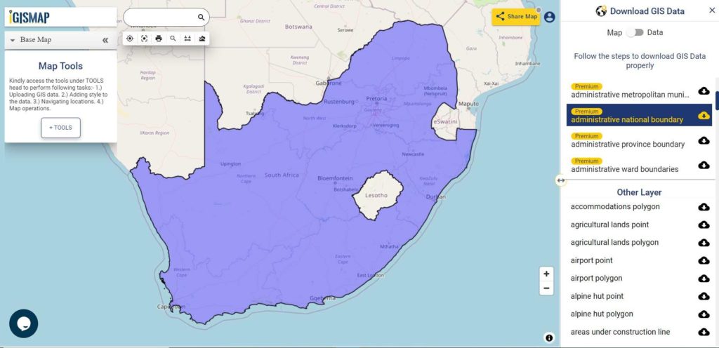
Download South Africa National Outline Boundary Shapefile
Download South Africa Province Shapefile Data
South Africa is divided into nine provinces as following:
- Eastern Cape
- Free State
- Gauteng
- KwaZulu-Natal
- Limpopo
- Mpumalanga
- North West
- Northern Cape
- Western Cape
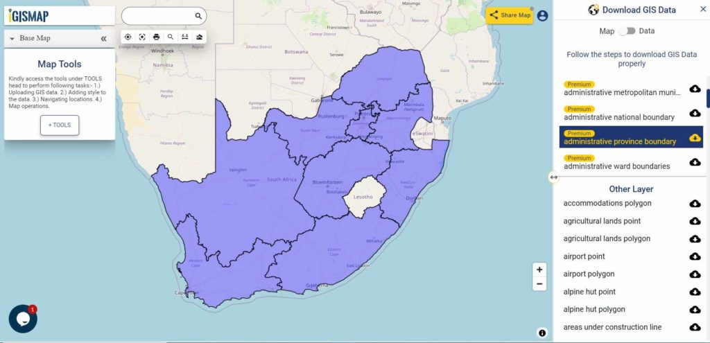
Download South Africa Province Boundaries Shapefile
Download South Africa District Shapefile Data
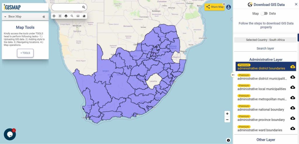
Download South Africa District Boundaries Shapefile
Download South Africa Wards Shapefile Data
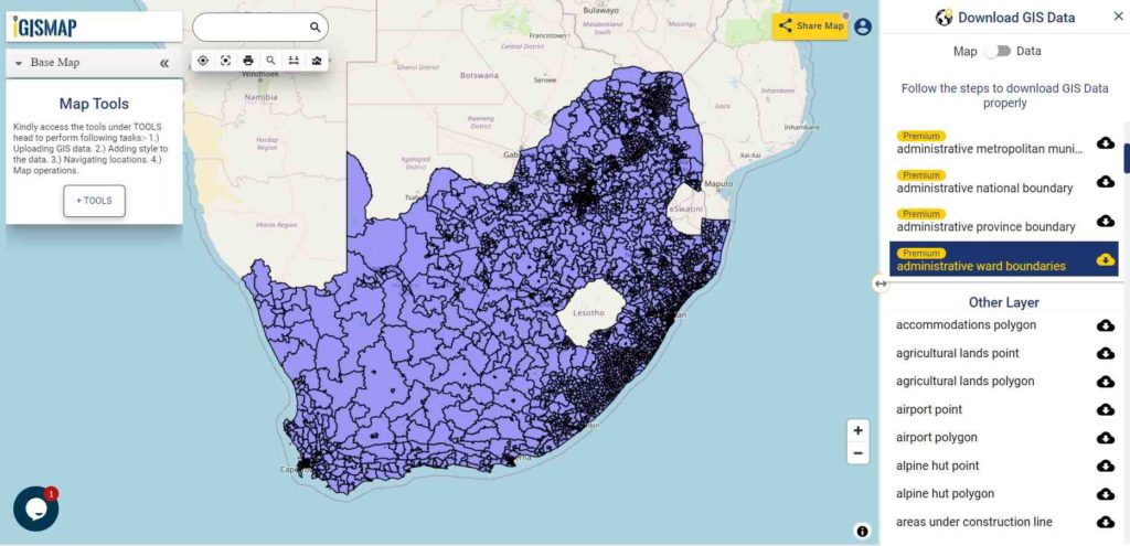
Download South Africa Ward Boundaries Shapefile
Please note that the Argentina data provided here is license under Open Data Commons Open Database License (ODbL). Please review the same before using it. If you want data under different license you can also look over to the post : Download Free Shapefile Maps – Country Boundary Polygon, Rail-Road, Water polyline etc
Other Administrative Shapefile Data:
- Download South Africa District Municipality Boundaries Shapefile
- Download South Africa Metropolitan Municipality Boundaries Shapefile
- Download South Africa Local Municipality Boundaries Shapefile
Other GIS Data:
- Download South Africa Highway Lines Shapefile
- Download South Africa Railway Lines Shapefile
- Download South Africa Airport Locations Shapefile
- Download South Africa Ferry Terminal Locations Shapefile
Download Free Shapefile for the following:
- World Countries Shapefile
- Australia
- Argentina
- Austria
- Belgium
- Brazil
- Canada
- Denmark
- Fiji
- Finland
- Germany
- Greece
- India
- Indonesia
- Ireland
- Italy
- Japan
- Kenya
- Lebanon
- Madagascar
- Malaysia
- Mexico
- Mongolia
- Netherlands
- New Zealand
- Nigeria
- Papua New Guinea
- Philippines
- Poland
- Russia
- Singapore
- South Africa
- South Korea
- Spain
- Switzerland
- Tunisia
- United Kingdom Shapefile
- United States of America
- Vietnam
- Croatia
- Chile
- Norway
Disclaimer : If you find any shapefile data of country provided is in correct do contact us or comment below, so that we will correct the same in our system.
Hi,
Do you have a shapefile of south africa with districts?
https://map.igismap.com/gis-data/south%20africa/administrative_boundaries_polygon Please try this
Good day, anyone perhaps have a shape file of storm water drainage systems in western cape
please
Hi do you have a specific layer with South Africa township
Hi,
do you have a shapefile of South African Provinces and all other countries on the same layer?
E.g. Western Cape, Eastern Cape, Lesotho, Italy
Hi Hendrik you can find shapefile of South Africa Province here https://map.igismap.com/gis-data/south%20africa/administrative_boundaries_province_polygon
Hi
Im looking for a shapefile with South African towns as poylgons, not points
I am looking for a shapefile of Biomes in SouthAfrica esp the savanna biome. Kindly assist
Hi
If anyone knows where to access a shapefile of farms in the northern Cape, Pixley ka Seme Municipality District.
Thanks
Martina
Martina, you can get that on the Planet GIS website
Regards
Deon
Please, could you kindly help me with the shapefiles for existing and proposed solar projects in the northern cape province
Hi Marvis, I am looking for the same, did you find it? Thanks
Hi am looking for a shapefile of only Johannesburg with road network, land use and buildings.
Could you please help.
Good day,
Is there any stand boundaries shapefiles in South africa.
Kind regards
Hey does anyone know where I can find shape file for flood prone areas in Gauteng.
Hello do you perhaps have the Letaba river boundary?