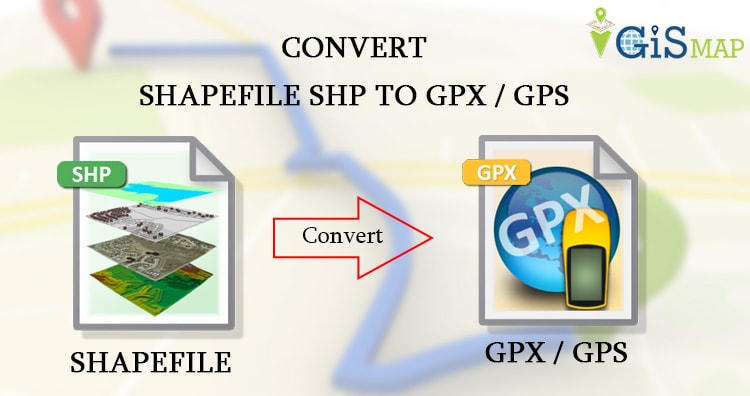
Shapefile shp can be converted into GPS ( Global Positioning System) using ogr2ogr utility. The GPS data is best option when routes and tracks are required in XML format. Here we will check how to convert shapefile shp to GPX / GPS.
Convert Shp to GPX – Using IGIS Map Tool
Go to MAPOG Conversion Tool . Login with registered id and password or if you are new then register with valid email id. Then tap on Switch To button select conversion in the drop down list.
Upload your file from system or drive or from drop box. After uploading the file choose the output format. And in the last click on Convert File button. You will be directed to the map where converted file is published.
Download the converted SHP to GPX file from the download icon. For detailed conversion watch the video provided below.
Details for GPX/GPS (GPS Exchange Format) and Shapefile Format Before Converting Shapefile to GPX GPS data-
GPX (GPS Exchange Format) is a light-weight XML data format for the interchange of GPS data (waypoints, routes, and tracks) between applications and Web services on the Internet. Shapefile is collection of geometry with attributes mainly comprised of three files .shp for which stores geometry, .shx which stores index and .dbf which stores data of respective attributes.
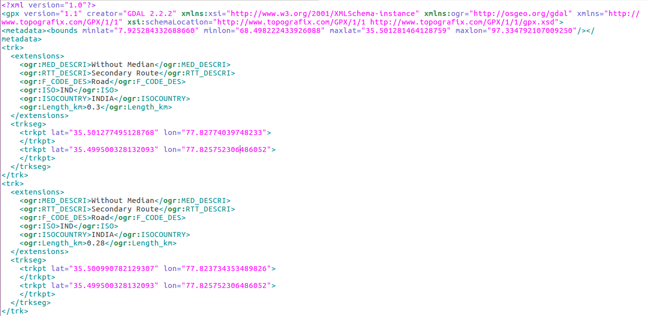
The example is given below for linestring feature of gpx version. Here metadata contains the bounding box with min (lat,long) and max (lat, long). The tag trk defines the tracks, which contains extension tag, trkseg tag and trkpt tag. Here extension tag contains all the attributes in ogr tag with values. Trkseg tag is the track segment, which is composed of track points with latitude longitude.
<gpx version=”1.1″ creator=”GDAL 2.2.2″ xmlns:xsi=”http://www.w3.org/2001/XMLSchema-instance” xmlns:ogr=”http://osgeo.org/gdal” xmlns=”http://www.topografix.com/GPX/1/1″ xsi:schemaLocation=”http://www.topografix.com/GPX/1/1 http://www.topografix.com/GPX/1/1/gpx.xsd”>
<metadata><bounds minlat=”7.925284332688660″ minlon=”68.498222433926088″ maxlat=”35.501281464128759″ maxlon=”97.334792107009250″/></metadata>
<trk>
<extensions>
<ogr:MED_DESCRI>Without Median</ogr:MED_DESCRI>
<ogr:RTT_DESCRI>Secondary Route</ogr:RTT_DESCRI>
<ogr:F_CODE_DES>Road</ogr:F_CODE_DES>
<ogr:ISO>IND</ogr:ISO>
<ogr:ISOCOUNTRY>INDIA</ogr:ISOCOUNTRY>
<ogr:Length_km>0.3</ogr:Length_km>
</extensions>
<trkseg>
<trkpt lat=”35.501277495128768″ lon=”77.82774039748233″>
</trkpt>
<trkpt lat=”35.499500328132093″ lon=”77.825752306486052″>
</trkpt>
</trkseg>
</trk>
Convert- Shapefile shp to GPX / GPS- Global Positioning System
Convert shp to GPX /GPS using ogr2ogr utility-
Ogr2ogr utility has some options some of them are give below,
-dsco NAME=VALUE:
Dataset creation option (format specific)
-nlt type:
Define the geometry type for the created layer. One of NONE, GEOMETRY, POINT, LINESTRING, POLYGON, GEOMETRYCOLLECTION, MULTIPOINT, MULTIPOLYGON or MULTILINESTRING.
-f option:
format_name
GPX_USE_EXTENSIONS:
By default, the GPX driver will discard attribute fields that do not match the GPX XML definition (name, cmt, etc.).
If GPX_USE_EXTENSIONS=YES is specified, extra fields will be written inside the <extensions> tag.
–> ogr2ogr -f “GPX” -dsco GPX_USE_EXTENSIONS=YES output_gpx.gpx India_raods.shp -nlt MULTILINESTRING
If you don’t have ogr2ogr utility in your system please execute the given commands to install ogr2ogr,
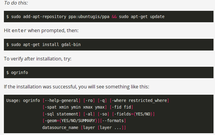
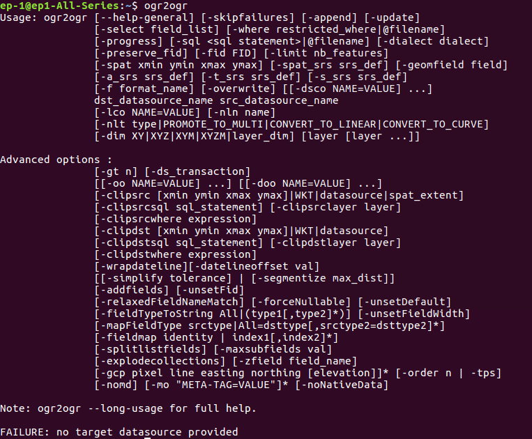
Check the presence of utility by typing ogr2ogr in command prompt-
Code to Convert GPX GPS from Shp
The conversion thing can be done in PHP using shell_exec() method, given below-
public function shptogpx ($shpfilepath,$output,$type) {
$query=”ogr2ogr -f GPX -dsco GPX_USE_EXTENSIONS=YES $output.gps $shpfilepath.shp -nlt $type”;
shell_exec($query);
}
Change coordinate system of GPS/GPX file-
Changing coordinate system using ogr2ogr is a one of the simple task. It has various option, here two are given, which will help to convert the coordinate system into desired one.
-t_srs srs_def:
Reproject/transform to this SRS on output
-s_srs srs_def:
Override source SRS
So using these option, we can get the data in required coordinate system. So for this you can write the query as-
–> ogr2ogr -f GPX -t_srs EPSG:32643 (new EPSG) -s_srs EPSG:4326 (old EPSG) -dsco GPX_USE_EXTENSIONS=YES newGPX_File.gpx InputFile.shp -nlt MULTILINESTRING
You also can visit Shapefile to GeoJSON, Shapefile to KML, Shapefile to TopoJSON, Shapfile to geopackage, Shapefile to MapInfoFile etc.
If you find any problem during implementing this tutorial, please let us know. Feel free to comment in given comment box.
it needs tutorial