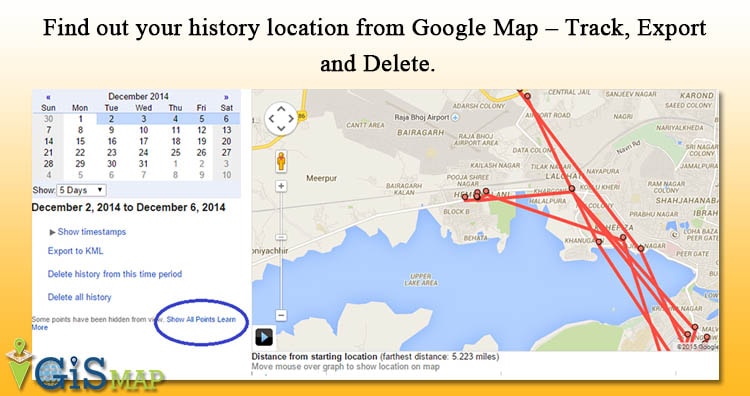
Google Map tracks your history location and allows you to manage, Delete and view your old location. Where you were, last week at 9 PM? Well its not easy to remember your every move in every day life, after few days. Google may maintains and tracks all your history location if you have opted to … Continue reading “Find out your history location from Google Map – Track, Export and Delete.”
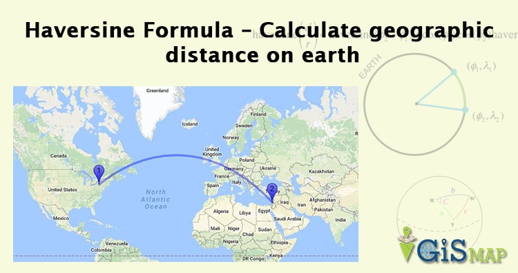
Haversine Formula – Calculate geographic distance on earth. If you have two different latitude – longitude values of two different point on earth, then with the help of Haversine Formula, you can easily compute the great-circle distance (The shortest distance between two points on the surface of a Sphere). The term Haversine was coined by Prof. … Continue reading “Haversine Formula – Calculate geographic distance on earth”
Privacy Policy We respect your privacy. This privacy policy applies to the Site and all products and services offered by IGISMAP. Here is information on what types of personal information we receive and collect when you use and visit www.igismap.com, and how we protect your information. Any personal information will never be sold or rented … Continue reading “Privacy Policy”
Disclaimer.The information contained in this website is for general information purposes only. The information is provided by Website In IGISMAP and while we endeavor to keep the information up to date and correct, we make no representations or warranties of any kind, express or implied, about the completeness, accuracy, reliability, suitability or availability with respect … Continue reading “Disclaimer”
Measure Straight line distance in Google Map between two points. Straight line distance can be calculated with Haversine distance formula or Great circle distance formula. Google Map, a web mapping service application and technology, which provides and enrich a common user experience for free, like, Route planner for traveling by foot, car or public transportation with … Continue reading “Measure Straight line distance in Google Map”
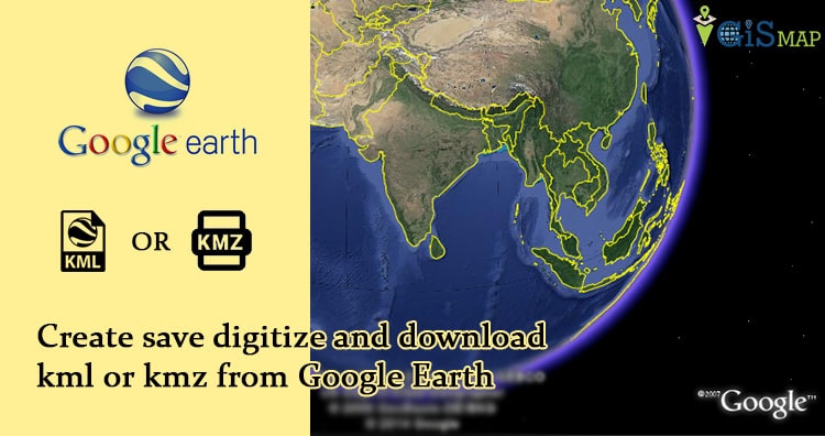
Create save digitize and download kml or kmz from Google Earth. Google earth can be named a virtual globe or map of earth, which provide high resolution view of any area in recent years or any period of time from last decades. Always its not possible to go for field survey and prepare the layers … Continue reading “Create save digitize and download kml or kmz from Google Earth”
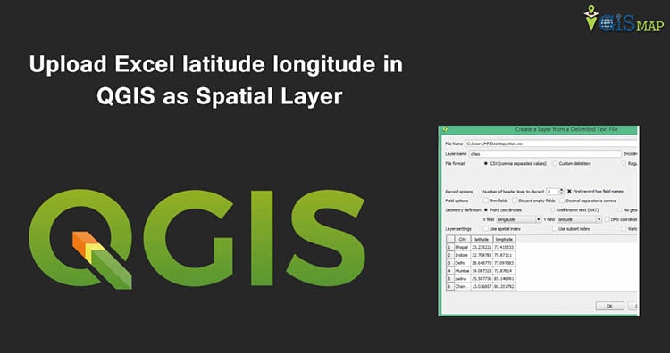
Upload Excel latitude longitude in QGIS as Spatial Layer and save as Shapefile. When you have collection of point data i.e latitude and longitude, stored in Excel file in different column, then you can easily view and Save it as Vector layer file in QGIS(Quantum GIS). Well after uploading Excel latitude longitude values as spatial layer, … Continue reading “Upload Excel latitude longitude in QGIS as Spatial Layer”
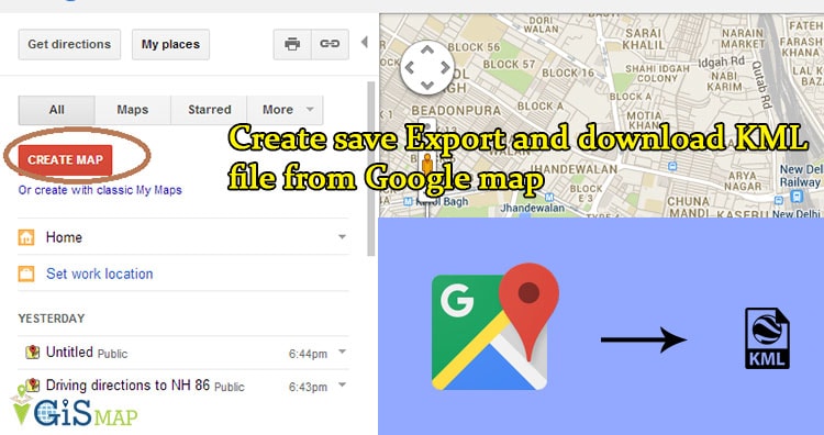
Create save Export and download KML file from Google map. Google map or Google Earth makes use of KML or keyhole markup language, to display features, which actually stores geographic features in Vector format. You can create KML file from Google map for mapping and displaying the same by again uploading the same KML file on Google map or created KML file converted from … Continue reading “Create save Export and download KML file from Google map”
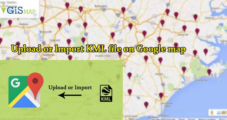
Upload or import KML file on Google map. KML or Keyhole Markup Language is file which models and stores geographic features for display in Google Earth or Google maps. You can upload and view the KML file you already created on Google Map, to verify Whether the overlapped feature of KML uploaded has proper valid geometry or not in respect to the Google Map … Continue reading “Upload or Import KML file on Google map”
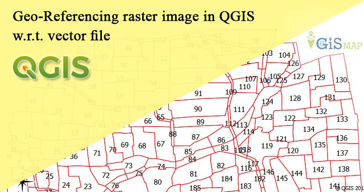
Geo-Referencing raster image in QGIS with respect to vector file. Geo referencing is the process used to provide geographical information to the raster images like cadastral maps, physical maps and satellite imagery with the help of projection or coordinate system. As an ordinary raster image formed by the number of pixel which has no particular size, … Continue reading “Geo-Referencing raster image in QGIS w.r.t. vector file”