

Search Results for:
Select and calculate area, length and perimeters of features in QGIS

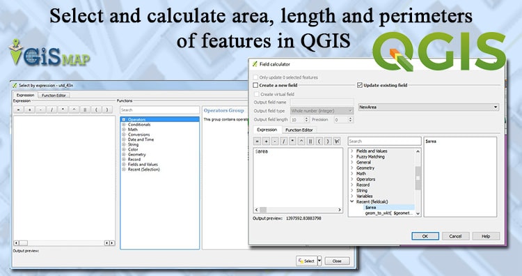
Select and calculate features according to area, length and perimeters in QGIS. Let us explore some selection technique and also how to use calculation in QGIS. To calculate these parameters we have to change the unit of the calculation to meters. If the layers are in WGS84 CRS we will get measurement in degrees, so first … Continue reading “Select and calculate area, length and perimeters of features in QGIS”
Edit – Export – download data from OpenStreetMap in QGIS
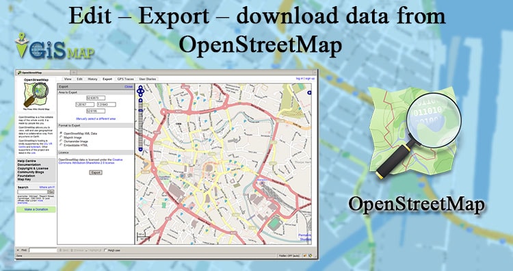
Edit – Export – download data from OpenStreetMap (OSM). Open Street Map is a free editable map of the world, and is very easy to handle. Here in this post we will see how to edit and create geometries on open street map. Also how to export, download and convert the .osm file to any … Continue reading “Edit – Export – download data from OpenStreetMap in QGIS”
Geo-processing Vector Analysis – Distance, Near by, Buffer, Intersection in QGIS
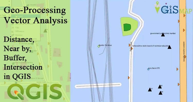
Geo-processing Vector Analysis – Distance, Near by, Buffer, Intersection in QGIS. Vector analysis is one of the important part of GIS. There are many vector analysis operation which we can discuss on another article theoretically. Here you will learn how to perform vector analyssis with QGIS too. Suppose, you want to select and find some places which … Continue reading “Geo-processing Vector Analysis – Distance, Near by, Buffer, Intersection in QGIS”
Web GIS and Open Source GIS Servers
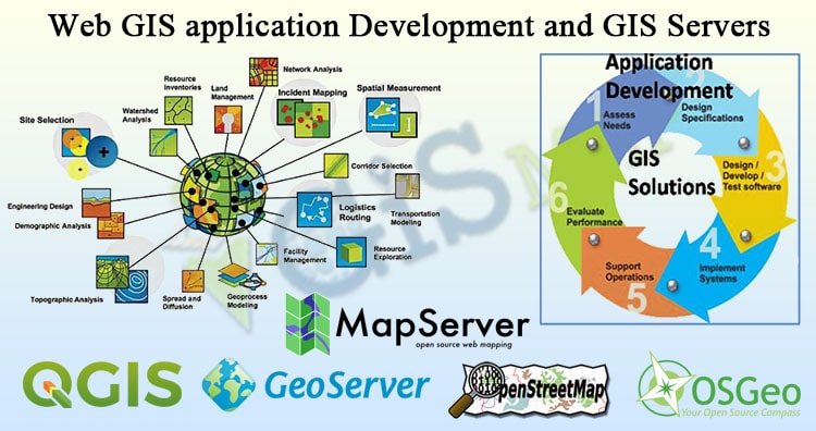
Web GIS application Development and GIS Servers. The Increasing popularity of internet, from online surfing to e-commerce to interactive chatting, has made internet an integral part of our society. Many applications in journalism, science, publishing and other fields have been changed by and adapted for use on internet. Likewise, the internet has changed how GIS … Continue reading “Web GIS and Open Source GIS Servers”
Digitization in QGIS – Exploring tools for Digitizing
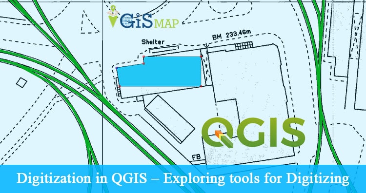
Digitization in QGIS – Exploring tools for Digitizing. Digitization is one of the important tasks for a GIS specialist. Digitization is a process of converting raster data to vector data. For this task QGIS provides many tools for efficient digitization. Digitization (or vectorization) should be clean and a copy of the raster data so that … Continue reading “Digitization in QGIS – Exploring tools for Digitizing”
Change projection of a georeference file in other projection – Reprojection in QGIS
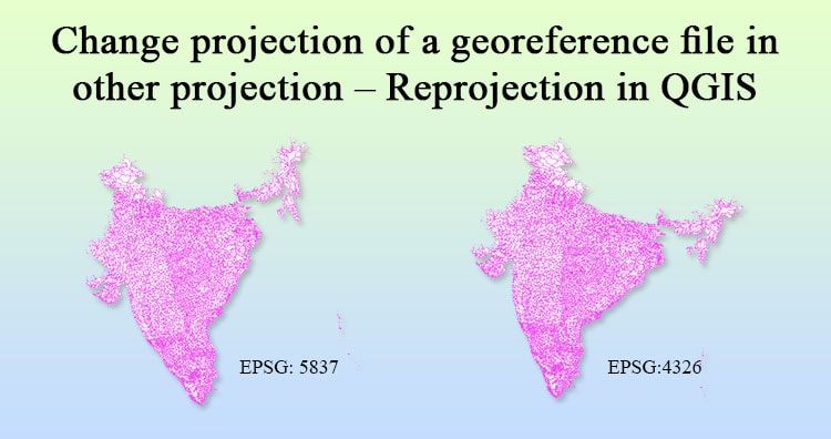
Reprojection in QGIS – Change projection of a georeference file in other projection. Earth is not a complete sphere; it is referred to as spheroid. Generally QGIS use by default Latitude and longitude (WGS 84) coordinate reference system which gives measurement in degrees. Projection is a very vast topic but we will discuss some basic concept … Continue reading “Change projection of a georeference file in other projection – Reprojection in QGIS”
8 Best Alternative to Google Maps – Classic old Map

Why to look for Alternative to Google Maps – Classic old Map? Recently (around 29, April 2015) Google shut down their old classic Map and replaced it with New Google Map and lite mode. While there are many people who dont like the new Google Map as they are facing some problems like lazy loading and … Continue reading “8 Best Alternative to Google Maps – Classic old Map”
Find or Search Nearby Restaurants, shops, malls or any places in New Google maps
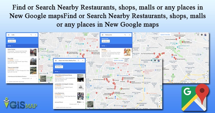
Find or Search Nearby Restaurants, shops, malls or any places in New Google maps. After the introduction of New Google Map and Google Lite mode Map many users are facing problems in using all features in new map, which they can easily use from old Google Classic Map as they are already used to with it. … Continue reading “Find or Search Nearby Restaurants, shops, malls or any places in New Google maps”
Google Map Route Planner – Find live public transit and Estimated time travel
Google Map Route Planner – Find live public transit and Estimated time travel. Google launched public transport Trip planner providing real time transit update for more than 800 cities world wide, for public welfare as a free service. This feature will help you know the next bus estimated time of arrival at your source, estimated time … Continue reading “Google Map Route Planner – Find live public transit and Estimated time travel”