Download Save Offline Google Map on app. Map helps you to navigate and find the nearest point of Interest location when you are travelling and at unknown place. While Network service provider doesn’t guarantee you to provide full Network at each and every places you visit, which results in either no or slow internet. Keeping that … Continue reading “Download Save Offline Google Map on app – Android and iOS”
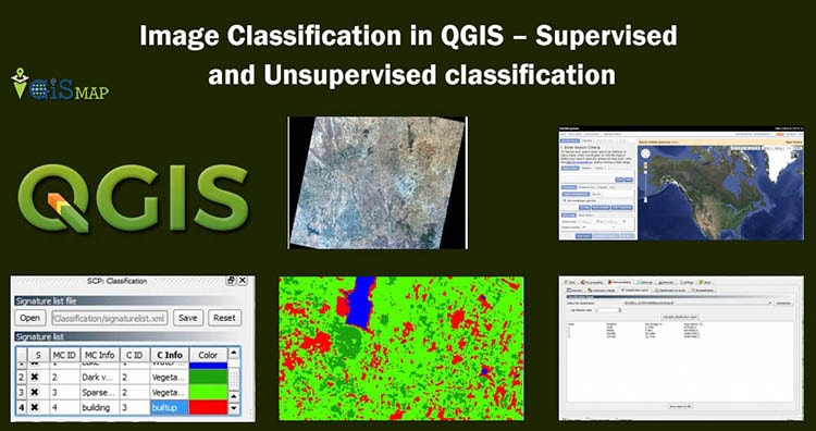
Image Classification in QGIS: Image classification is one of the most important tasks in image processing and analysis. It is used to analyze land use and land cover classes. With the help of remote sensing we get satellite images such as landsat satellite images. But these images are not enough to analyze, we need to do … Continue reading “Image Classification in QGIS – Supervised and Unsupervised classification”
Here we will see how to georeference a map with the help of another georeferenced map in QGIS (Quantum GIS). Georeference is a process to associate geographic location coordinates to any kind of physical object which is physically present over a Raster image map or to a physical map, with help of other georeferenced data or … Continue reading “Georeference a map with the help of another georeferenced map”
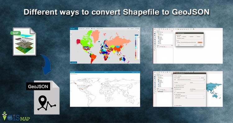
Convert Shapefile to GeoJSON. Shapefile, ESRI made a standard vector file format which is largely adopted in the field of GIS by programmers and geographers . While GeoJSON is also an open standard format designed for Web which largely supported with GIS JavaScript API, other programming API and with GIS (Geographic Information System) software tools … Continue reading “Different ways to convert Shapefile to GeoJSON – Online or Offline or API”
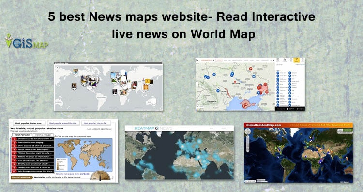
News Map Website – News, a new information either event, accident, social work, terrorists, sports, technical, launches, new innovation or election or in any form has some link with physical geographic location. How you filter latest news for a particular area or location? It would be really easy, nice and great way to filter the … Continue reading “5 best News maps website- Read Interactive live news on World Map”
Digital Elevation Model is a 3D representation of a terrain. It is generated by collecting elevation points of terrain. We don’t have to do hectic work like this as webgis provides us with ready-made digital elevation data. WebGIS is where you can find all the leading information and resources for Geographical Information Systems. Here you will find … Continue reading “Download Digital Terrain DEM (Digital Elevation Model) and create contours Maps”
About Info GIS MAP: Info GIS MAP.com provides information as to how to create, use and analyze different kind of maps for solving global complex problem with a different approach. This website has different GIS and map tools, making use of which you can solve problem without installing additional software’s. You may also get new innovative … Continue reading “About Akshay Upadhyay”
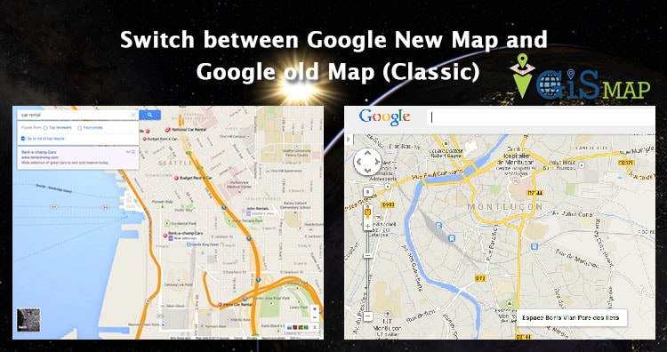
Switch between Google New Map and Google old Map (Classic). Google Map is a web mapping service which offers satellite imagery, street view and street map with many other functionality. Google introduced their New map in mid of 2013, with new User Interface and other improved features. While people are used to old user interface, which makes … Continue reading “Switch between Google New Map and Google old Map (Classic)”
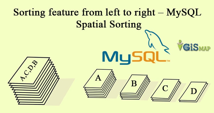
MySQL Spatial Sorting. Let’s think of the situation where you want to color the map in such a way, that no adjacent group of features should have the same color, where group of feature is more than the number of colors you can draw. Obviously this problem can be solved if we sort feature group … Continue reading “Sorting feature from left to right – MySQL Spatial Sorting”
Google Maps, a web mapping service of Google provides a very easy way to calculate and measure Area in google Map along with distance measurement. This would let you measure an area of any geographic location viz home, buildings, Grounds, city, etc from any where without visiting the location with just few clicks with Google Maps. Measuring … Continue reading “Measure Area in Google Map – Print and share measurement”