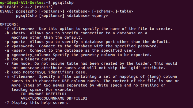
Import Shapefile in Postgresql – shp2pgsql
Import Shapefile in Postgresql directly by command line tool. Shapefile is a data vector file, which stores GeoSpatial Data. PostGreSql Database support Spatial or GIS data. As shapefile is just a representation of Geo Data, while postgresql is database which support many GIS functionalities as like finding nearest neighbour, distance calculation from one point to … Continue reading “Import Shapefile in Postgresql – shp2pgsql”