PHP connection with pgRouting for shortest path

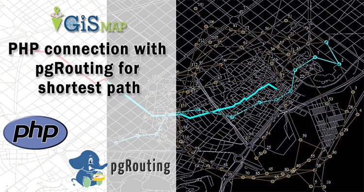
Here in this post we do PHP connection with pgRouting for shortest path. Here we have explained how we can add source and destination point in table and how can we query for shortest route. In this demo we have made a connection between pgrouting and PHP using code igniter using code igniter framework. Here we … Continue reading “PHP connection with pgRouting for shortest path”

GIS Data Conversion

In this post we are going to focus on one of the important topic of GIS world, which is the “DATA CONVERSION”. Data Conversion means converting computer data into another format. With huge amounts of GIS data available for use, it is more cost-efficient and effective to convert the GIS data from one format to … Continue reading “GIS Data Conversion”

Download Indonesia Administrative Boundary Shapefiles – Provinces, Districts, Sub Districts and more

Hello GIS enthusiasts, IGISMAP has now published the latest GIS vector data of Indonesia administrative levels. Links for downloading the shapefiles of the important administrative divisions of Indonesia are provided in the following. You can also download these data in KML, GeoJSON or CSV formats.  Note: Download Free Shapefile Data of Indonesia Indonesia, officially the … Continue reading “Download Indonesia Administrative Boundary Shapefiles – Provinces, Districts, Sub Districts and more”

Download Argentina Administrative Boundary Shapefiles – Provinces, Departmentos, Municipalities and more

Hello GIS enthusiasts, IGISMAP has now published the latest GIS vector data of Argentina administrative levels. Links for downloading the shapefiles of the important administrative divisions of Argentina are provided in the following. You can also download these data in KML, GeoJSON or CSV formats.  Note: Download Free Shapefile Data of Argentina Argentina, officially the … Continue reading “Download Argentina Administrative Boundary Shapefiles – Provinces, Departmentos, Municipalities and more”

Download Tunisia GIS Data – Provinces, Highway Lines, Airport Locations and More

Hello GIS enthusiasts, IGISMAP has now published the latest GIS vector data of Tunisia administrative levels. Links for downloading the shapefiles of the important administrative divisions of Tunisia are provided in the following. You can also download these data in KML, GeoJSON or CSV formats.  Note: Download Free Shapefile Data of Tunisia Tunisia, officially the … Continue reading “Download Tunisia GIS Data – Provinces, Highway Lines, Airport Locations and More”

Download Lebanon Administrative Boundary Shapefiles – Governorates, Districts, Municipalities and more

Hello GIS enthusiasts, IGISMAP has now published the latest GIS vector data of Lebanon administrative levels. Links for downloading the shapefiles of the important administrative divisions of Lebanon are provided in the following. You can also download these data in KML, GeoJSON or CSV formats.  Note: Download Free Shapefile Data of Lebanon Lebanon, officially the … Continue reading “Download Lebanon Administrative Boundary Shapefiles – Governorates, Districts, Municipalities and more”

Download Mongolia Administrative Boundary GIS Data for- National, Regions, Provinces, Districts and more

Elevate your mapping pursuits! IGISMAP presents a special offer: download Mongolia’s administrative boundary GIS data, including national, regions, provinces, districts, and more.

Download Vietnam Administrative Boundary Shapefiles – National, Provinces and Districts

Hello GIS enthusiasts, IGISMAP has now published the latest GIS vector data of Vietnam administrative levels. Links for downloading the shapefiles of the important administrative divisions of Vietnam are provided in the following. You can also download these data in KML, GeoJSON or CSV formats.  Note: Download Free Shapefile Data of Vietnam Vietnam, officially the … Continue reading “Download Vietnam Administrative Boundary Shapefiles – National, Provinces and Districts”

Convert Shapefile to SQLite

The shapefile format is a geospatial vector data format for geographic information system (GIS) software. It is developed and regulated by ESRI as a mostly open specification for data interoperability among ESRI and other GIS software products. SQLite is an in-process library that implements a self-contained, serverless, zero-configuration, transactional SQL database engine. It provides Geo … Continue reading “Convert Shapefile to SQLite”

Download Madagascar Administrative Boundary Shapefiles – Province, Regions, Districts and more

IGISMAP has now published the latest GIS vector data of Madagascar administrative levels. Links for downloading the shapefiles of the important administrative divisions of Madagascar are provided in the following. You can also download these data in KML, GeoJSON or CSV formats.  Note: Download Free Shapefile Data of Madagascar The Republic of Madagascar (and previously … Continue reading “Download Madagascar Administrative Boundary Shapefiles – Province, Regions, Districts and more”