Embed map Store/Shop location on website – Google Map Alternative

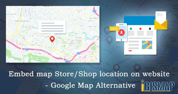
Making your Store/Shop location available on map makes your visitors or customers easy to find your premises. And if your business have different branches at different location then Embed map Store/Shop location on website – Google Map Alternative is advantageous to your business. It suits best for local business like – barber shops, groceries stores, cafes … Continue reading “Embed map Store/Shop location on website – Google Map Alternative”

Convert GML to KML

GML is used in a geographic information system(GIS) for expressing  geographic features as well as an open interchange format for geographic transactions on the Internet. KML is a file format used to display geographic data in an Earth browser such as Google Earth. KML is an international standard maintained by the Open Geospatial Consortium, Inc. … Continue reading “Convert GML to KML”

Convert GML to Shapefile

The Geography Markup Language (GML) is the XML grammar defined by the Open Geospatial Consortium (OGC) to express geographical features. Shapefile is a vector GIS format developed by ESRI. Using IGIS Map Tool you can easily convert – GML to Shapefile. You can also do other GIS Data Conversion using this tool. IGISMAP to Convert GML to Shapefile For GML to … Continue reading “Convert GML to Shapefile”

Online Conversion of GeoJSON to Shapefile

You can convert Geojson to Shapefile offline using GDAL or QGIS. This would require you to download and install those software. One should have adequate knowledge in using these GIS applications to do simple processes. IGISMAP is an online platform to carry out geospatial operations by any non GIS expert. Converter tool of IGISMAP is … Continue reading “Online Conversion of GeoJSON to Shapefile”

GeoJSON to GeoTIFF – Vector to Raster Conversion

GeoJSON is an open standard geospatial data interchange format that represents simple geographic features and their non-spatial attributes. It is based on JavaScript Object Notation (JSON) and serves as a format for encoding various geographic data structures. TIFF, also known as the Tagged Image File Format, is a file format designed for transferring, storing, and … Continue reading “GeoJSON to GeoTIFF – Vector to Raster Conversion”

Convert KML to PDF

KML or Keyhole Markup Language is a collection of geospatial data on map and commonly used in Google Earth or google services, while PDF stands for  Portable Document Format is used for digital exchange. KML and PDF is a type of vector format of GIS data. Using IGIS Map Tool you can easily convert – KML to … Continue reading “Convert KML to PDF”

KML to GeoTIFF – Vector to Raster Conversion

KML, or Keyhole Markup Language, is a geospatial data collection used in Google Earth and other Google services. TIFF, also known as Tagged Image File Format, is a file format for transferring, storing, and displaying raster images. This format is commonly used for scanned aerial photography and maps, as well as digital satellite imagery and … Continue reading “KML to GeoTIFF – Vector to Raster Conversion”

Convert Shapefile to PDF

A GIS file is a format used as a norm for encoding geographical information into computer readable file. GIS (geographical information system) file is mainly divided or differentiated into two vector format and raster format. Shapefile format is one of the commonly used GIS format developed by ESRI, while PDF stands for  Portable Document Format is … Continue reading “Convert Shapefile to PDF”

Convert KML to TopoJSON

KML or Keyhole Markup Language is a collection of geospatial data on map and commonly used in Google Earth or google services. TIFF (also known as Tagged Image File Format) is a file format for transferring, storing, and displaying raster images. Scanned aerial photography and maps, as well as digital satellite imagery and other geographic … Continue reading “Convert KML to TopoJSON”

Shapefile to GeoTIFF – Vector to Raster Conversion

Shapefile is a vector data format for storing geographical data and associated attribute information. It is developed and regulated by ESRI as open specification for data interoperability among ESRI and other GIS software products. Shapefile can be point, line, or polygon features. TIFF (also known as Tagged Image File Format) is a file format for … Continue reading “Shapefile to GeoTIFF – Vector to Raster Conversion”