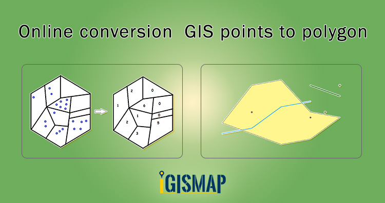
Developing polygon boundaries from GIS points is an important geostatistical process. IGISMap provides a Point to Polygon tool to create polygons from the point of input point GIS data. Conversion of GIS points to polygon in IGISMap is based on the Voronoi theorem. These polygons are called voronoi polygons. In mathematics, a Voronoi diagram is a division of a plane into regions close to each of a particular set of objects. Voronoi polygon represents the area of influence from the input point location such that any position within the polygon is closer to that point than any other point.
IGISMap is a web platform providing multiple GIS tools that are most important in the field of geospatial analytics. The uniqueness of IGISMap in the GIS industry is that it’s UI/UX that helps users to perform effortless geospatial operations. In IGISMap, you can upload your GIS data or use data from IGISMap collection to perform GIS analysis.
In this article , we will convert a point GIS data to polygon GIS data and publish in the map as follows.
Let’s look into the steps to use the Point to Polygon tool of IGISMap.
Click the below link to open the Point to Polygon tool directly
https://map.igismap.com/point-to-polygon
Add input point data
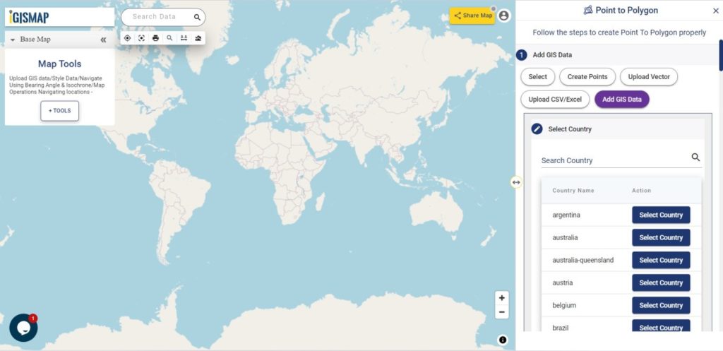
After opening the Point to Polygon tool, the first step is to add the required point GIS data. There are multiple options to add the required data, which are:
- Select
- Create Points
- Upload Vector
- Upload CSV/Excel
- Add GIS Data
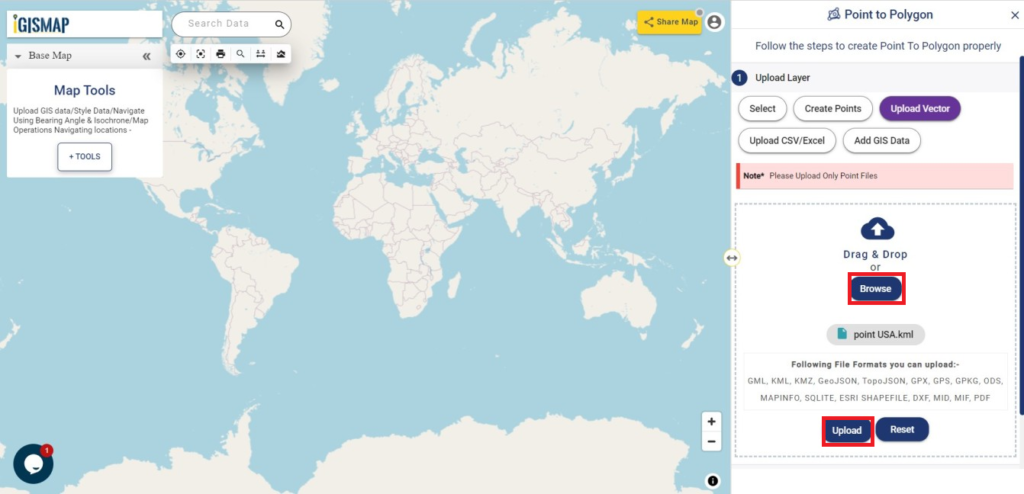
Upload the point data
For this article, we will upload the required point GIS data using the Upload Vector option. After selecting the Upload Vector tab, click the Browse button to browse and select the data from the system.
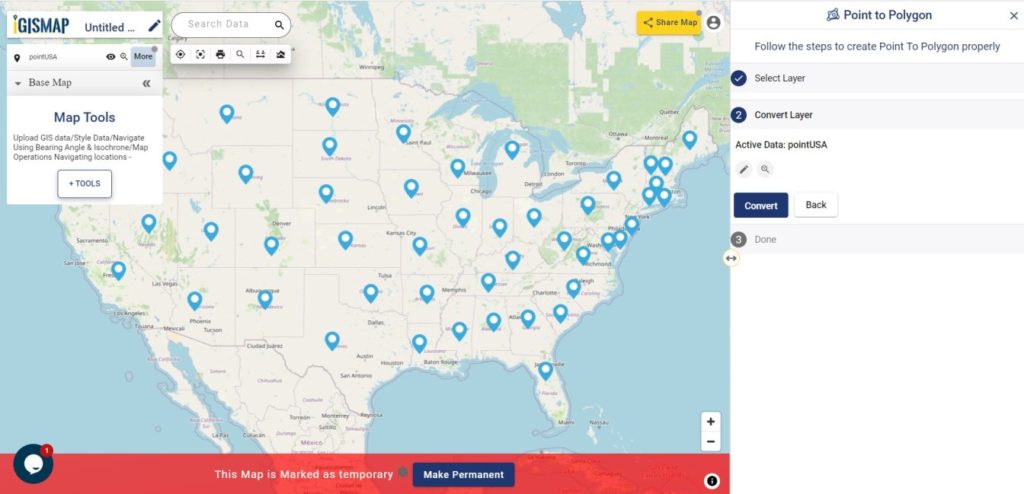
Select the right data and click the Upload button to start uploading the file. In this demonstration, we are going to use the KML file of GIS points representing locations from each state of USA. The name of the file is point USA.
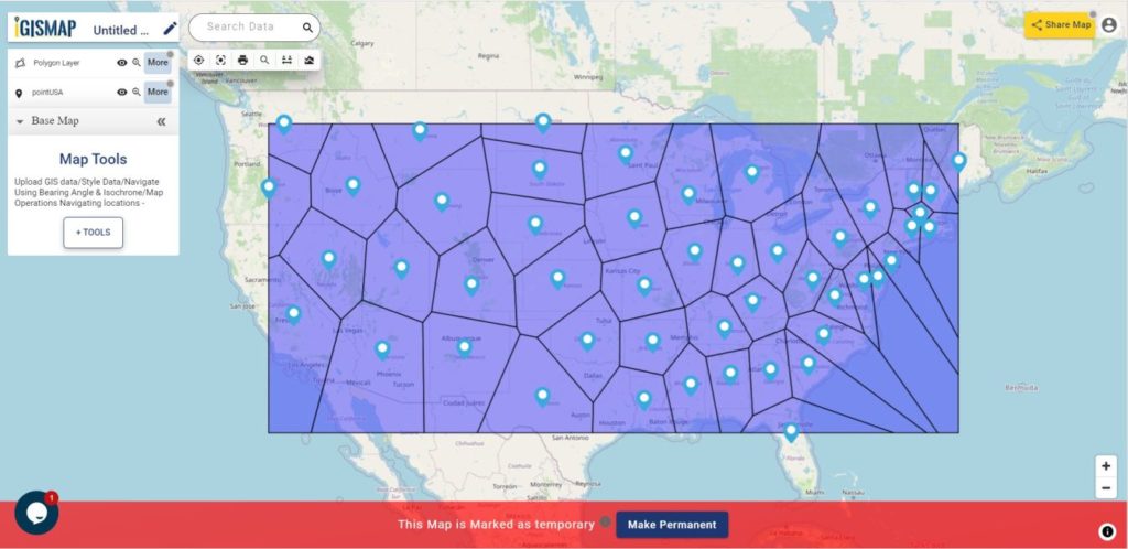
Input point data will get published in the map after uploading.
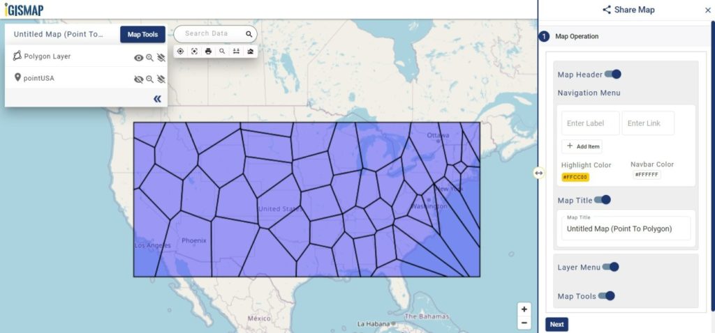
Conversion of GIS points to polygon
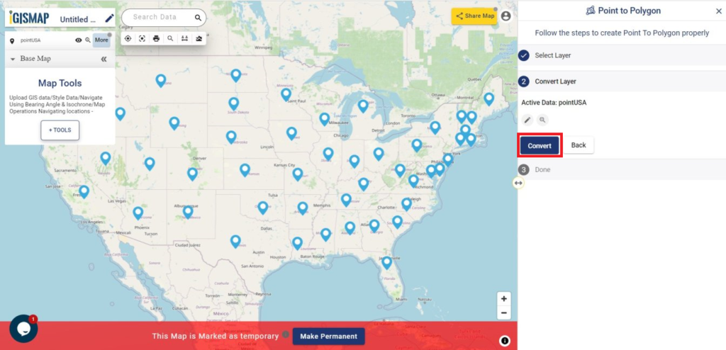
Convert Layer section opens when data is added. In this section, input point GIS data will be provided in the name Active Data. Input data can be changed by clicking the Edit icon. Users can zoom into the layer by clicking the lens icon.
Click the Convert button to start the process of converting the input points to polygons.
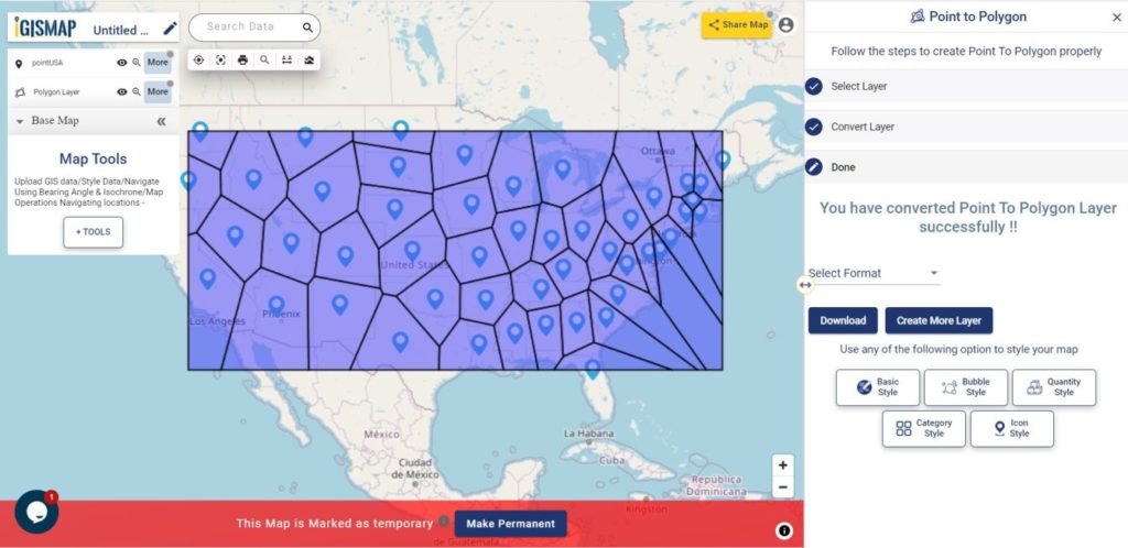
A few seconds after clicking the Convert button, polygon GIS data based on the Voronoi polygons will be published on the map. For making polygon maps appealing you can try the style polygon map feature of IGISMap Tool. Voronoi based polygon GIS data will be created
Export the data
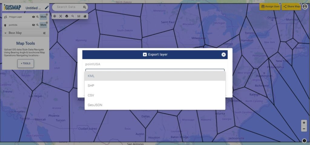
You can export the data published in a map in any GIS format such as ESRI Shapefile, KML, GeoJSON or CSV and use it for external applications. In the More option beside the layer name, click Export Layer to open the following popup where you can choose the desired format and export the file in your system.
Sharing the Voronoi polygon map
For sharing this map with others or embedding it in a website, click the Share Map button from the map to open the Share Map interface. In the Share Map window, edit the components to be provided in the shared map and click Next.
Now select the Share Map option and choose Public to share this map publicly. Click the Share Map button to generate the link to the map.
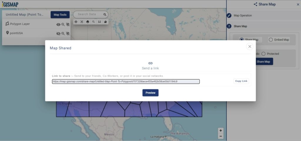
Copy this link and share it with others to access this map.