You can query on Gis map data for better understanding and analyzing. Using Search Data in the IGIS map is used to sort or filter data according to a need of a scenario. Firstly, you need to register or login into the Analysis & Share Tool. Create your map or upload gis data.
Search data and analyze GIS Maps
It simply uses OR, AND operation to give us sorted or filtered output.
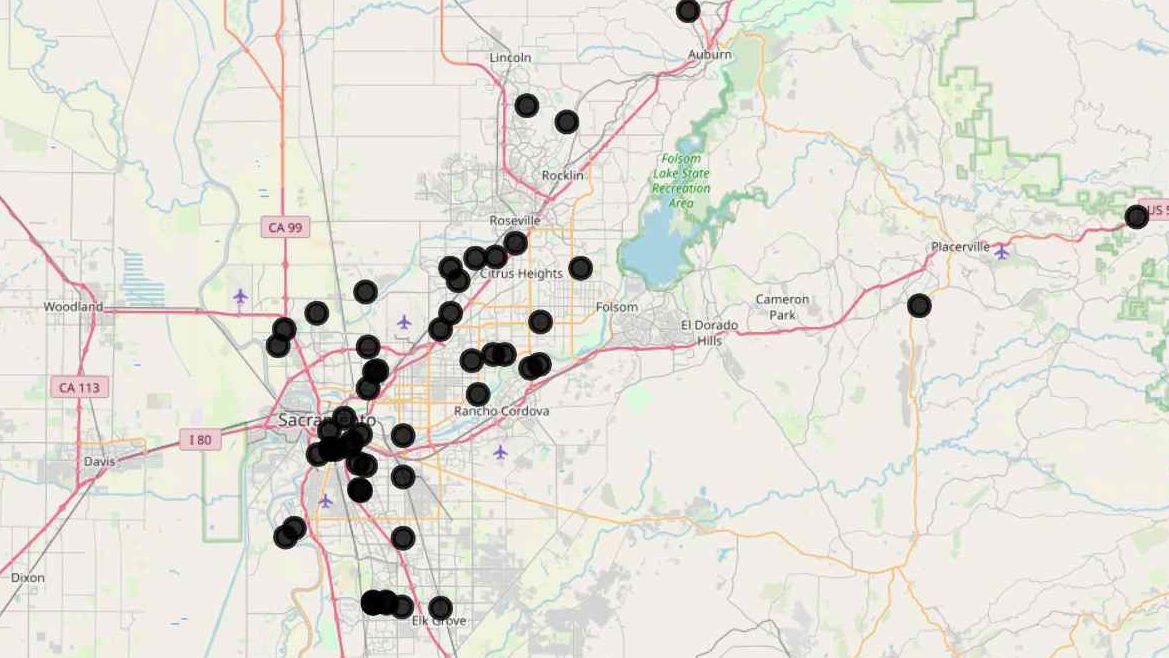
For example: – Property.csv
We have some data of properties in a locality and we want to sort out (or show) only the properties according to our client’s need.
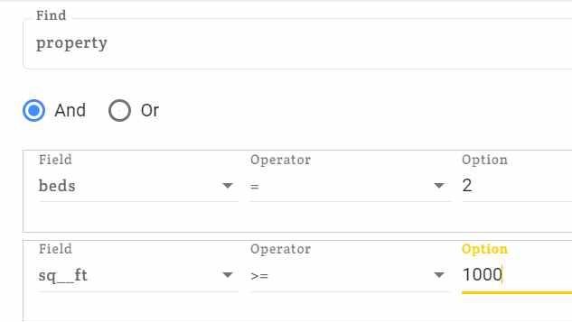
Client A needs a flat with 2 beds and area more than 1000sq. feet. (Use query tool with AND operator).
Client B needs a flat with either with 3 beds or area more than 1300sq. feet. (Use query tool with OR operator)
These kind of sorting among different layers or different requirements can be performed using search data. To just view the desired outputs at a time.
To use Search data on a map: –
- Open the map on IGIS map where you want to apply the query tool. (You can also upload your own maps shape file or CSV/Excel file to make map.)
- Check and correct the datatype as default datatype is varchar, change them to most appropriate data type. (number and string)
- Click on Search data.
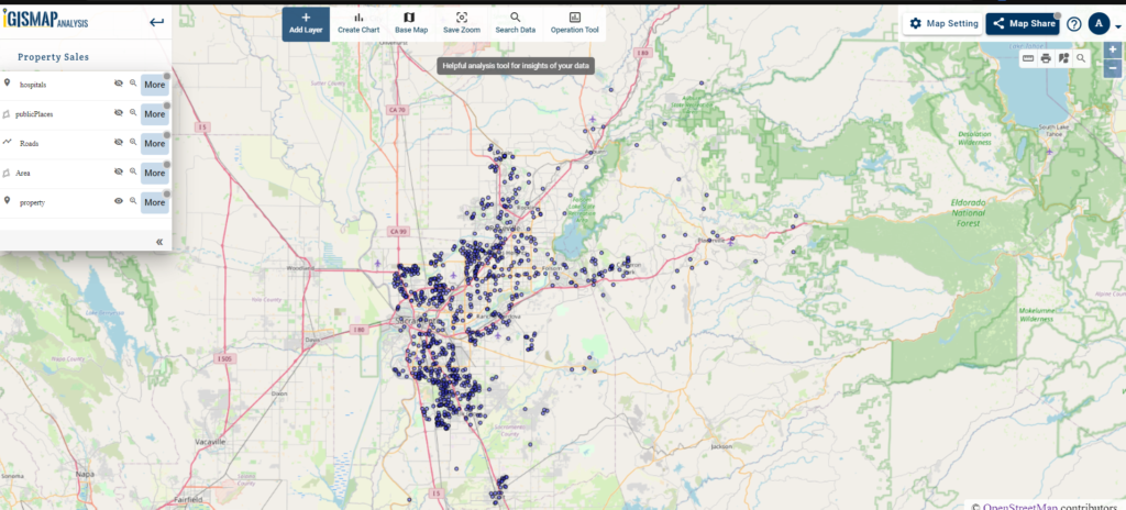
- A query can be applied within a layer so choose the layer on which you want to apply query or search data.
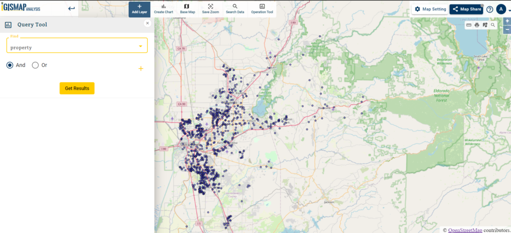
- Now select operation you want to perform through query. (i.e. AND OR)
Tip: -Refresh the page if it is not responding.
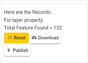
And in the last click on Get Result.
- Now you can see some points are highlighted which are the results of a query. It is required data you were searching for.
- You can use different combinations of AND and OR to get this kind or sorted view.
- You can download the result in CSV formats.
With the help of Search Data Query tools, we can answer so many analysis questions and can also draw out important results out of raw data. This is very important for future planning of any kind of business. This can be used to compare best selling rates among different markets, finding most favorable location for Schools, Industries, house etc.
In addition to search you can share your map with others.
If you don’t have data you can use sample gis data from here.