What is Shapefile ?
A shapefile is format for storing the geometric location and attribute information of geographic features.
Geographic features in a shapefile can be represented by points, lines, or polygons (areas).
Steps of making maps from (shp) shapefiles
- Find appropriate shape file from IGIS Data or any other sources on internet.
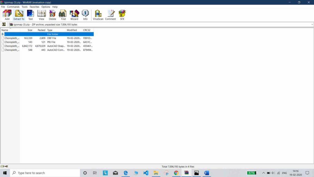
- Most of shape files on internet are downloaded as compressed file. Extract them to proper folder.
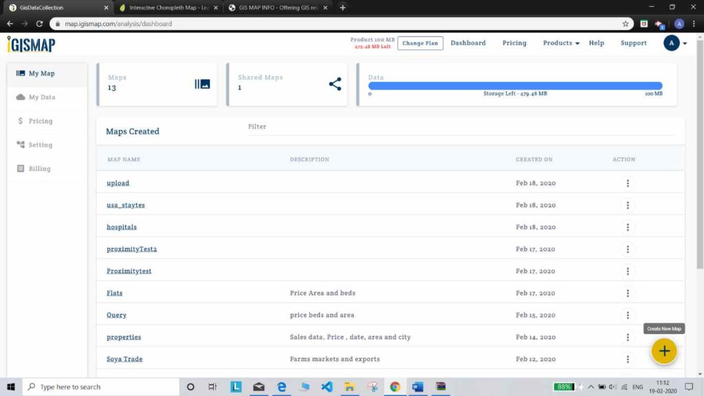
- Open IGIS maps
- Once you log in. Go to the Dashboard and firstly, create a new map by clicking on + on bottom right corner.
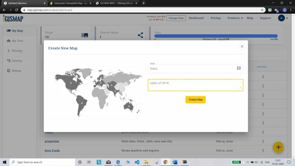
- Give title and description to your map. And tap or click on create map.
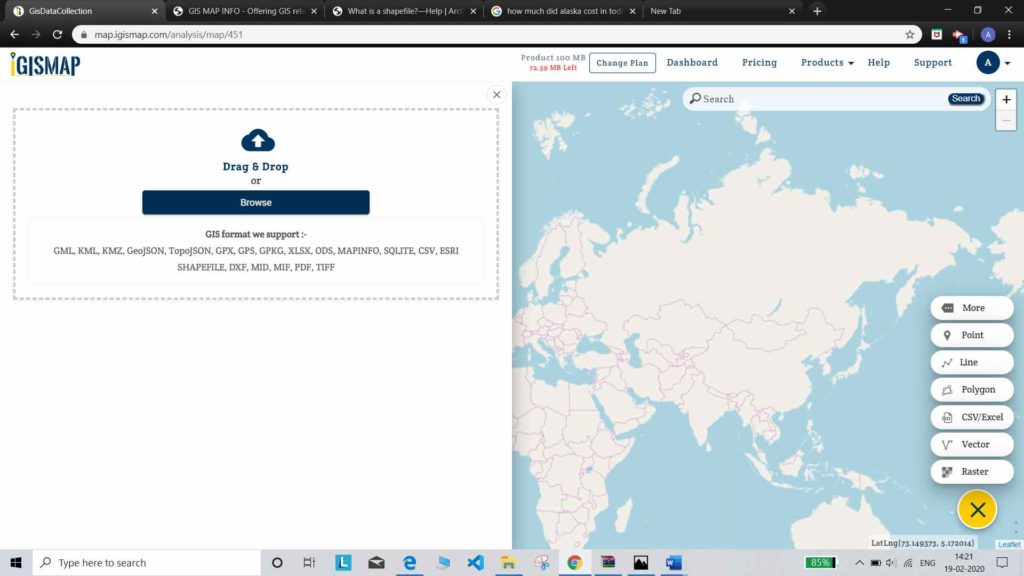
- A blank map will appear. Click on -> add -> vector layer.
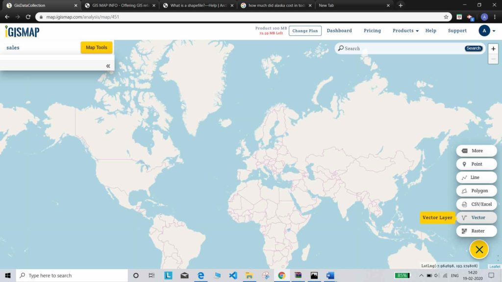
After clicking vector button a modal will appear for uploading your file. Shapefile should have all the formats.
A Shapefile is made up of a collection of files(.shp, .dbf, .shx, and .prj)
.shp—The main file that stores the feature geometry; required.
.shx—The index file that stores the index of the feature geometry; required.
.dbf—The dBASE table that stores the attribute information of features; required.
.prj—The file that stores the coordinate system information; used by ArcGIS.required
- Browse to the folder where shapefile was extracted. And select the files (.shp .shx .dbf .prj and any other if required)
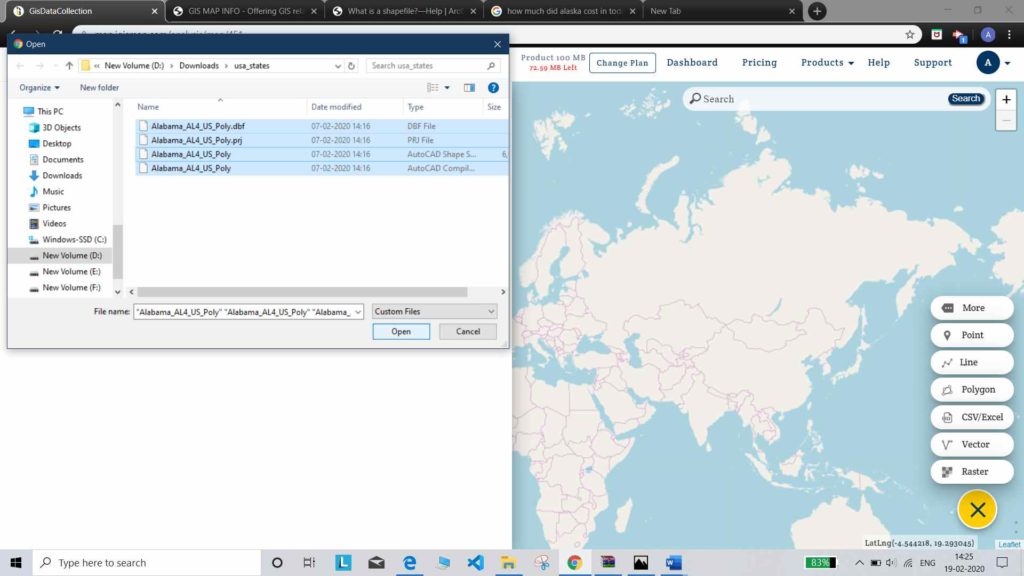
- After that, selecting all these required files click on Open.
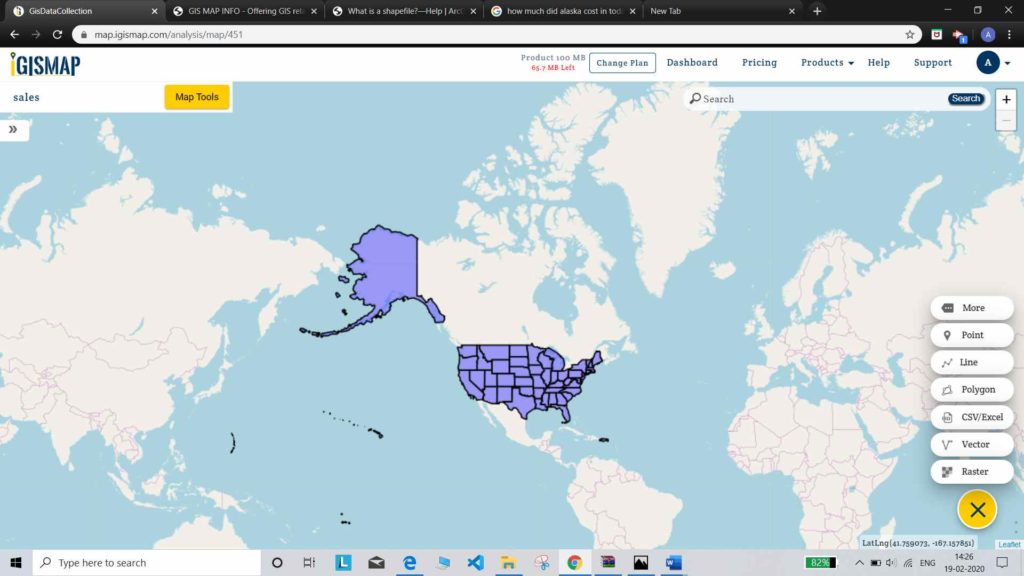
Map is created on the map area. Now you can further edit data and also add more lines points or polygons and other work. With above all steps you are now familiar with Making maps from (shp) shapefiles. In addition to, you can try formatting to the data and create a eye catching map.
Similarly you can download files from many shape files available on IGIS Data or any other source. Also you can edit your data from IGIS Map Analysis tool.