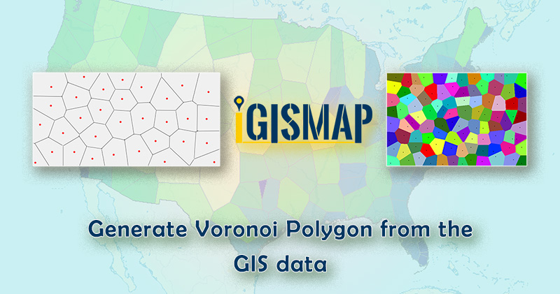
Developing polygon boundaries from GIS points is an important geostatistical process. IGISMap provides a Point to Polygon tool to create polygons from the point of input point GIS data. Conversion of point to polygon in IGISMap is based on Voronoi theorem. These polygons are called Voronoi polygons. In mathematics, a Voronoi diagram is a division of a plane into regions close to each of a particular set of objects. The Voronoi polygon created for each point represents the area of influence from the input point location such that any position within the polygon is closer to that point than any other point. Here we generate Voronoi polygon from the gis data.
IGISMap is a web-based platform that powers many of the most important GIS applications in the field of geospatial analysis. The uniqueness of IGISMap in the GIS industry is that it’s UI/UX helps users to perform geospatial operations easily. In IGISMap, you can upload your GIS data and perform geospatial analysis.
In this article, we will see how to make use of the point GIS data from the IGISMap GIS data collection for creating polygon GIS data.
Click the below link to open the Point to Polygon tool directly
Add input point data
After opening Point to Polygon tool, first step is to add the required point GIS data. There are multiple options to add the required data, which are:
- Select
- Create Points
- Upload Vector
- Upload CSV/Excel
- Add GIS Data
Among these options, we will choose Add GIS Data to add a point GIS data from IGISMap GIS data collection.
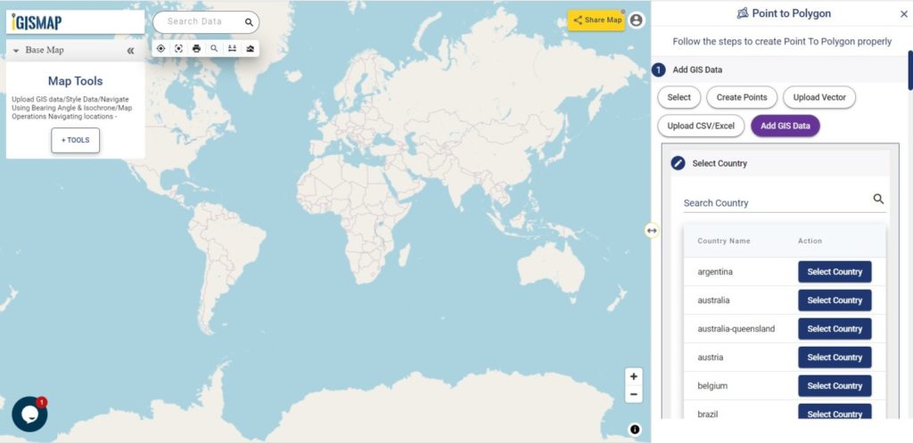
Add GIS Data option will be selected as default. Thus we will continue to add the required point GIS data for creating voronoi polygons.
Adding the GIS data
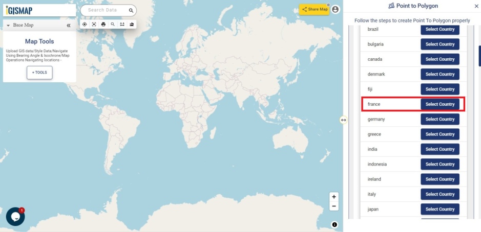
In this article, we will elaborate about the entire process for generating Voronoi polygon from the GIS data which will add from Add GIS Data in Point to Polygon tool. So we have to select the country which we want to add for creating a polygon after appearing in the Add GIS Data section. we can easily search the required country by the Search Country section.
For demonstration, let’s choose point GIS data of Airport locations in France for the demonstration. Browse for France in the Search Country search bar.
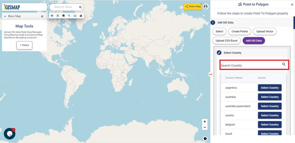
Otherwise, scroll down and choose France from the list of countries and click Select Country.
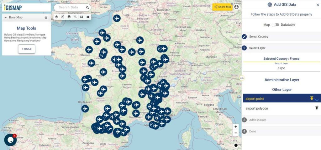
After selecting the country, browse airport point data from the list of data provided for France. You can also use Search Layer option for searching the data. After finding the required data, click on the name of the layer to preview the layer in the map. Click Add Layer icon to continue with the data.
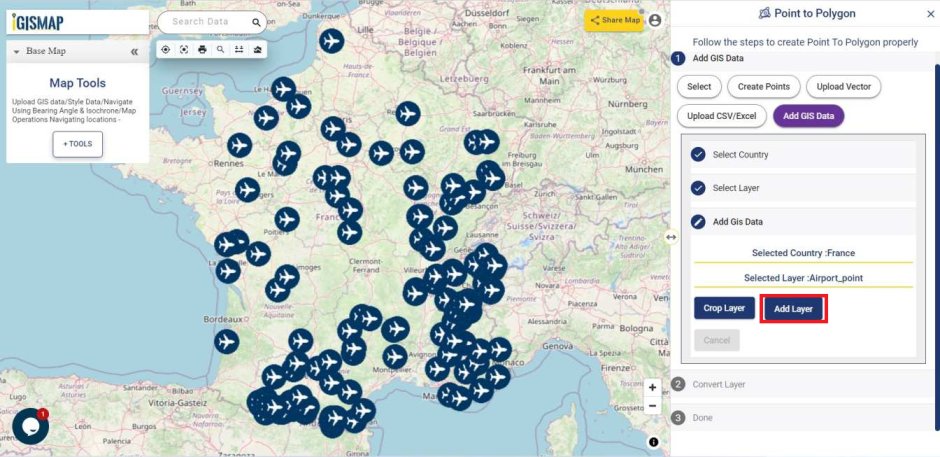
Moving on, the Crop Layer option will appear. Since we are going to add the whole data, let’s select Add Layer option to publish the GIS data of airport points on the map.
Download France Airport Points Shapefile
Converting the point data
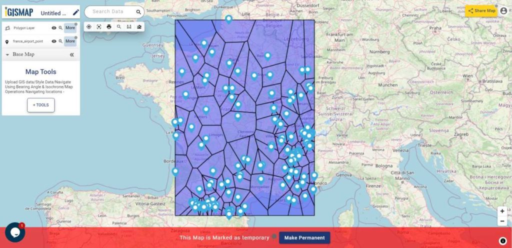
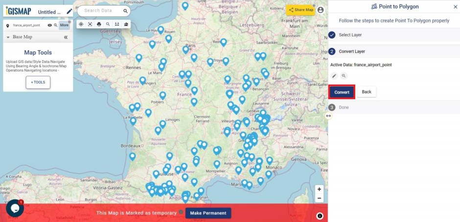
Now we have added the required data to the map, let’s continue to create Voronoi polygons from the input points GIS data. In the Convert Layer section, click Convert button to start the conversion.
As you can see below, voronoi polygons are created for each point in the point GIS data.
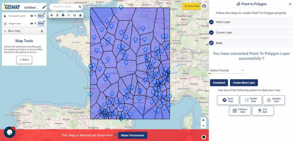
You can download this polygon GIS data in any important GIS format such as shapefile, KML, GeoJSON or CSV file. Or you can choose to use this data for further processing in IGISMap itself for visualization and analysis.