GIS Data and Maps of West Virginia State is used by planners and surveyors for visualizing and identifying the patterns that are difficult to examine when data is in table form. Here you can download the GIS data of the state boundary, county division, rail and highway maps in just a few clicks. You can use these data for analysis in MAPOG itself or download them in any suitable GIS format. You can download these data in KML, GeoJSON, CSV or Shapefile formats.
With MAPOG’s versatile toolkit, you can effortlessly upload vector, add WMS (Web Map Service) layers, upload Excel or CSV data, incorporate existing files, perform polygon splitting and merging, generate new polygon and polyline data, use the converter for various formats, conduct buffer analysis, create grids, transform points into polygons, calculate isochrones, and utilize the geocoder for precise location information.
We offer an extensive array of data formats, including KML, SHP, CSV, GeoJSON, Tab, SQL, Tiff, GML, KMZ, GPKZ, SQLITE, Dxf, MIF, TOPOJSON, XLSX, GPX, ODS, MID, and GPS, ensuring compatibility and accessibility for various applications and analyses.
Note:
- All data available are in GCS datum EPSG:4326 WGS84 CRS (Coordinate Reference System).
- You need to login for downloading the shapefile.
Download Shapefile Data West Virginia State
West Virginia is a state in the Appalachian, Mid-Atlantic and South-eastern regions of the United States. Charleston city is the capital city of the state. In addition, if you are looking for any other GIS formats then use GIS File Converter.
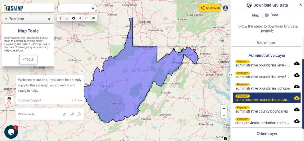
Download West Virginia State Outline Boundary Shapefile
In the above screen boundary map of West Virginia state. This is the map view for the data table switch button from the map to the data. The layer name is provided on the right side of the screen. For download click on the button placed beside the map layer name. You can locate your store/ shop on a map.
Download West Virginia Counties Shapefile Data
There are 55 counties in the U.S. state of West Virginia.
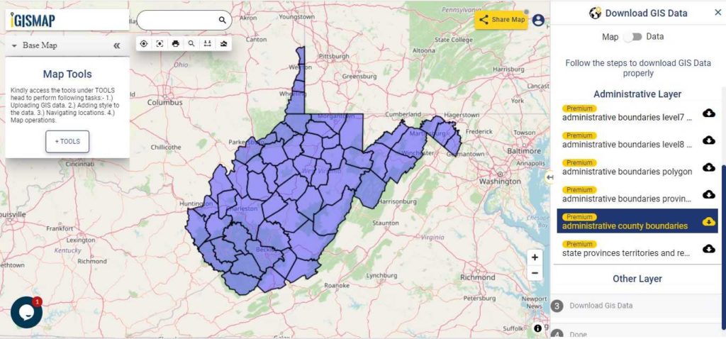
Download West Virginia County Boundary Shapefile
Polygon map with county division is visible on the above screen. You can easily download and upload in a tool for free and create a map from GIS data. Edit, format, add attribute column and share it with your colleagues.
Above all Layers cover GIS data of following Counties –
| Barbour |
| Berkeley |
| Boone |
| Braxton |
| Brooke |
| Cabell |
| Calhoun |
| Clay |
| Doddridge |
| Fayette |
| Gilmer |
| Grant |
| Greenbrier |
| Hampshire |
| Hancock |
| Hardy |
| Harrison |
| Jackson |
| Jefferson |
| Kanawha |
| Lewis |
| Lincoln |
| Logan |
| Marion |
| Marshall |
| Mason |
| McDowell |
| Mercer |
| Mineral Mingo Monongalia Monroe Morgan Nicholas Ohio Pendleton Pleasants Pocahontas Preston Putnam Raleigh Randolph Ritchie Roane Summers Taylor Tucker Tyler Upshur Wayne Webster Wetzel Wirt Wood Wyoming |
Highway Line GIS Data of West Virginia State
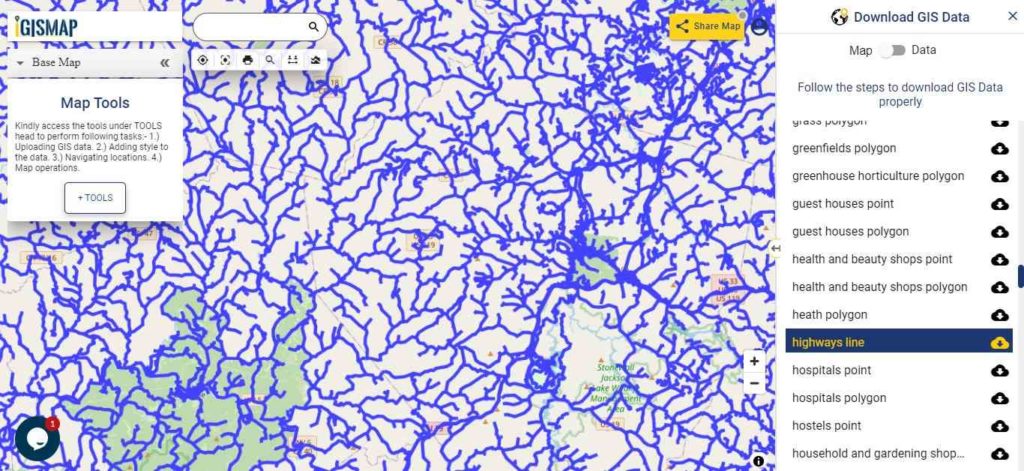
Download West Virginia Highway Lines Shapefile
Zoom in view of highway line map is shown shown above. Similarly, you can easily download point based GIS data of airport point, ATM point, parking area, hospital location, etc.
Railways Line GIS Data of West Virginia U.S. State
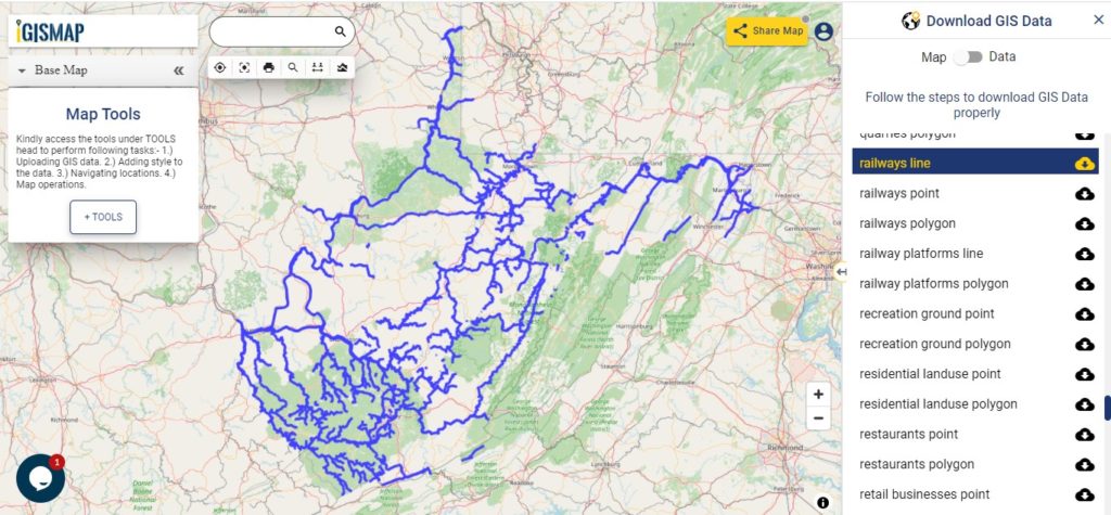
Download West Virginia Railway Lines Shapefile
On the above screen, the railways line map is shown. Likewise, you can download residential land-use points, polygon, restaurants, business GIS data layers.
Download GIS Data of other states of USA:
- Alabama
- Alaska
- Arizona
- Arkansas
- California
- Colorado
- Connecticut
- Florida
- Georgia
- Hawaii
- Idaho
- Illinois
- Indiana
- Iowa
- Kansas
- Massachusetts
- Maryland
- Michigan
- Minnesota
- Mississipi
- Missouri
- Montana
- Nevada
- Nebraska
- Ohio
- Oklahoma
- Pennsylvania
- Utah
- Vermont
- Washington
- Wisconsin
- Wyoming
- Tennessee
- Texas
- Kentucky
- Louisiana
- Maine
- North Carolina
- Oregon
- Virginia
- West Virginia
Disclaimer : If you find any shapefile data of country provided is in correct do contact us or comment below, so that we will correct the same in our system.