GIS Data and Maps of Tennessee State is used by planners and surveyors for visualizing and identifying the patterns that are difficult to examine when data is in table form. Here you can download the GIS data of the state boundary, county division, rail and highway maps in just a few clicks. You can use these data for analysis in MAPOG itself or download them in any suitable GIS format. You can download these data in KML, GeoJSON, CSV or Shapefile formats.
Note:
- All data available are in GCS datum EPSG:4326 WGS84 CRS (Coordinate Reference System).
- You need to login for downloading the shapefile.
Download Shapefile Data of Tennessee
Officially the State of Tennessee, is a state in the Southeastern region of the United States. Tennessee is the 36th largest by area and the 16th most populous of the 50 states. It is bordered by Kentucky to the north, Virginia to the northeast, North Carolina to the east, Georgia, Alabama, and Mississippi to the south, Arkansas to the southwest, and Missouri to the northwest. Tennessee is geographically, culturally, and legally divided into three Grand Divisions of East, Middle, and West Tennessee. Nashville is the state’s capital and largest city, and anchors its largest metropolitan area. Other major cities include Memphis, Knoxville, Chattanooga, and Clarksville. In addition, if you are looking for any other GIS formats then use GIS File Converter.
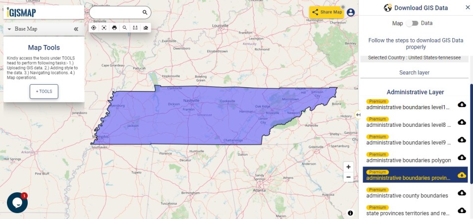
Download Tennessee State Outline Boundary Shapefile
Download Tennessee Counties Shapefile Data
There are 95 counties in the U.S. state of Tennessee.
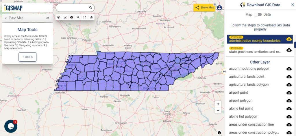
Download Tennessee County Boundaries Shapefile
Polygon map with county division is visible on the above screen. You can easily download and upload in a tool for free and create a map from GIS data, edit the format, add attribute column and share it with your colleagues.
Above layer cover the boundary feature of the following counties
| Anderson County |
| Bedford County |
| Benton County |
| Bledsoe County |
| Blount County |
| Bradley County |
| Campbell County |
| Cannon County |
| Carroll County |
| Carter County |
| Cheatham County |
| Chester County |
| Claiborne County |
| Clay County |
| Cocke County |
| Coffee County |
| Crockett County |
| Cumberland County |
| Davidson County |
| Decatur County |
| DeKalb County |
| Dickson County |
| Dyer County |
| Fayette County |
| Fentress County |
| Franklin County |
| Gibson County |
| Giles County |
| Grainger County |
| Greene County |
| Grundy County |
| Hamblen County |
| Hamilton County |
| Hancock County |
| Hardeman County |
| Hardin County |
| Hawkins County |
| Haywood County |
| Henderson County |
| Henry County |
| Hickman County |
| Houston County |
| Humphreys County |
| Jackson County |
| Jefferson County |
| Johnson County |
| Knox County |
| Lake County |
| Lauderdale County |
| Lawrence County |
| Lewis County |
| Lincoln County |
| Loudon County |
| Macon County |
| Madison County |
| Marion County |
| Marshall County |
| Maury County |
| McMinn County |
| McNairy County |
| Meigs County |
| Monroe County |
| Montgomery County |
| Moore County |
| Morgan County |
| Obion County |
| Overton County |
| Perry County |
| Pickett County |
| Polk County |
| Putnam County |
| Rhea County |
| Roane County |
| Robertson County |
| Rutherford County |
| Scott County |
| Sequatchie County |
| Sevier County |
| Shelby County |
| Smith County |
| Stewart County |
| Sullivan County |
| Sumner County |
| Tipton County |
| Trousdale County |
| Unicoi County |
| Union County |
| Van Buren County |
| Warren County |
| Washington County |
| Wayne County |
| Weakley County |
| White County |
| Williamson County |
| Wilson County |
Highway Line GIS Data of Tennessee State
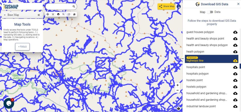
Download Tennessee Highway Lines Shapefile
In the above map, zoom in view of highway line map is shown. Similarly, you can easily download point based GIS data of airport locations, ATM locations, parking locations, hospital location, etc.
Railways Line GIS Data of Tennessee State
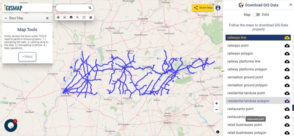
Download Tennessee Railway Lines Shapefile
In the above screen railways line map is shown. Likewise, you can download residential land use point, polygon, restaurants, business GIS data layers.
Download GIS Data of other states of USA:
- Alabama
- Alaska
- Arizona
- Arkansas
- California
- Colorado
- Connecticut
- Florida
- Georgia
- Hawaii
- Idaho
- Illinois
- Indiana
- Iowa
- Kansas
- Massachusetts
- Maryland
- Michigan
- Minnesota
- Mississipi
- Missouri
- Montana
- Nevada
- Nebraska
- Ohio
- Oklahoma
- Pennsylvania
- Utah
- Vermont
- Washington
- Wisconsin
- Wyoming
- Tennessee
- Texas
- Kentucky
- Louisiana
- Maine
- North Carolina
- Oregon
- Virginia
- West Virginia
Disclaimer : If you find any shapefile data of country provided is in correct do contact us or comment below, so that we will correct the same in our system.