Are you struggling to find accurate and up-to-date GIS data for your desired country? Worry no more, as MAPOG is here to be your ultimate solution! Our platform offers a comprehensive collection of GIS data covering more than 150 countries. You’ll find an impressive selection of over 150 GIS datasets available for each nation in the MAPOG GIS Data Collection. The hallmark of our GIS data lies in its exceptional accuracy, especially when representing administrative divisions. Moreover, our users can access a diverse range of data pertaining to natural and man-made geographic features, including rivers, roads, railway lines, airport locations, and much more, all meticulously represented in appropriate geometric structures (points, lines, and polygons). Facilitating seamless access to this invaluable data are two essential tools – Download GIS Data and Add GIS Data, thoughtfully integrated into the MAPOG platform. To delve deeper into the functionalities of the Add GIS Data tool, check out our enlightening article – “Add GIS data from IGISMap GIS data collection“
With MAPOG’s versatile toolkit, you can effortlessly upload vector, add WMS (Web Map Service) layers, upload Excel or CSV data, incorporate existing files, perform polygon splitting and merging, generate new polygon and polyline data, use the converter for various formats, conduct buffer analysis, create grids, transform points into polygons, calculate isochrones, and utilize the geocoder for precise location information.
We offer an extensive array of data formats, including KML, SHP, CSV, GeoJSON, Tab, SQL, Tiff, GML, KMZ, GPKZ, SQLITE, Dxf, MIF, TOPOJSON, XLSX, GPX, ODS, MID, and GPS, ensuring compatibility and accessibility for various applications and analyses.
Note:
- All data available are in GCS datum EPSG:4326 WGS84 CRS (Coordinate Reference System).
- You need to login for downloading the shapefile.
Download Shapefile Data of Seychelles
Seychelles, officially known as the Republic of Seychelles, is an island nation and archipelagic state in the Indian Ocean, comprising 115 islands as stated in its Constitution. The capital and largest city, Victoria, is situated 1,500 kilometers (800 nautical miles) east of mainland Africa. Seychelles is surrounded by nearby island nations and territories, including the Comoros, Madagascar, Mauritius, and the French overseas departments of Mayotte and Réunion to the south, and the Maldives and the Chagos Archipelago (administered by the United Kingdom as the British Indian Ocean Territory) to the east. With an estimated population of 100,600 in 2022, Seychelles is the smallest and least populated sovereign country in Africa.
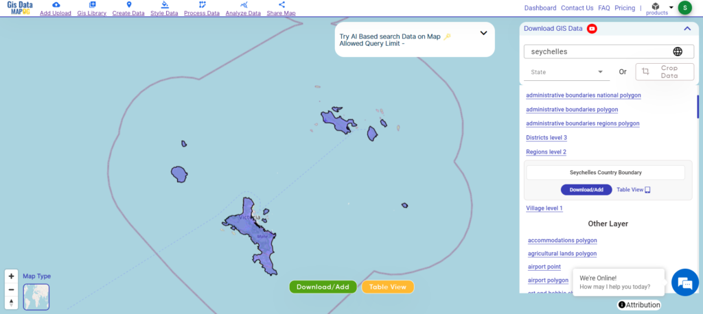
Download Seychelles National Boundary Shapefile
After successfully logging in with a legitimate email address, select the country you want to work with. Next, choose the specific layer you need and click on the download option. Once that’s done, pick the desired format to acquire the essential GIS data. Before proceeding with the data download, make sure to review the data table for any relevant information.
Download Seychelles districts Shapefile Data
Seychelles is divided into 27 districts, which are categorized into Greater Victoria, rural Mahé, and the outer islands. Here’s a breakdown of the districts:
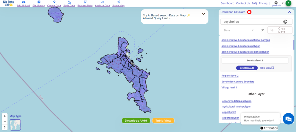
Download Seychelles districts Shapefile
Districts of Seychelles
- English River
- Saint Louis
- Mont Fleuri
- Roche Caiman
- Bel Air
- Les Mamelles
- Anse Aux Pins
- Anse Boileau
- Anse Etoile
- Anse Royale
- Baie Lazare
- Baie Sainte Anne
- Beau Vallon
- Bel Ombre
- Cascade
- Glacis
- Grand Anse Mahé
- Grand Anse Praslin
- La Digue and Inner Islands
- Mont Buxton
- Plaisance
- Pointe La Rue
- Port Glaud
- Takamaka
- Outer Islands
- Ile Perseverance I
- Ile Perseverance II
Download Seychelles Electoral areas Shapefile Data
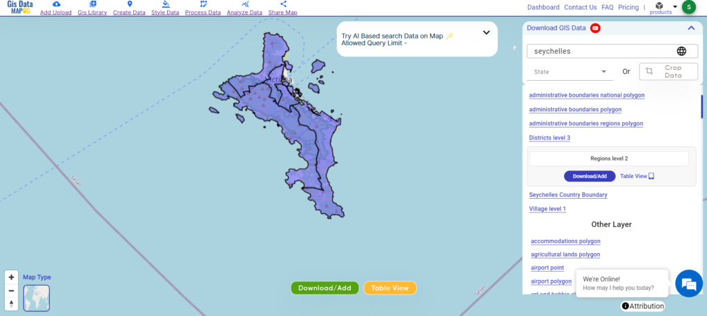
Seychelles divided into eight electoral areas: East Mahé, La Digue and Outlying Islands, North Mahé, Praslin, South Mahé, Victoria North, Victoria South, and West Mahé.
Download Seychelles Electoral areas Shapefile
Other GIS Data:
- Download Seychelles Airport Points Shapefile
- Download Seychelles Forest Polygons Shapefile
- Download Seychelles Highway Lines Shapefile
- Download Seychelles River Lines Shapefile
Above all links are provided for GIS data of Montenegro if you are looking for any specific data please write us on support@mapog.com
Download Shapefile for the following:
- World Countries Shapefile
- Australia
- Argentina
- Austria
- Belgium
- Brazil
- Canada
- Denmark
- Fiji
- Finland
- Germany
- Greece
- India
- Indonesia
- Ireland
- Italy
- Japan
- Kenya
- Lebanon
- Madagascar
- Malaysia
- Mexico
- Mongolia
- Netherlands
- New Zealand
- Nigeria
- Papua New Guinea
- Philippines
- Poland
- Russia
- Singapore
- South Africa
- South Korea
- Spain
- Switzerland
- Tunisia
- United Kingdom Shapefile
- United States of America
- Vietnam
- Croatia
- Chile
- Norway
- Maldives
- Bhutan
- Colombia
- Libya
- Comoros
- Hungary
- Laos
- Estonia
- Iraq
- Portugal
- Azerbaijan
- Macedonia
- Romania
- Peru
- Marshall Islands
- Slovenia
- Nauru
- Guatemala
- El Salvador
- Afghanistan
- Cyprus
- Syria
- Slovakia
- Luxembourg
- Jordan
- Armenia
- Haiti And Dominican Republic
- Malta
- Djibouti
- East Timor
- Micronesia
- Morocco
- Liberia
- Kosovo
- Isle Of Man
- Paraguay
- Tokelau
- Palau
- Ile De Clipperton
- Mauritius
- Equatorial Guinea
- Tonga
- Myanmar
- Thailand
- New Caledonia
- Mali
- Burundi
Disclaimer : If you find any shapefile data of country provided is incorrect do contact us or comment below, so that we will correct the same in our system as well we will try to correct the same in openstreetmap.