GIS Data and Maps of Pennsylvania State is used by planners and surveyors for visualizing and identifying the patterns that are difficult to examine when data is in table form. Here you can download the GIS data of the state boundary, county division, rail and highway maps in just a few clicks. You can use these data for analysis in MAPOG itself or download them in any suitable GIS format. You can download these data in KML, GeoJSON, CSV or Shapefile formats.
Note:
- All data available are in GCS datum EPSG:4326 WGS84 CRS (Coordinate Reference System).
- You need to login for downloading the shapefile.
Download Shapefile Data of Pennsylvania
Pennsylvania, officially the Commonwealth of Pennsylvania, is a U.S. state spanning the Mid-Atlantic, Northeastern, and Appalachian regions of the United States. It borders Delaware to the southeast, Maryland to the south, West Virginia to the southwest, Ohio to the west, Lake Erie and the Canadian province of Ontario to the northwest, New York to the north, and New Jersey to the east. In addition, if you are looking for any other GIS formats then use GIS File Converter.
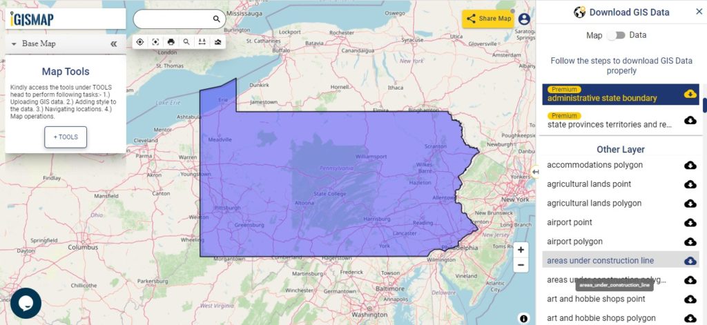
Download Pennsylvania State Outline Boundary Shapefile
Download Pennsylvania Counties Shapefile Data
There are 67 counties in the U.S. state of Pennsylvania. For a polygon map click on the link given below.
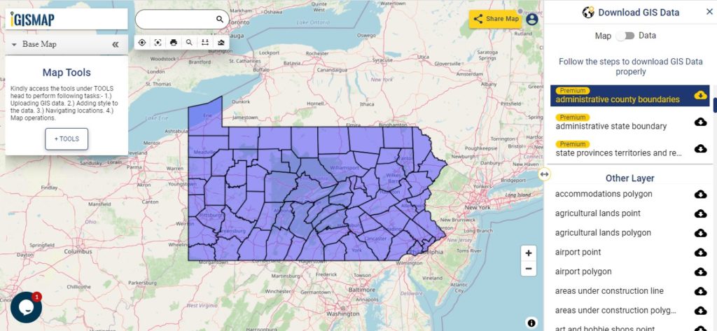
Download Pennsylvania County Boundaries Shapefile
Polygon map with county division is visible on the above screen. You can easily download and upload in a tool for free and create a map from GIS data, edit the format, add attribute column and share it with your colleagues.
Above layer cover the boundary feature of the following counties
| Adams County |
| Allegheny County |
| Armstrong County |
| Beaver County |
| Bedford County |
| Berks County |
| Blair County |
| Bradford County |
| Bucks County |
| Butler County |
| Cambria County |
| Cameron County |
| Carbon County |
| Centre County |
| Chester County |
| Clarion County |
| Clearfield County |
| Clinton County |
| Columbia County |
| Crawford County |
| Cumberland County |
| Dauphin County |
| Delaware County |
| Elk County |
| Erie County |
| Fayette County |
| Forest County |
| Franklin County |
| Fulton County |
| Greene County |
| Huntingdon County |
| Indiana County |
| Jefferson County |
| Juniata County |
| Lackawanna County |
| Lancaster County |
| Lawrence County |
| Lebanon County |
| Lehigh County |
| Luzerne County |
| Lycoming County |
| McKean County |
| Mercer County |
| Mifflin County |
| Monroe County |
| Montgomery County |
| Montour County |
| Northampton County |
| Northumberland County |
| Perry County |
| Philadelphia County |
| Pike County |
| Potter County |
| Schuylkill County |
| Snyder County |
| Somerset County |
| Sullivan County |
| Susquehanna County |
| Tioga County |
| Union County |
| Venango County |
| Warren County |
| Washington County |
| Wayne County |
| Westmoreland County |
| Wyoming County |
| York County |
Highway Line GIS Data of Pennsylvania State
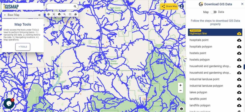
Download Pennsylvania Highway Lines Shapefile
In the above map, zoom in view of highway line map is shown. Similarly, you can easily download point based GIS data of airport locations, ATM locations, parking locations, hospital location, etc.
Railways Line GIS Data of Pennsylvania State
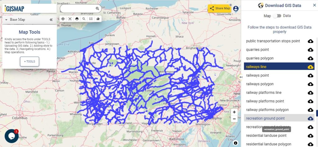
Download Pennsylvania Railway Lines Shapefile
In the above screen railways line map is shown. Likewise, you can download residential land use point, polygon, restaurants, business GIS data layers.
Download GIS Data of other states of USA:
- Alabama
- Alaska
- Arizona
- Arkansas
- California
- Colorado
- Connecticut
- Florida
- Georgia
- Hawaii
- Idaho
- Illinois
- Indiana
- Iowa
- Kansas
- Massachusetts
- Maryland
- Michigan
- Minnesota
- Mississipi
- Missouri
- Montana
- Nevada
- Nebraska
- Ohio
- Oklahoma
- Pennsylvania
- Utah
- Vermont
- Washington
- Wisconsin
- Wyoming
- Tennessee
- Texas
- Kentucky
- Louisiana
- Maine
- North Carolina
- Oregon
- Virginia
- West Virginia
Disclaimer : If you find any shapefile data of country provided is in correct do contact us or comment below, so that we will correct the same in our system.