GIS Data and Maps of Oregon State is used by planners and surveyors for visualizing and identifying the patterns that are difficult to examine when data is in table form. Here you can download the GIS data of the state boundary, county division, rail and highway maps in just a few clicks. You can use these data for analysis in MAPOG itself or download them in any suitable GIS format. You can download these data in KML, GeoJSON, CSV or Shapefile formats.
Note:
- All data available are in GCS datum EPSG:4326 WGS84 CRS (Coordinate Reference System).
- You need to login for downloading the shapefile.
Download Shapefile Data of Oregon
Oregon is a state in the Pacific Northwest region of the United States. Salem is the capital city of the state. In addition, if you are looking for any other GIS formats then use GIS File Converter.
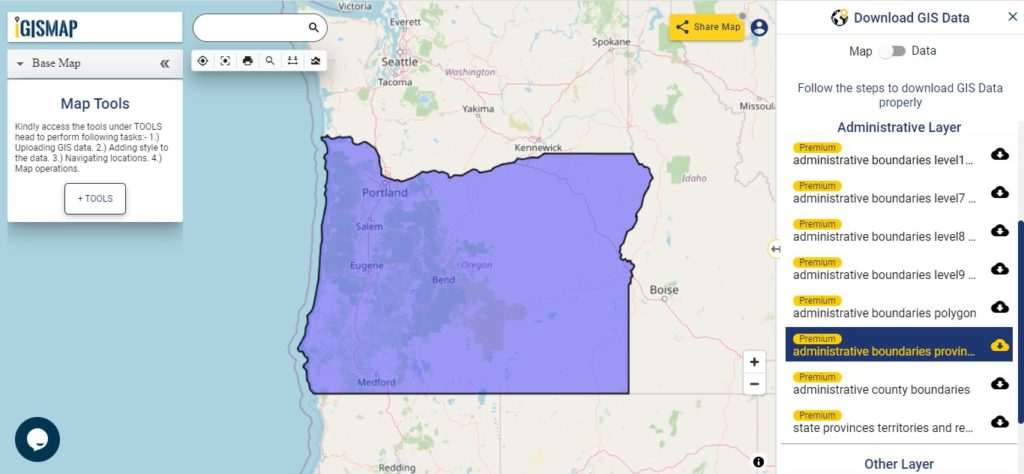
Download Oregon State Outline Boundary Shapefile
In the above screen boundary map of Oregon state. This is the map view for the data table switch button from the map to the data. The layer name is provided on the right side of the screen. For download click on the button placed beside the map layer name. You can locate your store/ shop on a map.
Download Oregon Counties Shapefile Data
There are 36 counties in the U.S. state of Oregon.
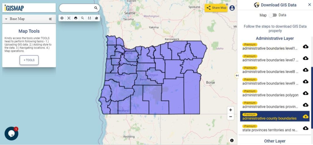
Download Oregon Counties Boundary Shapefile
Polygon map with county division is visible on the above screen. You can easily download and upload in a tool for free and create a map from gis data. Edit, format, add attribute column and share it with your colleagues.
For checking information at a particular location click on the map area and the data table on a particular location will appear.
Above all Layers cover GIS data of following Counties –
| Baker County |
| Benton County |
| Clackamas County |
| Clatsop County |
| Columbia County |
| Coos County |
| Crook County |
| Curry County |
| Deschutes County |
| Douglas County |
| Gilliam County |
| Grant County |
| Harney County |
| Hood River County |
| Jackson County |
| Jefferson County |
| Josephine County |
| Klamath County |
| Lake County |
| Lane County |
| Lincoln County |
| Linn County |
| Malheur County |
| Marion County |
| Morrow County |
| Multnomah County |
| Polk County |
| Sherman County |
| Tillamook County |
| Umatilla County |
| Union County |
| Wallowa County |
| Wasco County |
| Washington County |
| Wheeler County |
| Yamhill County |
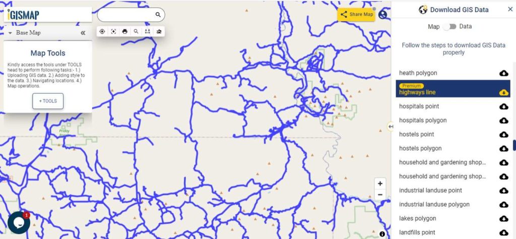
Highway Line GIS Data of Oregon State
Download Vermont Highway Lines Shapefile
Zoom in view of highway line map is shown shown above. Similarly, you can easily download point based GIS data of airport point, ATM point, parking area, hospital location, etc.
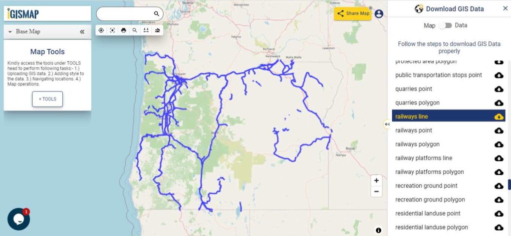
Railways Line GIS Data of Oregon U.S. State
Download Oregon Railway Lines Shapefile
In the above screen railways line map is shown. Likewise, you can download residential land use point, polygon, restaurants, business GIS data layers.
Download GIS Data of other states of USA:
- Alabama
- Alaska
- Arizona
- Arkansas
- California
- Colorado
- Connecticut
- Florida
- Georgia
- Hawaii
- Idaho
- Illinois
- Indiana
- Iowa
- Kansas
- Massachusetts
- Maryland
- Michigan
- Minnesota
- Mississipi
- Missouri
- Montana
- Nevada
- Nebraska
- Ohio
- Oklahoma
- Pennsylvania
- Utah
- Vermont
- Washington
- Wisconsin
- Wyoming
- Tennessee
- Texas
- Kentucky
- Louisiana
- Maine
- North Carolina
- Oregon
- Virginia
- West Virginia
Disclaimer : If you find any shapefile data of country provided is in correct do contact us or comment below, so that we will correct the same in our system.
“Portland city is the capital city of the state.”
WRONG
Thanks its corrected