GIS Data and Maps of North Carolina State is used by planners and surveyors for visualizing and identifying the patterns that are difficult to examine when data is in table form. Here you can download the GIS data of the state boundary, county division, rail and highway maps in just a few clicks. You can use these data for analysis in MAPOG itself or download them in any suitable GIS format. You can download these data in KML, GeoJSON, CSV or Shapefile formats.
With MAPOG’s versatile toolkit, you can effortlessly upload vector, add WMS (Web Map Service) layers, upload Excel or CSV data, incorporate existing files, perform polygon splitting and merging, generate new polygon and polyline data, use the converter for various formats, conduct buffer analysis, create grids, transform points into polygons, calculate isochrones, and utilize the geocoder for precise location information.
We offer an extensive array of data formats, including KML, SHP, CSV, GeoJSON, Tab, SQL, Tiff, GML, KMZ, GPKZ, SQLITE, Dxf, MIF, TOPOJSON, XLSX, GPX, ODS, MID, and GPS, ensuring compatibility and accessibility for various applications and analyses.
Note:
- All data available are in GCS datum EPSG:4326 WGS84 CRS (Coordinate Reference System).
- You need to login for downloading the shapefile
Download Shapefile Data of North Carolina State
North Carolina is a state in the Southeastern region of the United States. North Carolina is the 28th largest and 9th-most populous of the 50 United States.
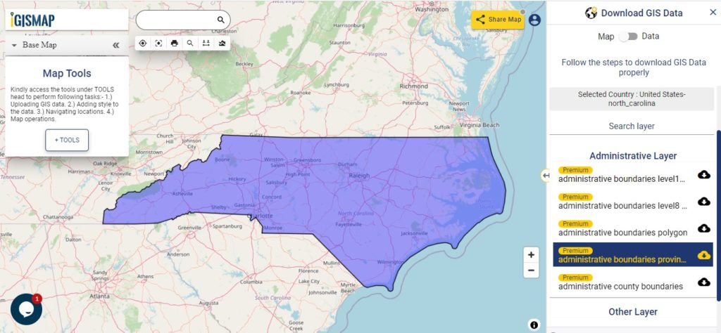
Download North Carolina State Outline Boundary Shapefile
In the above screen boundary map of North Carolina state. This is the map view for the data table switch button from the map to the data. The layer name is provided on the Right side of the screen. For download click on the button placed beside the map layer name. You can locate your store/ shop on a map.
Download North Carolina Counties Shapefile Data
There are 100 counties in the U.S. state of North Carolina. For a polygon map click on the link given below.
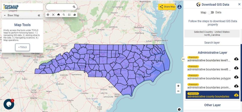
Download North Carolina Counties Boundary Shapefile
Polygon map with county division is visible on the above screen. You can easily download and upload in a tool for free and create a map from gis data. Edit, format, add attribute column and share it with your colleagues.
For checking information at a particular location click on the map area and the data table on a particular location will appear.
Above all Layers cover GIS data of following Counties –
| Alamance County |
| Alexander County |
| Alleghany County |
| Anson County |
| Ashe County |
| Avery County |
| Beaufort County |
| Bertie County |
| Bladen County |
| Brunswick County |
| Buncombe County |
| Burke County |
| Cabarrus County |
| Caldwell County |
| Camden County |
| Carteret County |
| Caswell County |
| Catawba County |
| Chatham County |
| Cherokee County |
| Chowan County |
| Clay County |
| Cleveland County |
| Columbus County |
| Craven County |
| Cumberland County |
| Currituck County |
| Dare County |
| Davidson County |
| Davie County Duplin County Durham County Edgecombe County Forsyth County Franklin County Gaston County Gates County Graham County Granville County Greene County Guilford County Halifax County Harnett County Haywood County Henderson County Hertford County Hoke County Hyde County Iredell County Jackson County Johnston County Jones County Lee County Lenoir County Lincoln County Macon County Madison County Martin County McDowell County |
Highway Line GIS DATA of North Carolina State
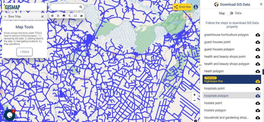
Download North Carolina Highway Lines Shapefile
Zoom in view of highway line map is shown shown above. Similarly, you can easily download point based GIS data of airport point, ATM point, parking area, hospital location, etc.
Railways Line GIS Data of North Carolina U.S. State
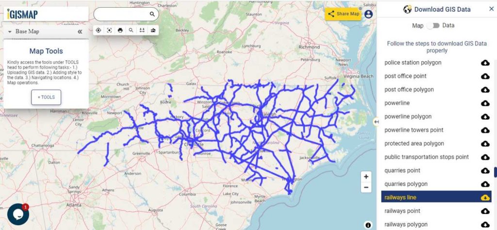
Download North Carolina Railway Lines Shapefile
In the above screen railways line map is shown. Likewise, you can download residential land use point, polygon, restaurants, business GIS is data layers.
Download GIS Data of other states of USA:
- Alabama
- Alaska
- Arizona
- Arkansas
- California
- Colorado
- Connecticut
- Florida
- Georgia
- Hawaii
- Idaho
- Illinois
- Indiana
- Iowa
- Kansas
- Massachusetts
- Maryland
- Michigan
- Minnesota
- Mississipi
- Missouri
- Montana
- Nevada
- Nebraska
- Ohio
- Oklahoma
- Pennsylvania
- Utah
- Vermont
- Washington
- Wisconsin
- Wyoming
- Tennessee
- Texas
- Kentucky
- Louisiana
- Maine
- North Carolina
- Oregon
- Virginia
- West Virginia
Disclaimer : If you find any shapefile data of country provided is in correct do contact us or comment below, so that we will correct the same in our system.