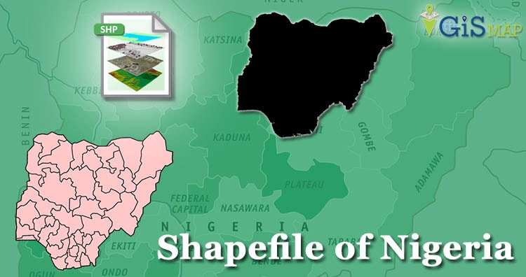
Hello GIS enthusiasts, IGISMAP has now published the latest GIS vector data of Nigeria administrative levels. Links for downloading the shapefiles of the important administrative divisions of Nigeria are provided in the following. You can also download these data in KML, GeoJSON or CSV formats.
Note:
- All data available are in GCS datum EPSG:4326 WGS84 CRS (Coordinate Reference System).
- You need to login for downloading the shapefile.
Download Free Shapefile Data of Nigeria
Nigeria, officially the Federal Republic of Nigeria, is a country in West Africa. It is geographically situated between the Sahel to the north and the Gulf of Guinea to the south in the Atlantic Ocean. It covers an area of 923,769 square kilometers (356,669 sq mi), and with a population of over 216 million, It is the most populous country in Africa, and the world’s seventh-most populous country. Nigeria borders Niger in the north, Chad in the northeast, Cameroon in the east, and Benin in the west. Nigeria is a federal republic comprising 36 states and the Federal Capital Territory, where the capital, Abuja, is located. The largest city in Nigeria is Lagos, one of the largest metropolitan areas in the world and the second-largest in Africa.
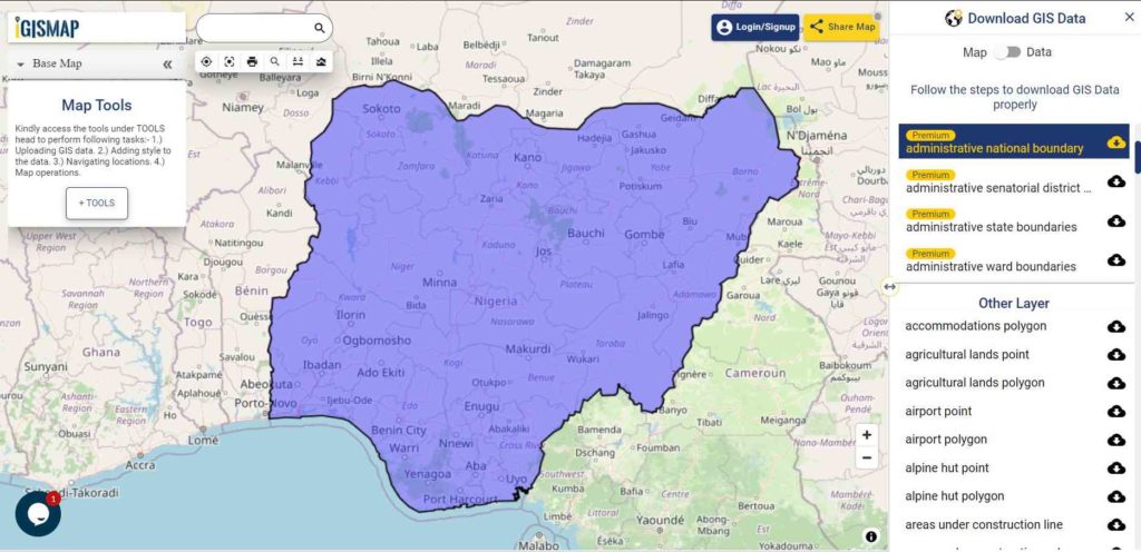
Download Nigeria National Outline Boundary Shapefile
Download Nigeria States Shapefile Data
It comprises 36 states and one federal capital territory, where Abuja is located. It covers the following states.
- Borno
- Cross River
- Delta
- Ebonyi
- Enugu
- Edo
- Ekiti
- Gombe
- Imo
- Jigawa
- KadunaKano
- Katsina
- Kebbi
- Kogi
- Kwara
- Lagos
- Nasarawa
- Niger
- Ogun
- Ondo
- Osun
- Oyo
- Plateau
- Rivers
- Sokoto
- Taraba
- Yobe
- Zamfara
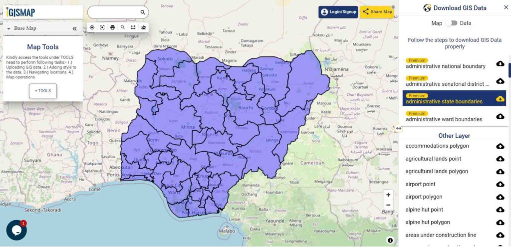
Download Nigeria States Boundaries Shapefile
Download Nigeria Local Government Areas Shapefile Data
Following GIS Data contains the polygons of 774 boundaries of Nigeria
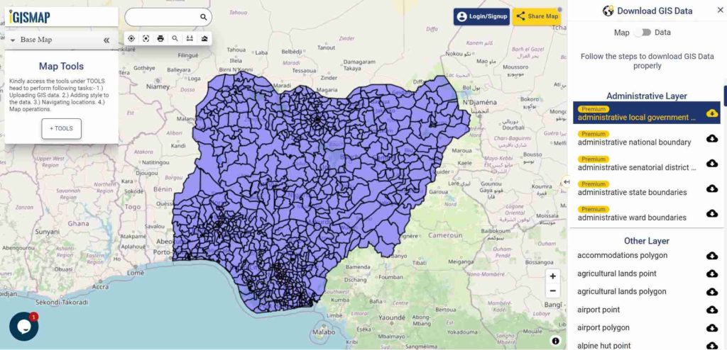
Download Nigeria Local Government Area Boundaries Shapefile
Download Nigeria Wards Shapefile Data
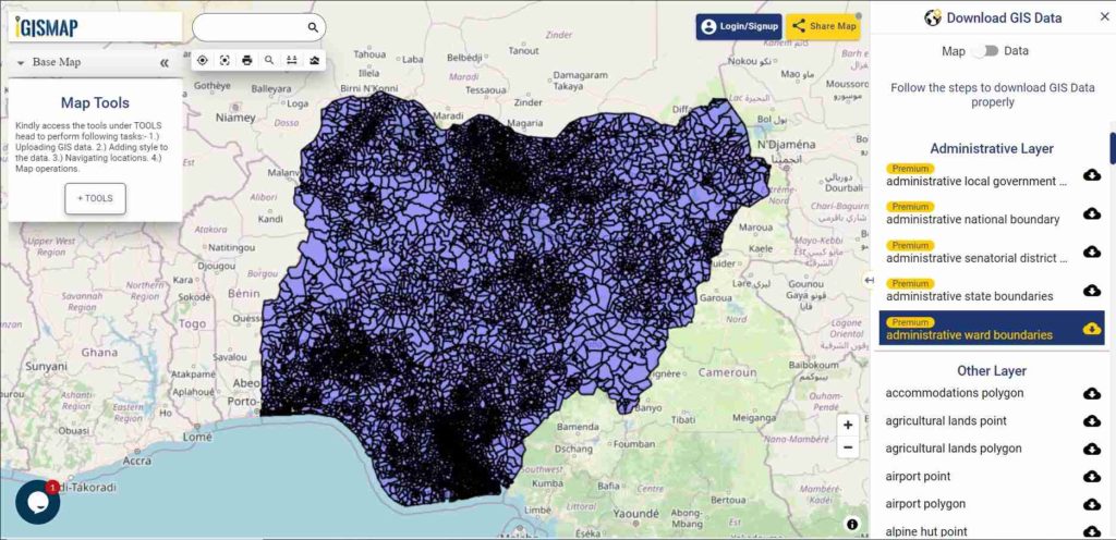
Download Nigeria Wards Boundaries Shapefile
Other GIS Data:
- Download Nigeria Senatorial Districts Boundaries Shapefile
- Download Nigeria Highway Lines Shapefile
- Download Nigeria Railway Lines Shapefile
- Download Nigeria Airport Locations Shapefile
- Download Nigeria Ferry Terminal Locations Shapefile
Convert Nigeria Shapefile into KML
You can easily convert Shapefile to KML using our IGIS Map Tool and vice versa.
We try to cover all data exported from osm in shapefile. The data is provided and converted from osm to shapefile from open street map. All data are updated periodically once in a quarter year. Similarly you may ask or hire us to download a map of water, roads, polygon, buildings, parks, etcs of a specific Area from open street map.
Download Free Shapefile for the following:
- World Countries Shapefile
- Australia
- Argentina
- Austria
- Belgium
- Brazil
- Canada
- Denmark
- Fiji
- Finland
- Germany
- Greece
- India
- Indonesia
- Ireland
- Italy
- Japan
- Kenya
- Lebanon
- Madagascar
- Malaysia
- Mexico
- Mongolia
- Netherlands
- New Zealand
- Nigeria
- Papua New Guinea
- Philippines
- Poland
- Russia
- Singapore
- South Africa
- South Korea
- Spain
- Switzerland
- Tunisia
- United Kingdom Shapefile
- United States of America
- Vietnam
- Croatia
- Chile
- Norway
Disclaimer : If you find any shapefile data of country provided is in correct do contact us or comment below, so that we will correct the same in our system.
We are interested in Nigeria GIS map(s) to assist with the fight against insurgency.
What type of map do you want exactly?
I need shape file for Southern Nigeria for my PhD thesis, how do I go about it. Thank you
Hello, I’m a GIS professional and I can help you with any difficulty you’re facing in GIS
I want the shapefile for whole Ecowas countries, Where can i find that?
Hello, the team is doing a nice job helping out with data. I need the Nigeria wards shape file to complete my analysis. I have subscribed to this website with my email and you can send the shape file to fareytos@gmail.com.Thank you
Hi, were you eventually able to get the wards shape file? I need something on either a Ward or an LGA level
I need Map and dataset for ilorin metropolis.
Thanks
Sir, i need Nigeria shape file for the states and LGA for my research. Thank you
Hi,
I recently downloaded SA shapefile from your website. However, I can’t find a way to import it into Power BI.
Hello! I need the shape file for plateau State, Nigeria.
I need data (shp) on the primary and secondary roads in Nigeria..
Great Job.
I need the shapefiles for the Nigerian Wards, especially Kano Wards (specifically Ungogo LGA).
Thank you.
Please can someone help me with Ondo state shapefile. And if I can also get the LGA shapefile for Ondo state, I will really appreciate that as well. Thanks
Please i neeed shapefile for nigeria
Hi use this link to download shapefile for Nigeria :
Shapefile of Nigeria
I NEED NIGERIA FULL ROAD NETWORK SHAPEFILE TO COMPLETE MY RESEARCH
Hi you can find here https://map.igismap.com/gis-data/nigeria/roads_line
Please can you help me with the shape file for kano state. It’s urgent please
Thank you
Hello pls is it possible for me to just get the shape file of Minna in Niger state. Thank you in advance
hello, pls i need shape file of Nigeria forest reserves and also shape file of nigeria ecological forest. kindly help if anyone have the knowledge.
Hi, please can I get the shapefile of the coastal area of Rivers State and its contour too. Thanks
Hi All,
please I need land use shapefile for edo state
Good say sir
Please I need update street files for the whole country of Nigeria
Thanks
i need state shapefile of nigeria.
Please I need shape file for places in Benin
Hello sir, please a need a shapefiles for all the street lights in ogun state. Thanks
i need zone shapefile of nigeria
😢😭😭😭😭
How will I get pipeline shapefiles of Niger Delta regions