Effortlessly explore New Caledonia’s geography with MAPOG. Access diverse datasets like boundaries, rivers, highways, and airports. Use user-friendly tools like Download GIS Data, choose from formats like Shapefile, KML, GeoJSON, and CSV. Dive confidently into New Caledonia GIS Data with IGISMAP.
With MAPOG’s versatile toolkit, you can effortlessly upload vector, add WMS (Web Map Service) layers, upload Excel or CSV data, incorporate existing files, perform polygon splitting and merging, generate new polygon and polyline data, use the converter for various formats, conduct buffer analysis, create grids, transform points into polygons, calculate isochrones, and utilize the geocoder for precise location information.
We offer an extensive array of data formats, including KML, SHP, CSV, GeoJSON, Tab, SQL, Tiff, GML, KMZ, GPKZ, SQLITE, Dxf, MIF, TOPOJSON, XLSX, GPX, ODS, MID, and GPS, ensuring compatibility and accessibility for various applications and analyses.
Note:
- All data available are in GCS datum EPSG:4326 WGS84 CRS (Coordinate Reference System).
- You need to login for downloading the shapefile.
Download Shapefile Data of New Caledonia
New Caledonia, a unique overseas collectivity of France, is located in the southwest Pacific Ocean, south of Vanuatu, approximately 1,210 km (750 mi) east of Australia, and a significant 17,000 km (11,000 mi) from Metropolitan France.
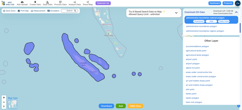
Download New Caledonia National Boundary Shapefile
After successfully logging in with a legitimate email address, select the country you want to work with. Next, choose the specific layer you need and click on the download option. Once that’s done, pick the desired format to acquire the essential GIS data. Before proceeding with the data download, make sure to review the data table for any relevant information.
Download New Caledonia Provinces Shapefile Data
New Caledonia is divided into three provinces:
- South Province (Province Sud)
- North Province (Province Nord)
- Loyalty Islands Province (Province des Îles Loyauté)
Each province in New Caledonia has its own government and a degree of autonomy, with specific powers and responsibilities.
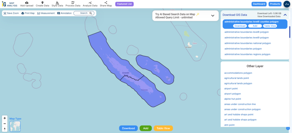
Download New Caledonia Provinces Shapefile
Download New Caledonia Communes Shapefile Data
New Caledonia is divided into three provinces, which in turn are divided into 33 communes.
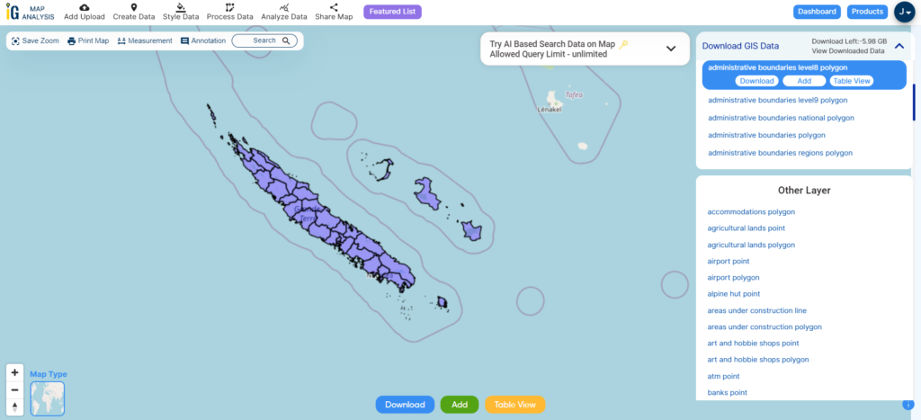
Download New Caledonia Communes Shapefile
here is the list of the 33 communes in New Caledonia without images:
- Ajie
- Anse-Vata
- Bourail
- Canala
- Dumbéa
- Hienghène
- Houaïlou
- Île des Pins (Vao)
- Kaala-Gomen
- Koné
- La Foa
- Lifou
- Maré
- Mont-Dore
- Ouvéa
- Païta
- Poindimié
- Poya
- Poum
- Saint-Louis
- Sarraméa
- Thio
- Touho
- Voh
- Yaté
Other Administrative Boundary Data:
Other GIS Data:
- Download New Caledonia Airport Point Shapefile
- Download New Caledonia Highway Lines Shapefile
- Download New Caledonia Road Lines Shapefile
- Download New Caledonia Rivers Shapefile
Above all links are provided for GIS data of New Caledonia if you are looking for any specific data please write us on support@igismap.com
Download Shapefile for the following:
- World Countries Shapefile
- Australia
- Argentina
- Austria
- Belgium
- Brazil
- Canada
- Denmark
- Fiji
- Finland
- Germany
- Greece
- India
- Indonesia
- Ireland
- Italy
- Japan
- Kenya
- Lebanon
- Madagascar
- Malaysia
- Mexico
- Mongolia
- Netherlands
- New Zealand
- Nigeria
- Papua New Guinea
- Philippines
- Poland
- Russia
- Singapore
- South Africa
- South Korea
- Spain
- Switzerland
- Tunisia
- United Kingdom Shapefile
- United States of America
- Vietnam
- Croatia
- Chile
- Norway
- Maldives
- Bhutan
- Colombia
- Libya
- Comoros
- Hungary
- Laos
- Estonia
- Iraq
- Portugal
- Azerbaijan
- Macedonia
- Romania
- Peru
- Marshall Islands
- Slovenia
- Nauru
- Guatemala
- El Salvador
- Afghanistan
- Cyprus
- Syria
- Slovakia
- Luxembourg
- Jordan
- Armenia
- Haiti And Dominican Republic
Disclaimer : If you find any shapefile data of country provided is incorrect do contact us or comment below, so that we will correct the same in our system as well we will try to correct the same in openstreetmap.