GIS Data and Maps of Nebraska State is used by planners and surveyors for visualizing and identifying the patterns that are difficult to examine when data is in table form. Here you can download the GIS data of the state boundary, county division, rail and highway maps in just a few clicks. You can use these data for analysis in IGISMAP itself or download them in any suitable GIS format. You can download these data in KML, GeoJSON, CSV or Shapefile formats.
Note:
- All data available are in GCS datum EPSG:4326 WGS84 CRS (Coordinate Reference System).
- You need to login for downloading the shapefile.
Download Shapefile Data of Nebraska
Nebraska is a state in the Midwestern region of the United States. It is bordered by South Dakota to the north; Iowa to the east and Missouri to the southeast, both across the Missouri River; Kansas to the south; Colorado to the southwest; and Wyoming to the west. It is the only triply landlocked U.S. state. In addition, if you are looking for any other GIS formats then use GIS File Converter.
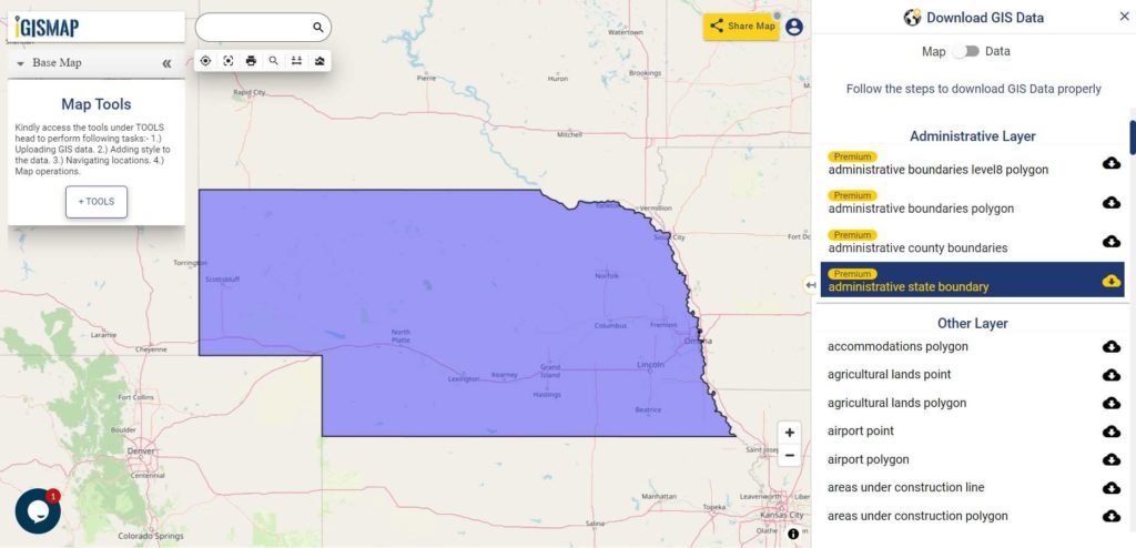
Download Nebraska State Outline Boundary Shapefile
In the above screen state boundary map of Nebraska state. This is the map view for the data table switch button from the map to the data. The layer name is provided on the right side of the screen. For download click on the button placed beside the map layer name. You can locate your store/ shop on a map.
Download Nebraska Counties Shapefile Data
There are 93 counties in the U.S. state of Nebraska. For a polygon map click on the link given below.
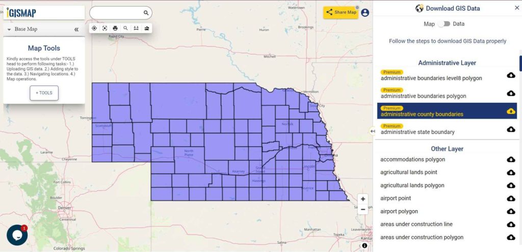
Download Nebraska County Boundaries Shapefile
Polygon map with county division is visible on the above screen. You can easily download and upload in a tool for free and create a map from GIS data, edit the format, add attribute column and share it with your colleagues.
Above layer cover the boundary feature of the following counties
| Omaha |
| Lincoln |
| Bellevue |
| Grand Island |
| Kearney |
| Fremont |
| Hastings |
| North Platte |
| Norfolk |
| Columbus |
| Papillion |
| La Vista |
| Scottsbluff |
| South Sioux City |
| Beatrice |
| Lexington |
| Alliance |
| Gering |
| Blair |
| York |
| McCook |
| Nebraska City |
| Ralston |
| Crete |
| Seward |
| Sidney |
| Plattsmouth |
| Schuyler |
| Chadron |
| Gretna |
| Wayne |
| Holdrege |
| Ogallala |
| Wahoo |
| Aurora |
| Falls City |
| Cozad |
| Fairbury |
| O’Neill |
| Waverly |
| Gothenburg |
| Broken Bow |
| Auburn |
| West Point |
| Minden |
| Central City |
| David City |
| Valentine |
| Ashland |
| Kimball |
| Madison |
| St. Paul |
| Milford |
| Geneva |
| Imperial |
| Ord |
| Valley |
Highway Line GIS Data of Nebraska State
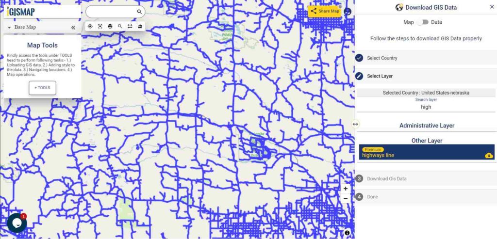
Download Nebraska Highway Lines Shapefile
In the above map, zoom in view of highway line map is shown. Similarly, you can easily download point based GIS data of airport locations, ATM locations, parking locations, hospital location, etc.
Railways Line GIS Data of Nebraska State
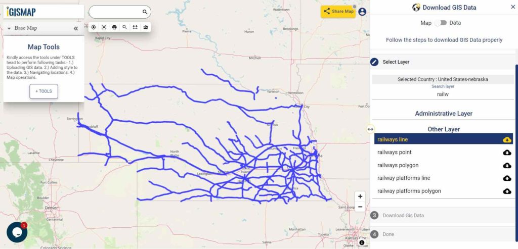
Download Nebraska Railway Lines Shapefile
In the above screen railways line map is shown. Likewise, you can download residential land use point, polygon, restaurants, business GIS data layers.
For more specific GIS data write us on support@mapog.com.
Download GIS Data of other states of USA:
- Alabama
- Alaska
- Arizona
- Arkansas
- California
- Colorado
- Connecticut
- Florida
- Georgia
- Hawaii
- Idaho
- Illinois
- Indiana
- Iowa
- Kansas
- Massachusetts
- Maryland
- Michigan
- Minnesota
- Mississipi
- Missouri
- Montana
- Nevada
- Nebraska
- Ohio
- Oklahoma
- Pennsylvania
- Utah
- Vermont
- Washington
- Wisconsin
- Wyoming
- Tennessee
- Texas
- Kentucky
- Louisiana
- Maine
- North Carolina
- Oregon
- Virginia
- West Virginia
Disclaimer : If you find any shapefile data of country provided is in correct do contact us or comment below, so that we will correct the same in our system.