

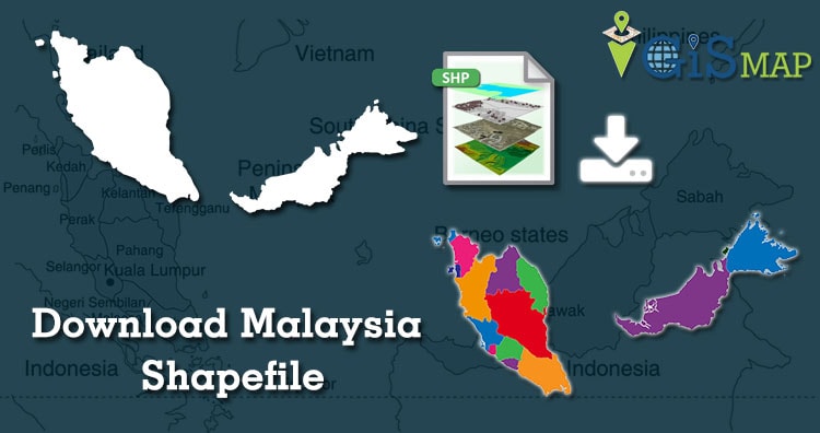
Hello GIS enthusiasts, IGISMAP has now published the latest GIS vector data of Malaysia administrative levels. Links for downloading the shapefiles of the important administrative divisions of Malaysia are provided in the following. You can also download these data in KML, GeoJSON or CSV formats.
Note:
- All data available are in GCS datum EPSG:4326 WGS84 CRS (Coordinate Reference System).
- You need to login for downloading the shapefile.
Download Free Shapefile Data of Malaysia
Malaysia is a country in Southeast Asia. The federal constitutional monarchy consists of thirteen states and three federal territories, separated by the South China Sea into two regions, Peninsular Malaysia and Borneo’s East Malaysia. Peninsular Malaysia shares a land and maritime border with Thailand and maritime borders with Singapore, Vietnam, and Indonesia. East Malaysia shares land and maritime borders with Brunei and Indonesia and a maritime border with the Philippines and Vietnam. Kuala Lumpur is the national capital, largest city and the seat of the legislative branch of the federal government. The nearby planned capital of Putrajaya is the administrative capital.

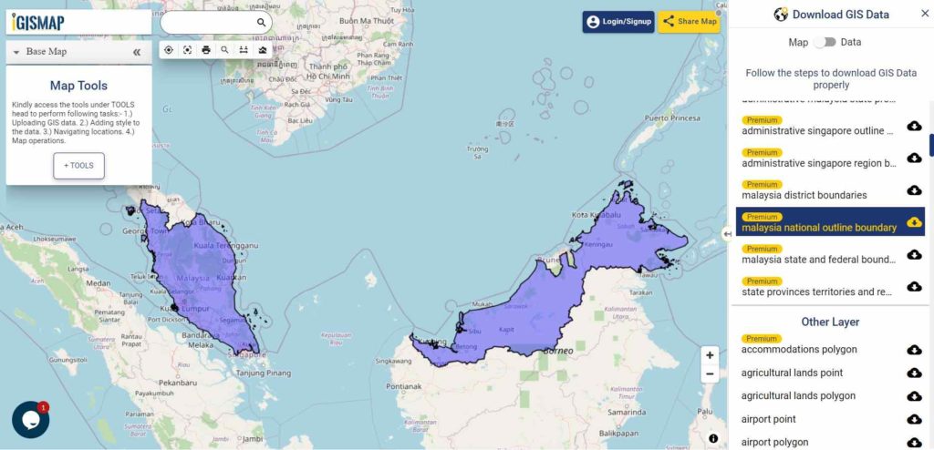
Download Malaysia National Outline Boundary Shapefile
Download Malaysia States Shapefile Data
This Malaysian Shapefile covers Johar, Kedah, Kelantan, Kaula Lumpur, Labuan, Malacca, Negeri Sembilian, Pahang, Penang, Perak, Perlis, Putrajaya, Sabah, Sarawak, Selangor, Terengganu.
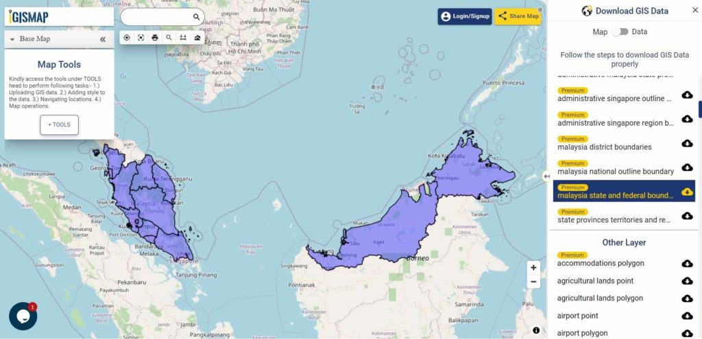
Download Malaysia State Boundaries Shapefile
Download Malaysia Districts Shapefile Data

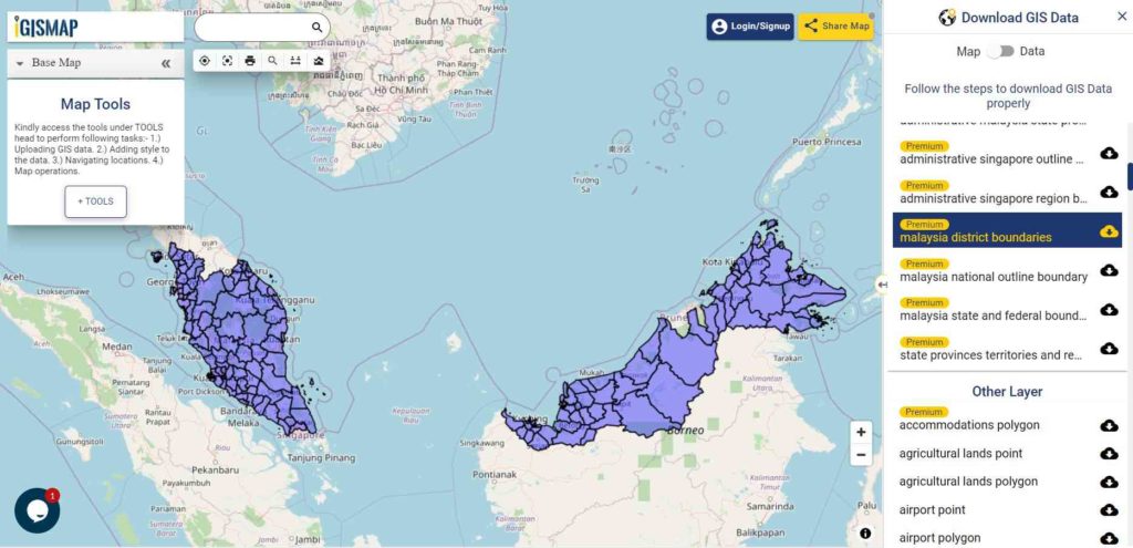
Download Malaysia District Boundaries Shapefile
Other GIS Data:
- Download Malaysia Highway Lines Shapefile
- Download Malaysia Railway Lines Shapefile
- Download Malaysia Airport Locations Shapefile
- Download Malaysia Ferry Locations Shapefile
Please note that the Malaysia data provided here is license under Open Data Commons Open Database License (ODbL). Please review the same before using it. If you want data under different license you can also look over to the post : Download Free Shapefile Maps – Country Boundary Polygon, Rail-Road, Water polyline etc
Disclaimer : If you find any shapefile data of country provided is in correct do contact us or comment below, so that we will correct the same in our system as well we will try to correct the same in openstreetmap.
Download Shapefile for the following:
- World Countries Shapefile
- Australia
- Argentina
- Austria
- Belgium
- Brazil
- Canada
- Denmark
- Fiji
- Finland
- Germany
- Greece
- India
- Indonesia
- Ireland
- Italy
- Japan
- Kenya
- Lebanon
- Madagascar
- Malaysia
- Mexico
- Mongolia
- Netherlands
- New Zealand
- Nigeria
- Papua New Guinea
- Philippines
- Poland
- Russia
- Singapore
- South Africa
- South Korea
- Spain
- Switzerland
- Tunisia
- United Kingdom Shapefile
- United States of America
- Vietnam
- Croatia
- Chile
- Norway
- Maldives
- Bhutan
- Colombia
- Libya
- Comoros
- Hungary
- Laos
- Estonia
- Iraq
- Portugal
- Azerbaijan
- Macedonia
- Romania
- Peru
- Marshall Islands
- Slovenia
- Nauru
- Guatemala
- El Salvador
- Afghanistan
- Cyprus
- Syria
- Slovakia
- Luxembourg
- Jordan
- Armenia
- Haiti And Dominican Republic
Disclaimer : If you find any shapefile data of country provided is incorrect do contact us or comment below, so that we will correct the same in our system as well we will try to correct the same in openstreetmap.
One thought on “Download Malaysia Administrative Boundary Shapefiles – National, States, Districts and more”