Great news for all GIS admirers. MAPOG have recently published the GIS data collection for more than 100 new countries. Currently we hold GIS data, covering 150+ countries with 150+ datasets available for each nation. Our data provides precise information on administrative divisions and various geographic features like rivers, roads, and airports. Accessing this valuable resource is easy through two tools: Download GIS Data and Add GIS Data. You can download data in different formats such as Shapefile, KML, GeoJSON, or CSV. To learn more about the Add GIS Data tool, check out our article “Add GIS data from MAPOG GIS data collection.” This article will walk you through downloading administrative-level GIS data for Jordan using the Download GIS Data tool. Experience a seamless geospatial journey with MAPOG as your trusted partner!
Note:
- All data available are in GCS datum EPSG:4326 WGS84 CRS (Coordinate Reference System).
- You need to login for downloading the shapefile.
Download Free Shapefile Data of Jordan
Jordan sits strategically at the crossroads of the continents of Asia, Africa and Europe, in the Levant area of the Fertile Crescent, a cradle of civilization. It is 89,341 square kilometres (34,495 sq mi) large, and 400 kilometres (250 mi) long between its northernmost and southernmost points; Umm Qais and Aqaba respectively. The kingdom lies between 29° and 34° N, and 34° and 40° E. It is bordered by Saudi Arabia to the south and the east, Iraq to the north-east, Syria to the north, and Israel and Palestine (West Bank) to the west.
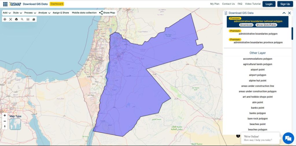
Download Jordan National Boundary Shapefile
Download Jordan Districts Shapefile Data
The district “Liwaa” (Arabic: لواء, plural Alwiya ألوية) are the administrative centres (“chief towns”) in Jordan. The twelve governorates of Jordan contain fifty-two alwiya.
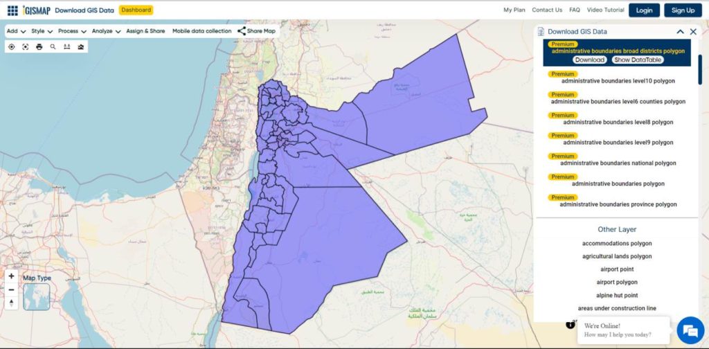
Download Jordan Districts Boundaries Shapefile
Other GIS Data:
- Download Jordan Highway Lines Shapefile
- Download Jordan Airport Locations Shapefile
- Download Jordan Railway Lines Shapefile
- Download Jordan Ferry Terminal Locations Shapefile
Download Shapefile for the following:
- World Countries Shapefile
- Australia
- Argentina
- Austria
- Belgium
- Brazil
- Canada
- Denmark
- Fiji
- Finland
- Germany
- Greece
- India
- Indonesia
- Ireland
- Italy
- Japan
- Kenya
- Lebanon
- Madagascar
- Malaysia
- Mexico
- Mongolia
- Netherlands
- New Zealand
- Nigeria
- Papua New Guinea
- Philippines
- Poland
- Russia
- Singapore
- South Africa
- South Korea
- Spain
- Switzerland
- Tunisia
- United Kingdom Shapefile
- United States of America
- Vietnam
- Norway
- Chile
- Croatia
Disclaimer : If you find any shapefile data of country provided is incorrect do contact us or comment below, so that we will correct the same in our system as well we will try to correct the same in OpenStreetMap.