Exciting news for GIS enthusiasts! MAPOG has just released GIS data collection sets for over 100 countries. Hungary is one among the 100 new countries that is published with updated GIS data representing almost all geographic and administrative features such as waterbodies, road lines, airport locations etc. GIS data of different levels of administrative divisions are also made available for Hungary. GIS data can be downloaded in ESRI Shapefile, KML, GeoJSON, and CSV etc. The links provided in this article will allow easy access to the data in IGIMAP Download GIS Data tool . Don’t miss this opportunity to enhance your mapping projects with up-to-date Hungary GIS data. Happy exploring!
Note:
- All data available are in GCS datum EPSG:4326 WGS84 CRS (Coordinate Reference System).
- You need to login for downloading the shapefile.
Here is the video tutorial to download data:
Download Shapefile Data of Hungary
Hungary, a landlocked country in Central Europe, boasts a geography as diverse as its rich history and culture. From the meandering Danube River to the picturesque Carpathian Mountains, Hungary’s landscape offers a captivating blend of natural wonders and breathtaking vistas.
The administrative structure of Hungary is organized into seven statistical regions, each with its unique character and offerings. These regions, such as Central Hungary, Northern Hungary, and Western Transdanubia, play a significant role in the country’s economic and development planning.
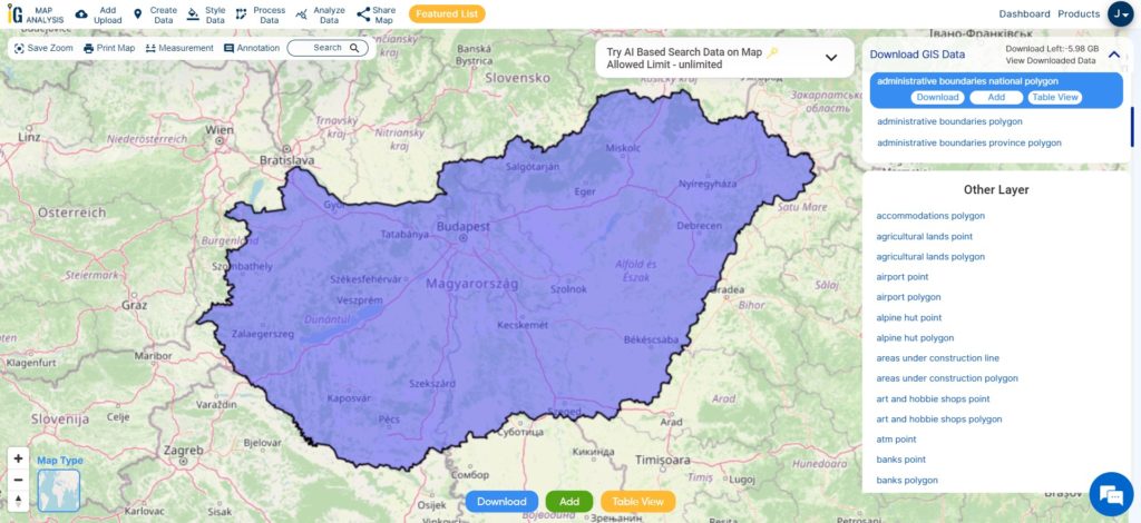
Download Hungary National Boundary Shapefile
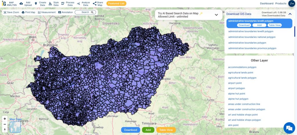
After login with your verified email ID, select Hungary from the list of countries, which will open the list of GIS data available. Choose the desired GIS data from the list to preview the data on the map. You can review the GIS data through visualization of data on the map and opening the data table. Click Download button if you wish to download the file. This will open the section to select the file format. After selecting the format from the dropdown, click Download to start downloading the data to your system.
Download Hungary Regions Shapefile Data
Hungary is divided into seven statistical regions, each offering its own unique charm and attractions. These regions, including Central Hungary, Northern Hungary, and Western Transdanubia, showcase the diverse landscapes, cultural heritage, and historical landmarks that Hungary has to offer. From the vibrant streets of Budapest in Central Hungary to the enchanting caves of Aggtelek in Northern Hungary, each region provides a distinct experience for visitors. The regions of Hungary play a vital role in the country’s economic and development planning, ensuring that the cultural, natural, and historical treasures are preserved and promoted for both locals and tourists to enjoy.
Download Hungary Region Boundaries Shapefile
This shapefile covers following regions of hungary listed below:
- Central Hungary (Közép-Magyarország)
- Northern Hungary (Észak-Magyarország)
- Northern Great Plain (Észak-Alföld)
- Southern Great Plain (Dél-Alföld)
- Central Transdanubia (Közép-Dunántúl)
- Western Transdanubia (Nyugat-Dunántúl)
- Southern Transdanubia (Dél-Dunántúl)
Download Hungary county Shapefile Data
Hungary is further divided into counties, which are administrative divisions that play a crucial role in local governance and regional development. The country is divided into 19 counties, each with its unique characteristics and offerings. From Pest County, home to the bustling capital city of Budapest, to the historical landmarks of Borsod-Abaúj-Zemplén County, each county showcases a blend of natural beauty, cultural heritage, and economic activities.
Click on the link given below
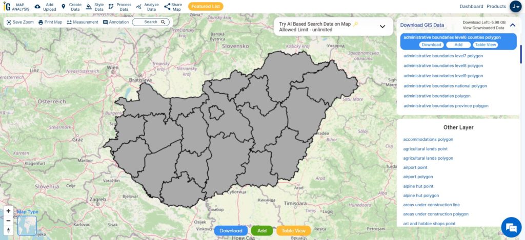
Download Hungary county Boundaries Shapefile
This shapefile covers following counties of hungary listed below:
- Bács-Kiskun County
- Baranya County
- Békés County
- Borsod-Abaúj-Zemplén County
- Csongrád-Csanád County
- Fejér County
- Győr-Moson-Sopron County
- Hajdú-Bihar County
- Heves County
- Jász-Nagykun-Szolnok County
- Komárom-Esztergom County
- Nógrád County
- Pest County
- Somogy County
- Szabolcs-Szatmár-Bereg County
- Tolna County
- Vas County
- Veszprém County
- Zala County
Download Hungary NUTS 1 Statistical Regions Shapefile Data
Hungary’s NUTS 1 statistical regions offer a higher-level classification of the country’s territorial units, facilitating statistical analysis. The three main regions, namely Central Hungary, Transdanubia, and the Great Plain and North, each have distinct characteristics that contribute to Hungary’s geographical and cultural diversity.
Download Hungary NUTS1 Boundaries Shapefile
This shapefile covers following NUTS1 big statistical regions of hungary listed below:
- Central Hungary (Közép-Magyarország)
- Transdanubia (Dunántúl)
- Great Plain and North (Alföld és Észak)
Download Hungary Municipality Shapefile Data
The municipalities of Hungary represent the smallest administrative divisions within the country. With over 3,155 municipalities, they play a vital role in local governance and community development.
Download Hungary Municipality Boundaries Shapefile
Other Administrative Boundary Data:
- Download Hungary national polygon, regions, city and towns Shapefile
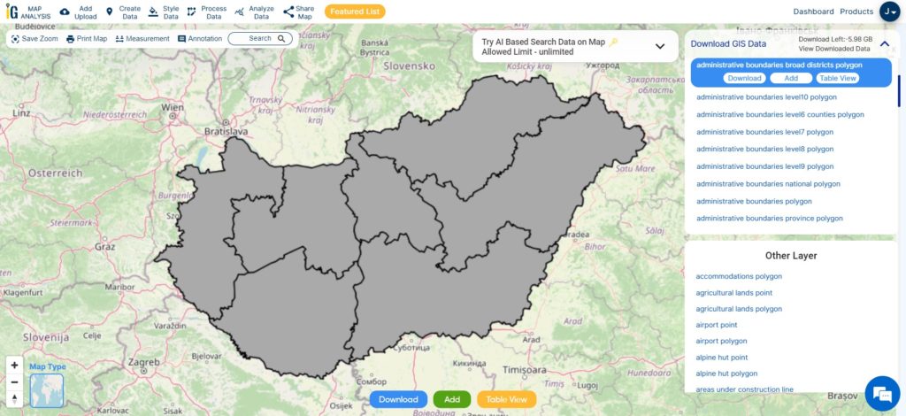
- Download Hungary Districts Shapefile
- Download Hungary Suburbs, Neighborhoods Polygon Shapefile
Other GIS Data:
- Download Hungary Highway Lines Shapefile
- Download Hungary Railway Lines Shapefile
- DownloadHungary Airport Point Shapefile
- Download HungaryFerry Terminal Point Shapefile
Above all links are provided for GIS data of Hungary if you are looking for any specific data please write us on support@mapog.com
Download Shapefile for the following:
- World Countries Shapefile
- Australia
- Argentina
- Austria
- Belgium
- Brazil
- Canada
- Denmark
- Fiji
- Finland
- Germany
- Greece
- India
- Indonesia
- Ireland
- Italy
- Japan
- Kenya
- Lebanon
- Madagascar
- Malaysia
- Mexico
- Mongolia
- Netherlands
- New Zealand
- Nigeria
- Papua New Guinea
- Philippines
- Poland
- Russia
- Singapore
- South Africa
- South Korea
- Spain
- Switzerland
- Tunisia
- United Kingdom Shapefile
- United States of America
- Vietnam
- Croatia
- Chile
- Norway
- Maldives
- Bhutan
- Colombia
- Libya
- Comoros
- Hungary
- Laos
- Estonia
- Iraq
- Portugal
- Azerbaijan
- Macedonia
- Romania
- Peru
- Marshall Islands
- Slovenia
- Nauru
- Guatemala
- El Salvador
- Afghanistan
- Cyprus
- Syria
Disclaimer : If you find any shapefile data of country provided is incorrect do contact us or comment below, so that we will correct the same in our system as well we will try to correct the same in openstreetmap.