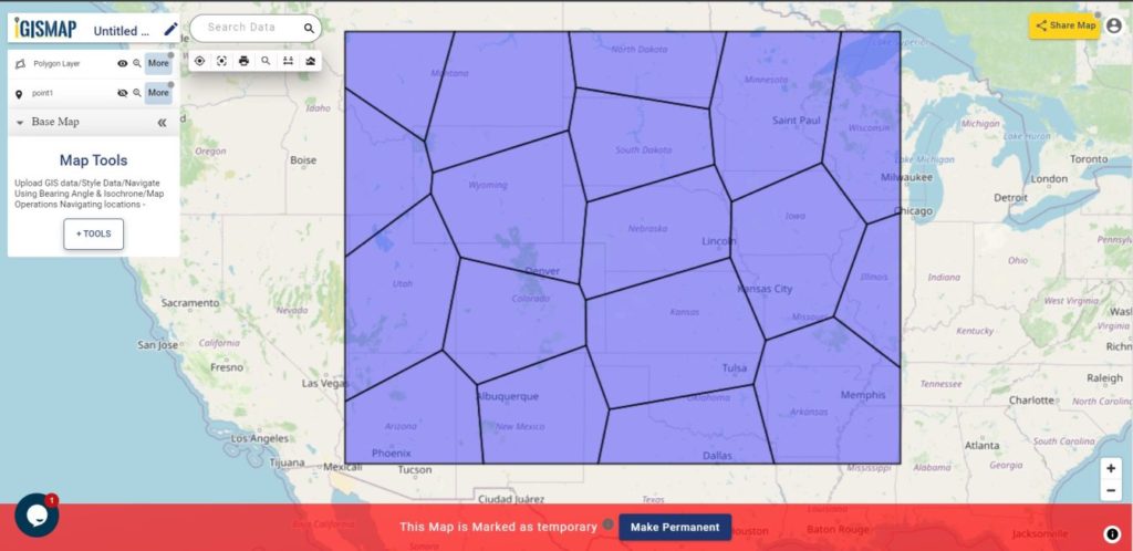
Voronoi polygon is an area representing the influence from a particular point location. A Voronoi polygon is actually a systematic way to divide spaces into a number of regions using a set of input points. For each point there will be a corresponding area that consists of the locations closer to that point than any other. These areas are called Voronoi cells.
MAPOG provides a Point to Polygon tool to create Voronoi polygons out of point from input point data. IGISMap is a web platform providing multiple GIS applications that are most important in the field of geospatial analytics. In IGISMap, you can upload your GIS data and perform geospatial analysis.
In IGISMap, Point To Polygon tool will convert input point data into polygon data by creating a polygon shape for each point in the input point data, like the following.
Let’s look into the steps to use Point to Polygon tool of IGISMap.
Click https://story.mapog.com/app/process/point-to-polygon to open Point to Polygon tool directly
Point to polygon
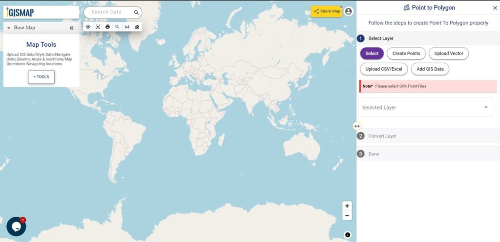
After opening Point to Polygon tool, first step is to add the data using any of the following options:
- Select
- Create Points
- Upload Vector
- Upload CSV/Excel
- Add GIS Data
Here we are going to choose the option to Create Points and then convert the point to polygons through voronoi conversion. Thus lets first create and publish point GIS data.
Creating point data
Select Create Points tab which open Add Points section to plot points on the map at the desired locations.
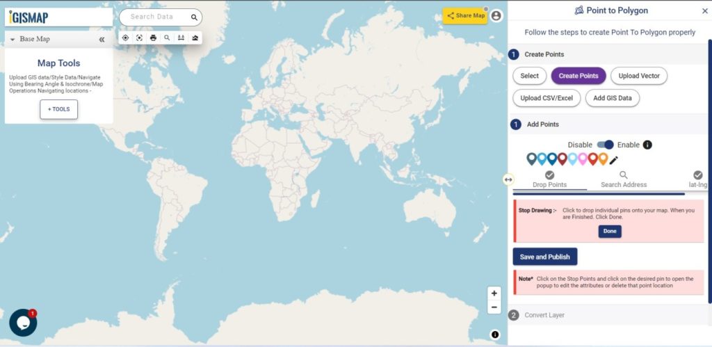
Points can be plotted through any of the following options that can be used anytime in this section. They are:
- Add Points
- Search Address
- Lat Lon Values
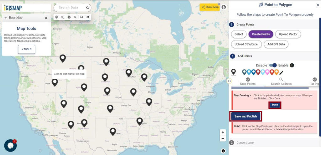
After finish the plotting, click Save and Publish button to publish the point GIS data.
Check the article Plot ATM locations on a map and embed in your website to know how to create point GIS data using Create Point Data tool.
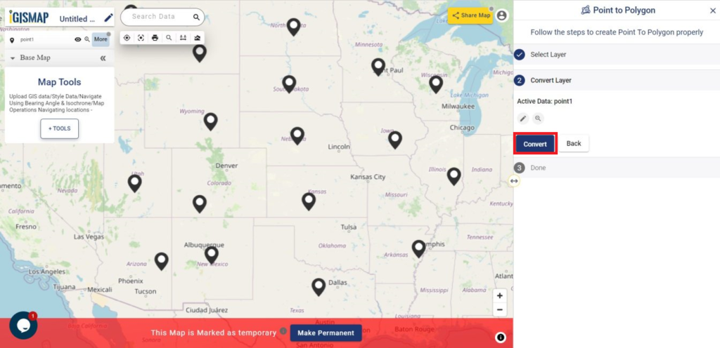
Converting the Point data to Polygon data
After saving the point data, Convert Layer section is appears to carry out the point to polygon process.
Now click Convert button to run the point to polygon process.
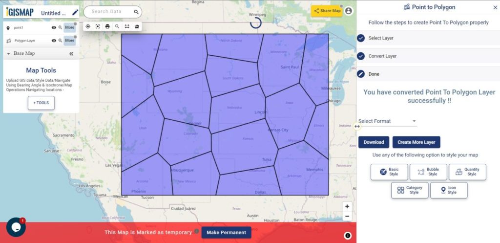
As you can see, voronoi polygon layer is created and published in the map.
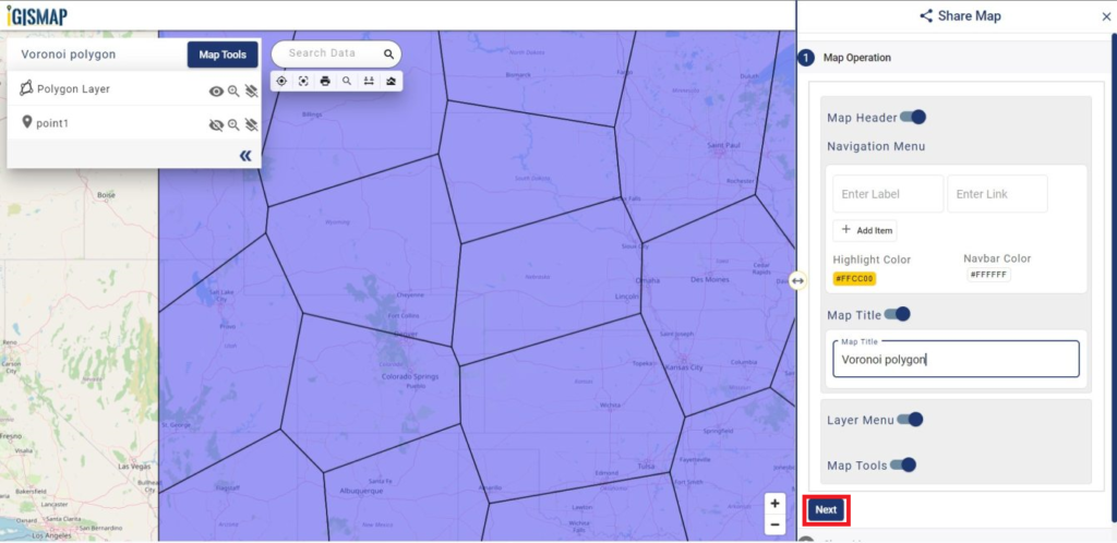
Sharing the voronoi polygon map
For sharing this map we have to click on Share Map button from the map. In the Share Map window, you can give the map name at the map title and click on Next. Then a share map section appears.
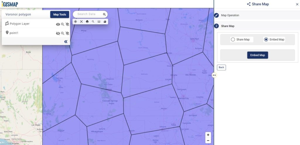
Choose the option between Share Map as a link or Embed Map to get the html iframe to attach in the webpage. Here you can also two security of the map by selecting Public or Private.
Check the article Share your Map to understand the Share Map feature of IGISMap.
Check other articles:
- Online conversion of GIS points to polygon
- Plot points from spreadhseet file and create voronoi polygons
- Map the locations of slums and embed the map on your website
- Create GIS Bubble Map – IGIS Map Tool
- Charts with Map – Create Bar Chart, Histogram, Number Chart, Table
- How to Share Map – Publicly