GIS solutions are based on mathematical and geometrical models applied on location integrated data. Most GIS software have mapping platforms built on these models that support geospatial data and tools for creating, editing and analysing these data. Tools for creating new GIS data with respect to the input GIS data plays an important role in geospatial operation. Creating Voronoi polygons, polygon to point conversion, create buffer layer etc are some of the important tools. Developing grid strcuture over the area of interest is a process that has important application in GIS. Simply understanding grids are intersection of coordinates addressing latitude and longitude data. For example, if we add index to the boxes created by grid then we can easily identify agricultural lands, settlement area, parks, stadium, forests, etc.
Most GIS software provides the tool to create grids based on an input GIS data. But using these software require adequate traning and knowledge in GIS concept. Here is why IGISMap become an important tool in GIS industry.
MAPOG is a GIS based web platform providing multiple GIS applications that are most important in the field of geospatial analytics. The peculiarity of IGISMAP in the GIS Industry is its UI/UX that helps the user to perform effortless geospatial operations.
IGISMap Create Grid tool
Create Grid tool of IGISMap lets you create grids over your GIS data in just two steps and lets you publish as a GIS layer in your map, where you can further download in any GIS format. You can create grid layer using GIS data of any spatial vector structure. In this article, we will talk about using Create Grid tool for creating grid, like the following.
To navigate directly to use this tool, refer link attached here.
https://story.mapog.com/app/process/create-grid
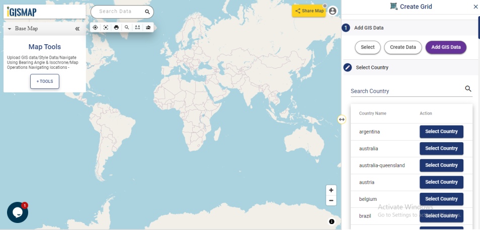
Add GIS data to create grid layer
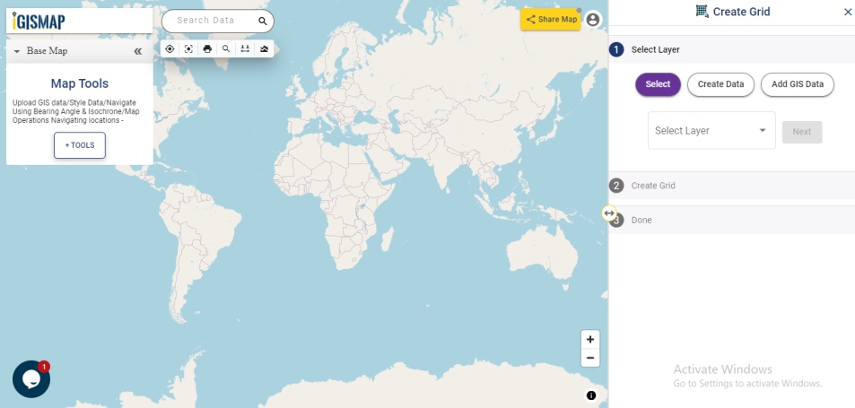
First step of the Create Grid tool is Select Layer, where you need to provide the input GIS data. There are three options to add your data:
- Select
- Create Data
- Add GIS Data
Using Select option, you can input your data by selecting the data that is already uploaded in your map.
If the user wants to add the vector data in the form of point, line or polygon then click on Create Data and select the option using Create Polygon, Create Line or Create Point.
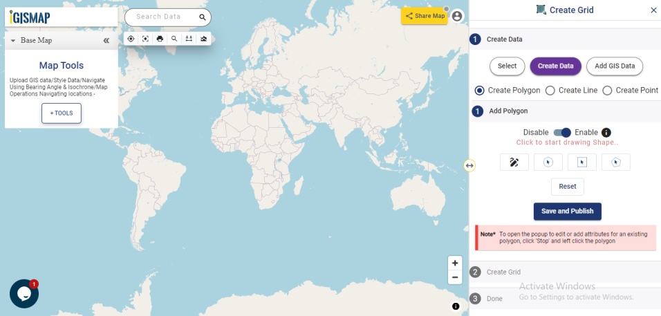
IGISMap provides you with Add GIS Data tool that provides GIS vector layers of administrative boundaries such as country, states, districts, provinces, postcode boundaries and other geographical features such as roads, farmlands, waterbody etc. These data are made available for more than 30 countries, 51 US states and few spatial data of globally distributed features.
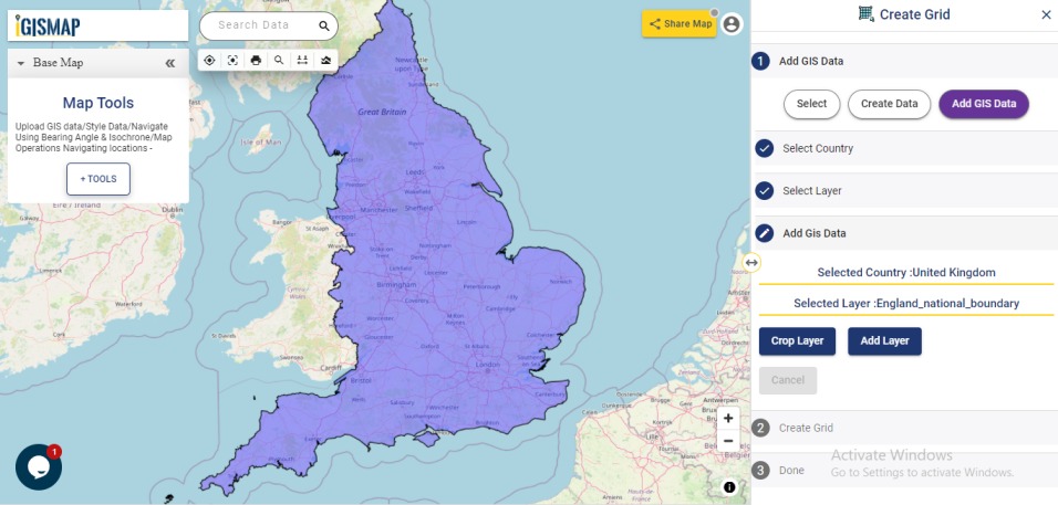
In this article, we will use Add GIS Data option to add the data for working with Create Grid tool. And we will use National Outline Polygon GIS Data of England from Add GIS Data to demonstrate the steps. First let’s select the Country Name from the list below provided or you can search the name in the search box. Here we will select United Kingdom, from the list to add grid over country England.
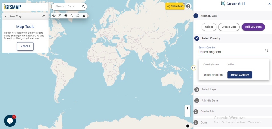
Add Input Data
In this article, lets add the GIS data of the national boundary of England from IGISMap GIS data collection as input data.
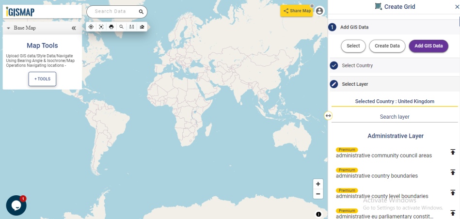
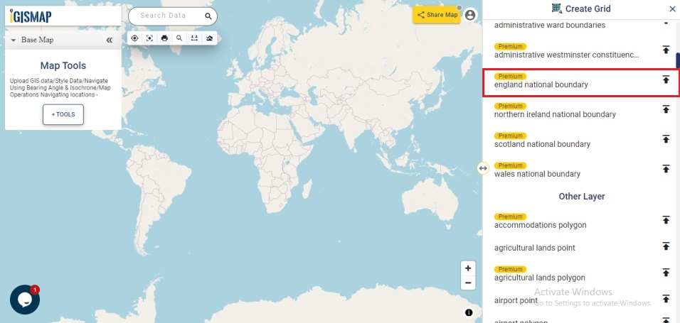
Select United Kingdom in the Select Country section and choose the data england national boundary from the administrative layer list and click add layer button.
If we need the desired portion of the selected GIS data, you can make use of the Crop Layer tool. Since this is a GIS data with single polygon feature of the national boundary of England, lets directly click Add layer to add the data as input layer for creating grid.
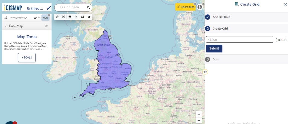
Enter the range for the grid
After selecting the input data, provide the range for each grid feature for your grid GIS data and click Submit.
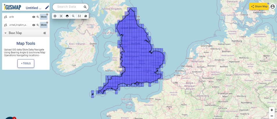
The grid polygons in specified range are added successfully to the base map. Users can observe that the gird layer is added as a separate layer to perform other geospatial operations.
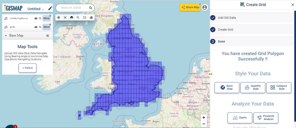
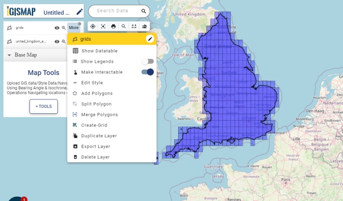
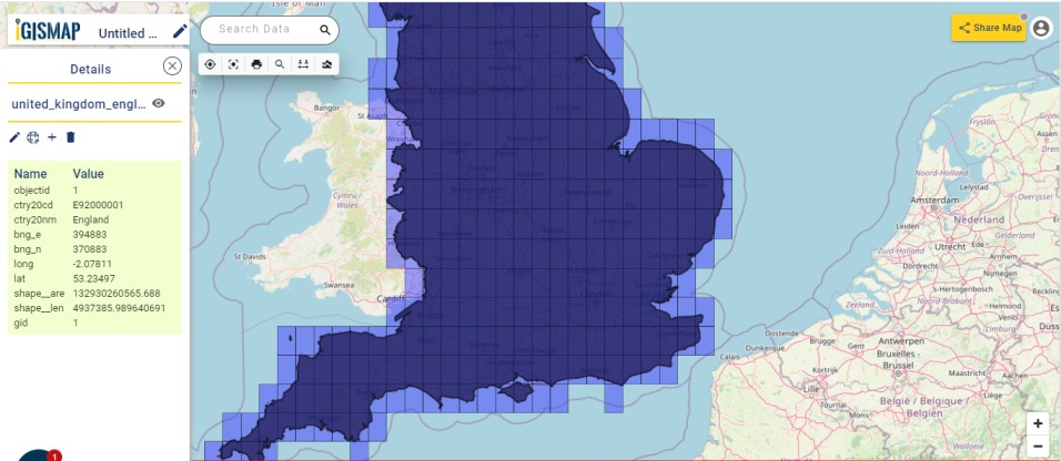
When you click on any of added grid layer polygon then the details of longitude, latitude, country, etc. are mentioned with added layer to map index accordingly. These details can help the user to locate easily anywhere on the base map.
To perform other geospatial options, click on More option present besides added grid layer. The geospatial options to Show Datatable, Show legend, Edit Style, Add/Merge/Split polygons, Export Layer and Delete Layer are available on IGISMap application.