This tutorial will walk you through the process of using MAPOG‘s Converter Tool to rapidly and simply convert GeoJSON files to DXF format. Therefore, the complete procedure of Converting GeoJSON to DXF with MAPOG will be presented to you in easy steps, regardless of whether you are a first-time user or not.
Key Concept to Converting files
One tool in the MAPOG is the Converter Tool, which is used to change the type of information you have. It resembles magic! It accepts data supplied in one format and outputs it in another that you can use for analysis. Additionally, GIS Data, may be downloaded in any format, meaning it can be used for a variety of purposes.
Online GeoJSON to DXF GIS Converter
Step 1: Upload the Data
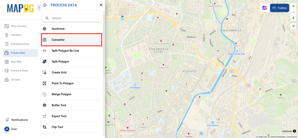
1. Select the data through the “Process Data” and go to the “Converter Tool”.
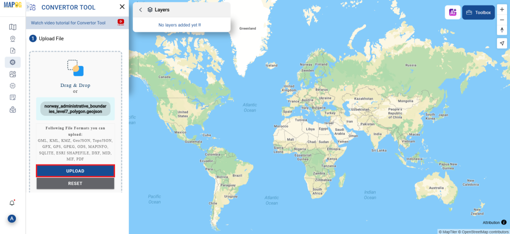
2. Upload your GeoJSON file. This is your entry point where you feed in the information that needs conversion.
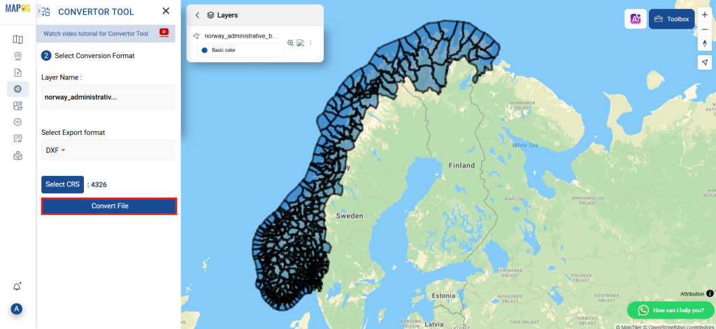
Step 2: Select the Format for Conversion
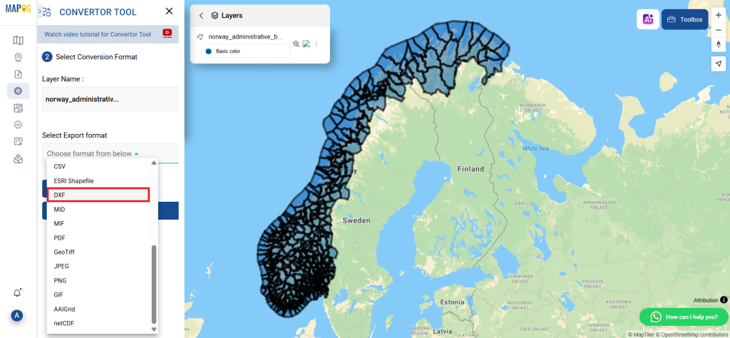
1. If you wish to export just the data, choose DXF or Drawing Exchange Format as the output format. Although the tool offers other ways to get the desired outcome, we are selecting the option to convert the file to DXF for the purposes of this guide.
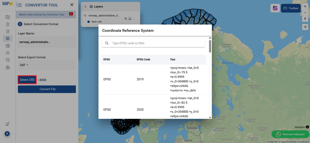
2. You can also set the Output CRS at this stage.
Step 3: Run the Conversion
Go to ‘Convert Files’ and watch the tool at work. Working with the Converter Tool you input your data and then the tool converts it from the GeoJSON format to the DXF format.
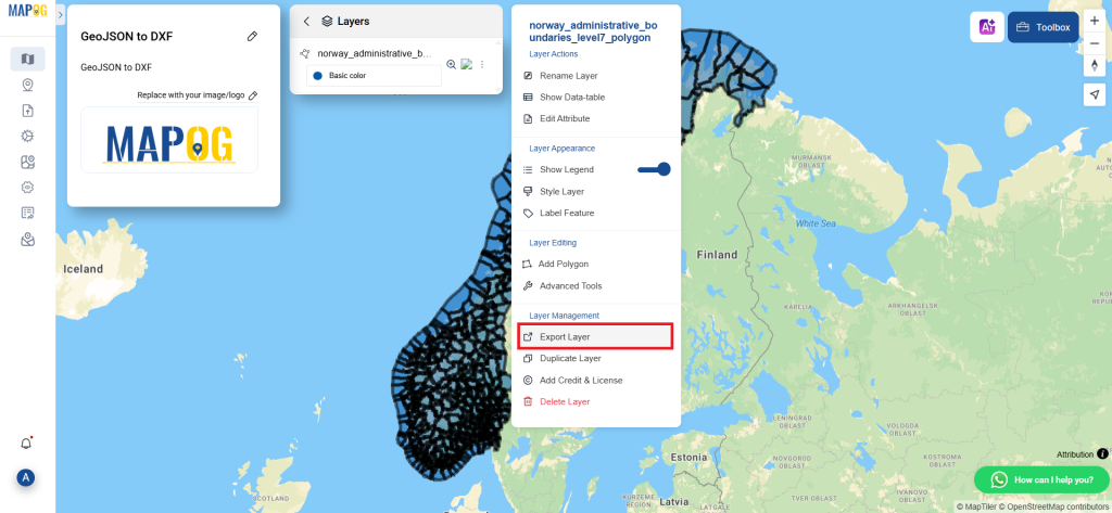
Step 4: Review and Download
Check that everything seems correct by taking a moment to go over your converted DXF data. You can download the file now that you’re satisfied. To make sure the conversion went well and that all of your data is intact, this step is crucial.
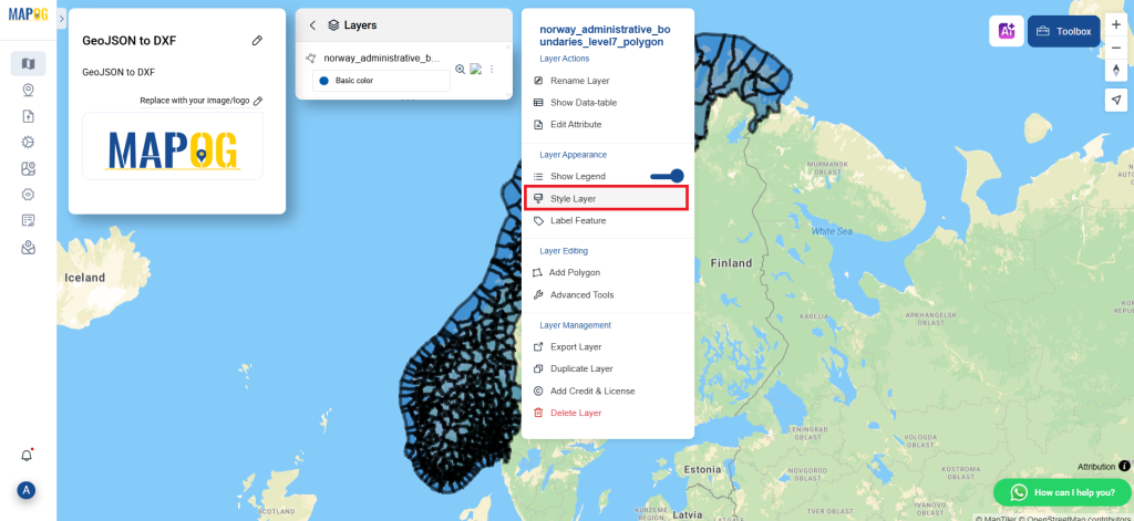
Step 5: Add Category Style
We can add the Category Style on this map using the Category Style in the map analysis interface. First, We need to go to the action button of the newly converted layer. Then select the category style from the “style editor” section.
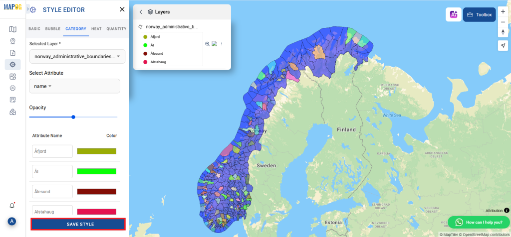
Next, we need to provide the newly converted file in select layer and the desired attribute in the attribute section. Category style has the option to change color, opacity etc. When you are happy with it, Click the save style button.
And that’s it! You now know how to convert your GeoJSON data into DXFs using the Converter Tool in MAPOG. It’s now simpler than ever to modify your data and get it ready for whatever analysis you require. This useful tool makes handling different data types easier, which improves the efficiency and productivity of your work.
With MAPOG’s versatile toolkit, you can effortlessly upload vector and upload Excel or CSV data, incorporate existing layers, perform polyline splitting, use the converter for various formats, calculate isochrones, and utilize the Export Tool.
Here are some other blogs you might be interested in
- Convert Online GIS data : KML to PDF file
- Converting KML to GeoTIFF , Online Gis Data Converter
- Converting KMZ to SHP : Online GIS Data Conversion
- Converting TopoJSON to SHP Online : GIS Data Converter
- Converting GeoJSON to TopoJSON with MAPOG
- Converting GeoJSON to CSV with MAPOG
- Converting KMZ to KML with MAPOG
- Converting GML to KML with MAPOG
- Convert KMZ to TopoJSON Online
- Converting KMZ to GeoJSON Online
- Convert KML to MID Online
- Online Conversion KML to MIF