This tutorial will guide you through the straightforward process of convert SQLITE to GPS format with the Converter Tool in MAPOG. Whether you’re a beginner or an experienced user, you’ll learn just how quick and effortless it can be to perform this conversion with MAPOG. We’ll explain each step in detail, ensuring the process is simple and easy to understand.
Understanding File Conversion:
The Converter Tool in MAPOG makes it simple to change data from one format to another with ease. You just need to upload your data in its original format, and the tool will convert it into a format that suits your specific analysis requirements. Moreover, it allows you to download GIS Data in various formats, offering flexibility for different applications.
Online GIS Data Conversion
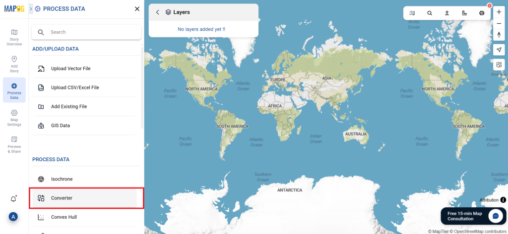
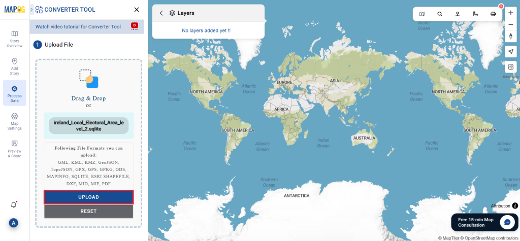
Step 1: Upload Your Data:
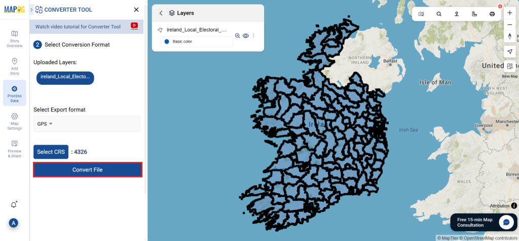
- Start by navigating to the “Process Data” section and choosing the “Converter Tool” option.
- Here, you’ll upload your SQLITE file, which serves as the input data for conversion.
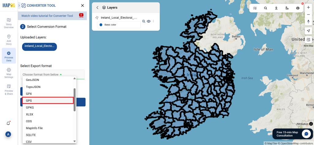
Step 2: Choose Your Output Format:
- If you want to export the data, select “GPS” as the desired output format. Although the tool offers multiple conversion options, this guide will specifically cover converting your file to the GPS format.
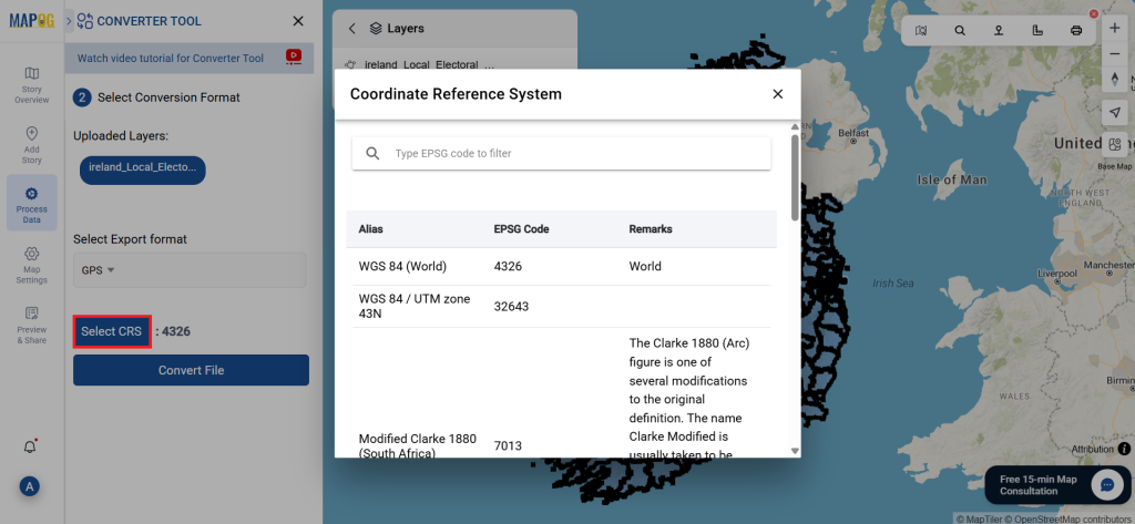
2.You can also customize the Output CRS based on your spatial needs.
Step 3: Run the Conversion:
Click on Convert Files and allow the tool to work its magic. Once your data is uploaded, the Converter Tool will convert it from SQLITE format to GPS format.
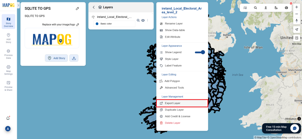
Step 4: Verify and Download:
Review the converted GPS data to make sure everything is accurate. Once you’re satisfied with the results, proceed to download the file. This step is crucial to ensure the conversion was successful and that all your data remains complete and correct.
Explore Additional Tools for Enhanced Analysis:
With MAPOG’s versatile toolkit, you can effortlessly upload vectors and upload Excel or CSV data, incorporate existing layers, perform polygon splitting, use the converter for various formats, calculate isochrones, and utilize the Export Tool.
Here are some other blogs you might be interested in:
- Convert Online GIS data : KML to PDF file
- Converting KML to GeoTIFF , Online Gis Data Converter
- Converting KMZ to SHP : Online GIS Data Conversion
- Converting TopoJSON to SHP Online : GIS Data Converter
- Converting GeoJSON to TopoJSON with MAPOG
- Converting GeoJSON to CSV with MAPOG
- Converting KMZ to KML with MAPOG
- Converting GML to KML with MAPOG
- Convert KMZ to TopoJSON Online
- Converting KMZ to GeoJSON Online
- Convert KML to MID Online