In this article we are going you discuss conversion process of NetCDF to geoTIFF file. Here this conversion is required because many of servers does not directly support NetCDF. You need to install some plug-ins to publish and view the Netcdf data. So it would be better to convert the Netcdf data in geotiff for particular bands so that you do not have to install plugins.
Online Tool to Convert NetCDF to GeoTiff
Convert NetCDF to Geotiff
NetCDF data is a multi-Dimensional data to store large number of bands in one file. There can be various dimensional such as space (Latitude, Longitude and Altitude) and time. In bands you can have information about pressure, temperature, wind direction etc. You can look over in detail of multidimensional data of NetCDF file.
Convert NetCDF into GeoTiff using gdal utility
For using Gdal utility you need to add gdal in your system. For that you can follow the given commands
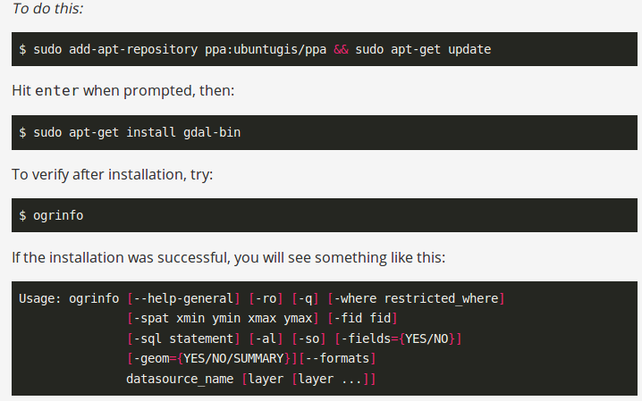
To check the availability of ogr2ogr in system, you can type the command ogr2ogr and get following response
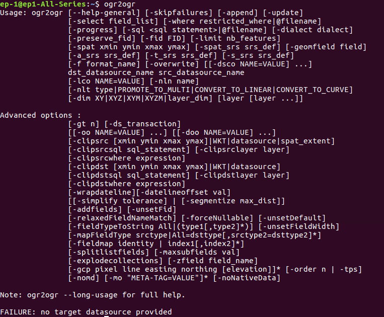
Now you can follow the given command to convert NetCDF in GeoTiff
–> gdal_translate -a_srs EPSG:4326 NETCDF:File_Name.nc:Band_Name -of ‘Gtiff’ Output_FileName.geotiff
Here we have used gdal_translate utility of GDAL. It has following options
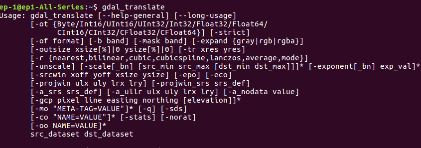
Here -a_srs srs_def defines the assignment of SRS (Spatial Reference system) to output file. we have selected EPSG (European Petroleum Survey Group) 4326. You can choose your file’s SRS. The next option is NetCDF file name with a band which needed to be convert in geotiff. The option -of is the Output file format. Here ‘Gtiff’ is geotiff driver in gdal. After this specify the output file name with .geotiff or .tiff extension.
Output Geotiff file- Convert NetCDF to Geotiff
The generated output tiff file can be viewd in QGIS software.
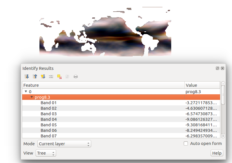
The output shows one of the band converted into geotiff. It has multiple bands. Similarly you can can convert other file in geotiff like HDF5 to GeoTIFF or Grib to GeoTIFF.
For more information or any help you can comment in given box. We are always available for your help.
I used the above gdal translate command to convert one of the datasets in netcdf file to GTiff and it worked fine but the issue is after opening the tiff file in qgis the tiff file appears inverted…..kindly let me the way out if this problem….
hola, me gustaria saber como se puede realizar el procedimiento de conversion de netcdf a goetiff en sistema windows
Hola, emir es lo mismo, solo debes de tener instalado GDAL en tu sistema Windows..