Do you want to read and write your GIS data easily in excel sheets? Have you extracted and downloaded kml file from Google Earth or Google map and want to Edit or read your data normally in CSV format?. So today we are discussing on how to convert KMZ to CSV.
KMZ is a zipped file containing one or compressed KML files. It is a file format used to display geographic data in Google Earth and Google Maps and CSV is a simple file format used to store tabular data, such as a spreadsheet or database. Files in the CSV format can be imported to and exported from programs that store data in tables, such as Microsoft Excel or OpenOffice Calc. Converting GIS data file from KMZ to CSV format is just a few click process with GIS MAPOG Converter Online.
IGISMAP to Convert KMZ to CSV
For KMZ to CSV conversion go to MapOG Converter Tool, after logging in with your registered email and password. If you are a new user, click the Sign Up button in the Login popup and register to IGISMAP by filling the details.
There are three main steps for using GIS Converter:
- Upload the data
- Choose the format to which it should be converted
- Download the converted file.
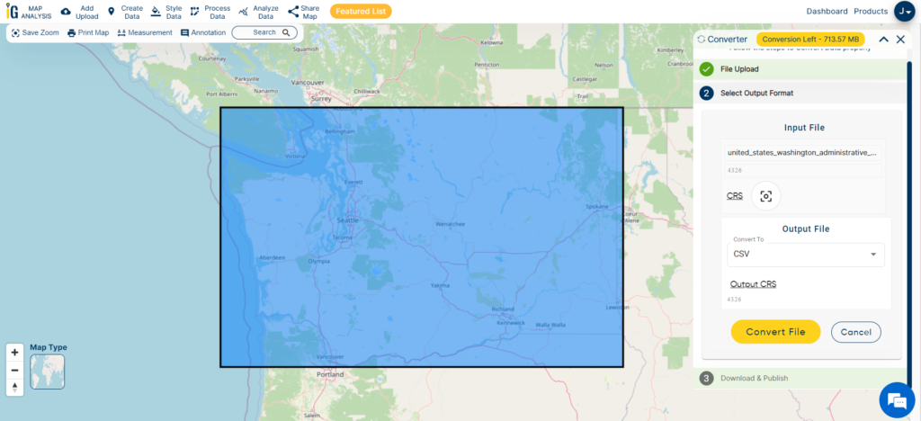
Step one is to upload your KMZ file which you want to convert. You can upload the file from your system or select from the Recent Files.

Here we are uploading the KMZ file of the Washington counties
Step two is to select choose the output format of the converted file, in this case its CSV. You can also set the Coordinate Reference System of your preference. As a default CRS will set to WGS 84 (World) [EPSG:4326]. Click on the Convert File.
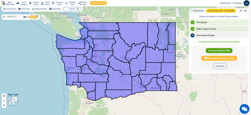
Your KMZ file will then get converted to CSV file after a few seconds and will be published in the map canvas. You can download the CSV file of Washington state boundary by clicking the Download Converted File button.
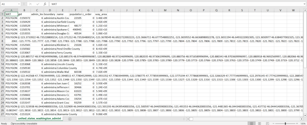
The output CSV file is generated with location information represented in WKT format under the field ‘WKT’ as shown in the following image.
You can also choose to style the layer or continue with further conversion process by clicking the Convert Another File button.
Converted Files section from the dashboard contains the list of the details of all the conversion done in your account, providing both input and output data available for download their corresponding formats.
You can also search locations, add new datasets, edit layers and style the map according to your choice and requirements. As IGIS Map Converter Tool provides many benefits other then just conversion of data. This tool provides us to generate this published map in PDF or as image format. You can also share the map on social media and you are able to embed on your website very easily.
- Download free shapefile of various countries.
- Create your own shapefile and share with your clients or embed on your website.
Other GIS data Conversions
- SHP to Tiff
- SHP to DXF
- GeoJSON to GML
- KML to GeoJSON
- GML to KML
- GML to Shapefile
- KML to PDF
- Shapefile to PDF
- KMZ to CSV
- CSV to KML
- KML to DXF
- KMZ to KML
If you are facing any problem in conversion or login then please let us know by mailing at support@igismap.com or drop comment.