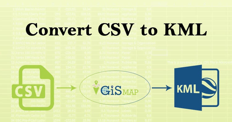
Hello guys, If you are looking for converting your CSV file into KML, you have landed on the right place. Here in this article we are discussing on how to convert CSV to KML in the easiest way possible.
A comma-separated values (CSV) file is a delimited text file that uses a comma to separate values. Each line of the file is a data record. KML or Keyhole Markup Language is a collection of geospatial data on map and commonly used in Google Earth or google services
Using Online MAPOG Converter Tool you can easily convert – CSV to KML. You can also do other GIS Data Conversion using this tool.
IGISMAP to Convert CSV to KML
For CSV to KML conversion go to MAPOG Converter Tool, after logging in with your registered email and password. If you are a new user, click the Sign Up button in the Login popup and register to IGISMAP by filling the details.
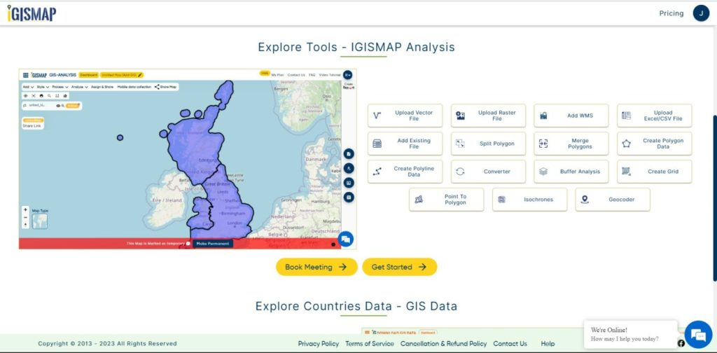
There are three main steps for using GIS Converter:
- Click on Tool Converter
- Upload the data
- Choose the format to which it should be converted
Step one is to upload your CSV file which you want to convert. You can upload the file from your system or select from the Recent Files.
Note:
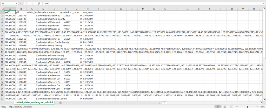
- Input CSV file should have location information in WKT format under a field named as WKT.
- Input CSV file should not have any columns with empty column name between other fields.
- Well Known Text (WKT) is an Open Geospatial Consortium (OGC) standard that is used to represent spatial data in a textual format.
- WKT format represents a geometry with the name of the vector entity ie., POINT, POLYGON or LINESTRING followed by the longitude and latitude of the point feature or the vertex of the polygon in brackets. Example for each entity is given below
- POINT (169.03934 -46.32844)
- POLYGON ((76.61103048 9.85276413,76.612068 9.85303305,76.6124496 9.85362534,76.61269368 9.85513401,76.61374668 9.85455036,76.61466216 9.85409739,76.61630232 9.85377888))
- LINESTRING (-123.031531560501 40.4178012488507,-122.889863902657 39.8410114990573,-122.464860929125 38.7886231836447,-121.311281429538 37.473137789379)
- Name of the field ‘WKT’ is not necessary to be case sensitive.

Here we have uploaded the CSV file containing the locations of counties of Washington. It contains locations recorded in WKT format as follows:
Step two is to select choose the output format of the converted file, in this case its KML. You can also set the Coordinate Reference System of your preference. As a default CRS will set to WGS 84 (World) [EPSG:4326]. Click on the Convert File.

Your CSV file will then get converted to KML file after a few seconds and will be available for downloading.

You can also choose to style the layer or continue with further conversion process by clicking the Convert Another File button.
Converted Files section from the dashboard contains the list of the details of all the conversion done in your account, providing both input and output data available for download their corresponding formats.
You can also search locations, add new datasets, edit layers and style the map according to your choice and requirements. As IGIS Map Converter Tool provides many benefits other then just conversion of data. This tool provides us to generate this published map in PDF or as image format.
Other GIS data Conversions
- SHP to Tiff
- SHP to DXF
- GeoJSON to GML
- KML to GeoJSON
- GML to KML
- GML to Shapefile
- KML to PDF
- Shapefile to PDF
- KMZ to CSV
- CSV to KML
- KML to DXF
- KMZ to KML
If you are facing any problem in conversion or login then please let us know by mailing at support@igismap.com or drop comment.